|
Samedan
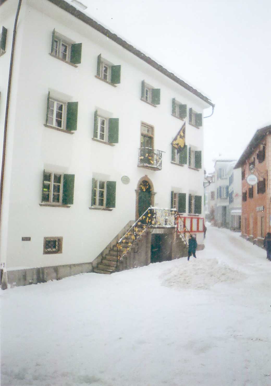
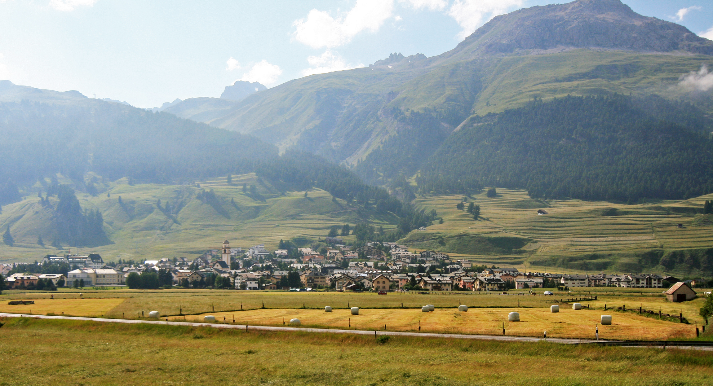
Samedan (, locally ) is a town and municipalities of Switzerland, municipality in the Maloja Region in the Switzerland, Swiss Cantons of Switzerland, canton of Grisons. It is served by Samedan railway station on the Rhaetian Railway network and by the Samedan Airport. History Samedan is first mentioned in 1139 as ''Samaden''. In 1334 it was mentioned as ''Semeden'', in 1367 as ''Semaden'', in 1498 as ''Sumada'' and in 1527 as ''Sameden''. Samedan is the location of The Smallest Whiskey Bar on Earth, the establishment holding the Guinness World Records distinction of "Smallest Permanently Licensed Bar in the World." File:Johann Heinrich Müller, 1825-1894 J08 Samaden.JPG, Samedan c. 1870 with the Bernina hotel (opened in 1865), one of the oldest hotels in the Engadin. Etching by commons:Johann Heinrich Müller (1825-1894), Heinrich Müller File:Samedan circa 1870 B.jpg, A photograph of Samedan in the circa 1870s File:Samedan circa 1870.jpg, Another photographic view of Samedan i ... [...More Info...] [...Related Items...] OR: [Wikipedia] [Google] [Baidu] |
Rhaetian Railway
The Rhaetian Railway (; ; ), abbreviated RhB, is a Swiss transport company that owns the largest network of all private railway operators in Switzerland. Headquartered in Chur, the RhB operates all the railway lines of the Cantons of Switzerland, Swiss canton of canton of Grisons, Grisons, except for the line from Sargans to the cantonal capital, Chur, which are operated by Swiss Federal Railways (SBB CFF FFS), as well as the line from Disentis/Mustér to the Oberalp Pass and further on to Andermatt, Canton of Uri, Uri, which is operated by Matterhorn Gotthard Bahn (MGB). Inaugurated in 1888 and expanded from 1896 onwards in various sections, the RhB network is located almost entirely within Grisons, with one station across the Italy–Switzerland border, Italian border at Tirano (Rhaetian Railway station), Tirano. The Rhaetian Railway serves a number of major tourist destinations, such as St. Moritz and Davos. One of the RhB lines, the Bernina Railway, crosses the Berni ... [...More Info...] [...Related Items...] OR: [Wikipedia] [Google] [Baidu] |
Samedan Airport
Samedan Airport , also known as Engadin Airport, is a regional airport in Samedan in the Engadin valley of Switzerland, 5 km from St. Moritz. History At the end of World War II, Swiss authorities identified existing locations that were to be modernized with new regional airports, as second tiers of infrastructure to support the primary urban airports, with Samedan being one of the five. Facilities The airport has one runway designated 03/21 with an asphalt pavement measuring 1800 x 40 metres (5905 x 130 ft). Because of its location at the bottom of a valley, it is not equipped with an instrument landing system. Operations At an elevation of 1,707 metres (5,600 ft), it is the second highest airliner airport in Europe (with Courchevel being the highest). It is also considered one of the most challenging airports in the world because of its difficult topography and winds, and because of the thinness of the air at its altitude. The airport does not have any schedul ... [...More Info...] [...Related Items...] OR: [Wikipedia] [Google] [Baidu] |
Samedan Railway Station
Samedan railway station is a railway station in the municipality of Samedan, in the Swiss canton of Graubünden. It is an important interchange station on the Rhaetian Railway network between the Albula Railway line (between Chur and St. Moritz) and the Samedan–Pontresina railway. Hourly services operate on each line. Services the following services stop at Samedan: * ''Glacier Express'': Several round-trips per day between Zermatt and St. Moritz. * InterRegio: hourly service between and St. Moritz. * RegioExpress RegioExpress, commonly abbreviated to RE, is a Train categories in Europe, category of fast regional train service in Switzerland, run by Swiss Federal Railways (SBB CFF FFS) or other railway companies (such as Treni Regionali Ticino Lombardia, ...: hourly service between and St. Moritz. * Regio: hourly service between and . References External links * * * Railway stations in Graubünden Rhaetian Railway stations Railway stations in Switzerland ... [...More Info...] [...Related Items...] OR: [Wikipedia] [Google] [Baidu] |
Sankt-Moritz
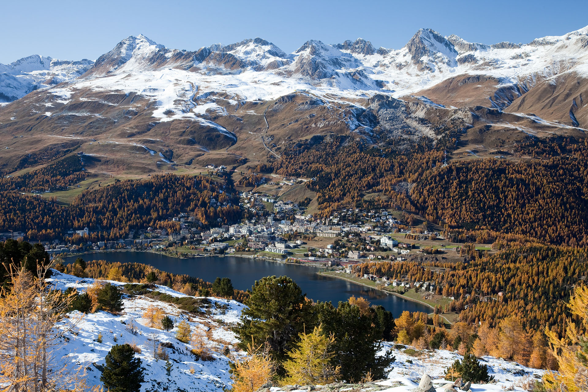
St. Moritz ( , , ; ; ; ; ) is a high Alpine resort town in the Engadine in Switzerland, at an elevation of about above sea level. It is Upper Engadine's major town and a municipality in the administrative region of Maloja in the Swiss canton of the Grisons. St. Moritz lies on the southern slopes of the Albula Alps below the Piz Nair () overlooking the flat and wide glaciated valley of the Upper Engadine and eponymous lake: Lake St. Moritz. It hosted the Winter Olympics in 1928 and 1948. History Votive offerings, swords, and needles from the Bronze Age found at the base of the springs in St. Moritz indicate that the Celts had already discovered them. St. Moritz is first mentioned around 1137–39 as ''ad sanctum Mauricium''. The village was named after Saint Maurice, an early Christian saint from southern Egypt said to have been martyred in the 3rd century by Maximian in Switzerland while serving as leader of the Theban Legion. Pilgrims traveled to Saint Mauritius ... [...More Info...] [...Related Items...] OR: [Wikipedia] [Google] [Baidu] |
Engadin
The Engadin or Engadine (;This is the name in the two Romansh idioms that are spoken in the Engadin, Vallader and Puter, as well as in Sursilvan and Rumantsch Grischun. In Surmiran, the name is ''Nagiadegna'', and in Sutsilvan, it is ''Gidegna''. ; ; ) is a long high Alps, Alpine valley region in the eastern Swiss Alps in the canton of Graubünden in southeasternmost Switzerland with about 25,000 inhabitants. It follows the route of the Inn (river), Inn () from its headwaters at Maloja Pass in the southwest running roughly northeast until the Inn flows into Austria, little less than one hundred kilometers downstream. The En/Inn subsequently flows at Passau into the Danube, making it the only Swiss river to drain into the Black Sea. The Engadine is protected by high mountain ranges on all sides and is famous for its sunny climate, beautiful landscapes and outdoor activities. Name In English, the valley is known as either ''Engadin'' (, locally also ) or ''Engadine'' ( , ). The R ... [...More Info...] [...Related Items...] OR: [Wikipedia] [Google] [Baidu] |
Grisons
The Grisons (; ) or Graubünden (),Names include: * ; *Romansh language, Romansh: ** ** ** ** ** **; * ; * ; * . See also list of European regions with alternative names#G, other names. more formally the Canton of the Grisons or the Canton of Graubünden, is one of the twenty-six cantons of Switzerland, cantons of Switzerland. It has eleven districts, and its capital is Chur. The German language, German name of the canton, , translates as the "Grey Leagues", referring to the canton's origin in three local alliances, the Three Leagues. The other native names also refer to the Grey League: in Sutsilvan, in the other forms of Romansh language, Romansh, and in Italian language, Italian. is the Latin name for the area. The Alpine ibex is the canton's heraldic symbol. The largest and easternmost canton of Switzerland, it is also one of the three large southern Alps, Alpine cantons, along with Valais and Ticino. It is the most diverse canton in terms of natural and cultural ge ... [...More Info...] [...Related Items...] OR: [Wikipedia] [Google] [Baidu] |
Maloja Region
Maloja Region is one of the eleven Districts of Switzerland, administrative districts in the Cantons of Switzerland, canton of Grisons in Switzerland. It has an area of and a population of (as of ). It was created on 1 January 2017 as part of a reorganization of the Canton. accessed 16 February 2017 References {{coord, 46, 24, 9, N, 9, 41, 42, E, source:plwiki_region:CH, display=title Regions of Graubünden Engadin People from Maloja District, ...[...More Info...] [...Related Items...] OR: [Wikipedia] [Google] [Baidu] |
Celerina/Schlarigna
Celerina/Schlarigna (German/Italian ''Celerina''; Romansh ) is a municipality in the Maloja Region in the Swiss canton of Graubünden. History Celerina/Schlarigna was first mentioned in 1313 as ''Schellarin'' and in 1320 as ''Celarina''. In 1631, a fire destroyed 43 houses. From the 1860s onwards, tourism became more and more important to the village. The Cresta Run opened in 1884, the St. Moritz-Celerina Olympic Bobrun in 1904 and the cable car to Saluver in 1958. In the course of the 20th century, the population structure of the originally Romansh-speaking farming village underwent radical change, with people moving to the thriving resort from the German-speaking part of Switzerland and also from Italy. Geography Celerina/Schlarigna has an area, , of . Of this area, 34% is used for agricultural purposes, while 30.5% is forested. Of the rest of the land, 4.1% is settled (buildings or roads) and the remainder (31.4%) is non-productive (rivers, glaciers or mountains). I ... [...More Info...] [...Related Items...] OR: [Wikipedia] [Google] [Baidu] |
Piz Bernina
Piz Bernina (Romansh language, Romansh, , ) is the highest mountain in the Eastern Alps, the highest point of the Bernina Range, and the highest peak in the Rhaetian Alps. It rises and is located south of Pontresina in the Bernina Region and near the major Alpine resort of St. Moritz, in the Engadin valley. It is also the most easterly mountain higher than in the Alps, the highest point of the Switzerland, Swiss Cantons of Switzerland, canton of Grisons, and the fifth-most prominent peak in the Alps. Although the summit lies within Switzerland, the massif is on the border with Italy. The "shoulder" () known as La Spedla is the highest point in the Italian Lombardy region. Piz Bernina is entirely surrounded by glaciers, of which the largest is the Morteratsch Glacier. The mountain was named after the Bernina Pass in 1850 by Johann Coaz, who also made the first ascent. The prefix ''Piz'' comes from the Romansh language, Romansch language of the Grisons; any mountain with that na ... [...More Info...] [...Related Items...] OR: [Wikipedia] [Google] [Baidu] |
Val Roseg
The Val Roseg is a valley of the Swiss Alps, located on the north side of the Bernina Range in the canton of Graubünden (Engadin). The valley is drained by the ''Ova da Roseg'', a tributary of the Flaz ( Inn basin), at Pontresina. Most of the valley is part of an exclave of the municipality of Samedan. Only the bottom of Val Roseg lies in the municipality of Pontresina. The main locality, outside Pontresina on the bottom of the valley, is Roseg (1,999 m) at the end of the main road. Two mountain huts owned by the Swiss Alpine Club are located in the valley near the glaciers: the Coaz Hut (2,610 m) and the Tschierva Hut (2,584 m). The Val Roseg is surrounded by the highest mountains of Graubünden and Eastern Switzerland. The highest are Piz Bernina Piz Bernina (Romansh language, Romansh, , ) is the highest mountain in the Eastern Alps, the highest point of the Bernina Range, and the highest peak in the Rhaetian Alps. It rises and is located south of Pontresina in the Berni ... [...More Info...] [...Related Items...] OR: [Wikipedia] [Google] [Baidu] |
Lanzada
Lanzada is a ''comune'' (municipality) in the Province of Sondrio in the Italy, Italian region Lombardy, located about northeast of Milan and north of Sondrio, on the border with Switzerland. As of 31 December 2004, it had a population of 1,445 and an area of .All demographics and other statistics: Italian statistical institute National Institute of Statistics (Italy), Istat. Lanzada borders the following municipalities: Caspoggio, Chiesa in Valmalenco, Chiuro, Montagna in Valtellina, Pontresina (Switzerland), Poschiavo (Switzerland), Samedan (Switzerland), Sils im Engadin/Segl (Switzerland). Demographic evolution Colors= id:lightgrey value:gray(0.9) id:darkgrey value:gray(0.8) id:sfondo value:rgb(1,1,1) id:barra value:rgb(0.6,0.7,0.8) ImageSize = width:455 height:303 PlotArea = left:50 bottom:50 top:30 right:30 DateFormat = x.y Period = from:0 till:2000 TimeAxis = orientation:vertical AlignBars = justify ScaleMajor = gridcolor:darkgrey increment:1000 start ... [...More Info...] [...Related Items...] OR: [Wikipedia] [Google] [Baidu] |


