|
Saint Lucia Channel
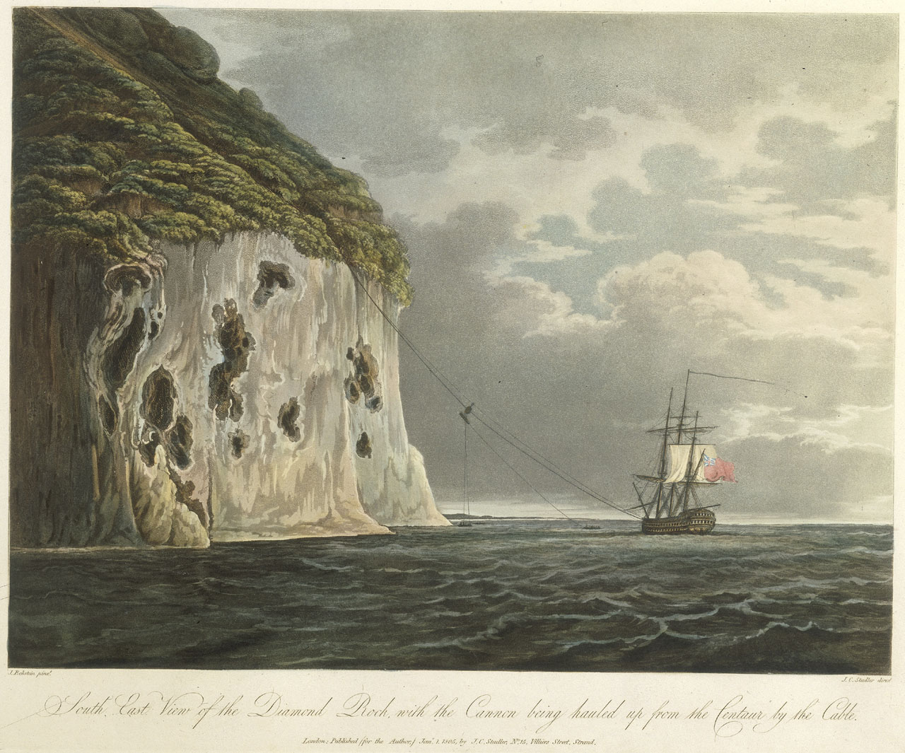
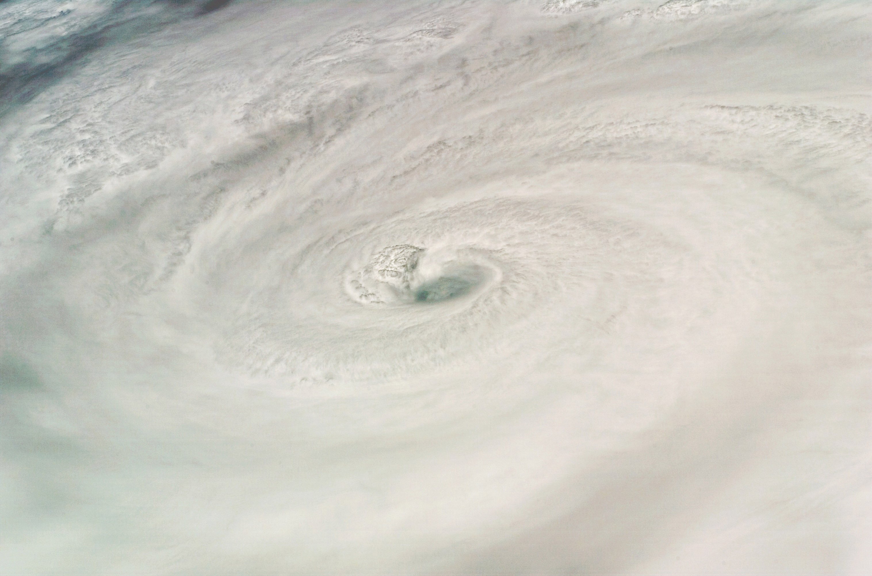
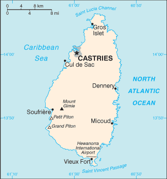
Saint Lucia Channel is a strait in the Caribbean that separates French island Martinique, to the north, and Saint Lucia, in the south. It is a pathway between the Caribbean Sea and Atlantic Ocean.Ana G. López MartíInternational Straits: Concept, Classification and Rules of Passage.218 pages. Publisher: Springer Science & Business Media, 2010 The Diamond Rock is in the St. Lucia Canal. History On August 17, 2007, Hurricane Dean (2007), Hurricane Dean crossed the channel as a Category 2 storm. See also *Martinique Passage *Barbados–France Maritime Delimitation Agreement *France–Saint Lucia Delimitation Agreement *Saint Vincent Passage References Straits of the Caribbean Bodies of water of Martinique Bodies of water of Saint Lucia Martinique–Saint Lucia border International straits {{Martinique-geo-stub ... [...More Info...] [...Related Items...] OR: [Wikipedia] [Google] [Baidu] |
Saint Lucia
Saint Lucia is an island country of the West Indies in the eastern Caribbean. Part of the Windward Islands of the Lesser Antilles, it is located north/northeast of the island of Saint Vincent (Saint Vincent and the Grenadines), Saint Vincent, northwest of Barbados and south of Martinique. It covers a land area of with an estimated population of over 180,000 people as of 2018. The nation's capital and largest city is Castries. The first proven inhabitants of the island, the Arawaks, are believed to have been the first to settle on the island in 200–400 AD. In 800 AD, the island was taken over by the Kalinago. The French people, French were the first European colonization of the Americas, European colonists to settle on the island, and they signed a treaty with the native Caribs in 1660. The English people, English took control of the island in 1663. In ensuing years, Kingdom of England, England and Kingdom of France, France fought 14 times for control of the island; conseq ... [...More Info...] [...Related Items...] OR: [Wikipedia] [Google] [Baidu] |
Martinique
Martinique ( ; or ; Kalinago language, Kalinago: or ) is an island in the Lesser Antilles of the West Indies, in the eastern Caribbean Sea. It was previously known as Iguanacaera which translates to iguana island in Carib language, Kariʼnja. A part of the French West Indies (Antilles), Martinique is an Overseas departments and regions of France, overseas department and region and a single territorial collectivity of France. It is a part of the European Union as an outermost region within the special territories of members of the European Economic Area, and an associate member of the Caribbean Community, CARICOM, the Organization of Eastern Caribbean States (OECS), the Association of Caribbean States (ACS), and the Economic Commission for Latin America and the Caribbean (ECLAC) but is not part of the Schengen Area or the European Union Customs Union. The currency in use is the euro. It has been a UNESCO Biosphere Reserve since 2021 for its entire land and sea territory. In ... [...More Info...] [...Related Items...] OR: [Wikipedia] [Google] [Baidu] |
Strait
A strait is a water body connecting two seas or water basins. The surface water is, for the most part, at the same elevation on both sides and flows through the strait in both directions, even though the topography generally constricts the flow somewhat. In some straits there is a dominant directional current. Most commonly, the strait is a narrowing channel that lies between two land masses. Straits are loci for sediment accumulation, with sand-size deposits usually occurring on the two strait exits, forming subaqueous fans or deltas. Some straits are not navigable because, for example, they are too narrow or too shallow, or because of an unnavigable reef or archipelago. Terminology The terms '' channel'', ''pass'', or ''passage'' can be synonymous and used interchangeably with ''strait'', although each is sometimes differentiated with varying senses. In Scotland, '' firth'' or ''Kyle'' are also sometimes used as synonyms for strait. Many straits are economically impor ... [...More Info...] [...Related Items...] OR: [Wikipedia] [Google] [Baidu] |
Caribbean
The Caribbean ( , ; ; ; ) is a region in the middle of the Americas centered around the Caribbean Sea in the Atlantic Ocean, North Atlantic Ocean, mostly overlapping with the West Indies. Bordered by North America to the north, Central America to the west, and South America to the south, it comprises numerous List of Caribbean islands, islands, cays, islets, reefs, and banks. It includes the Lucayan Archipelago, Greater Antilles, and Lesser Antilles of the West Indies; the Quintana Roo Municipalities of Quintana Roo#Municipalities, islands and Districts of Belize#List, Belizean List of islands of Belize, islands of the Yucatán Peninsula; and the Bay Islands Department#Islands, Bay Islands, Miskito Cays, Archipelago of San Andrés, Providencia and Santa Catalina, Archipelago of San Andrés, Providencia, and Santa Catalina, Corn Islands, and San Blas Islands of Central America. It also includes the coastal areas on the Mainland, continental mainland of the Americas bordering the ... [...More Info...] [...Related Items...] OR: [Wikipedia] [Google] [Baidu] |
Caribbean Sea
The Caribbean Sea is a sea of the Atlantic Ocean, North Atlantic Ocean in the tropics of the Western Hemisphere, located south of the Gulf of Mexico and southwest of the Sargasso Sea. It is bounded by the Greater Antilles to the north from Cuba to Puerto Rico, the Lesser Antilles to the east from the Virgin Islands to Trinidad and Tobago, South America to the south from the Venezuela, Venezuelan coastline to the Colombia, Colombian coastline, and Central America and the Yucatán Peninsula to the west from Panama to Mexico. The Geopolitics, geopolitical region around the Caribbean Sea, including the numerous islands of the West Indies and adjacent coastal areas in the mainland of the Americas, is known as the Caribbean. The Caribbean Sea is one of the largest seas on Earth and has an area of about . The sea's deepest point is the Cayman Trough, between the Cayman Islands and Jamaica, at below sea level. The Caribbean coastline has many gulfs and bays: the Gulf of Gonâve, the Gul ... [...More Info...] [...Related Items...] OR: [Wikipedia] [Google] [Baidu] |
Atlantic Ocean
The Atlantic Ocean is the second largest of the world's five borders of the oceans, oceanic divisions, with an area of about . It covers approximately 17% of Earth#Surface, Earth's surface and about 24% of its water surface area. During the Age of Discovery, it was known for separating the New World of the Americas (North America and South America) from the Old World of Afro-Eurasia (Africa, Asia, and Europe). Through its separation of Afro-Eurasia from the Americas, the Atlantic Ocean has played a central role in the development of human society, globalization, and the histories of many nations. While the Norse colonization of North America, Norse were the first known humans to cross the Atlantic, it was the expedition of Christopher Columbus in 1492 that proved to be the most consequential. Columbus's expedition ushered in an Age of Discovery, age of exploration and colonization of the Americas by European powers, most notably Portuguese Empire, Portugal, Spanish Empire, Sp ... [...More Info...] [...Related Items...] OR: [Wikipedia] [Google] [Baidu] |
Diamond Rock
Diamond Rock () is a Tour Of The Caribbean – No Flint Grey and the Stone Ship (1925) ''Old and Sold Antiques Digest'' island located south of "Grande Anse du Diamant" before arriving from the south at , the main port of the island of . The uninhabited island is about from Pointe ... [...More Info...] [...Related Items...] OR: [Wikipedia] [Google] [Baidu] |
Hurricane Dean (2007)
Hurricane Dean was the strongest tropical cyclone of the 2007 Atlantic hurricane season. It was the most intense North Atlantic hurricane since Hurricane Wilma of the 2005 season, and is tied with Hurricane Mitch of the 1998 season for the ninth most intense hurricane in the Atlantic basin in terms of pressure. Additionally, it was the fourth most intense Atlantic hurricane to make landfall on record in the basin, behind Hurricanes Camille and Gilbert, which made landfall at 900 mbar. A Cape Verde hurricane that formed on August 13, 2007, Dean took a west-northwest path from the eastern Atlantic Ocean through the Saint Lucia Channel and into the Caribbean. It strengthened into a major hurricane, reaching Category 5 status on the Saffir–Simpson hurricane wind scale before passing just south of Jamaica on August 20. The storm made landfall on the Yucatán Peninsula on August 21 at peak intensity. It crossed the peninsula and emerged into the Bay of Campeche ... [...More Info...] [...Related Items...] OR: [Wikipedia] [Google] [Baidu] |
Martinique Passage
Martinique Passage (also called Dominica Channel) is a strait in the Caribbean that separates Dominica and Martinique. Latitude.to See also * Dominica–France Maritime Delimitation Agreement *Saint Lucia Channel
Saint Lucia Channel is a strait in the Caribbean that separates French island Martinique, to the north, and Saint Lucia, in the south. It is a pathway between the Caribbean Sea and Atlantic Ocean.Ana G. López Mart ...
[...More Info...] [...Related Items...] OR: [Wikipedia] [Google] [Baidu] |
Barbados–France Maritime Delimitation Agreement
The Barbados–France Maritime Delimitation Agreement is a 2009 treaty between Barbados and France which delimits the maritime boundary between Barbados and the French Overseas departments of Guadeloupe and Martinique. The far western point under this agreement consists of the border at a tripoint with Saint Lucia as under the France–Saint Lucia Delimitation Agreement and proceeds in a northeast direction. See also * Martinique Passage * Dominica–France Maritime Delimitation Agreement * Saint Lucia Channel Saint Lucia Channel is a strait in the Caribbean that separates French island Martinique, to the north, and Saint Lucia, in the south. It is a pathway between the Caribbean Sea and Atlantic Ocean.Ana G. López MartíInternational Straits: Concep ... NotesNotice of preliminary discussionsSignature Of The Barbados/France Maritime Boundary Delimitation Treaty [...More Info...] [...Related Items...] OR: [Wikipedia] [Google] [Baidu] |
France–Saint Lucia Delimitation Agreement
The France – Saint Lucia Agreement on Delimitation is a 1981 treaty between France and Saint Lucia which delimits the maritime boundary between Saint Lucia and the French territory of Martinique.Anderson, Ewan W.(2003). ; Charney, Jonathan I. ''et al.'' (2005). ''International Maritime Boundaries,'' Vol. 1, pp. 591-602. The treaty was signed in Paris on 4 March 1981. The text of the treaty sets out a boundary that is an equidistant line between the two islands in the Saint Lucia Channel. The boundary is set out in an east–west direction and consists of 17 straight-line maritime segments defined by 18 individual coordinate points. The far western point of the boundary is the tripoint with Venezuela and the far eastern point is the tripoint with Barbados. Commentators have noted that it is curious that the treaty does not refer to the island of Martinique. The treaty came into force upon signature. The full name of the treaty is ''Agreement on Delimitation between the Governme ... [...More Info...] [...Related Items...] OR: [Wikipedia] [Google] [Baidu] |
Saint Vincent Passage
Saint Vincent Passage is a strait in the Caribbean, that separates the Saint Lucia and Saint Vincent. It is a pathway between Caribbean Sea and Atlantic Ocean. Jorge Heine, Leslie F. Manigat The Caribbean and World Politics: Cross Currents and Cleavages' Pages 385 Publisher: Holmes & Meier, 1988 page 31 See also *Saint Lucia Channel Saint Lucia Channel is a strait in the Caribbean that separates French island Martinique, to the north, and Saint Lucia, in the south. It is a pathway between the Caribbean Sea and Atlantic Ocean.Ana G. López MartíInternational Straits: Concep ... References Straits of the Caribbean Bodies of water of Saint Lucia Bodies of water of Saint Vincent and the Grenadines Saint Lucia–Saint Vincent and the Grenadines border International straits {{SaintLucia-geo-stub ... [...More Info...] [...Related Items...] OR: [Wikipedia] [Google] [Baidu] |


