|
Saha-gu
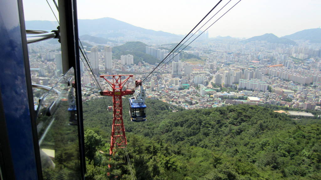
Saha District is a '' gu'' in western Busan, South Korea. It has an area of 40.89 km², and a population of about 375,000. About a third of the area is forest land. Saha-gu became a ''gu'' of Busan in 1983. It is home to the Seunghak Campus of Dong-A University. Administrative divisions Saha-gu is divided into 8 legal ''dong'', which all together comprise 16 administrative ''dong'', as follows: * Goejeong-dong (4 administrative ''dong'') * Dangni-dong * Hadan-dong (2 administrative ''dong'') * Sinpyeong-dong (2 administrative ''dong'') * Jangnim-dong (2 administrative ''dong'') * Dadae-dong (2 administrative ''dong'') * Gupyeong-dong * Gamcheon-dong (2 administrative ''dong'') Sister cities * Dongli, China See also *Busan *Geography of South Korea South Korea is located in East Asia, on the southern portion of the Korean Peninsula located out from the far east of the Asian landmass. The only country with a land border to South Korea is North Korea, lying to the ... [...More Info...] [...Related Items...] OR: [Wikipedia] [Google] [Baidu] |
Busan
Busan (), officially known as is South Korea's most populous city after Seoul, with a population of over 3.4 million inhabitants. Formerly romanized as Pusan, it is the economic, cultural and educational center of southeastern South Korea, with its port being Korea's busiest and the sixth-busiest in the world. The surrounding "Southeastern Maritime Industrial Region" (including Ulsan, South Gyeongsang, Daegu, and some of North Gyeongsang and South Jeolla) is South Korea's largest industrial area. The large volumes of port traffic and urban population in excess of 1 million make Busan a Large-Port metropolis using the Southampton System of Port-City classification . Busan is divided into 15 major administrative districts and a single county, together housing a population of approximately 3.6 million. The full metropolitan area, the Southeastern Maritime Industrial Region, has a population of approximately 8 million. The most densely built-up areas of the city are situat ... [...More Info...] [...Related Items...] OR: [Wikipedia] [Google] [Baidu] |
Gamcheon-dong
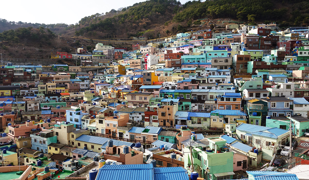
Gamcheon-dong is a subdivision of Saha-gu district in central-west Busan, South Korea. Gamcheon Culture Village, which features steep streets, twisting alleys, and brightly painted houses, is located in Gamcheon-dong. Some painted street murals, art installations, cafes, stores, museums, workshops, and craft boutiques have also sprung up in the area. The area was previously known as Taegeukdo Village. Previously one of the city's poorer areas, the government of Korea invested money in Gamcheon-dong in 2009 to fund the "Dreaming of Machu Picchu Machu Picchu is a 15th-century Inca citadel located in the Eastern Cordillera of southern Peru on a mountain range.UNESCO World Heritage Centre. It is located in the Machupicchu District within Urubamba Province above the Sacred Valley, whi ... in Busan Project".http://busanhaps.com/history-hills-busans-gamcheon-culture-village/ Busan Haps Subsequently the area has won several regional awards including the 2012 UN-HABITAT Asian Towns ... [...More Info...] [...Related Items...] OR: [Wikipedia] [Google] [Baidu] |
Geography Of South Korea
South Korea is located in East Asia, on the southern portion of the Korean Peninsula located out from the far east of the Asian landmass. The only country with a land border to South Korea is North Korea, lying to the north with of the border running along the Korean Demilitarized Zone. South Korea is mostly surrounded by water and has of coast line along three seas; to the west is the Yellow Sea (called ''Sohae'' ; in South Korea, literally means west sea), to the south is the East China Sea, and to the east is the Sea of Japan (called ''Donghae'' ; in South Korea, literally means east sea). Geographically, South Korea's landmass is approximately . of South Korea are occupied by water. The approximate coordinates are 37° North, 128° East. Land area and borders The Korean Peninsula extends southward from the northeast part of the Asian continental landmass. The Japanese islands of Honshū and Kyūshū are located some 200 km (124 mi) to the southeast acro ... [...More Info...] [...Related Items...] OR: [Wikipedia] [Google] [Baidu] |
China
China, officially the People's Republic of China (PRC), is a country in East Asia. It is the world's List of countries and dependencies by population, most populous country, with a Population of China, population exceeding 1.4 billion, slightly ahead of India. China spans the equivalent of five time zones and Borders of China, borders fourteen countries by land, the List of countries and territories by land borders, most of any country in the world, tied with Russia. Covering an area of approximately , it is the world's third List of countries and dependencies by area, largest country by total land area. The country consists of 22 provinces of China, provinces, five autonomous regions of China, autonomous regions, four direct-administered municipalities of China, municipalities, and two special administrative regions of China, Special Administrative Regions (Hong Kong and Macau). The national capital is Beijing, and the List of cities in China by population, most populous cit ... [...More Info...] [...Related Items...] OR: [Wikipedia] [Google] [Baidu] |
Dongli District
Dongli District () is a district of the municipality of Tianjin, People's Republic of China. Located in the district are Tianjin Binhai International Airport and Tianjin Airlines headquarters. Administrative divisions There are 9 subdistricts in the district: Transportation Metro Dongli is currently served by two metro lines operated by Tianjin Metro: * - Yudongcheng, Dengzhoulu, Guoshanlu, Konggangjingjiqu, Binhaiguojijichang * - Xinli, Dongli Economic Development Area, Xiaodongzhuang, Junliangcheng JunliangchengChinese: t , s , p ''Jūnliángchéng'', w Chun-liang-Cheng, lit. "Army Depot". is a town in the Dongli District of Tianjin in China. The area of the current city was previously along the coast of the Bohai, before the 1043 Ye ..., Tianjin Pipe Corporation References Districts of Tianjin {{Tianjin-geo-stub ... [...More Info...] [...Related Items...] OR: [Wikipedia] [Google] [Baidu] |


