|
Saas Almagell
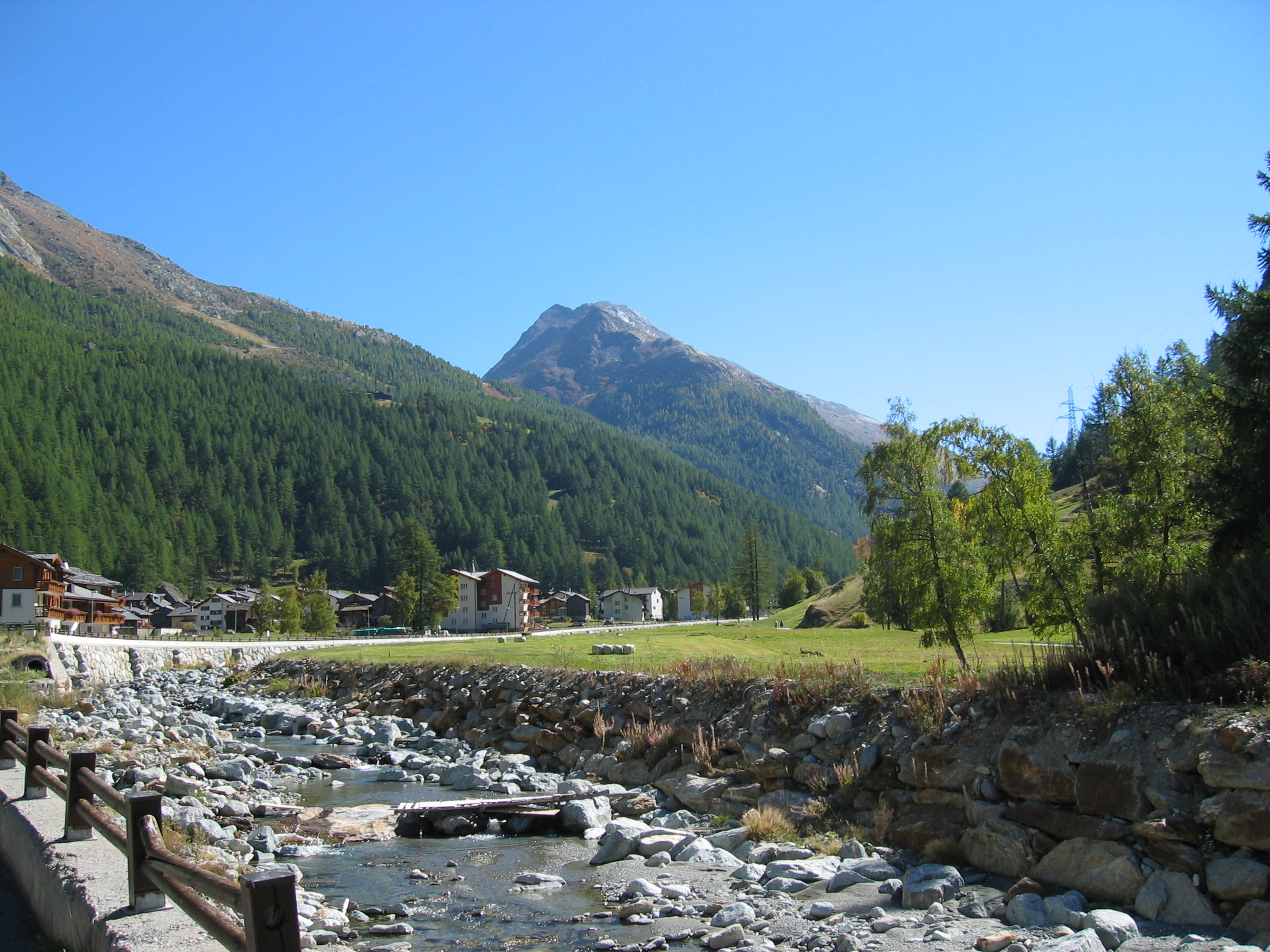
Saas-Almagell is a municipality in the district of Visp in the canton of Valais in Switzerland. History Saas-Almagell is first mentioned in 1291 as ''Armenzello''. In 1307 it was mentioned as ''Almenkel''. The settlement, at the upper end of the Saastal, was relatively isolated for much of its history. A road suitable for motor vehicles was completed in 1948, whilst the village did not have its own school until 1958. The local economy was boosted in the 1960s by the construction of the Mattmark Dam. Geography Saas-Almagell has an area, , of . Of this area, 7.5% is used for agricultural purposes, while 4.1% is forested. Of the rest of the land, 0.5% is settled (buildings or roads) and 87.9% is unproductive land. The municipality is located in the Visp district and is located approximately from Saas-Fee. It is the southernmost municipality in the Saas valley. It consists of the village of Saas-Almagell, part of the hamlet of Unter den Bodmen and the hamlets of zum Moos, ... [...More Info...] [...Related Items...] OR: [Wikipedia] [Google] [Baidu] |
Visp (district)
The district of Visp (german: Bezirk Visp, french: District de Viège) is a district in the Canton of Valais in southern Switzerland. It has a population of (as of ). Municipalities It consists of the following municipalities: Coat of arms The blazon of the district coat of arms is ''Per pale Argent and Gules, two Lions rampant respectant counterchanged.'' Demographics Visp has a population () of . Most of the population () speaks German (23,373 or 87.2%) as their first language, Portuguese is the second most common (853 or 3.2%) and Italian is the third (658 or 2.5%). There are 398 people who speak French and 12 people who speak Romansh. , the gender distribution of the population was 49.8% male and 50.2% female. The population was made up of 10,909 Swiss men (39.4% of the population) and 2,881 (10.4%) non-Swiss men. There were 11,353 Swiss women (41.0%) and 2,528 (9.1%) non-Swiss women. [...More Info...] [...Related Items...] OR: [Wikipedia] [Google] [Baidu] |
Saaser Vispa
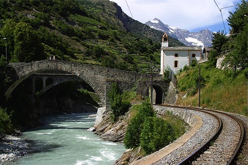
The Vispa is a river in the canton of Valais, located in the Visp area. It is essentially composed of two large branches: the Matter Vispa and the Saaser Vispa, converging at Stalden, then forming the Vispa proper, flowing for less than before converging with the Rhône at Visp. The Vispa is a left and major affluent of the Rhône, before it enters Lake Geneva. The Vispa collects the waters from the Mattertal (formed by the Matter Vispa) and the Saastal (formed by the Saaser Vispa), the two highest valleys in Switzerland and the Pennine Alps. Both valleys have mountains over above sea level, the highest being Monte Rosa, the Dom and the Weisshorn, and include numerous glaciers, large and small. As a result, the river is characterized by a glacial regime, similarly to the Massa, another nearby affluent of the Rhône. The Matter Vispa is the longest of the two branches. It is over long, from the mouth of the Gorner Glacier to Stalden. It comprehends small but numerous afflue ... [...More Info...] [...Related Items...] OR: [Wikipedia] [Google] [Baidu] |
Almagellhorn
The Almagellhorn (or Almagellerhorn) (3,327 m) is a mountain of the Pennine Alps, overlooking Saas Almagell, in the canton of Valais Valais ( , , ; frp, Valês; german: Wallis ), more formally the Canton of Valais,; german: Kanton Wallis; in other official Swiss languages outside Valais: it, (Canton) Vallese ; rm, (Chantun) Vallais. is one of the 26 cantons forming the S .... References Landeskarte Der Schweiz: Saas 1,329 1:25,000 External links Almagellhorn on Hikr Mountains of the Alps Alpine three-thousanders Mountains of Valais Mountains of Switzerland {{valais-mountain-stub ... [...More Info...] [...Related Items...] OR: [Wikipedia] [Google] [Baidu] |
Jazzihorn
The Jazzihorn is a mountain of the Pennine Alps, located on the Swiss-Italian border. On the Italian side it is named ''Pizzo Cingino Nord'' as another summit is named ''Pizzo Cingino Sud'' on the south. The Jazzihorn has an elevation of 3,227 metres above sea level and lies between the valleys of Saastal The Saastal or the Saas Valley is an alpine valley in the district of Visp, in the eastern part of the Canton of Valais, Switzerland. It is the valley of the river Saaser Vispa. It is separated from the Mattertal to the west by the Mischab ... (Valais) and Valle d'Antrona (Piedmont). References External links Jazzihorn on Hikr Mountains of the Alps Mountains of Piedmont Mountains of Valais Alpine three-thousanders Italy–Switzerland border International mountains of Europe Mountains of Switzerland {{VerbanoCusioOssola-mountain-stub ... [...More Info...] [...Related Items...] OR: [Wikipedia] [Google] [Baidu] |
Egginer
The Egginer is a mountain of the Swiss Pennine Alps, overlooking Saas-Fee in the canton of Valais Valais ( , , ; frp, Valês; german: Wallis ), more formally the Canton of Valais,; german: Kanton Wallis; in other official Swiss languages outside Valais: it, (Canton) Vallese ; rm, (Chantun) Vallais. is one of the 26 cantons forming the S .... References External links Egginer on HikrEgginer on Summitpost Mountains of the Alps Alpine three-thousanders Mountains of Valais Mountains of Switzerland {{valais-mountain-stub ... [...More Info...] [...Related Items...] OR: [Wikipedia] [Google] [Baidu] |
Stellihorn
The Stellihorn is a mountain of the Swiss Pennine Alps, overlooking the lake of Mattmark in the canton of Valais. It lies south of Saas-Almagell in the upper valley of Saas Software as a service (SaaS ) is a software licensing and delivery model in which software is licensed on a subscription basis and is centrally hosted. SaaS is also known as "on-demand software" and Web-based/Web-hosted software. SaaS is co .... The north side is covered by a glacier named ''Nollen Gletscher''. References External linksStellihorn on Hikr Mountains of the Alps Alpine three-thousanders Mountains of Switzerland Mountains of Valais {{Valais-geo-stub ... [...More Info...] [...Related Items...] OR: [Wikipedia] [Google] [Baidu] |
Sonnighorn
The Sonnighorn ( it ''Pizzo Bottarello'') is a mountain of the Pennine Alps, located on the Swiss-Italian border. The closest locality is Saas Almagell Saas-Almagell is a municipality in the district of Visp in the canton of Valais in Switzerland. History Saas-Almagell is first mentioned in 1291 as ''Armenzello''. In 1307 it was mentioned as ''Almenkel''. The settlement, at the upper end of ... on the west side. References External links Sonnighorn on Hikr Mountains of the Alps Alpine three-thousanders Mountains of Switzerland Mountains of Italy Italy–Switzerland border International mountains of Europe Mountains of Valais {{VerbanoCusioOssola-mountain-stub ... [...More Info...] [...Related Items...] OR: [Wikipedia] [Google] [Baidu] |
Portjengrat
The Portjengrat (also known as ''Pizzo d'Andolla'') is a mountain of the Pennine Alps, located on the border between Switzerland and Italy. It lies south of the Weissmies and the Zwischbergen Pass, where the international border diverges away from the main Alpine watershed. The summit of the Portjengrat has an elevation of 3,654 metres above sea level and is the tripoint between the valleys of Saas, Divedro (both in Valais) and Antrona (in Piedmont). It is the culminating point of the Antrona valley. The east side of the Portjengrat is covered by a glacier named ''Zwischbergen Gletscher''. Smaller glaciers can be found on the west and south side of the mountain. The closest locality is Saas-Almagell, on the west side. See also *List of mountains of Switzerland This article contains a sortable table of many of the major mountains and hills of Switzerland. The table only includes those summits that have a topographic prominence of at least above other points, and ranks th ... [...More Info...] [...Related Items...] OR: [Wikipedia] [Google] [Baidu] |
Weissmies
The Weissmies is a mountain in the Pennine Alps in the canton of Valais in Switzerland near the village of Saas-Fee. It is the easternmost four-thousander of its range. Geography The Weissmies is located on the main Alpine chain, on a massif separating the Saastal valley on the west and Simplon valley on the east. The massif consists of two other main summits lying to the north at almost the same altitude, the Lagginhorn and Fletschhorn. The mountain lies between the Lagginjoch (3,500 m) to the north and the Zwischbergen Pass (3,260 m) to the south. The Weissmies is one of the 10 four-thousanders surrounding the Saastal, facing the Dom on the west, the third highest summit of the Alps. Climbing It was first climbed by Jakob Christian Häusser and Peter Josef Zurbriggen in 1855 via the Triftgrat. The ascent was mired in some controversy as the local guides did not believe that the peak could be ascended without their help; when they themselves ascended to the s ... [...More Info...] [...Related Items...] OR: [Wikipedia] [Google] [Baidu] |
Allalinhorn
The Allalinhorn () is a mountain in the Pennine Alps in Switzerland. It lies between Zermatt and Saas-Fee in the canton of Valais, and is part of the Mischabel range, which culminates at the Dom (4,545 m). It was first climbed by London barrister Edward Levi Ames, a member of the Imseng family and Franz-Josef Andenmatten on 28 August 1856. The building of the Metro Alpin funicular to the Mittelallalin (3456 m) just below the north-east face has turned the mountain into one of the easiest and popular 4000-metre peaks of the Alps, when climbed by the standard route (WNW Ridge, difficulty Grade F). On the normal route, climbers can ride up to the Mittelallalin; from there, there are only about 500 vertical metres to tackle. However, even the 'easiest' route still has objective dangers from crevasses and should not be attempted by inexperienced mountaineers without a mountain guide or adequate crevasse rescue training. See also *List of 4000 metre peaks of the Alps This l ... [...More Info...] [...Related Items...] OR: [Wikipedia] [Google] [Baidu] |
Strahlhorn
The Strahlhorn (4,190 m) is a mountain of the Swiss Pennine Alps, located south of Saas-Fee and east of Zermatt in the canton of Valais. It lies on the range that separates the Mattertal from the Saastal and is located approximately halfway between the Rimpfischhorn and the Schwarzberghorn. There are three less known peaks of the same name in Switzerland (3027m, 3194m, 3200m). See also *List of 4000 metre peaks of the Alps This list tabulates all of the 82 official mountain summits of or more in height in the Alps, as defined by the International Climbing and Mountaineering Federation (UIAA). All are located within France, Italy or Switzerland, and are often refe ... References Sources * Dumler, Helmut and Willi P. Burkhardt, ''The High Mountains of the Alps'', London: Diadem, 1994 External links * Strahlhorn on Hikr Alpine four-thousanders Mountains of the Alps Mountains of Valais Pennine Alps Mountains of Switzerland Four-thousanders of Switzerland ... [...More Info...] [...Related Items...] OR: [Wikipedia] [Google] [Baidu] |
Rimpfischhorn
The Rimpfischhorn (4,199 m) is a mountain in the Pennine Alps of Switzerland. The first ascent of the mountain was by Leslie Stephen and Robert Living with guides Melchior Anderegg and Johann Zumtaugwald on 9 September 1859. Their route of ascent was from Fluh Alp via the Rimpfischwänge. See also *List of 4000 metre peaks of the Alps This list tabulates all of the 82 official mountain summits of or more in height in the Alps, as defined by the International Climbing and Mountaineering Federation (UIAA). All are located within France, Italy or Switzerland, and are often refe ... References External links The Rimpfischhorn on SummitPostThe Rimpfischhorn on Mount Wiki Alpine four-thousanders Mountains of the Alps Mountains of Valais Pennine Alps Mountains of Switzerland Four-thousanders of Switzerland {{Valais-mountain-stub ... [...More Info...] [...Related Items...] OR: [Wikipedia] [Google] [Baidu] |


