|
SR 178 (CA)
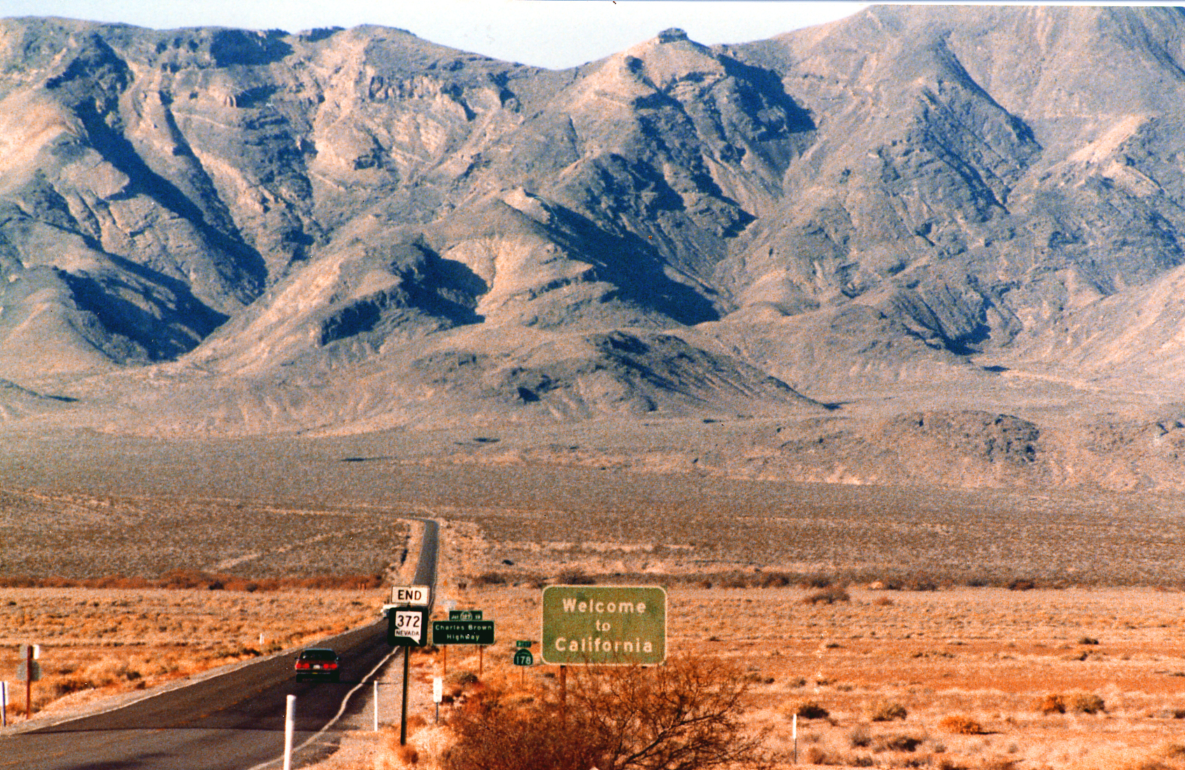
State Route 178 (SR 178) is a state highway in the U.S. state of California that exists in two constructed segments. The gap in between segments is connected by various local roads and State Route 190 through Death Valley National Park. The western segment runs from State Route 99 in Bakersfield and over the Walker Pass in the Sierra Nevada to the turnoff for the Trona Pinnacles National Natural Landmark. The eastern segment runs from the southeasterly part of Death Valley to Nevada State Route 372 at the Nevada state line. SR 178 serves many different purposes. It connects Downtown Bakersfield with East Bakersfield and Lake Isabella. It is one of three crossings over the Sierra Nevada south of Yosemite ( SR 120, Tioga Pass Road), connecting the southern San Joaquin Valley with the upper Mojave Desert and the Owens Valley. This also provides access to Death Valley National Park. If the unconstructed portion were built, it would also provide an easy route between Ridgecrest, C ... [...More Info...] [...Related Items...] OR: [Wikipedia] [Google] [Baidu] |
Bakersfield, California
Bakersfield is a city in and the county seat of Kern County, California, United States. The city covers about near the southern end of the San Joaquin Valley, which is located in the Central Valley region. Bakersfield's population as of the 2020 Census was 403,455, making it the 47th-most populous city in the United States and the 9th-most populous in California. The Bakersfield–Delano Metropolitan Statistical Area, which includes all of Kern County, had a 2020 census population of 909,235, making it the 62nd largest metropolitan area in the United States. Bakersfield is a significant hub for both agriculture and energy production. Kern County is California's most productive oil-producing county and the fourth most productive agricultural county (by value) in the United States. Industries in and around Bakersfield include natural gas and other energy extraction, mining, petroleum refining, distribution, food processing, and corporate regional offices. The city is t ... [...More Info...] [...Related Items...] OR: [Wikipedia] [Google] [Baidu] |
Sierra Nevada (U
The Sierra Nevada ( ) is a mountain range in the Western United States, between the Central Valley (California), Central Valley of California and the Great Basin. The vast majority of the range lies in the state of California, although the Carson Range spur lies primarily in Nevada. The Sierra Nevada is part of the American Cordillera, an almost continuous chain of mountain ranges that forms the western "backbone" of the Americas. The Sierra runs north-south, and its width ranges from to across east–west. Notable features include the General Sherman Tree, the largest tree in the world by volume; Lake Tahoe, the largest alpine lake in North America; Mount Whitney at , the highest point in the contiguous United States; and Yosemite Valley sculpted by glaciers from one-hundred-million-year-old granite, containing List of waterfalls in Yosemite National Park, high waterfalls. The Sierra is home to three national parks, twenty-six wilderness areas, ten national forests, and two ... [...More Info...] [...Related Items...] OR: [Wikipedia] [Google] [Baidu] |
Federal Highway Administration
The Federal Highway Administration (FHWA) is a division of the United States Department of Transportation that specializes in highway transportation. The agency's major activities are grouped into two programs, the Federal-aid Highway Program and the Federal Lands Highway Program. Its role had previously been performed by the Office of Road Inquiry, Office of Public Roads and the Bureau of Public Roads. History Background With the coming of the bicycle in the 1890s, interest grew regarding the improvement of streets and roads in America. The traditional method of putting the burden on maintaining roads on local landowners was increasingly inadequate. In 1893, the federal Office of Road Inquiry (ORI) was founded; in 1905, it was renamed the Office of Public Roads (OPR) and made a division of the United States Department of Agriculture. Demands grew for local and state government to take charge. With the coming of the automobile, urgent efforts were made to upgrade and moderniz ... [...More Info...] [...Related Items...] OR: [Wikipedia] [Google] [Baidu] |
National Highway System (United States)
The National Highway System (NHS) is a network of strategic highways within the United States, including the Interstate Highway System and other roads serving major airports, ports, military bases, rail or truck terminals, railway stations, pipeline terminals and other strategic transport facilities. Altogether, it constitutes the largest highway system in the world. Individual states are encouraged to focus federal funds on improving the efficiency and safety of this network. The roads within the system were identified by the United States Department of Transportation (USDOT) in cooperation with the states, local officials, and metropolitan planning organizations (MPOs) and approved by the United States Congress in 1995. Legislation The Intermodal Surface Transportation Efficiency Act (ISTEA) in 1991 established certain key routes such as the Interstate Highway System, be included. The act provided a framework to develop a National Intermodal Transportation System which "co ... [...More Info...] [...Related Items...] OR: [Wikipedia] [Google] [Baidu] |
California Freeway And Expressway System
The California Freeway and Expressway System is a system of existing or planned freeways and expressways in the U.S. state of California. It encompasses both state highways and federal highways in California. It was defined by Article 2 (commencing with section 250) of Chapter 2 of Division 1 of the Streets and Highways Code. which was originally added by Chapter 1062 of 1959. List of roads in the system The following is a list of roads defined by the Streets and Highways Code, sections 250–257, as part of the California Freeway and Expressway System. Some of the routes listed may still be in the planning stages of being fully upgraded to freeways or expressways. # State Route 1 (part) # State Route 2 (part) # State Route 3 (part) # State Route 4 (part) #Interstate 5 # U.S. Route 6 # State Route 7 # Interstate 8 # State Route 9 #Interstate 10 # State Route 11 # State Route 12 # State Route 13 (part) # State Route 14 #Interstate 15 and State Route 15 # State Route 16 (part) ... [...More Info...] [...Related Items...] OR: [Wikipedia] [Google] [Baidu] |
Las Vegas Valley
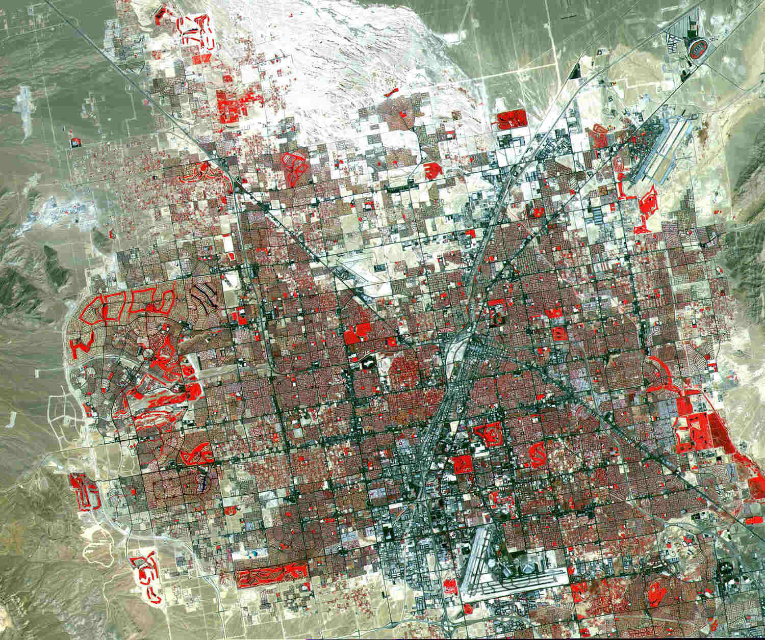
The Las Vegas Valley is a major metropolitan area in the Southern Nevada, southern part of the U.S. state of Nevada, and the second largest in the Southwestern United States. The state's largest urban agglomeration, the Las Vegas Metropolitan Statistical Area is coextensive since 2003 with Clark County, Nevada. The Valley is largely defined by the Las Vegas Valley land formation, a Depression (geology), basin area surrounded by mountains to the north, south, east and west of the metropolitan area. The Valley is home to the three largest incorporated cities in Nevada: Las Vegas, Henderson, Nevada, Henderson and North Las Vegas, Nevada, North Las Vegas. Eleven unincorporated towns governed by the Clark County government are part of the Las Vegas Township and constitute the largest community in the state of Nevada. The names Las Vegas and Vegas are interchangeably used to indicate the Valley, Las Vegas Strip, the Strip, and the city, and as a brand by the Las Vegas Convention and V ... [...More Info...] [...Related Items...] OR: [Wikipedia] [Google] [Baidu] |
Ridgecrest, California
Ridgecrest is a city in Kern County, California, United States, along U.S. Route 395 in California, U.S. Route 395 in the Indian Wells Valley in northeastern Kern County, adjacent to the Naval Air Weapons Station China Lake (NAWS, or China Lake). It was incorporated as a city in 1963. The population was 27,959 at the 2020 United States census, 2020 census, up slightly from 27,616 at the 2010 United States Census, 2010 census, making it the third-largest city in Kern County. Ridgecrest is surrounded by four mountain ranges; the Sierra Nevada on the west, the Coso Range, Coso Range on the north, the Argus Range on the east, and the El Paso Mountains on the south. The most isolated community in Kern county, it is approximately from the Lancaster, California, Lancaster/Palmdale, California, Palmdale area, from Bakersfield, California, Bakersfield, and from San Bernardino, California, San Bernardino, the three nearest major urban centers. Private air travel in and out of the city i ... [...More Info...] [...Related Items...] OR: [Wikipedia] [Google] [Baidu] |
Owens Valley
Owens Valley (Mono language (California), Mono: ''Payahǖǖnadǖ'', meaning "place of flowing water") is an arid valley of the Owens River in eastern California in the United States. It is located to the east of the Sierra Nevada (U.S.), Sierra Nevada, west of the White Mountains (California), White Mountains and Inyo Mountains, and is split between the Great Basin Desert and the Mojave Desert. The mountain peaks on its west side (including Mount Whitney) reach above in elevation, while the floor of the Owens Valley is at about , making the valley the deepest in the United States. The Sierra Nevada casts the valley in a rain shadow, which makes Owens Valley "the Land of Little Rain". The bed of Owens Lake, now a predominantly dry Endorheic basin, endorheic alkali flat, sits on the southern end of the valley. The current arid nature of the valley is mostly due to the Los Angeles Department of Water and Power diverting the water of the region. The valley provides water to the Los ... [...More Info...] [...Related Items...] OR: [Wikipedia] [Google] [Baidu] |
Mojave Desert
The Mojave Desert (; ; ) is a desert in the rain shadow of the southern Sierra Nevada mountains and Transverse Ranges in the Southwestern United States. Named for the Indigenous peoples of the Americas, indigenous Mohave people, it is located primarily in southeastern California and southwestern Nevada, with small portions extending into Arizona and Utah. The Mojave Desert, together with the Sonoran Desert, Sonoran, Chihuahuan Desert, Chihuahuan, and Great Basin Desert, Great Basin deserts, form a larger List of North American deserts, North American desert. Of these, the Mojave is the smallest and driest. It displays typical basin and range topography, generally having a pattern of a series of parallel mountain ranges and valleys. It is also the site of Death Valley, which is the lowest elevation in North America. The Mojave Desert is often colloquially called the "high desert", as most of it lies between . It supports a diversity of flora and fauna. The desert supports a numb ... [...More Info...] [...Related Items...] OR: [Wikipedia] [Google] [Baidu] |
San Joaquin Valley
The San Joaquin Valley ( ; Spanish language in California, Spanish: ''Valle de San Joaquín'') is the southern half of California's Central Valley (California), Central Valley. Famed as a major breadbasket, the San Joaquin Valley is an important source of food, producing a significant part of California's agricultural output. San Joaquin Valley draws from nine counties of Northern California, Northern and Central California, including all of San Joaquin County, San Joaquin and Kings County, California, Kings counties, most of Stanislaus County, Stanislaus, Merced County, Merced, and Fresno County, California, Fresno counties, and parts of Madera County, California, Madera and Tulare County, California, Tulare counties, along with a majority of Kern County, California, Kern County. Although the valley is predominantly rural, it has three densely populated urban centers: Stockton, California, Stockton/Modesto, California, Modesto, Fresno, California, Fresno/Visalia, California, ... [...More Info...] [...Related Items...] OR: [Wikipedia] [Google] [Baidu] |
California State Route 120
State Route 120 (SR 120) is a state highway in the central part of California, connecting the San Joaquin Valley with the Sierra Nevada, Yosemite National Park, and the Mono Lake area. It runs between Interstate 5 in California, Interstate 5 in Lathrop, California, Lathrop and U.S. Route 6 in California, U.S. Route 6 in Benton, California, Benton. While the route is signed as a contiguous route through Yosemite, the portion inside the park is federally maintained and is not included in the state route logs. The portion at Tioga Pass at Yosemite's eastern boundary is the highest paved through road in the California State Route system. This part is not maintained in the winter and is usually closed during the winter season. Route description SR 120 begins as a freeway intersecting Interstate 5 in California, Interstate 5 to extend Interstate 205 (California), Interstate 205 through Manteca, California, Manteca. In east Manteca the freeway ends at California State Route 99, SR 9 ... [...More Info...] [...Related Items...] OR: [Wikipedia] [Google] [Baidu] |
Yosemite
Yosemite National Park ( ) is a national park of the United States in California. It is bordered on the southeast by Sierra National Forest and on the northwest by Stanislaus National Forest. The park is managed by the National Park Service and covers in four countiescentered in Tuolumne and Mariposa, extending north and east to Mono and south to Madera. Designated a World Heritage Site in 1984, Yosemite is internationally recognized for its granite cliffs, waterfalls, clear streams, groves of giant sequoia, lakes, mountains, meadows, glaciers, and biological diversity. Almost 95 percent of the park is designated wilderness. Yosemite is one of the largest and least fragmented habitat blocks in the Sierra Nevada. Its geology is characterized by granite and remnants of older rock. About 10 million years ago, the Sierra Nevada was uplifted and tilted to form its unique slopes, which increased the steepness of stream and river beds, forming deep, narrow canyons. Abou ... [...More Info...] [...Related Items...] OR: [Wikipedia] [Google] [Baidu] |


