|
SK Postcode Area
The SK postcode area, also known as the Stockport postcode area, is a group of nineteen postcode districts in England, within eleven post towns. These cover south-east Greater Manchester (including Stockport, Cheadle, Hyde, Stalybridge and Dukinfield), parts of east Cheshire (including Macclesfield, Wilmslow and Alderley Edge), north-west Derbyshire (including Buxton, High Peak and Glossop) and a small part of north Staffordshire. Mail for the SK postcode area is processed at Manchester Mail Centre, along with mail for the M, BL and OL postcode areas. __TOC__ Coverage The approximate coverage of the postcode districts: , - ! SK1 , STOCKPORT , Stockport , Stockport , - ! SK2 , STOCKPORT , Stockport, Offerton , Stockport , - ! SK3 , STOCKPORT , Stockport, Davenport, Edgeley, Adswood, Bridgehall , Stockport , - ! SK4 , STOCKPORT , Stockport, Four Heatons, Heaton Moor , Stockport , - ! SK5 , STOCKPORT , Stockport, Brinnington, Reddish , Stockport , ... [...More Info...] [...Related Items...] OR: [Wikipedia] [Google] [Baidu] |
Post Town
A post town is a required part of all postal addresses in the United Kingdom and Republic of Ireland, Ireland, and a basic unit of the postal delivery system.Royal Mail, ''Address Management Guide'', (2004) Including the correct post town in the address increases the chance of a letter or parcel being delivered on time. Post towns in general originated as the location of delivery offices. , their main function is to distinguish between localities or street names in addresses not including a Postcodes in the United Kingdom, postcode. Organisation There are approximately 1,500 post towns which are organised by Royal Mail subject to its policy only to impose changes where it has a proven, economic and practical benefit to the organisation, covering its own cost. Each post town usually corresponds to one or more UK postcodes, postal districts (the "outward" part of the postcode, before the space); therefore, each post town can cover an area comprising many towns, urban districts an ... [...More Info...] [...Related Items...] OR: [Wikipedia] [Google] [Baidu] |
BL Postcode Area
The BL postcode area, also known as the Bolton postcode area,Royal Mail, ''Address Management Guide'', (2004) is a group of ten postcode districts in North West England. These cover most of the Metropolitan Borough of Bolton and the northern and central parts of the Metropolitan Borough of Bury in Greater Manchester, plus small parts of the boroughs of Chorley, Rossendale and Blackburn with Darwen in Lancashire. Mail for the BL postcode area is processed at Manchester Mail Centre, along with mail for the M, OL and SK postcode areas. __TOC__ Coverage The approximate coverage of the postcode districts: , - ! BL0 , BURY , Ramsbottom, Edenfield, Shuttleworth , Bury, Rossendale , - ! BL1 , BOLTON , Bolton centre, Smithills, Halliwell, Heaton , Bolton , - ! BL2 , BOLTON , Bolton centre, Ainsworth, Bradley Fold, Bradshaw, Breightmet, Harwood, Tonge Fold, Tonge Moor , Bolton, Bury , - ! BL3 , BOLTON , Bolton centre, Little Lever, Great Lever, Darcy Lever, ... [...More Info...] [...Related Items...] OR: [Wikipedia] [Google] [Baidu] |
Woodley, Greater Manchester
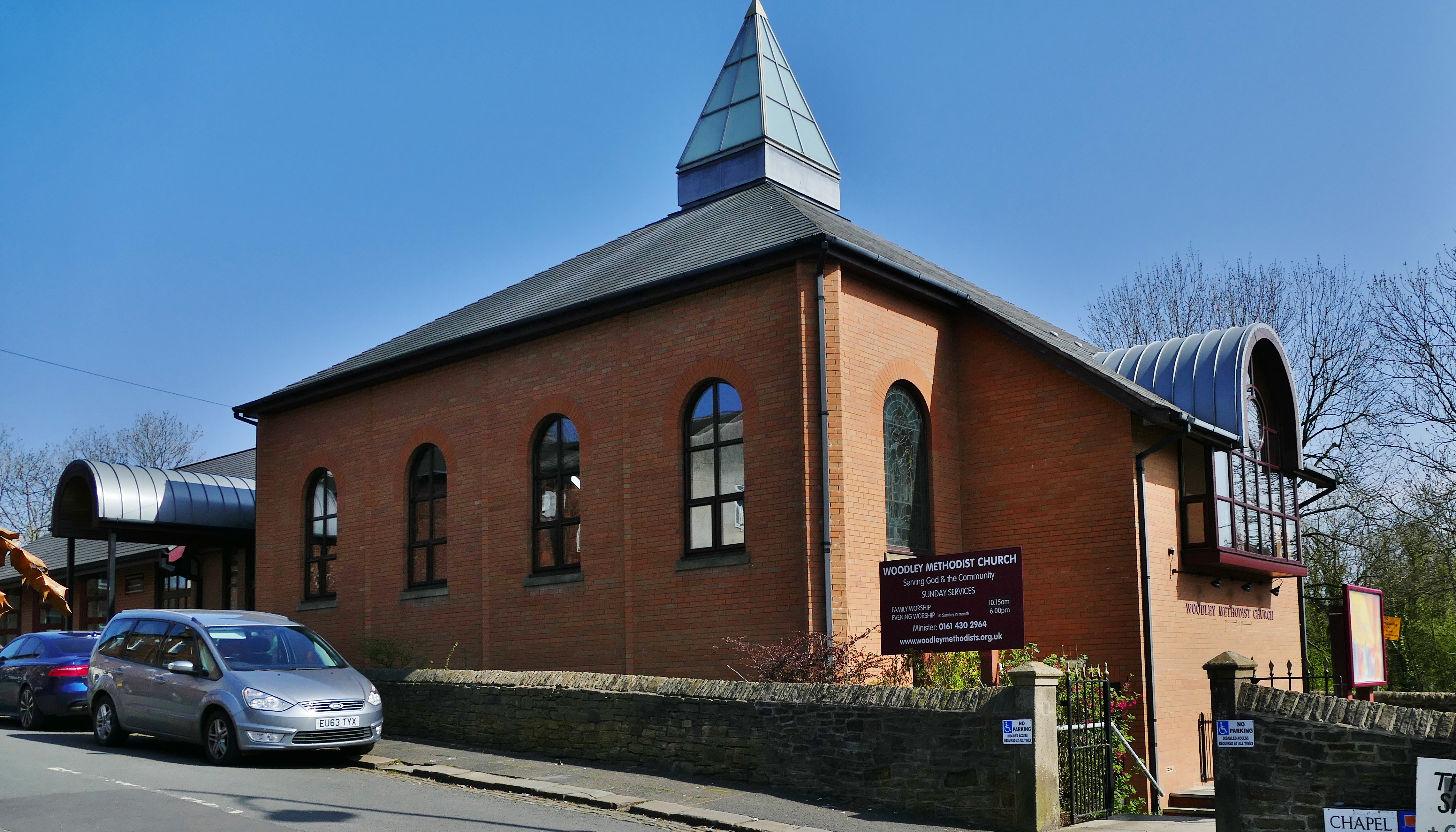
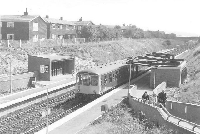
Woodley is a suburb in the Metropolitan Borough of Stockport, Greater Manchester, England. It is situated mostly on the east side of the Peak Forest Canal, next to Bredbury, Romiley and the boundary with Tameside, at Gee Cross. Historic counties of England, Historically part of Cheshire, the name means "a clearing in the wood" because the area contains much woodland. Religion Woodley Methodist Church, sited on Chapel Street, has been a part of the community since 1868; the building was rebuilt in 1998. St Mark's Church, sited on Redhouse Lane in Bredbury, is an Church of England, Anglican church which serves the parish of Bredbury and Woodley. Transport Railway Woodley railway station is a stop on the Hope Valley line; it is on the ''Hyde Loop'' which stretches from to , via but by-passing . Northern Trains operates services in a generally half-hourly pattern between and on Mondays to Saturdays; there is no service on Sundays. Buses Stagecoach Manchester operates two loc ... [...More Info...] [...Related Items...] OR: [Wikipedia] [Google] [Baidu] |
Romiley
Romiley is a village in the Metropolitan Borough of Stockport, Greater Manchester, England. Historic counties of England, Historically part of Cheshire, it borders Marple, Greater Manchester, Marple, Bredbury and Woodley, Greater Manchester, Woodley. At the United Kingdom Census 2021, 2021 census, the built up area had a population of 10,900. History Romiley (or ''Rvmelie'' in Medieval Latin) is documented in the Domesday Book of 1086 as being predominantly agricultural, with 16 ploughlands (areas defined as 120 acres each) and 9 square League (unit), leagues of woodland. It had no recorded population. Romiley's agricultural nature continued during the centuries leading up to the late Victorian era, when it became a residential area with a small district centre. The Peak Forest Canal flows around the west and south of Romiley. It was completed in 1805. Although much of the canal fell into disuse by the early 1960s, it was restored and subsequently reopened in April 1974. G ... [...More Info...] [...Related Items...] OR: [Wikipedia] [Google] [Baidu] |
Bredbury
Bredbury is a town in the Metropolitan Borough of Stockport, Greater Manchester, England, south-east of Manchester, east of Stockport and south-west of Hyde, Greater Manchester, Hyde. The Bredbury and Woodley, Greater Manchester, Woodley built up area (as defined by the Office for National Statistics) had a population of 17,040 at the 2021 United Kingdom census, 2021 census. Bredbury is on the lower southern slopes of Werneth Low, an outlier of the Pennines; it lies between the valleys of the River Tame, Greater Manchester, River Tame and River Goyt, head-waters of the River Mersey. History Iron Age The area must have been unattractive to the Brigantes settlers in pre-Roman Britain, with its bleak hilltop, the heavy clay soil of the intermediate land probably covered by trees and becoming marshy where the slopes flattened out, and the swampy valley floors. The rivers flowed more fully before their waters were dammed in the 19th century to supply Manchester, Stockport and othe ... [...More Info...] [...Related Items...] OR: [Wikipedia] [Google] [Baidu] |
Reddish
Reddish is an area of the Metropolitan Borough of Stockport, Greater Manchester, England, south-east of Manchester city centre. At the 2011 United Kingdom census, 2011 census, the population was 28,052. Historic counties of England, Historically part of Lancashire, Reddish grew rapidly in the Industrial Revolution and still retains landmarks from that period, such as Houldsworth Mill, Reddish, Houldsworth Mill, a former cotton mill, textile mill. Reddish Vale is a country park. History Toponymy Reddish is recorded as Redich (1205, 1212), Redych, Radich (1226), Radish, Rediche (1262), Redditch (1381), Redwyche, Radishe and Reddishe (16th century).Farrer and Brownbillpp. 326–9Booker, p. 197. The name either means "reedy ditch" (Old English, OE ''hrēod-dīc'') or "red ditch" (OE ''rēad-dīc''). Ekwall (1922) allows either form, stating "red" is less probable; Mills (1991) and Arrowsmith (1997) only give the "reed" option.Arrowsmith, p. 23. The ditch referred to is poss ... [...More Info...] [...Related Items...] OR: [Wikipedia] [Google] [Baidu] |
Brinnington
Brinnington is a north-eastern suburb of Stockport, Greater Manchester, England, on a bluff above a bend in the Tame Valley between the M60 motorway and Reddish Vale Country Park. Description Brinnington was open farm land before the local authority housing developments of the 1950s and 1960s. To the west of Brinnington is Reddish Vale, a country park popular with families to go for a walk and explore the ponds and brick viaducts; under the arches there is a sharp bend in the river and sand has been deposited giving the effect of a miniature beach. The area consists mainly of council owned dwellings including high rise flats. Brinnington has high crime levels and long-term unemployment at 20%. Two streets, Northumberland Road and Brinnington Road, were named by police as two of the three worst roads in north Stockport in 2010. The area has undergone regeneration, including the demolition of the Top Shops site, replaced with 53 shared ownership houses, and First House commun ... [...More Info...] [...Related Items...] OR: [Wikipedia] [Google] [Baidu] |
Heaton Moor
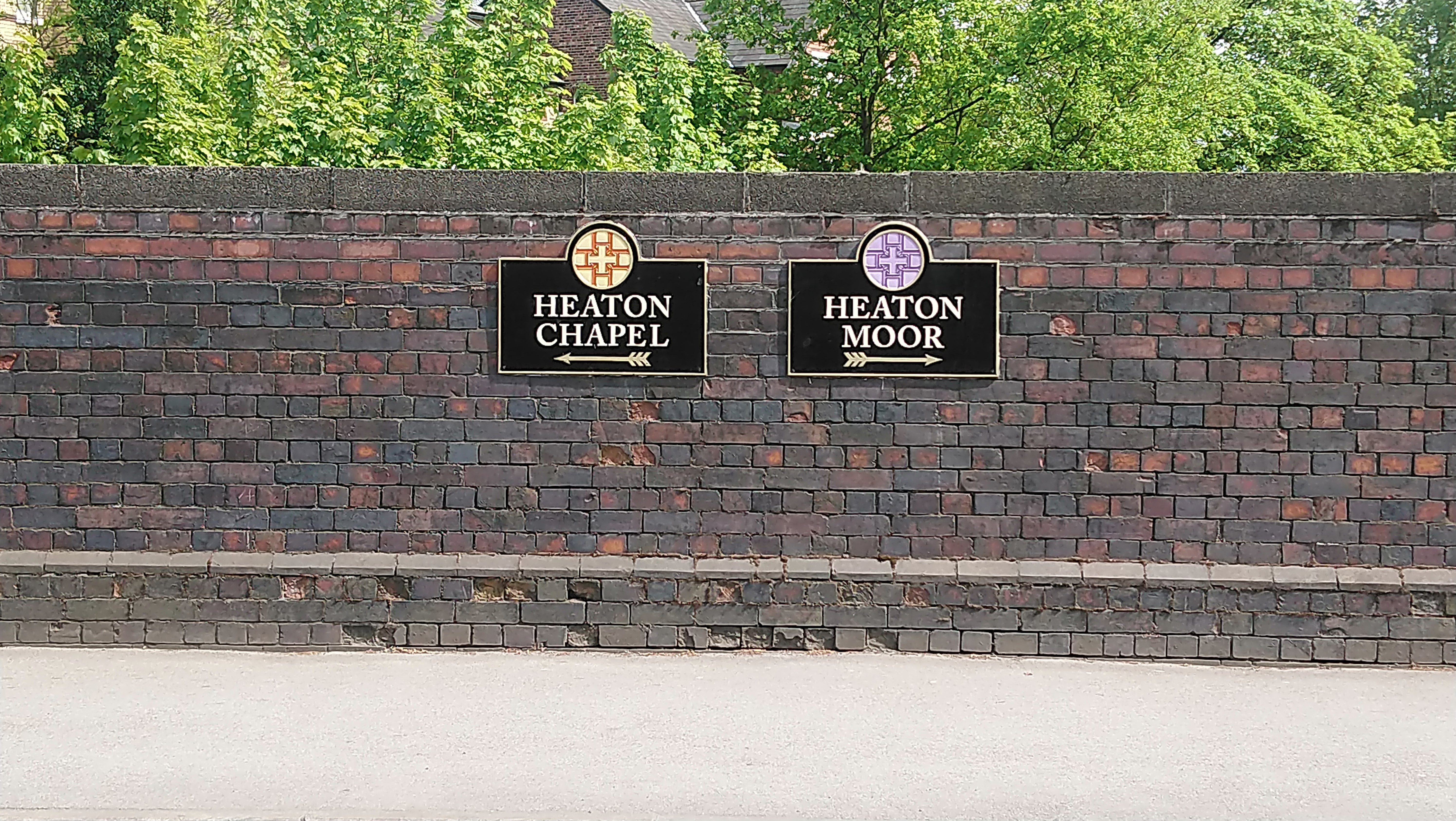
Heaton Moor is a suburb of Stockport, Greater Manchester, England. It is one of the Four Heatons and borders Heaton Chapel, Heaton Norris and Heaton Mersey. Heaton Moor has Victorian housing, built between 1852 and 1892, along affluent tree-lined streets which follow the field patterns of a former agricultural economy. Governance Heaton Moor is in the Metropolitan Borough of Stockport, mainly within the Heatons South ward. It was originally in the township of Heaton Norris, in the Salford hundred of Lancashire. Following the 1834 Poor Law Amendment Act it was administered by Heaton Norris Local Board as part of the Stockport Poor Law Union. In 1913, Heaton Moor, as part of Heaton Norris, was absorbed into the County Borough of Stockport. In 1934, the area voted to leave Lancashire and join Cheshire. Geography The land in Heaton Moor is predominantly flat with no rivers or streams. The soil is black and fertile as expected from land that was previously peat moor. Heaton ... [...More Info...] [...Related Items...] OR: [Wikipedia] [Google] [Baidu] |
Four Heatons
The Four Heatons are four neighbourhoods, Heaton Chapel, Heaton Mersey, Heaton Moor and Heaton Norris, which form a suburban area of Stockport in North West England. North of the River Mersey, they were historically split, with Heaton Mersey and Heaton Moor in Cheshire and Heaton Norris and Heaton Chapel in Lancashire. It is a commuter zone, with greenbelt and a conservation area, and is coterminous with the SK4 postcode district. The opening of railway stations, at Heaton Norris Heaton Norris is a suburb of the Metropolitan Borough of Stockport, Greater Manchester, England. It is one of the Four Heatons, along with neighbours Heaton Chapel, Heaton Mersey and Heaton Moor. Originally within the boundaries of the Historic ... in 1840 and Heaton Chapel in 1853, resulted in the suburbanisation of the Four Heatons. The area is home to various retailers, as well as bars, delis, independent music venues and a privately owned single-screen cinema. References {{Reflist ... [...More Info...] [...Related Items...] OR: [Wikipedia] [Google] [Baidu] |
Adswood
Adswood is a suburb of Stockport, Greater Manchester, England. History Adswood Hall Built in the seventeenth century, the hall was originally inhabited by the Hirst family. By the nineteenth century, the site was a farm, and in the early twentieth century the building was sold off along with other local farmland in the course of housing developments on the site. WW2 bombing On Christmas Eve morning 1944, a German V1 bomb landed in a resident’s garden in Garners Lane, Adswood. There was one fatality and some injuries. The impact destroyed and damaged a number of houses. Brickworks Adswood was home to a number of brickworks sites belonging to the company J.&A. Jacksons, inc. 1922. The company was an important supplier for the local Manchester area, mainly in its provision of common bricks used for internal wall eaves. Housing Council housing in Adswood began in the 1920s with the building of Culver Road at the back of the estate towards neighbouring Cale Green. The ... [...More Info...] [...Related Items...] OR: [Wikipedia] [Google] [Baidu] |
Edgeley
Edgeley is a suburb of Stockport, Greater Manchester, England. Edgeley is characterised largely by Victorian terraced housing around Alexandra Park. The population in 2021 was 14,182. Edgeley Park is home to Stockport County F.C. History References to Edgeley, or "Eddyshelegh", are recorded in the early part of the 13th century. However the main history of the area dates from the beginning of the Industrial Revolution where it was a working class hub, after the decline of industrial Britain, Edgeley like many northern urban areas suffered economically and the area fell into decay, after some subtle investment the area is slowly showing signs of improvement. On 27 November 1792, an advertisement appeared in the ''Manchester Mercury'' to let land at Edgeley as: An Eligible situation for Bleach Ground or Print Field in which there are a number of Fine White Sand Springs with a Rivulet capable of Turning Wash Wheels etc. The Grounds lie very contiguous to the populous Manuf ... [...More Info...] [...Related Items...] OR: [Wikipedia] [Google] [Baidu] |
Davenport, Greater Manchester
Davenport is a district of Stockport, Greater Manchester, England; until 1974, it was part of Cheshire. At the 2011 census, it had a population of 14,924. History Davenport's name arose from the building of Davenport railway station at the behest of the Davenport family, who since the later 14th century had owned Bramall Hall in the neighbouring village of Bramhall. The family name came from an ancestral estate between Holmes Chapel and Congleton, in Mid Cheshire. The estate is recorded in the Domesday Book of 1086, where it is listed as ''Deneport''. Originally, Davenport's expansion in the 1850s consisted of three key routes, Bramhall Lane, Kennerley Road and Buxton Road, all of which remain in place today. The 1900s saw an increase in construction of residential houses and commercial developments. The aftermath of World War II saw the demolition of larger, older properties in extensive gardens to make way for smaller private residences and flats. Transport The railwa ... [...More Info...] [...Related Items...] OR: [Wikipedia] [Google] [Baidu] |


