|
Rácalmás
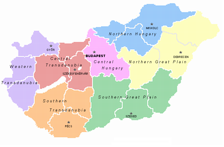
Rácalmás is a town in Central Transdanubia, in Fejér county, Hungary. Located on the right side of river Danube around 61 km south of Budapest. The Name Rácalmás is derived from a Serbian ("Rác" - from medieval "Raška") apple picker. There is also on a Grassed area alongside of a Lake in the Town, A white Tree Called, the Holmar Apple Tree. Twin towns – sister cities Rácalmás is twinned with: * Dransfeld Dransfeld is a town in the district of Göttingen, in Lower Saxony, Germany. It is situated approximately 12 km west of Göttingen. Dransfeld is also the seat of the ''Samtgemeinde'' ("collective municipality") Dransfeld. Infrastructure ..., Germany References External links * in Hungarian Related link collection Street map Populated places in Fejér County {{Fejer-geo-stub ... [...More Info...] [...Related Items...] OR: [Wikipedia] [Google] [Baidu] |
Fejér County
Fejér ( hu, Fejér megye, ) is an administrative county (comitatus or megye) in Central Hungary. It lies on the west bank of the river Danube and nearly touches the eastern shore of Lake Balaton. It shares borders with the Hungarian counties Veszprém, Komárom-Esztergom, Pest, Bács-Kiskun, Tolna and Somogy. The capital of Fejér county is Székesfehérvár. Geography Geographically, Fejér County is very diverse; its southern part is similar (and adjacent) to the Great Hungarian Plain, and other parts are hilly (Bakony, Vértes, Gerecse mountains). Lake Velence, a popular resort, is also located there. History Early history The area was already inhabited 20,000 years ago. When this part of Hungary formed a Roman province called ''Pannonia'', several settlements stood here: the capital was Gorsium, but there were other significant towns too, where present-day Baracs and Dunaújváros are (the towns were called ''Annamatia'' and ''Intercisa'', respectively). In the earl ... [...More Info...] [...Related Items...] OR: [Wikipedia] [Google] [Baidu] |
List Of Cities And Towns Of Hungary
Hungary has 3,152 Municipality, municipalities as of July 15, 2013: 346 towns (Hungarian term: ''város'', plural: ''városok''; the terminology doesn't distinguish between city, cities and towns – the term town is used in official translations) and 2,806 villages (Hungarian: ''község'', plural: ''községek'') of which 126 are classified as large villages (Hungarian: ''nagyközség'', plural: ''nagyközségek''). The number of towns can change, since villages can be elevated to town status by act of the President. The capital Budapest has a special status and is not included in any county while 23 of the towns are so-called urban counties (''megyei jogú város'' – town with county rights). All county seats except Budapest are urban counties. Four of the cities (Budapest, Miskolc, Győr, and Pécs) have agglomerations, and the Hungarian Statistical Office distinguishes seventeen other areas in earlier stages of agglomeration development. The largest city is the capital, Bu ... [...More Info...] [...Related Items...] OR: [Wikipedia] [Google] [Baidu] |
Dunaújváros District
Dunaújváros ( hu, Dunaújvárosi járás) is a district in south-eastern part of Fejér County. ''Dunaújváros'' is also the name of the town where the district seat is found. The district is located in the Central Transdanubia Statistical Region. Geography Dunaújváros District borders with Martonvásár District to the northeast, Ráckeve District ''( Pest County)'' and Kunszentmiklós District ''( Bács-Kiskun County)'' to the east, Paks District ''(Tolna County)'' to the south, Sárbogárd District, Székesfehérvár District and Gárdony District to the west. The number of the inhabited places in Dunaújváros District is 16. Municipalities The district has 1 urban county, 3 towns, 3 large villages and 9 villages. (ordered by population, as of 1 January 2012) The bolded municipalities are cities, ''italics'' municipalities are large villages. See also *List of cities and towns in Hungary Hungary has 3,152 municipalities as of July 15, 2013: 346 towns (Hungarian ... [...More Info...] [...Related Items...] OR: [Wikipedia] [Google] [Baidu] |
Dransfeld
Dransfeld is a town in the district of Göttingen, in Lower Saxony, Germany. It is situated approximately 12 km west of Göttingen. Dransfeld is also the seat of the ''Samtgemeinde'' ("collective municipality") Dransfeld. Infrastructure Traffic Bundesstraße 3 runs through Dransfeld connecting it to Göttingen and Hann. Münden and to Bundesautobahn 7, one of the most important motorways in Germany. Bundesautobahn 38 to Halle and Leipzig is also nearby. Local bus line 120 runs from Göttingen to Hann. Münden up to every 30 minutes and there are several other lines to nearby villages. The nearby train station in Göttingen is part of the Schnellfahrstrecke Hannover/Würzburg and has regular ICE stops and multiple daily connections to Berlin, Hamburg, Munich, Frankfurt, Stuttgart and Basel , french: link=no, Bâlois(e), it, Basilese , neighboring_municipalities= Allschwil (BL), Hégenheim (FR-68), Binningen (BL), Birsfelden (BL), Bottmingen (BL), Huningue ... [...More Info...] [...Related Items...] OR: [Wikipedia] [Google] [Baidu] |
Budapest
Budapest (, ; ) is the capital and most populous city of Hungary. It is the ninth-largest city in the European Union by population within city limits and the second-largest city on the Danube river; the city has an estimated population of 1,752,286 over a land area of about . Budapest, which is both a city and county, forms the centre of the Budapest metropolitan area, which has an area of and a population of 3,303,786; it is a primate city, constituting 33% of the population of Hungary. The history of Budapest began when an early Celtic settlement transformed into the Roman town of Aquincum, the capital of Lower Pannonia. The Hungarians arrived in the territory in the late 9th century, but the area was pillaged by the Mongols in 1241–42. Re-established Buda became one of the centres of Renaissance humanist culture by the 15th century. The Battle of Mohács, in 1526, was followed by nearly 150 years of Ottoman rule. After the reconquest of Buda in 1686, the ... [...More Info...] [...Related Items...] OR: [Wikipedia] [Google] [Baidu] |
Danube
The Danube ( ; ) is a river that was once a long-standing frontier of the Roman Empire and today connects 10 European countries, running through their territories or being a border. Originating in Germany, the Danube flows southeast for , passing through or bordering Austria, Slovakia, Hungary, Croatia, Serbia, Romania, Bulgaria, Moldova, and Ukraine before draining into the Black Sea. Its drainage basin extends into nine more countries. The largest cities on the river are Vienna, Budapest, Belgrade and Bratislava, all of which are the capitals of their respective countries; the Danube passes through four capital cities, more than any other river in the world. Five more capital cities lie in the Danube's basin: Bucharest, Sofia, Zagreb, Ljubljana and Sarajevo. The fourth-largest city in its basin is Munich, the capital of Bavaria, standing on the Isar River. The Danube is the second-longest river in Europe, after the Volga in Russia. It flows through much of Central and Sou ... [...More Info...] [...Related Items...] OR: [Wikipedia] [Google] [Baidu] |
Hungary
Hungary ( hu, Magyarország ) is a landlocked country in Central Europe. Spanning of the Carpathian Basin, it is bordered by Slovakia to the north, Ukraine to the northeast, Romania to the east and southeast, Serbia to the south, Croatia and Slovenia to the southwest, and Austria to the west. Hungary has a population of nearly 9 million, mostly ethnic Hungarians and a significant Romani minority. Hungarian, the official language, is the world's most widely spoken Uralic language and among the few non-Indo-European languages widely spoken in Europe. Budapest is the country's capital and largest city; other major urban areas include Debrecen, Szeged, Miskolc, Pécs, and Győr. The territory of present-day Hungary has for centuries been a crossroads for various peoples, including Celts, Romans, Germanic tribes, Huns, West Slavs and the Avars. The foundation of the Hungarian state was established in the late 9th century AD with the conquest of the Carpathian Basin by Hungar ... [...More Info...] [...Related Items...] OR: [Wikipedia] [Google] [Baidu] |
Transdanubia
Transdanubia ( hu, Dunántúl; german: Transdanubien, hr, Prekodunavlje or ', sk, Zadunajsko :sk:Zadunajsko) is a traditional region of Hungary. It is also referred to as Hungarian Pannonia, or Pannonian Hungary. Administrative divisions Traditional interpretation The borders of Transdanubia are the Danube River (north and east), the Drava and Mura rivers (south), and the foothills of the Alps roughly along the border between Hungary and Austria (west). Transdanubia comprises the counties of Győr-Moson-Sopron, Komárom-Esztergom, Fejér, Veszprém, Vas, Zala, Somogy, Tolna, Baranya and the part of Pest that lies west of the Danube. (In the early Middle Ages the latter was known as Pilis county.) This article deals with Transdanubia in this geographical meaning. Territorial changes While the northern, eastern and southern borders of the region are clearly marked by the Danube and Drava rivers, the western border was always identical with the political boundary of ... [...More Info...] [...Related Items...] OR: [Wikipedia] [Google] [Baidu] |
Germany
Germany,, officially the Federal Republic of Germany, is a country in Central Europe. It is the second most populous country in Europe after Russia, and the most populous member state of the European Union. Germany is situated between the Baltic and North seas to the north, and the Alps to the south; it covers an area of , with a population of almost 84 million within its 16 constituent states. Germany borders Denmark to the north, Poland and the Czech Republic to the east, Austria and Switzerland to the south, and France, Luxembourg, Belgium, and the Netherlands to the west. The nation's capital and most populous city is Berlin and its financial centre is Frankfurt; the largest urban area is the Ruhr. Various Germanic tribes have inhabited the northern parts of modern Germany since classical antiquity. A region named Germania was documented before AD 100. In 962, the Kingdom of Germany formed the bulk of the Holy Roman Empire. During the 16th ce ... [...More Info...] [...Related Items...] OR: [Wikipedia] [Google] [Baidu] |
Telephone Numbers In Hungary
This article details the dialling protocol for reaching Hungarian telephone numbers from within Hungary. The standard landline number consists of 6 numerals except those in Budapest which have 7 numerals, as do mobile numbers. Before keying the subscriber number required, a caller may need to enter a domestic code (06) and an area code. Hungary area codes In Hungary the standard lengths for area codes is two, except for Budapest (the capital), which has the area code 1. Landline numbers are six digits in general; numbers in Budapest and mobile numbers are seven digits. Making calls within and from Hungary Calls within local areas can be made by dialling the number without the area code, such as 123 4567 in Budapest or 123 456 in other areas. However, this is not permitted in mobile phone networks. Domestic calls to all other area codes must be preceded with 06 + area code. For example, a call from Budapest to Monor (area code 29) would be made as 06 29 123 456 and a call from M ... [...More Info...] [...Related Items...] OR: [Wikipedia] [Google] [Baidu] |
Mayor
In many countries, a mayor is the highest-ranking official in a municipal government such as that of a city or a town. Worldwide, there is a wide variance in local laws and customs regarding the powers and responsibilities of a mayor as well as the means by which a mayor is elected or otherwise mandated. Depending on the system chosen, a mayor may be the chief executive officer of the municipal government, may simply chair a multi-member governing body with little or no independent power, or may play a solely ceremonial role. A mayor's duties and responsibilities may be to appoint and oversee municipal managers and employees, provide basic governmental services to constituents, and execute the laws and ordinances passed by a municipal governing body (or mandated by a state, territorial or national governing body). Options for selection of a mayor include direct election by the public, or selection by an elected governing council or board. The term ''mayor'' shares a linguistic ... [...More Info...] [...Related Items...] OR: [Wikipedia] [Google] [Baidu] |


