|
Rusk Mountain
Rusk Mountain is a peak located in the towns of Jewett and Lexington in Greene County, New York, United States. At 3,680 feet (1,121 m) in elevation, it is the 20th-highest peak in the Catskill Mountains and considered a member of the Catskill High Peaks. While there is no maintained trail, a bushwhack to the summit is considered relatively easy, and required for membership in the Catskill Mountain 3500 Club. Geography Rusk is the highest peak (and the only High Peak) on what Catskill forest historian Michael Kudish calls the Lexington Range, the northern of two that fork off from nearby Hunter Mountain, the second-highest Catskill peak. Between Rusk and Taylor Hollow, the col between it and Hunter to its east, there is an unnamed 3,640-foot (1,109 m) summit referred to as East Rusk. The range continues to Evergreen and Packsaddle mountains to the west before ending at Lexington. The mountain is within the Schoharie Creek watershed. Its southern slopes are draine ... [...More Info...] [...Related Items...] OR: [Wikipedia] [Google] [Baidu] |
West Kill Mountain
West Kill Mountain, or Westkill Mountain, is located in Greene County, New York. The mountain is named after the West Kill stream which flows along its northern side, and is part of the Devil's Path range of the Catskill Mountains. To the east, West Kill Mountain faces Southwest Hunter Mountain across Diamond Notch; to the west, West Kill faces North Dome across Mink Hollow. West Kill Mountain stands within the watershed of the Hudson River, which drains into New York Bay. The north slopes drain into the West Kill, thence into Schoharie Creek, the Mohawk River, and the Hudson River. The southeast slopes of the mountain drain into Hollow Tree Brook, thence into Stony Clove Creek, Esopus Creek, and the Hudson River. The southwest slopes of West Kill Mountain drain into the Broadstreet Hollow stream, thence into Esopus Creek. West Kill Mountain is contained within the Westkill Mountain Wilderness Area of New York's Catskill State Park. See also * List of mountains in ... [...More Info...] [...Related Items...] OR: [Wikipedia] [Google] [Baidu] |
Hunter Brook
Hunter Brook is a brook that converges with West Kill The West Kill, an tributary of Schoharie Creek, flows through the town of Lexington, New York, United States, from its source on Hunter Mountain, the second-highest peak of the Catskill Mountains. Ultimately its waters reach the Hudson River v ... east of Spruceton, New York. References Rivers of New York (state) Rivers of Greene County, New York {{NewYork-river-stub ... [...More Info...] [...Related Items...] OR: [Wikipedia] [Google] [Baidu] |
Princeton University
Princeton University is a private research university in Princeton, New Jersey. Founded in 1746 in Elizabeth as the College of New Jersey, Princeton is the fourth-oldest institution of higher education in the United States and one of the nine colonial colleges chartered before the American Revolution. It is one of the highest-ranked universities in the world. The institution moved to Newark in 1747, and then to the current site nine years later. It officially became a university in 1896 and was subsequently renamed Princeton University. It is a member of the Ivy League. The university is governed by the Trustees of Princeton University and has an endowment of $37.7 billion, the largest endowment per student in the United States. Princeton provides undergraduate and graduate instruction in the humanities, social sciences, natural sciences, and engineering to approximately 8,500 students on its main campus. It offers postgraduate degrees through the Princeton Schoo ... [...More Info...] [...Related Items...] OR: [Wikipedia] [Google] [Baidu] |
Arnold Henri Guyot
Arnold Henry Guyot ( ) (September 28, 1807February 8, 1884) was a Swiss-American geologist and geographer. Early life Guyot was born on September 28, 1807, at Boudevilliers, near Neuchâtel, Switzerland. He was educated at Chaux-de-Fonds, then at the college of Neuchâtel. In 1825, he went to Germany and resided in Karlsruhe where he met Louis Agassiz, the beginning of a lifelong friendship. From Karlsruhe he moved to Stuttgart, where he studied at the gymnasium. He returned to Neuchâtel in 1827. He determined to enter the ministry and started at the University of Berlin to attend lectures. While pursuing his studies, he also attended lectures on philosophy and natural science. His leisure time was spent in collecting shells and plants, and he received an entrée to the Berlin Botanical Garden from Humboldt. In 1835, he received the degree of PhD from Berlin. Scientific career In 1838, at Agassiz's suggestion, he visited the Swiss glaciers and communicated the results of his ... [...More Info...] [...Related Items...] OR: [Wikipedia] [Google] [Baidu] |
Wilderness Area
Wilderness or wildlands (usually in the plural), are natural environments on Earth that have not been significantly modified by human activity or any nonurbanized land not under extensive agricultural cultivation. The term has traditionally referred to terrestrial environments, though growing attention is being placed on marine wilderness. Recent maps of wilderness suggest it covers roughly one quarter of Earth's terrestrial surface, but is being rapidly degraded by human activity. Even less wilderness remains in the ocean, with only 13.2% free from intense human activity. Some governments establish protection for wilderness areas by law to not only preserve what already exists, but also to promote and advance a natural expression and development. These can be set up in preserves, conservation preserves, national forests, national parks and even in urban areas along rivers, gulches or otherwise undeveloped areas. Often these areas are considered important for the survival of c ... [...More Info...] [...Related Items...] OR: [Wikipedia] [Google] [Baidu] |
Catskill Park
The Catskill Park is in the Catskill Mountains in New York in the United States. It consists of of land inside a Blue Line in four counties: Delaware, Greene, Sullivan, and Ulster. As of 2005, or 41 percent of the land within, is owned by the state as part of the Forest Preserve; it is managed by the Department of Environmental Conservation (DEC). Another 5% is owned by New York City to protect four of the city's reservoirs in the region that lie partially within the park and their respective watersheds. There are bobcats, minks and fishers in the preserve, and coyotes are often heard. There are some 400 black bears living in the region. The state operates numerous campgrounds and there are over of multi-use trails. Hunting is permitted, in season, in much of the park. It has approximately 50,000 permanent residents, bolstered somewhat by second-home ownership on weekends and in the summer, and attracts about half a million visitors every year. The park is gove ... [...More Info...] [...Related Items...] OR: [Wikipedia] [Google] [Baidu] |
Hunter Mountain Wild Forest
Hunting is the human practice of seeking, pursuing, capturing, or killing wildlife or feral animals. The most common reasons for humans to hunt are to harvest food (i.e. meat) and useful animal products (fur/ hide, bone/ tusks, horn/antler, etc.), for recreation/ taxidermy (see trophy hunting), to remove predators dangerous to humans or domestic animals (e.g. wolf hunting), to eliminate pests and nuisance animals that damage crops/livestock/poultry or spread diseases (see varminting), for trade/tourism (see safari), or for ecological conservation against overpopulation and invasive species. Recreationally hunted species are generally referred to as the ''game'', and are usually mammals and birds. A person participating in a hunt is a hunter or (less commonly) huntsman; a natural area used for hunting is called a game reserve; an experienced hunter who helps organize a hunt and/or manage the game reserve is known as a gamekeeper. Many non-human animals also hunt (see pr ... [...More Info...] [...Related Items...] OR: [Wikipedia] [Google] [Baidu] |
Forest Preserve (New York)
New York's Forest Preserve, comprises almost all the lands owned by the state of New York within the Adirondack and Catskill parks. It is managed by the state Department of Environmental Conservation (DEC). , the Forest Preserve covers nearly 3 million acres (), about 61% of all land managed by DEC. Around 2.7 million acres () are in the Adirondacks while are in the Catskills. Article XIV of the state constitution requires the Forest Preserve to be kept "forever wild", thus providing the highest degree of protection of wild lands in any state. A constitutional amendment would be required to transfer any of this land to another owner or lessee. A later amendment to Article XIV also made the lands important parts of water supply networks in the state, particularly New York City's, by allowing 3% of the total lands to be flooded for the construction of reservoirs. The establishment of the Forest Preserve in the 19th century was motivated primarily by economi ... [...More Info...] [...Related Items...] OR: [Wikipedia] [Google] [Baidu] |
Promontory
A promontory is a raised mass of land that projects into a lowland or a body of water (in which case it is a peninsula). Most promontories either are formed from a hard ridge of rock that has resisted the erosive forces that have removed the softer rock to the sides of it, or are the high ground that remains between two river valleys where they form a confluence. A headland, or head, is a type of promontory. Promontories in history Located at the edge of a landmass, promontories offer a natural defense against enemies, as they are often surrounded by water and difficult to access. Many ancient and modern forts and castles have been built on promontories for this reason. One of the most famous examples of promontory forts is the Citadel of Namur in Belgium. Located at the confluence of the Meuse and Sambre rivers, the citadel has been a prime fortified location since the 10th century. The surrounding rivers act as a natural moat, making it difficult for enemies to access the fo ... [...More Info...] [...Related Items...] OR: [Wikipedia] [Google] [Baidu] |
New York State Route 23A
New York State Route 23A (NY 23A) is an east–west state highway in Greene County, New York, in the United States. It serves as a alternate route of NY 23 through the northern Catskill Mountains. The route passes several of the Catskill High Peaks, including Hunter Mountain, before dropping into the Hudson Valley via Kaaterskill Clove and ending at an intersection with U.S. Route 9W (US 9W) in the village of Catskill. NY 23A was assigned in the mid-1920s and has not been changed since. A portion of the route through Kaaterskill Clove was closed for several months in 2006 after landslides triggered by heavy rains damaged the route. Route description NY 23A begins southeast of the hamlet of Prattsville at a three-way junction with NY 23 in the town of Prattsville. NY 23 enters the intersection from the northwest and turns left (east) to continue toward Windham while traffic proceeding straight through the junction is directe ... [...More Info...] [...Related Items...] OR: [Wikipedia] [Google] [Baidu] |
New York State Route 296
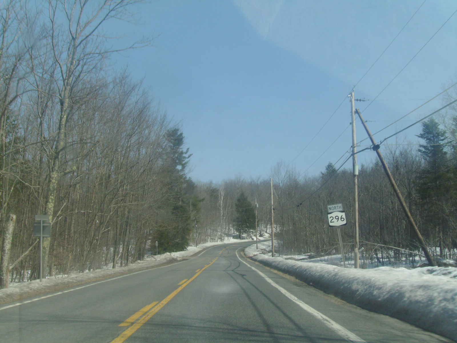
New York State Route 296 (NY 296) is a north–south state highway located entirely within both the Catskill Park and Greene County, New York, in the United States. It connects NY 23A in the village of Hunter with NY 23 near the Windham hamlet of Hensonville. The route follows a mountainous track between the two locations, climbing up from the Schoharie Creek valley before descending again into the Batavia Kill watershed. NY 296 was assigned as part of the 1930 renumbering of state highways in New York; however, the highway had been state-maintained since the early 1910s. Route description NY 296 begins at an intersection with NY 23A (Main Street) along the banks of Schoharie Creek just west of the village of Hunter in the town of Hunter. Located within the Catskill Forest Preserve, NY 296 passes the small Hunter Airport, where views of Rusk Mountain are visible. Winding into the town of Jewett, NY 296 is a two-lane asphal ... [...More Info...] [...Related Items...] OR: [Wikipedia] [Google] [Baidu] |
Water Supply Network
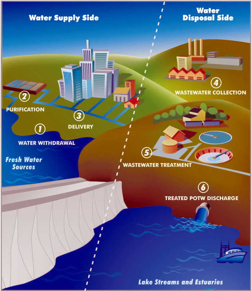
A water supply network or water supply system is a system of engineered hydrologic and hydraulic components that provide water supply. A water supply system typically includes the following: # A drainage basin (see water purification – sources of drinking water) # A raw water collection point (above or below ground) where the water accumulates, such as a lake, a river, or groundwater from an underground aquifer. Raw water may be transferred using uncovered ground-level aqueducts, covered tunnels, or underground water pipes to water purification facilities. # Water purification facilities. Treated water is transferred using water pipes (usually underground). # Water storage facilities such as reservoirs, water tanks, or water towers. Smaller water systems may store the water in cisterns or pressure vessels. Tall buildings may also need to store water locally in pressure vessels in order for the water to reach the upper floors. # Additional water pressurizing components such ... [...More Info...] [...Related Items...] OR: [Wikipedia] [Google] [Baidu] |


