|
Rushen (sheading)
Rushen ( ; ) is one of the six sheadings of the Isle of Man. It is located in the south of the island (part of the traditional ''South Side'' division) and consists of the three historic parishes of Arbory, Malew and (Kirk Christ) Rushen. Administratively, the sheading of Rushen also includes the town of Castletown, Isle of Man, Castletown and the village districts of Port Erin and Port St Mary. Other settlements in the sheading include Ballabeg, Colby, Isle of Man, Colby and Ronague (all in the parish of Arbory), Ballasalla, Derbyhaven and St Mark's, Isle of Man, St Mark's (all in the parish of Malew), and Cregneash in the parish of Rushen. MHKs and elections Since 2016, when it was reduced from a three-member seat to a two-member seat, the House of Keys Constituencies, House of Keys constituency of Rushen (constituency), Rushen covers the historical parish of Rushen (as above) with some minor departures from the historical parish boundary. See also *Local government i ... [...More Info...] [...Related Items...] OR: [Wikipedia] [Google] [Baidu] |
Port St Mary
Port St Mary ( or ''Purt-noo-Moirrey'' ) is a village district in the south-west of the Isle of Man. The village takes its name from the former Chapel of St Mary () which is thought to have overlooked Chapel Bay in the village. Its population is 1,953 according to the 2011 census. In the 19th century it was sometimes called Port-le-Murray. Etymology The English version ''Port St Mary'' comes directly from the Manx version, originally ''purt kill Moirrey'' 'harbour of/by St Mary's church' most likely in reference to the former Chapel of St Mary. The vowel and Voiced dental, alveolar and postalveolar lateral approximants, lateral /l/ of ''kill'' was Metathesis (linguistics), metathesized into ''le'' (documented as ) or alternatively it could have been Borrowing (linguistics), borrowed from French ''le'' 'the'. Geography and communications Port St Mary is located in the south-western part of the island, near Port Erin. A Port St Mary railway station, railway station is just n ... [...More Info...] [...Related Items...] OR: [Wikipedia] [Google] [Baidu] |
Rushen (constituency)
Rushen () is a House of Keys Constituencies, House of Keys constituency in the south of the Isle of Man which incorporates most of the parish of Rushen together with the village districts of Port Erin and Port St Mary. Until 2016 the constituency covered the whole of the Rushen (sheading), sheading of Rushen except for the parish of Malew and the town of Castletown, Isle of Man, Castletown, and elected three Member of the House of Keys, MHKs. (Malew was removed from the constituency in 1986.) In 2016 the constituency boundaries were redrawn. This constituency lost the parish of Arbory (parish), Arbory and a small part of the parish of Rushen and now consists of most of the Rushen, parish of Rushen, plus the village districts of Port Erin and Port St Mary. It now elects two MHKs. MHKs & Elections This information is incomplete. Election results since 2016 In 2014, Tynwald approved recommendations from the Boundary Review Commission which saw the reform of the Island's elector ... [...More Info...] [...Related Items...] OR: [Wikipedia] [Google] [Baidu] |
Cregneash
Cregneash or Cregneish () is a small village and tourist destination in the extreme south-west of the Isle of Man, about from Port Erin. Most of the village is now part of a living museum run by Manx National Heritage. There are also a number of private homes in the village, but their external appearance is controlled to maintain an older look. The village was also home to prominent Manx language speakers, Edward Faragher and Ned Maddrell. Living museum Much of the village forms a "Living Museum" dedicated to the preservation of the traditional Manx ways of life. Officially opened in 1938, the Cregneash Folk Village shows the typical way of life of a small Manx village in the 19th century. Many original Manx cottages have been preserved and exhibit Victorian farming and fishing equipment. Historically most of the cottages were thatched, and this is reflected on many of the cottages. A central museum holds a wealth of historical information, whilst many of the cottages ... [...More Info...] [...Related Items...] OR: [Wikipedia] [Google] [Baidu] |
Derbyhaven
Derbyhaven () ("King's Harbour" or "King's Cove") is a hamlet near Castletown in the southern parish of Malew, Isle of Man. It is located on the isthmus connecting Langness Peninsula to the rest of the island, on the bay of the same name, and also on Castletown Bay on the other side of the isthmus. In the 17th century it was a significant port. The then Lord of Mann, James, 7th Earl of Derby, had the fort on nearby St Michael's Isle (Fort Island) rebuilt in 1645 (Henry VIII built the original fort in 1540) to protect Derbyhaven from the parliamentarians in the English Civil War. Later, in the 18th century, the fort served as a lighthouse. Derbyhaven has a plaque commemorating the Battle of Ronaldsway, in which a Manx revolt led by Guðrøðr Magnússon was utterly crushed by Scottish Scottish usually refers to something of, from, or related to Scotland, including: *Scottish Gaelic, a Celtic Goidelic language of the Indo-European language family native to Scotland *Scottis ... [...More Info...] [...Related Items...] OR: [Wikipedia] [Google] [Baidu] |
Ballasalla
Ballasalla () is a village in the parish of Malew in the south-east of the Isle of Man. The village is situated close to the Isle of Man Airport and north-east of the town of Castletown, Isle of Man, Castletown. History Ballasalla grew up around nearby Rushen Abbey. The abbey was originally for monks of the Congregation of Savigny, but later came under Cistercian control. The abbey was an important centre of knowledge and literacy on the Isle of Man and also of economic importance to the local area as it was also the site of a major annual market. After the Dissolution of the Monasteries, dissolution of the monasteries under Henry VIII, King Henry VIII, the abbey was dissolved, fell into disrepair and was eventually ruined. Much of stonework from the original abbey structures were used in the construction of new buildings for the village of Ballasalla in the following centuries. Ballasalla was the site of a cotton mill in the late 18th century of which the ruins can still be ... [...More Info...] [...Related Items...] OR: [Wikipedia] [Google] [Baidu] |
Ronague
Ronague ( or ) is a tiny hamlet in the south of the Isle of Man, in the parish of Arbory. It consists of an old chapel, several houses and some farms. It lies to the north of the villages of Ballabeg and Colby, west of the hamlet of Grenaby and south of the hill South Barrule. On the A27 road between Ronague and the Round Table The Round Table (; ; ; ) is King Arthur's famed table (furniture), table in the Arthurian legend, around which he and his knights congregate. As its name suggests, it has no head, implying that everyone who sits there has equal status, unlike co ... is the seemingly magical ''magnetic hill''.http://www.gov.im/lib/docs/tourism/trade/media/attractionsfactsheet.pdf Isle of Man attractions leaflet A gravity hill, it appears to pull cars uphill when their drive is not engaged (grid reference ). References {{Isle of Man Populated places in the Isle of Man ... [...More Info...] [...Related Items...] OR: [Wikipedia] [Google] [Baidu] |
Colby, Isle Of Man
Colby () is a small village in the south of the Isle of Man in the parish of Arbory. It lies on the A7 road between the towns of Castletown and Port Erin and close to the similarly sized village of Ballabeg. History and facilities The name Colby is of Scandinavian origin, and is thought to derive from the Viking words ''col'' (meaning hill) and ''byr'' (meaning farm). The village has a railway station on the Isle of Man Steam Railway and is home to Colby Glen, one of the seventeen National Manx Glens. The village is home to Colby Football Club who play in the Isle of Man Football League and are based at Station Road. Methodism Colby has long been associated with Methodism. John Wesley preached at Balladoole in 1781, invited to do so by a local family. The first Methodist preacher arrived in the village in 1822 and a local house was set up as the Preaching House for Primitive Methodists. By 1883 two Methodist chapels were built, Colby Primitive Methodist Chapel on M ... [...More Info...] [...Related Items...] OR: [Wikipedia] [Google] [Baidu] |
Ballabeg
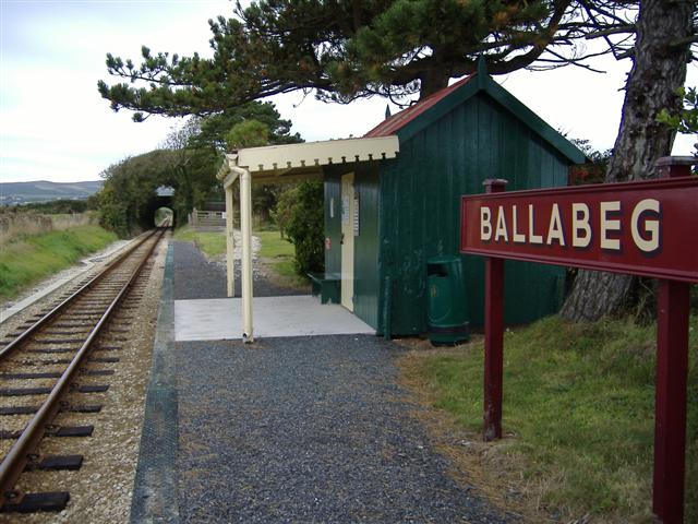
Ballabeg () is a village on the Isle of Man. It is in the parish of Arbory (parish), Arbory in the Local government in the Isle of Man, sheading of Rushen, in the south of the island near Castletown, Isle of Man, Castletown. There are several small villages and hamlets with the name, although Ballabeg in Arbory is the most well-known and populous. History The name Ballabeg derives from the Manx language, Manx which means "small homestead"; although the spelling is different, it is pronounced approximately the same as the English name. The village has previously been recorded on Ordnance Survey maps simply as the village of 'Arbory'. The parish church and school still use this name. There was a small farm with the name 'Ballabeg' but the location of this farm is not certain. At some point in the late 19th or early 20th century the name 'Ballabeg' was applied to the whole village. The village first grew up around the site of a 13th century Franciscans, Franciscan friary at Be ... [...More Info...] [...Related Items...] OR: [Wikipedia] [Google] [Baidu] |
Port Erin
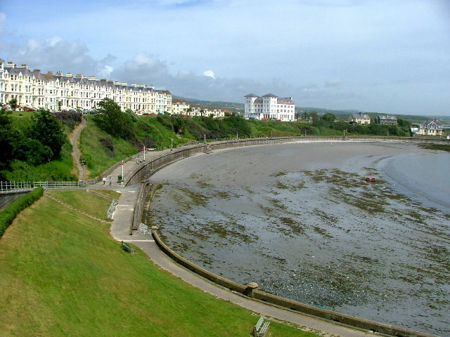
Port Erin ( 'lord's port' or originally 'Irish port') is a seaside village in the south-west of the Isle of Man, in the historic parish of Rushen. It was previously a seaside resort before the decline of the tourist trade. Administratively it is designated as a village district, with its own board of Commissioners. The district covers around 1 square mile, and is adjacent to: Port St Mary to the south-east; the main part of Arbory and Rushen parish district to the north and east; the sea to the west; and an exclave of Arbory and Rushen parish district (including the village of Cregneash) to the south. Following recent residential expansion, the settlement is now contiguous with that of Port St Mary, and on 18 July 2018 Tynwald authorised a public enquiry into the proposed expansion of the district boundary to include some of this expansion. The village was twinned with Latour-de-France. Etymology The English toponym ''Port Erin'' means 'Irish port', coming from "Goidelic lang ... [...More Info...] [...Related Items...] OR: [Wikipedia] [Google] [Baidu] |


