|
Rupel Formation
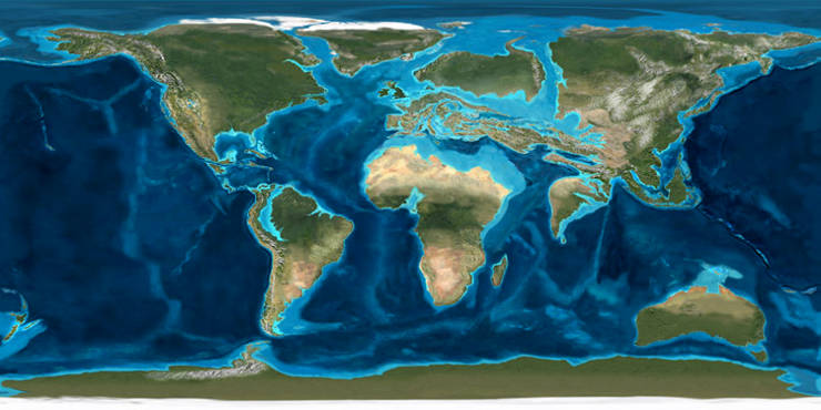
The Rupel Formation (abbreviation: RU) is a geologic formation in the subsurface of the Netherlands that consists of Oligocene marine sands and clays. The Rupel Formation is part of the Middle North Sea Group and correlates exactly with the Belgian Rupel Group. Name The Rupel Formation was first described by André Hubert Dumont in 1849. The formation is taken from Belgian lithostratigraphy, although it is considered a group in Belgium. The age in which the formation formed is the Rupelian (34 to 28 million years ago), a subdivision of the Oligocene epoch. The age and the formation are both named after the Belgian river Rupel. Facies and lithologies The Rupel Formation can be 250 meters thick at maximum. During the Rupelian age the Netherlands (and Belgium) were covered by a shallow sea, which became deeper towards the northwest. In the northwest, the sedimentary facies can be more than 500 m deep marine, while in southeastern parts of the Netherlands the formation has a near c ... [...More Info...] [...Related Items...] OR: [Wikipedia] [Google] [Baidu] |
Formation (stratigraphy)
A geological formation, or simply formation, is a body of rock having a consistent set of physical characteristics (lithology) that distinguishes it from adjacent bodies of rock, and which occupies a particular position in the layers of rock exposed in a geographical region (the stratigraphic column). It is the fundamental unit of lithostratigraphy, the study of strata or rock layers. A formation must be large enough that it can be mapped at the surface or traced in the subsurface. Formations are otherwise not defined by the thickness (geology), thickness of their rock strata, which can vary widely. They are usually, but not universally, tabular in form. They may consist of a single lithology (rock type), or of alternating beds of two or more lithologies, or even a heterogeneous mixture of lithologies, so long as this distinguishes them from adjacent bodies of rock. The concept of a geologic formation goes back to the beginnings of modern scientific geology. The term was used by ... [...More Info...] [...Related Items...] OR: [Wikipedia] [Google] [Baidu] |
Bilzen Member
Bilzen () is a former municipality and city located in the Belgian province of Limburg. In 2021, Bilzen had a total population of 32,536. The total area is 75.90 km2 which gives a population density of 426 inhabitants per km2. Bilzen consists of the city of Bilzen and the following villages: Beverst, Eigenbilzen, , , , , , , , Rijkhoven, , and . It was in 1977 that they all became part of the municipality Bilzen because of the fusion of municipalities. Cities in Bilzen's neighbourhood are all within a distance of some 10 to 15 kilometers: to its north, Genk; to its east, Maastricht (Netherlands); to its south Tongeren; and to its north-west, Diepenbeek. From 1965 to 1981 Bilzen hosted Jazz Bilzen, a jazz and rock festival that lasted several days. In its time Jazz Bilzen was the most important Belgian festival. Artists that performed there were, among many others, Humble Pie, The Moody Blues, Deep Purple, Black Sabbath, Humble Pie, The Kinks, The Troggs, Procol Harum, Gold ... [...More Info...] [...Related Items...] OR: [Wikipedia] [Google] [Baidu] |
Veldhoven Formation
The Veldhoven Formation (; abbreviation: VE) is a geologic formation in the subsurface of the Netherlands. The formation consists of an alternation of marine clay and sand from the Oligocene epoch. Lithology The Veldhoven Formation has a shallow marine (less than 200 meters deep) or beach facies. It consists of an alternation of glauconiferous and micaceous fine sands and micaceous clays. In some places hardgrounds or shell-rich layers occur. The formation is Chattian, 28.4 to 23.0 million years old. Stratigraphy The Veldhoven Formation is part of the Middle North Sea Group and is named after the town of Veldhoven in North Brabant, the type location. Actually the type section is in a well log, since the formation only rarely crops out at the surface. The formation is subdivided into three members (): *the Someren Member, glauconiferous fine sand; *the Wintelre Member, greenish silty clay; *the Voort Member, greenish clayey sand, locally rich in fossils, especially mollusc ... [...More Info...] [...Related Items...] OR: [Wikipedia] [Google] [Baidu] |
Mesozoic
The Mesozoic Era is the Era (geology), era of Earth's Geologic time scale, geological history, lasting from about , comprising the Triassic, Jurassic and Cretaceous Period (geology), Periods. It is characterized by the dominance of archosaurian reptiles such as the dinosaurs, and of Gymnosperm, gymnosperms such as cycads, ginkgoaceae and Araucariaceae, araucarian conifers; a hot Greenhouse and icehouse earth, greenhouse climate; and the tectonic break-up of Pangaea. The Mesozoic is the middle of the three eras since Cambrian explosion, complex life evolved: the Paleozoic, the Mesozoic, and the Cenozoic. The era began in the wake of the Permian–Triassic extinction event, the largest mass extinction in Earth's history, and ended with the Cretaceous–Paleogene extinction event, another mass extinction whose victims included the non-avian dinosaurs, Pterosaur, pterosaurs, Mosasaur, mosasaurs, and Plesiosaur, plesiosaurs. The Mesozoic was a time of significant tectonic, climatic, an ... [...More Info...] [...Related Items...] OR: [Wikipedia] [Google] [Baidu] |
Unconformity
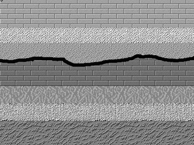
An unconformity is a buried erosional or non-depositional surface separating two rock masses or strata of different ages, indicating that sediment deposition was not continuous. In general, the older layer was exposed to erosion for an interval of time before deposition of the younger layer, but the term is used to describe any break in the sedimentary geologic record. The significance of angular unconformity (see below) was shown by James Hutton, who found examples of Hutton's Unconformity at Jedburgh in 1787 and at Siccar Point in Berwickshire in 1788, both in Scotland. The rocks above an unconformity are younger than the rocks beneath (unless the sequence has been overturned). An unconformity represents time during which no sediments were preserved in a region or were subsequently eroded before the next deposition. The local record for that time interval is missing and geologists must use other clues to discover that part of the geologic history of that area. The interval ... [...More Info...] [...Related Items...] OR: [Wikipedia] [Google] [Baidu] |
Dongen Formation
The Dongen Formation (; abbreviation: DO) is a geologic formation in the subsurface of the Netherlands. The formation consists of early Eocene marine clay and sand. It is named after the town of Dongen in North Brabant. Lithology and stratigraphy The Dongen Formation consists predominantly of marine clay, alternated with layers of fine sand or glauconiferous marl. The clay can also contain glauconite and locally thin layers of tuffite or loam can occur. The formation is subdivided into four members: *the Asse Member, clay with locally sandy layers, glauconite or/and nummulites; *the Brussels Member, fine glauconiferous sand, locally calcareous; *the Ieper Member, clay with layers of marl and limestone; *the Oosteind Member, clay with sand and tuffite layers. The base of the formation is often formed by a tuffite layer. The Dutch Dongen Formation correlates with the Belgian Ieper Group and Zenne Group. All of these units are marine sands and clay cats from the Ypresian (55.8 - ... [...More Info...] [...Related Items...] OR: [Wikipedia] [Google] [Baidu] |
Tongeren Formation
The Tongeren Formation (; abbreviation: TO) is a geologic formation in the subsurface of the Netherlands. The formation consists of shallow marine, epicontinental and continental sediments, predominantly clay and sand from the late Eocene and early Oligocene epochs (between 37 and 30 million years old). The Tongeren Formation is part of the Middle North Sea Group and correlates with the Tongeren Group from Belgian stratigraphy. The name was introduced by Belgian geologist André Hubert Dumont in 1849. Lithologies and subdivision The Tongeren Formation is subdivided into three members: *the Goudsberg Member, an alternation of clay with chert nodules and thin lignite layers; *the Klimmen Member, micaceous fine sand; and *the Zelzate Member, shallow marine glauconiferous sand alternating with clay layers. Stratigraphic position In southern Limburg the Tongeren Formation is lies on top of formations of the Lower North Sea Group (in particular the late Paleocene to early Eoce ... [...More Info...] [...Related Items...] OR: [Wikipedia] [Google] [Baidu] |
Eocene
The Eocene ( ) is a geological epoch (geology), epoch that lasted from about 56 to 33.9 million years ago (Ma). It is the second epoch of the Paleogene Period (geology), Period in the modern Cenozoic Era (geology), Era. The name ''Eocene'' comes from the Ancient Greek (''Ēṓs'', 'Eos, Dawn') and (''kainós'', "new") and refers to the "dawn" of modern ('new') fauna that appeared during the epoch.See: *Letter from William Whewell to Charles Lyell dated 31 January 1831 in: * From p. 55: "The period next antecedent we shall call Eocene, from ήως, aurora, and χαινος, recens, because the extremely small proportion of living species contained in these strata, indicates what may be considered the first commencement, or ''dawn'', of the existing state of the animate creation." The Eocene spans the time from the end of the Paleocene Epoch to the beginning of the Oligocene Epoch. The start of the Eocene is marked by a brief period in which the concentration of the carbon isoto ... [...More Info...] [...Related Items...] OR: [Wikipedia] [Google] [Baidu] |
Eigenbilzen Member
Eigenbilzen is a village and former municipality in the Bilzen municipality of the Limburg province in the Flemish Community of Belgium. Eigenbilzen was an independent municipality until 1977 when it merged into Bilzen. History The village was first mentioned in 1096 as Eigenbilesen. Prehistoric and Roman remains have been discovered in the area. In 1871 a tumulus was discovered at the Kannesberg which dated from 400 B.C. Furthermore three Roman villas, and a Roman cemetery were discovered. The Roman road connecting Tongeren to Maastricht used to pass through the village. was built in 1423. In 1680, the family of de Heusch de Zangerye became manor of the village, and resided in the castle. The castle was torn down in the early 19th century. In 1864, the Hasselt-Maastricht railway was opened with a station for Eigenbilzen. The railway line was closed for passengers in 1954, and goods in 1992. In 1977, the municipality merged into Bilzen. Near the village is the Zangerheimolen, a ... [...More Info...] [...Related Items...] OR: [Wikipedia] [Google] [Baidu] |
Septarium
A concretion is a hard and compact mass formed by the precipitation of mineral cement within the spaces between particles, and is found in sedimentary rock or soil. Concretions are often ovoid or spherical in shape, although irregular shapes also occur. The word ''concretion'' is borrowed from Latin , itself derived from ''concrescere'' , from ''con-'' and ''crescere'' . Concretions form within layers of sedimentary strata that have already been deposited. They usually form early in the burial history of the sediment, before the rest of the sediment is hardened into rock. This concretionary cement often makes the concretion harder and more resistant to weathering than the host stratum. There is an important distinction to draw between concretions and nodules. Concretions are formed from mineral precipitation around some kind of nucleus while a nodule is a replacement body. Descriptions dating from the 18th century attest to the fact that concretions have long been regarded ... [...More Info...] [...Related Items...] OR: [Wikipedia] [Google] [Baidu] |


