|
Rupat Island
Rupat () is an island in the Strait of Malacca, and forms part of Bengkalis Regency within Riau, Indonesia. It lies just off the eastern coast of Sumatra, across from Dumai city, from which it is separated by the Rupat Strait (). Its area is . The island is sparsely populated (50,803 in mid-2024), with an average population density of 33.4 per km2.Badan Pusat Statistik, Jakarta, 28 February 2025, ''Kabupaten Bengkalis Dalam Angka 2025'' (Katalog-BPS 1102001.1408) Rupat was one of thousands of abandoned islands, but its population is growing yearly, which has made the government expand the area for the settlement. The island is administratively divided into two districts (''kecamatan'') of Bengkalis Regency. Rupat District comprises the southern 75.2% of the island, covering 1,143.72 km2, with 30,550 inhabitants at the 2010 Census and 34,719 at the 2020 Census; the official estimate in mid 2024 was 36,307 inhabitants;Badan Pusat Statistik, Jakarta, 28 February 2025, ''Kabupaten Ben ... [...More Info...] [...Related Items...] OR: [Wikipedia] [Google] [Baidu] |
Strait Of Malacca
The Strait of Malacca is a narrow stretch of water, long and from wide, between the Malay Peninsula to the northeast and the Indonesian island of Sumatra to the southwest, connecting the Andaman Sea (Indian Ocean) and the South China Sea (Pacific Ocean). As the main shipping channel between the Indian and Pacific oceans, it is one of the most important shipping lanes in the world. Etymology The name "Malacca" is traditionally associated with the Malacca tree ('' Phyllanthus emblica''), also known as the Indian gooseberry tree, and is believed to derive from the local Malay word "Melaka". According to historical traditions, Parameswara, a Sumatran prince and the founder of the Malacca Sultanate, selected the site for his new kingdom where the city of Malacca now stands. It is said that he named the location "Melaka" after the Malacca tree under which he had rested. Over time, the name "Malacca" came to refer not only to the city but also to the strategically significant ... [...More Info...] [...Related Items...] OR: [Wikipedia] [Google] [Baidu] |
Bengkalis Regency
Bengkalis Regency is a regency of Indonesia in Riau Province. The regency was originally established in 1956 and then included most of the northern part of the province, but on 4 October 1999 it was divided up, with most of the territory being split off to form the new Rokan Hilir Regency, Siak Regency and the city of Dumai. On 19 December 2008 a further five districts were removed to create the new Meranti Islands Regency, leaving eight districts (or ''kecamatan'') in the Bengkalis Regency. These eight districts has increased since 2010 to eleven by the splitting of existing districts on the Sumatran mainland. Bengkalis Regency produces natural resources, particularly petroleum, rubber, and coconut. The southern part of this regency contains a large part of the Bukit Batu Biosphere Reserve. Geography Bengkalis Regency comprises the whole of Bengkalis Island and Rupat Island, which are located in the Straits of Malacca, together with a wide swathe of the eastern coastal ... [...More Info...] [...Related Items...] OR: [Wikipedia] [Google] [Baidu] |
Riau
Riau (Jawi script, Jawi: ) is a Provinces of Indonesia, province of Indonesia. It is located on the central eastern coast of the island of Sumatra, and extends from the eastern slopes of the Barisan Mountains to the Malacca Strait, including several large islands situated within the Strait. The province shares land borders with North Sumatra to the northwest, West Sumatra to the west, and Jambi to the south, and a maritime border with the Riau Islands and the country of Malaysia to the east. It is the second-largest province in the island of Sumatra after South Sumatra, and is slightly larger than the nation of Jordan. The total land area is 93,356.32 km² (about the same area as Hungary or the State of Maine), and the population was 5,538,367 at the 2010 Census and 6,394,087 at the 2020 Indonesian census, 2020 census;Badan Pusat Statistik, Jakarta, 2021. the official estimate of population as of mid-2024 was 7,007,353.Badan Pusat Statistik, Jakarta, 28 February 2025, ''Pro ... [...More Info...] [...Related Items...] OR: [Wikipedia] [Google] [Baidu] |
Sumatra
Sumatra () is one of the Sunda Islands of western Indonesia. It is the largest island that is fully within Indonesian territory, as well as the list of islands by area, sixth-largest island in the world at 482,286.55 km2 (182,812 mi.2), including adjacent islands such as the Simeulue Island, Simeulue, Nias Island, Nias, Mentawai Islands, Mentawai, Enggano Island, Enggano, Riau Islands, Bangka Belitung and Krakatoa archipelago. Sumatra is an elongated landmass spanning a diagonal northwest–southeast axis. The Indian Ocean borders the northwest, west, and southwest coasts of Sumatra, with the island chain of Simeulue, Nias, Mentawai Islands, Mentawai, and Enggano off the western coast. In the northeast, the narrow Strait of Malacca separates the island from the Malay Peninsula, which is an extension of the Eurasian continent. In the southeast, the narrow Sunda Strait, containing the Krakatoa archipelago, separates Sumatra from Java. The northern tip of Sumatra is near ... [...More Info...] [...Related Items...] OR: [Wikipedia] [Google] [Baidu] |
Dumai
Dumai ( Jawi: , ), is a coastal city in Riau Province on the island of Sumatra, Indonesia, about 188 km from Pekanbaru, the provincial capital. The city has an area of 2,065.59 km2 and had 349,389 inhabitants at the mid 2024 official estimate (comprising 179,604 males and 169,785 females).Badan Pusat Statistik, Jakarta, 28 February 2025, ''Kota Dumai Dalam Angka 2025'' (Katalog-BPS 1102001.1473) Dumai has a domestic airport, Pinang Kampai Airport. The city is an important transport and trade centre, both regionally and internationally, especially for traffic to and from Malaysia. The region is rich in oil (petroleum and palm oil). History Currently Dumai City is the second largest city in the province of Riau, but earlier it was a small hamlet on the east coast of Riau Province. It was inaugurated as a city on 20 April 1999, by Law no. 16 of year 1999, having previously been an administrative town () in Bengkalis Regency. Administration At its inception, the city ... [...More Info...] [...Related Items...] OR: [Wikipedia] [Google] [Baidu] |
Rupat Strait
The Rupat Strait () is the strait which separates small island of Rupat from major island of Sumatra in Indonesia. It is the main shipping route to city of Dumai Dumai ( Jawi: , ), is a coastal city in Riau Province on the island of Sumatra, Indonesia, about 188 km from Pekanbaru, the provincial capital. The city has an area of 2,065.59 km2 and had 349,389 inhabitants at the mid 2024 official .... References Straits of Indonesia {{Indonesia-geo-stub ... [...More Info...] [...Related Items...] OR: [Wikipedia] [Google] [Baidu] |
Malacca Strait Bridge
The Central Spine Road 2 or Malacca Strait Bridge (Indonesian language, Indonesian: ''Jembatan Selat Malaka'', Malaysian language, Malaysian: ''Jambatan Selat Melaka'' or ''JSM'' and ''Jembatan Selmal'') is a proposed bridge that would connect Telok Gong, near Masjid Tanah, Malacca in Peninsular Malaysia to Rupat Island and Dumai in Sumatra island, Indonesia. The project has been submitted for government approval, and is expected to take 10 years to complete. Once completed, the bridge will be the List of longest bridges in the world, longest sea-crossing bridge in the world. The project will have two cable-stayed bridges and one suspension bridge, both the longest in the world. The construction of a bridge of this kind would have numerous implications, including for the management of ship movements through the Malacca Straits, one of the busiest shipping channels in the world. Timeline * In March 2013 during a visit to China, Germany, Russia and Japan, president Susilo Bamban ... [...More Info...] [...Related Items...] OR: [Wikipedia] [Google] [Baidu] |
Sunda Strait Bridge
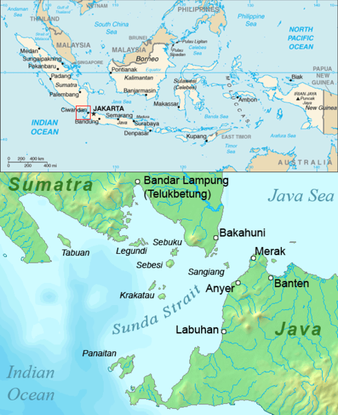
The Sunda Strait Bridge (, ''JSS'', ''Jembatan Selsun'', sometimes referred to in English-language reports as the ''SSB'') was a planned road and railway megaproject between the two large Indonesian islands of Sumatra and Java. The suggestion for a bridge was reportedly first put forward in 1960 by Professor Sedyatmo from Institut Teknologi Bandung as a part of broader plans, known as ''Tri Nusa Bimasakti'', to link the three islands of Sumatra, Java and Bali (the latter via the Bali Strait Bridge). In October 2007, after years of discussion and planning, the Indonesian government gave the initial go-ahead for a project which includes several of the world's longest suspension bridges, across the Sunda Strait. However, seven years later in November 2014, the incoming Joko Widodo government announced that plans to build the bridge would be shelved.Satria Sambijantoro,No more Sunda Strait Bridge plan' ''The Jakarta Post'', 3 November 2014. See alsoNew Government Will Not Priorit ... [...More Info...] [...Related Items...] OR: [Wikipedia] [Google] [Baidu] |
Sangihe Islands
The Sangihe Islands (also spelled "Sangir", "Sanghir" or "Sangi") – – are a group of islands that constitute two regencies within the province of North Sulawesi, in northern Indonesia, the Sangihe Islands Regency. The word Sangihe actually comes from the word Sang Ihe which is means Strong Sailor or Brave Fisherman. ''Kabupaten Kepulauan Sangihe'') and the Sitaro Islands Regency (''Kabupaten Siau Tagulandang Biaro''). They are located northeast of Sulawesi between the Celebes Sea and the Molucca Sea, roughly halfway between Sulawesi and Mindanao, in the Philippines; the Sangihes form the eastern limit of the Celebes Sea. The islands combine to total , with many of the islands being actively volcanic with fertile soil and mountains. The main islands of the group are, north to south, Sangir Besar (or Sangir Island), Siau (or Siao), Tagulandang, and Biaro. The largest island is Sangir Besar and contains an active volcano, Mount Awu (). Tahuna is the chief town ... [...More Info...] [...Related Items...] OR: [Wikipedia] [Google] [Baidu] |
East Asian-Australasian Flyway
East is one of the four cardinal directions or points of the compass. It is the opposite direction from west and is the direction from which the Sun rises on the Earth. Etymology As in other languages, the word is formed from the fact that east is the direction where the Sun rises: ''east'' comes from Middle English ''est'', from Old English ''ēast'', which itself comes from the Proto-Germanic *''aus-to-'' or *''austra-'' "east, toward the sunrise", from Proto-Indo-European *aus- "to shine," or "dawn", cognate with Old High German ''*ōstar'' "to the east", Latin ''aurora'' 'dawn', and Greek ''ēōs'' 'dawn, east'. Examples of the same formation in other languages include Latin oriens 'east, sunrise' from orior 'to rise, to originate', Greek ανατολή anatolé 'east' from ἀνατέλλω 'to rise' and Hebrew מִזְרָח mizraḥ 'east' from זָרַח zaraḥ 'to rise, to shine'. ''Ēostre'', a Germanic goddess of dawn, might have been a personification of both da ... [...More Info...] [...Related Items...] OR: [Wikipedia] [Google] [Baidu] |
Bird Of Prey
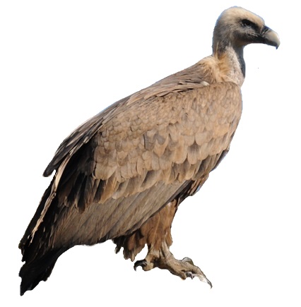
Birds of prey or predatory birds, also known as (although not the same as) raptors, are hypercarnivorous bird species that actively predation, hunt and feed on other vertebrates (mainly mammals, reptiles and smaller birds). In addition to speed and strength, these predators have bird vision, keen eyesight for detecting prey from a distance or during flight, strong feet with sharp talon (anatomy), talons for grasping or killing prey, and powerful, curved beaks for tearing off flesh. Although predatory birds primarily hunt live prey, many species (such as fish eagles, vultures and condors) also scavenge and eat carrion. Although the term "bird of prey" could theoretically be taken to include all birds that actively hunt and eat other animals, ornithologists typically use the narrower definition followed in this page, excluding many piscivorous predators such as storks, Crane (bird), cranes, herons, gulls, skuas, penguins, and kingfishers, as well as many primarily insectivorous bir ... [...More Info...] [...Related Items...] OR: [Wikipedia] [Google] [Baidu] |
Islands Of Sumatra
This is a list of the lists of islands in the world grouped by country, by continent, by body of water A body of water or waterbody is any significant accumulation of water on the surface of Earth or another planet. The term most often refers to oceans, seas, and lakes, but it includes smaller pools of water such as ponds, wetlands, or more rare ..., and by other classifications. For rank-order lists, see the other lists of islands below. Lists of islands by country or location Africa Antarctica Asia Europe North America Oceania South America Lists of islands by continent Lists of islands by body of water By ocean: By other bodies of water: List of ancient islands Other lists of islands External links Island Superlatives {{South America topic, List of islands of * ... [...More Info...] [...Related Items...] OR: [Wikipedia] [Google] [Baidu] |


