|
Runyenjes
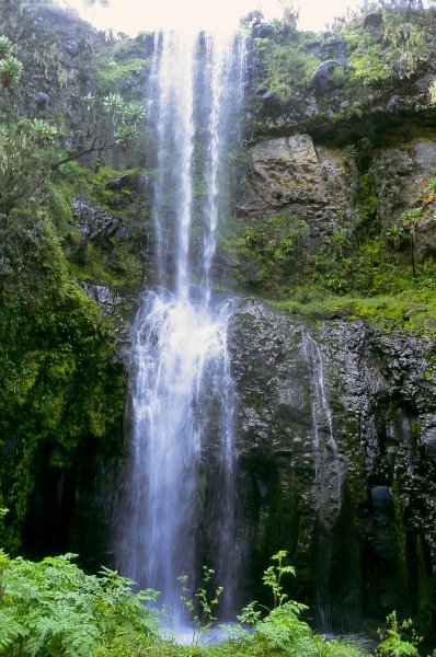
Runyenjes is the second largest town in Embu County, Kenya. It is located about 150 km from Nairobi, and 75 km from Mount Kenya, at an altitude of 1500m.The population is estimated at 58,000 people, the majority of which are the Embu people, Embu People who speak Embu language, Kiembu, a Bantu languages, Bantu language, as well as Swahili language, Kiswahili and English language, English, the two official languages in Kenya. The area offers scenic views, with densely wooded hills, gentle valleys, flowing streams and rivers, waterfalls, as well as small-scale Smallholding, farms. Etymology Runyenjes derives its name from a popular Chief Runyenje of the colonial era who ruled from Thuci River to Sagana. Geography Runyenjes is located at an altitude of 1495.62 m (4906.89 ft) and lies on the windward side of Mount Kenya, Mt. Kenya. It is about 150 km from Nairobi city and about 25 km from Embu, Kenya, Embu town along the Nairobi-Meru-Isiolo r ... [...More Info...] [...Related Items...] OR: [Wikipedia] [Google] [Baidu] |
Embu County
Embu County is a Counties of Kenya, county in the Mt Kenya region in Kenya. As of 2024 its estimated population is 608,599. The county borders Kirinyaga County, Kirinyaga to the west, Kitui County, Kitui to the east, Tharaka Nithi County, Tharaka Nithi to the north and Machakos County, Machakos to the south. The county occupies an area of 2,821 km2. The county is home to the Aembu and Mbeere ethnic communities, with a smaller Akamba population. Its Capital city, capital and largest town is Embu, Kenya, Embu. Administrative and political units The county is divided into 5 sub-counties, with a total of 20 county assembly wards, 51 locations and 127 locations. Source Administrative divisions Administrative Subdivision Embu County is divided into five districts; namely, Embu West with headquarters at Embu town, and Embu North with headquarters at Manyatta. These two form the Manyatta constituency, Embu East with headquarters at Runyenjes, Mbeere North with headquarters at S ... [...More Info...] [...Related Items...] OR: [Wikipedia] [Google] [Baidu] |
Embu, Kenya
Embu is a town located approximately northeast of Nairobi towards Mount Kenya. Embu served as the provincial capital of the former Eastern Province (Kenya), Eastern Province and currently serves as the headquarters of Embu County in Kenya. Located on the south-eastern foothills of Mount Kenya, the Municipality of Embu had a population of 204,979 in 2019 census. Embu is also the 8th Largest Municipality in Kenya. It is the commercial hub of the Central Eastern part of Kenya and provides an avenue for trade, tourism and highway transit between the national capital and the Northern Frontier. History Embu town is a major trading centre in Eastern Kenya. For a long time, it was the main economic centre for the Embu people, Embu, Mbeere people, Mbeere, Meru people, Meru and Kamba people, Kamba communities as well as other communities from central Kenya. Mbeere was carved out of the former Embu district in the 1990s and Siakago town, about east of Embu town, was made its headquarte ... [...More Info...] [...Related Items...] OR: [Wikipedia] [Google] [Baidu] |
Mukuuri
Mûkûûrî is an administrative Location and township in Runyenjes Division, in Embu County, Kenya, with a population of about 25,000 people. It is named for a large, strong Sycamore Fig Tree (Mûkûû in Kiembu. Scientific name: Ficus Sycomorus) that stood for over 100 years at the current site of the township. The Sycamore Fig tree symbolizes strength, rejuvenation and regeneration. Mûkûû-rî region lies on the green, rolling hills of the Mount Kenya slopes. The administrative region begins from the stone cliffs of Nthûngû waterfalls, all the way to Nthenge Njerû falls, through the famous Kirimiri Forest, stretching to the historic Gogo Salt lick, bordering Gitare. It is home to four public primary schools, including Kubu Kubu Memorial Boarding School and Muragari School, which is among the oldest schools in Embu and Kîrînyaga districts. Mukuuri is also home to the historic Kîrîmîri Forest Hill. The 800-acre forest was popular during Kenya's freedom war the Mau ... [...More Info...] [...Related Items...] OR: [Wikipedia] [Google] [Baidu] |
Kanja
Kanja is a small settlement in Embu County in Kenya Kenya, officially the Republic of Kenya, is a country located in East Africa. With an estimated population of more than 52.4 million as of mid-2024, Kenya is the 27th-most-populous country in the world and the 7th most populous in Africa. ...'s Eastern Province, at about 1,785 metres above sea level. It falls under the Runyenjes Constituency, one of four electoral constituencies in Embu County, and specifically in the ward Kagaari North. Kagaari North had 12,893 registered voters in September 2005. The area is prone to mosquitoes and Accu weather sometimes issues warnings for "high mosquito activity" in the area. Coffee Factories The Kanja Coffee Factory is located in the area. Having started operation in 1979, this is where the coffee beans from hundreds of contributing farmers - currently around 1 100 of them from the surrounding villages of Kanja, Mbogori and Irangi - are processed. Each of these small-scale f ... [...More Info...] [...Related Items...] OR: [Wikipedia] [Google] [Baidu] |
Kirimiri
Kîrîmîri Forest Is an area dominated by tree vegetation in the Mukuuri locality of Runyenjes, Embu, in the country of Kenya. It is recognised as an Ecologically Sensitive Site in Africa by the International Union for Conservation of Nature. There are a variety of rare indigenous and medicinal trees that continue to face the threat of deforestation. The Kîrîmîri Forest center lies at a latitude of -0.41667 and longitude of 37.55 and it has an elevation of 1520 meters above sea level Mean sea level (MSL, often shortened to sea level) is an mean, average surface level of one or more among Earth's coastal Body of water, bodies of water from which heights such as elevation may be measured. The global MSL is a type of vertical .... The predominant languages spoken are Kiembu, Swahili, and English. The Hill is culturally famous as a hideout for Mau Mau fighters including Embu's most venerated fighter General Kubu Kubu. Several schools have been built near the reserve. T ... [...More Info...] [...Related Items...] OR: [Wikipedia] [Google] [Baidu] |
Seventh-day Adventist Church
The Seventh-day Adventist Church (SDA) is an Adventist Protestant Christian denomination which is distinguished by its observance of Saturday, the seventh day of the week in the Christian (Gregorian) and the Hebrew calendar, as the Sabbath, its emphasis on the imminent Second Coming (advent) of Jesus Christ, and its annihilationist soteriology. The denomination grew out of the Millerite movement in the United States during the mid-19th century, and it was formally established in 1863. Among its co-founders was Ellen G. White, whose extensive writings are still held in high regard by the church. Much of the theology of the Seventh-day Adventist Church corresponds to common evangelical Christian teachings, such as the Trinity and the infallibility of Scripture. Distinctive eschatological teachings include the unconscious state of the dead and the doctrine of an investigative judgment. The church emphasizes diet and health, including adhering to Jewish dietary l ... [...More Info...] [...Related Items...] OR: [Wikipedia] [Google] [Baidu] |
Catholic Church In Kenya
The Catholic Church in Kenya is part of the worldwide Catholic Church, under the spiritual leadership of the Kenyan Conference of Catholic Bishops and the Pope in the Vatican City. The earliest traces of the Catholic Church in Kenya begin with the missionaries that penetrated the state in 1498, led by Vasco da Gama. Due to regional conflict, poor transportation, and a largely nomadic presence, it became more established in northern Kenya during the twentieth century. Demographics According to the Catholic Church official records, there are over 18 million baptised Catholics in Kenya (nearly 40% of the country's population). According to the 2019 national housing census, 10.6 million Catholics in Kenya are strict adherents and attend Mass regularly. In 2020, there were over 3,644 priests working across more than 1,100 parishes. Organization Within Kenya the hierarchy consists of: * Archbishopric ** Bishopric * Kisumu ** Bungoma ** Eldoret ** Homa Bay ** Kakamega ** Kis ... [...More Info...] [...Related Items...] OR: [Wikipedia] [Google] [Baidu] |
Anglican Church Of Kenya
The Anglican Church of Kenya (ACK) is a province of the Anglican Communion, and it is composed by 41 dioceses. The current Leader and Archbishop of Kenya is Jackson Ole Sapit. The Anglican Church of Kenya claims 5 million total members. According to a study published in the ''Journal of Anglican Studies'' and by ''Cambridge University Press,'' the ACK claims 5 million adherents, with no official definition of membership, with nearly 2 million officially affiliated members, and 310,000 active baptised members. The church became part of the Province of East Africa in 1960, but Kenya and Tanzania were divided into separate provinces in 1970. History The church was founded as the diocese of Eastern Equatorial Africa (Uganda, Kenya, Tanzania) in 1884, with James Hannington as the first bishop; however, Protestant missionary activity had been present in the area since 1844, when Johann Ludwig Krapf, a Lutheran missionary, landed in Mombasa. The first Africans were ordained to the pr ... [...More Info...] [...Related Items...] OR: [Wikipedia] [Google] [Baidu] |
Makutano, Kirinyaga, Kenya
Makutano is a settlement that straddle in the borders of Kenya's Kirinyaga County and Embu County. Location The town is located where the Nairobi-Embu Road splits from the Nairobi-Nyeri Nyeri is a town situated in the Central Highlands of Kenya. It is the county headquarters of Nyeri County and was the central administrative headquarters of the country's former Central Province (Kenya), Central Province. The town is situated a ... Road, approximately , northeast of Nairobi, the capital and largest city in the country. The coordinates of Makutano are: 0°45'24.0"S, 37°16'44.0"E (Latitude:-0.756663; Longitude:37.278887). Overview At the beginning of 2016, a dual carriage highway through Makutano, referred to as the ''Kenol–Makutano–Sagana–Marua Highway'', part of the greater Cape to Cairo Road, was considered. The Tana Hydroelectric Power Station is located southwest of Makutano. See also * List of power stations in Kenya * List of roads in Kenya References {{r ... [...More Info...] [...Related Items...] OR: [Wikipedia] [Google] [Baidu] |
Gichiche
The Eastern Province () of Kenya was one of 8 Provinces of Kenya The provinces of Kenya were replaced by a system of counties in 2013, after the 2010 constitution was effected. History Before the new constitution of Kenya that came into force on 27 August 2010, Kenya was divided into eight provinces (se .... Its northern boundary ran along with that of Ethiopia; the North Eastern Province, Kenya, North Eastern Province and Coast Province, Kenya, Coast Province lay to the east and south; and the remainder of Kenya's provinces, including Central Province, Kenya, Central Province, ran along its western border. The provincial capital was Embu, Kenya, Embu. Overview On 16 July 2009, the province was sub-divided into three: Lower Eastern with Machakos as headquarters, Central Eastern with Embu, Kenya, Embu as headquarters, and Upper Eastern with Marsabit as headquarters; however, those changes never took effect due to the political wrangles in the Kenyan coalition gover ... [...More Info...] [...Related Items...] OR: [Wikipedia] [Google] [Baidu] |


