|
Ruinaulta From Zault Observation Deck
Ruinaulta is a canyon created by the Anterior Rhine by Ilanz/Glion and Reichenau in the debris of the Flims Rockslide just upstream of its confluence with the Posterior Rhine at Reichenau in the Grisons, eastern Switzerland. It is sometimes known as the ''Rhine Gorge'', or sometimes rather ironically called the ''Swiss Grand Canyon''. Protected by cliffs several hundred metres high, the area is forested and a haven for wildlife. It is a popular location for rafting. The gorge is largely inaccessible by road, but is traversed by the Disentis to Chur line of the Rhaetian Railway. It is accessible from the Valendas-Sagogn, Versam-Safien and Trin stations that lie within the gorge. Gallery File:View from Islabord bus stop in Versam.jpg, Ruinaulta from Islabord bus stop in Versam File:Rafting to Versam.jpg, Rafting from Ilanz to Versam File:Ruinaulta from Zault Observation Deck.jpg, Ruinaulta from Zault Observation Deck in Bonaduz Bonaduz () is a municipality in the ... [...More Info...] [...Related Items...] OR: [Wikipedia] [Google] [Baidu] |
Valendas-Sagogn Railway Station
Valendas-Sagogn railway station is a station on the Reichenau-Tamins–Disentis/Mustér railway of the Rhaetian Railway in the Swiss canton of Graubünden. It is situated alongside the Anterior Rhine, and marks the upstream end of the railway's scenic passage through the Ruinaulta or Rhine Gorge. The station is located on the south bank of the river in the municipality of Safiental, and serves the villages of Valendas and Sagogn, which lie at higher elevations on either side of the gorge. Services the following services stop at Valendas-Sagogn: * RegioExpress RegioExpress, commonly abbreviated to RE, is a Train categories in Europe, category of fast regional train service in Switzerland, run by Swiss Federal Railways (SBB CFF FFS) or other railway companies (such as Treni Regionali Ticino Lombardia, ...: hourly service between and . Gallery File:Bahnhof Valendas-Sagogn (2009).jpg, The station building from the east File:Valendas-Sagogn 2017-05-22 17.33.26.jpg, The stati ... [...More Info...] [...Related Items...] OR: [Wikipedia] [Google] [Baidu] |
Landforms Of Graubünden
A landform is a land feature on the solid surface of the Earth or other planetary body. They may be natural or may be anthropogenic (caused or influenced by human activity). Landforms together make up a given terrain, and their arrangement in the landscape is known as topography. Landforms include hills, mountains, canyons, and valleys, as well as shoreline features such as bays, peninsulas, and seas, including submerged features such as mid-ocean ridges, volcanoes, and the great oceanic basins. Physical characteristics Landforms are categorized by characteristic physical attributes such as elevation, slope, orientation, structure stratification, rock exposure, and soil type. Gross physical features or landforms include intuitive elements such as berms, cliffs, hills, mounds, peninsulas, ridges, rivers, valleys, volcanoes, and numerous other structural and size-scaled (e.g. ponds vs. lakes, hills vs. mountains) elements including various kinds of inland and oceanic waterbodi ... [...More Info...] [...Related Items...] OR: [Wikipedia] [Google] [Baidu] |
Canyons And Gorges Of Switzerland
A canyon (; archaic British English spelling: ''cañon''), gorge or chasm, is a deep cleft between escarpments or cliffs resulting from weathering and the erosive activity of a river over geologic time scales. Rivers have a natural tendency to cut through underlying surfaces, eventually wearing away rock layers as sediments are removed downstream. A river bed will gradually reach a baseline elevation, which is the same elevation as the body of water into which the river drains. The processes of weathering and erosion will form canyons when the river's headwaters and estuary are at significantly different elevations, particularly through regions where softer rock layers are intermingled with harder layers more resistant to weathering. A canyon may also refer to a rift between two mountain peaks, such as those in ranges including the Rocky Mountains, the Alps, the Himalayas or the Andes. Usually, a river or stream carves out such splits between mountains. Examples of mountain-type ... [...More Info...] [...Related Items...] OR: [Wikipedia] [Google] [Baidu] |
List Of Canyons
This list of canyons and gorges includes both land and submarine canyons with the land canyons being sorted by continent and then by country. Africa File:Blyde River Canyon, Bourke's Luck - panoramio - Frans-Banja Mulder.jpg, Blyde River Canyon, South Africa File:FishRiverCanyon-7624.jpg, Fish River Canyon, Namibia File:Olduvai 2012 05 31 2823 (7522639084).jpg, Olduvai Gorge, Tanzania South Africa *Blyde River Canyon, Mpumalanga *Kloof, KwaZulu-Natal (The word ''Kloof'' means 'gorge' in Afrikaans) *Komati Gorge *Lanner Gorge *Oribi Gorge, KwaZulu-Natal Other countries *Lesotho - Senqu River Canyon *Lesotho - Maletsunyane River Gorge *Lesotho - Makhaleng River Canyon *Cameroon- Gorges de Kola *Egypt- Arada Canyon *Ethiopia- Blue Nile Gorge *Madagascar- Isalo National Park, Isalo Canyon *MaliTalari Gorges *Morocco- Todgha Gorge *NamibiaFish River Canyon *Republic of Congo- Gorges of Diosso *TanzaniaOlduvai Gorge *TunisiaMides Canyon Americas File:Itaimbézinho Canyon 2006.jpg ... [...More Info...] [...Related Items...] OR: [Wikipedia] [Google] [Baidu] |
Bonaduz
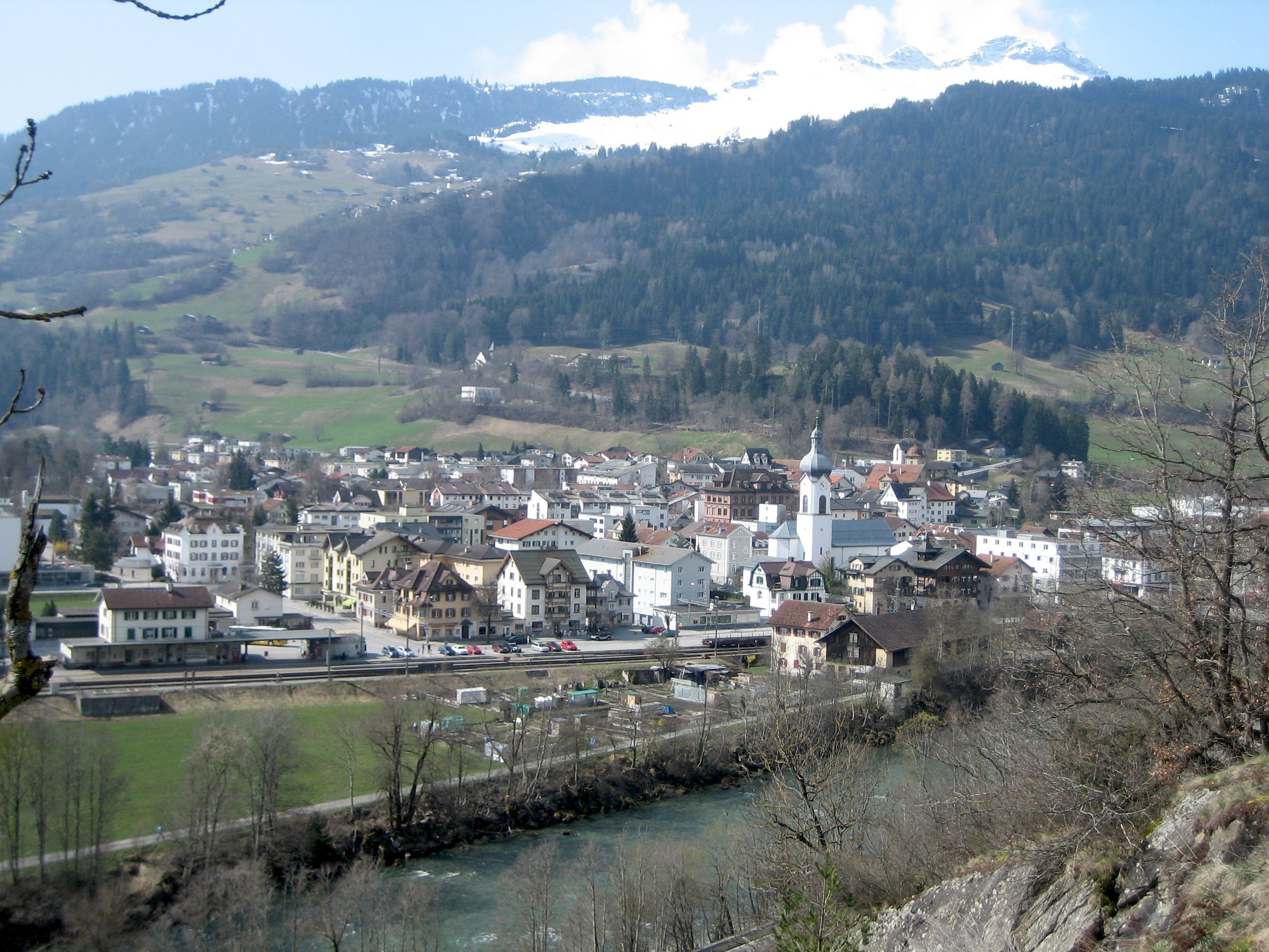
Bonaduz () is a municipality in the Imboden Region in the Swiss canton of Graubünden. History Bonaduz is first mentioned in 960 as ''Beneduces''. Until 1854, the German-speaking hamlet of Sculms belonged to Bonaduz. Following a vote in that year, Sculms joined Versam. Geography Bonaduz has an area, , of . Of this area, 25.2% is used for agricultural purposes, while 61.3% is forested. Of the rest of the land, 7.3% is settled (buildings or roads) and the remainder (6.2%) is non-productive (rivers, glaciers or mountains). Until 2017 the municipality was located in the Rhäzüns sub-district, of the Imboden district, after 2017 it became part of the Imboden Region. [...More Info...] [...Related Items...] OR: [Wikipedia] [Google] [Baidu] |
Ilanz
Ilanz () is a former Municipalities of Switzerland, municipality in the district of Surselva (district), Surselva in the Switzerland, Swiss Cantons of Switzerland, canton of the Grisons. The former municipality of Ilanz was congruent with the town of Ilanz. On 1 January 1978, the former municipality of Strada merged into the new municipality of Ilanz. On 1 January 2014, the municipality of Ilanz and the surrounding municipalities Castrisch, Ladir, Luven, Pitasch, Riein, Ruschein, Schnaus, Sevgein, Duvin, Pigniu, Rueun and Siat merged into the new municipality of Ilanz/Glion. History Ilanz is first mentioned in 765 as "''Iliande''." Ilanz became the capital of the newly formed Grey League in 1395. The Grey League was the second of the Three Leagues which eventually formed canton of the Grisons. Johannes von Ilanz, the Abbot of Disentis, was among the three nobles instrumental in creating this "eternal alliance." Ilanz has a special place in the history of the Protestant Reformation ... [...More Info...] [...Related Items...] OR: [Wikipedia] [Google] [Baidu] |
Rafting
Rafting and whitewater rafting are recreational outdoor activities which use an inflatable raft to navigate a river or other body of water. This is often done on whitewater or different degrees of rough water. Dealing with risk is often a part of the experience. This activity as an adventure sport has become popular since the 1950s, if not earlier, evolving from individuals paddling to rafts with double-bladed paddles or oars to multi-person rafts propelled by single-bladed paddles and steered by a person at the stern, or by the use of oars. Rafting on certain sections of rivers is considered an extreme sport and can be fatal, while other sections are not so extreme or difficult. Rafting is also a competitive sport practiced around the world which culminates in a world rafting championship event between the participating nations. The International Rafting Federation, often referred to as the IRF, is the worldwide body which oversees all aspects of the sport. Equipment ... [...More Info...] [...Related Items...] OR: [Wikipedia] [Google] [Baidu] |
Versam
Versam is a former municipality in the district of Surselva in the canton of Graubünden in Switzerland. The municipalities of Valendas, Versam, Safien and Tenna merged on 1 January 2013 into the new municipality of Safiental.Amtliches Gemeindeverzeichnis der Schweiz published by the Swiss Federal Statistical Office accessed 2 January 2013 History Versam is first mentioned in 1050 as ''a valle Versamia''.Geography Versam had an area, , of . Of this area, 16.8% is used for agricultural purposes, while 70.6% is forested. Of the rest of the land, 2% is settled (buildings or roads) and the remainder (10.6%) is non-productive (rivers, glaciers or mountains). The former municipality is ...[...More Info...] [...Related Items...] OR: [Wikipedia] [Google] [Baidu] |
Trin Railway Station
Trin railway station is a station on the Reichenau-Tamins–Disentis/Mustér of the Rhaetian Railway in the Swiss canton of Graubünden. It is situated alongside the Anterior Rhine, in the railway's scenic passage through the Ruinaulta or Rhine Gorge. The station is located on the north bank of the river in the municipality of Trin, although the village of Trin lies about to the north and some higher than the station. Services the following services stop at Trin: * RegioExpress RegioExpress, commonly abbreviated to RE, is a Train categories in Europe, category of fast regional train service in Switzerland, run by Swiss Federal Railways (SBB CFF FFS) or other railway companies (such as Treni Regionali Ticino Lombardia, ...: hourly service between and . Gallery File:Ruinaulta - RhB Station Trin.jpg, The station building File:Trin Bahnhof.JPG, Activity at the station File:RhB-Zug gegenüber Rne Wackenau.JPG, Train passing through the Ruinaulta References External ... [...More Info...] [...Related Items...] OR: [Wikipedia] [Google] [Baidu] |


