|
Ross (barony)
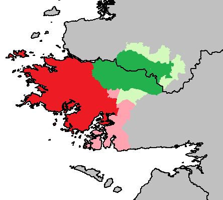
Ross () is a historical barony in northern County Galway, Ireland; part of it is in County Mayo. Baronies were mainly cadastral rather than administrative units. They acquired modest local taxation and spending functions in the 19th century before being superseded by the Local Government (Ireland) Act 1898. History The name derived from Irish , meaning "promontory" or "peninsula." This originally referred to the narrow strip of land between Loughs Mask and Corrib. This region was originally ruled by the Partraige (Partry) tribe. After allying with the Ó Flaithbheartaigh (Flahertys), the Anglo-Norman de Jorse (Joy, Joyce) family received grants of land here, and the area near here became part of Joyce Country. Ross barony was created before 1574 and was part of County Mayo; it was transferred to County Galway in 1585. In 1898 the county border was redrawn, putting about a third of Ross into Mayo. Geography Ross roughly corresponds to the traditional Joyce Country, and ... [...More Info...] [...Related Items...] OR: [Wikipedia] [Google] [Baidu] |
Irish Language
Irish (Standard Irish: ), also known as Irish Gaelic or simply Gaelic ( ), is a Celtic language of the Indo-European language family. It is a member of the Goidelic languages of the Insular Celtic sub branch of the family and is indigenous language, indigenous to the island of Ireland. It was the majority of the population's first language until the 19th century, when English (language), English gradually became dominant, particularly in the last decades of the century, in what is sometimes characterised as a result of linguistic imperialism. Today, Irish is still commonly spoken as a first language in Ireland's Gaeltacht regions, in which 2% of Ireland's population lived in 2022. The total number of people (aged 3 and over) in Ireland who declared they could speak Irish in April 2022 was 1,873,997, representing 40% of respondents, but of these, 472,887 said they never spoke it and a further 551,993 said they only spoke it within the education system. Linguistic analyses o ... [...More Info...] [...Related Items...] OR: [Wikipedia] [Google] [Baidu] |
Peninsula
A peninsula is a landform that extends from a mainland and is only connected to land on one side. Peninsulas exist on each continent. The largest peninsula in the world is the Arabian Peninsula. Etymology The word ''peninsula'' derives , . The word entered English in the 16th century. Definitions A peninsula is generally defined as a piece of land surrounded on most sides by water. A peninsula may be bordered by more than one body of water, and the body of water does not have to be an ocean or a sea. A piece of land on a very tight river bend or one between two rivers is sometimes said to form a peninsula, for example in the New Barbadoes Neck in New Jersey, United States. A peninsula may be connected to the mainland via an isthmus, for example, in the Isthmus of Corinth which connects to the Peloponnese peninsula. Formation and types Peninsulas can be formed from continental drift, glacial erosion, meltwater, glacial meltwater, glacial deposition (geology), deposition, ... [...More Info...] [...Related Items...] OR: [Wikipedia] [Google] [Baidu] |
Maam Cross
Maam Cross () is a crossroads in Connemara, County Galway, Ireland. It lies within the townland of Shindilla, at the junction of the N59 from Galway to Clifden and the R336 from Galway Galway ( ; , ) is a City status in Ireland, city in (and the county town of) County Galway. It lies on the River Corrib between Lough Corrib and Galway Bay. It is the most populous settlement in the province of Connacht, the List of settleme ... to the Maam Valley which runs from Maum or Maam to Leenaun or Leenane. station, on the Galway - Clifden line, opened on 1 January 1896. It finally closed on 29 April 1935. The station facilities and a short section of railway line have been restored in a project launched in 2017 and ongoing as of 2022. The location has a service station and hotel, with dining facilities and a gift shop. It is also home to a weekly agricultural mart, handling sheep, cattle and Connemara ponies. See also * List of towns and villages in Ireland References ... [...More Info...] [...Related Items...] OR: [Wikipedia] [Google] [Baidu] |
Leenaun
Leenaun (), also Leenane, is a village and 1,845 acre townland in County Galway, Ireland, on the southern shore of Killary Harbour and the northern edge of Connemara. Location and geography Leenaun is situated on the junction of the N59 road, and the R336 road in Connemara. Leenaun lies where the deep u-shaped Maam Valley, bounded by the Devilsmother to the east, and the massif of Leenaun Hill to the west, meets Killary Harbour, Ireland's deepest fjord. Across the fjord from the village, is the massif of Ben Gorm, with the larger massif of Mweelrea behind it; while to the east, lie the scenic Aasleagh Falls. The village is on the route of the Western Way long-distance trail and the Wild Atlantic Way. Within Maam Valley are some ancient woods, the Erriff Woods are nearby. Across the fjord is the hamlet of Bundorragha and Delphi (the valley of the Bundorragha River is sometimes called the Delphi Valley) in County Mayo. The River Erriff which runs into the fjord, along wit ... [...More Info...] [...Related Items...] OR: [Wikipedia] [Google] [Baidu] |
Finny, County Mayo
Finny (or Finney) () is a small village and townland in County Mayo, Ireland. The village is situated in the civil parish of Ross, in the Barony of Ross. Finny is located on the R300 regional road. The nearby Finny River, rising from the south-east of Loch Na Fooey drains eastward into the southwest part of Lough Mask. Finny is approximately 10 km to the west of Clonbur, County Galway, 11 km to the east of Leenaun, County Galway and 17 km south west of Toormakeady, County Mayo. Culture Finny is an Irish-speaking district within the Gaeltacht of south Mayo and is also located within the cultural district of Joyce Country Joyce Country () is a cultural region in counties Galway and Mayo in Ireland. It is sometimes called Partry, after the former tribal territory of the '' Partraige'', which it largely matches. Part of it falls within the Connacht Gaeltacht. Joy .... Religion The Catholic Church of the Immaculate Conception in Finny was completed in 1921 ... [...More Info...] [...Related Items...] OR: [Wikipedia] [Google] [Baidu] |
Cornamona
Corr na Móna (anglicized as Cornamona) is a village and townland in County Galway, Ireland. It is part of the Gaeltacht (Irish-speaking region) in Joyce Country, and of the possible future geopark. The village lies on the north of Lough Corrib in the middle of the Joyce Country Mountain and Lake Districts. It is a popular site among trout and salmon anglers. The eastern edge of the area comes down to the shores of the Corrib while the western edge borders the upland area of An Mám, the Maam Valley and the Maumturk Mountains. The local secondary school is Coláiste Naomh Feichín, Corr na Móna. The village also has a shop, pub, playground, pier and community centre. Corr na Móna was used as the filming location for Foscadh, an Irish language film released in 2021. Notable people * Mick Molloy — earned 27 caps playing rugby for Ireland from 1967–73; served as the IRB's first medical officer from 2005–2010. [...More Info...] [...Related Items...] OR: [Wikipedia] [Google] [Baidu] |
Loch Na Fooey
Loch Na Fooey (), also Loch Nafooey or Lough Nafooey, is a rectangular shaped glacial lake in County Galway, Ireland. Part of the north-eastern shore lies along the border to County Mayo. The closest village is Finny, County Mayo with the County Galway village of Leenaun approximately 11 km distant. At approximately 2.5 miles long and 0.5 miles wide, Loch Na Fooey is set in a steep-sided valley, surrounded by the mountains of Galway to the south and Mayo's Partry Mountains to the north. A number of rivers feed the lake, including the River Fooey (), which rises from the Devil’s Mother mountain and enters the lake at the western shore. The Finny River, rising from the south-east of the lake drains into the southwest part of Lough Mask. Also many mountain streams flow into the lake. The lake has a small sandy shore on its western end. There are several extinct volcanoes in locations like Armagh, Dublin, Offaly, and the Loch na Foeey in Galway. They are not believed to be d ... [...More Info...] [...Related Items...] OR: [Wikipedia] [Google] [Baidu] |
Killary Harbour
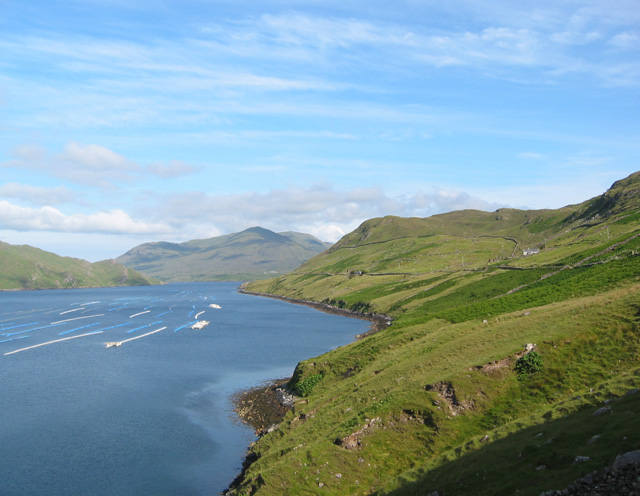
Killary Harbour or Killary Fjord () is a fjord or fjard on the west coast of Ireland, in northern Connemara. To its north is County Mayo and the mountains of Mweelrea and Ben Gorm; to its south is County Galway and the Maumturk Mountains. Structure The flooded valley is long, and in the centre over deep; the sea level is higher outside its mouth, as is normal for a fjord.Collins Press, Cork, Ireland - Ireland's Coastline: Exploring its Nature and Heritage - Nairn, Richard, 2007: "the long, narrow fjord of Killary Harbour, which forms the boundary between the counties of Mayo and Galway. ... only a few hundred metres wide. A glacier must have scoured the bottom as it moved towards the sea, taking large volumes of rock and gravel with it. Just outside the entrance, the depth reduces dramatically and there are a number of rocky islands giving a profile that is typical of the fjords of Scandinavia." For nearly half its length, it runs south east from the Atlantic, and then it c ... [...More Info...] [...Related Items...] OR: [Wikipedia] [Google] [Baidu] |
Lough Corrib
Lough Corrib ( ; ) is a lake in the west of Ireland. The River Corrib or Galway River connects the lake to the sea at Galway. It is the largest lake within the Republic of Ireland and the second largest on the island of Ireland (after Lough Neagh). It covers 176 km² and lies mostly in County Galway with a small area of its northeast corner in County Mayo. The first canal on the island of Ireland was cut in the 12th century. Known as the Friar's Cut, it allowed boats to pass from Lough Corrib to the sea at Galway. Lough Corrib was designated a Ramsar site in June 1996. It has also been designated a Special Area of Conservation. Name is a corruption of , . According to placename lore, this refers to or —another name for the figure —who is believed to have been a god of the sea. In Irish, the lough is also called ("the Corrib"). Marine archaeology and charts Surveys have been undertaken since 2007 by a local surveyor/cartographer to create up-to-date charts of ... [...More Info...] [...Related Items...] OR: [Wikipedia] [Google] [Baidu] |
Lough Mask
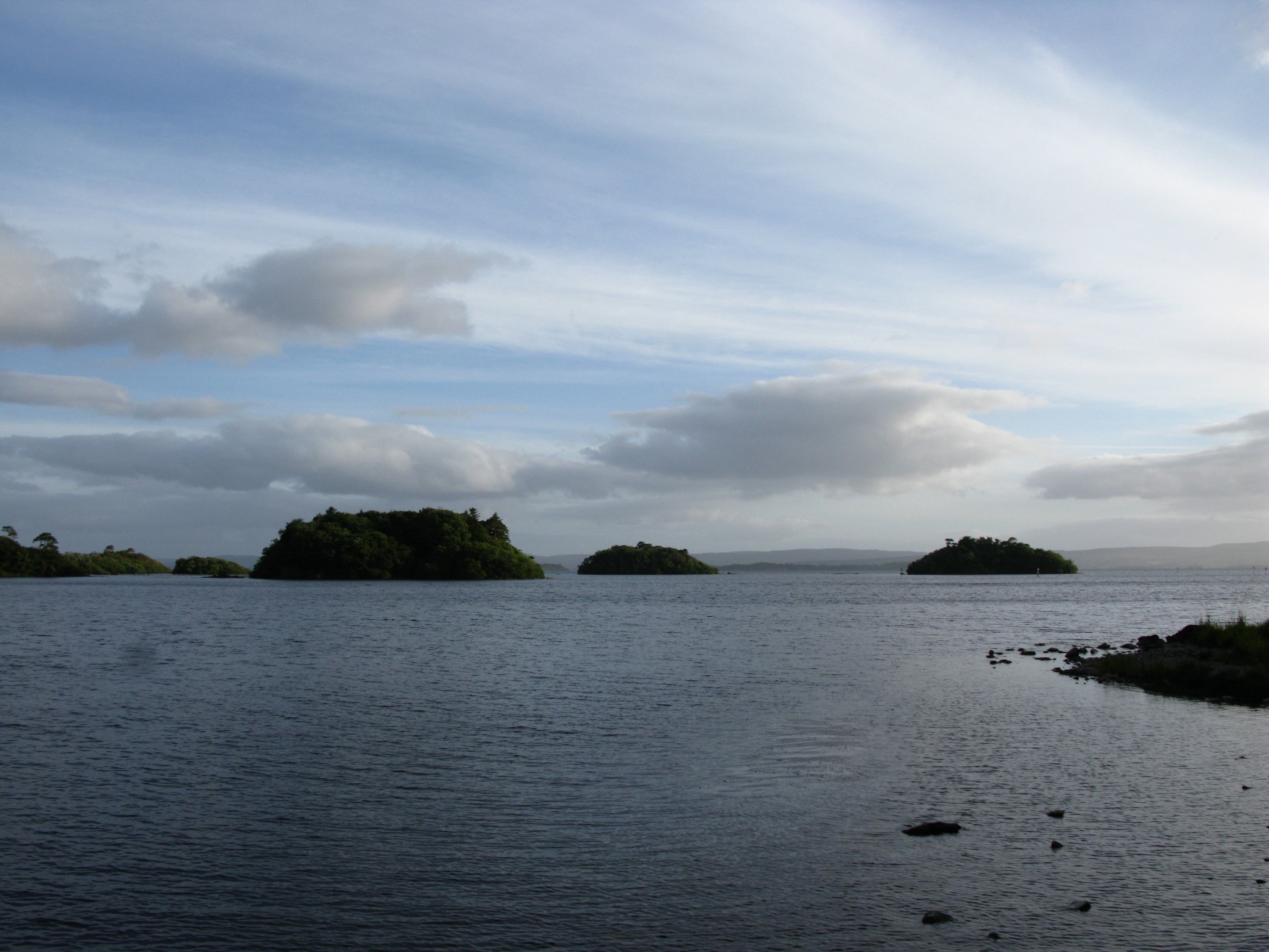
Lough Mask () is a limestone lake of about in Counties Mayo and Galway, Ireland, north of Lough Corrib. Lough Mask is the middle of the three lakes, which empty into the Corrib River, through Galway, into Galway Bay. Lough Carra flows into Lough Mask, which discharges through the Cong Canal and underground passages in the limestone bedrock of the district. The flows from the underground passages and the Cong Canal come together at the village of Cong to form the River Cong which flows into Lough Corrib. Lough Mask is the fourth largest lake, by area, in Ireland and the sixth largest lake in the island of Ireland. The eastern half of Lough Mask is shallow and contains many islands. The other half (Upper Lough Mask) is much deeper, sinking to a long trench with depths in excess of 50 metres. Lough Mask has a mean depth of , and a maximum depth of . Its water volume of is the largest in the Republic of Ireland and the second largest on the island of Ireland (after Lough ... [...More Info...] [...Related Items...] OR: [Wikipedia] [Google] [Baidu] |
Joyce Country
Joyce Country () is a cultural region in counties Galway and Mayo in Ireland. It is sometimes called Partry, after the former tribal territory of the '' Partraige'', which it largely matches. Part of it falls within the Connacht Gaeltacht. Joyce Country lies on the shores of Lough Mask and Lough Corrib, and includes the Partry Mountains. It is a rural area that includes small settlements such as Clonbur, Cong, Cornamona and Toormakeady. It borders Connemara, to its south and west. Joyce family One of the first of the family ("Seoige" in Gaelic) recorded in Connacht was Thomas Joy, who established a minor Hiberno-Norman lordship in northern Iar Connacht. His territory was the barony of Ross, contiguous to Killery Bay and extending from Cong river to the river. The Joyce family became completely Gaelicised, ruled over their followers like the Chiefs of an Irish clan, and assimilated into the local Gaelic culture. Statistics See also County Galway * Galway City Gaelta ... [...More Info...] [...Related Items...] OR: [Wikipedia] [Google] [Baidu] |
Anglo-Norman People
The Anglo-Normans (, ) were the medieval ruling class in the Kingdom of England following the Norman Conquest. They were primarily a combination of Normans, Bretons, Flemings, Frenchmen, Anglo-Saxons and Celtic Britons. After the conquest the victorious Normans formed a ruling class in England, distinct from (although intermarrying with) the native Anglo-Saxon and Celtic populations. Over time, their language evolved from the continental Old Norman to the distinct Anglo-Norman language. Anglo-Normans quickly established control over all of England, as well as parts of Wales (the Welsh-Normans). After 1130, parts of southern and eastern Scotland came under Anglo-Norman rule (the Scots-Normans), in return for their support of David I's conquest. The Anglo-Norman invasion of Ireland from 1169 saw Anglo-Normans and Cambro-Normans conquer swaths of Ireland, becoming the Irish-Normans. The composite expression ''regno Norman-Anglorum'' for the Anglo-Norman kingdom that comp ... [...More Info...] [...Related Items...] OR: [Wikipedia] [Google] [Baidu] |


