|
Rongbuk Monastery
''Rongbuk Monastery'' (; other spellings include ''Rongpu'', ''Rongphu'', ''Rongphuk'' and ''Rong sbug'' ()), also known as Dzarongpu or Dzarong, is a Tibetan Buddhist monastery of the Nyingma sect in Basum Township, Dingri County, in Shigatse Prefecture of the Tibet Autonomous Region in China. Location Rongbuk Monastery lies near the base of the north side of Mount Everest at above sea level, at the end of the Dzakar Chu valley. Rongbuk is claimed to be the highest-elevation monastery in the world. However, the true highest monastery in the world is Drirapuk Monastery in Ngari Prefecture, at an altitude of . For Sherpas living on the south slopes of Everest in the Khumbu region of Nepal, Rongbuk Monastery was an important pilgrimage site, accessed in a few days' travel across the Himalaya through the Nangpa La.Tenzing Norgay and James Ramsey Ullman, ''Man of Everest'' (1955, also published as ''Tiger of the Snows'') The monastery was also regularly visited by the early ... [...More Info...] [...Related Items...] OR: [Wikipedia] [Google] [Baidu] |
Mount Everest
Mount Everest (; Tibetan: ''Chomolungma'' ; ) is Earth's highest mountain above sea level, located in the Mahalangur Himal sub-range of the Himalayas. The China–Nepal border runs across its summit point. Its elevation (snow height) of was most recently established in 2020 by the Chinese and Nepali authorities. Mount Everest attracts many climbers, including highly experienced mountaineers. There are two main climbing routes, one approaching the summit from the southeast in Nepal (known as the "standard route") and the other from the north in Tibet. While not posing substantial technical climbing challenges on the standard route, Everest presents dangers such as altitude sickness, weather, and wind, as well as hazards from avalanches and the Khumbu Icefall. , over 300 people have died on Everest, many of whose bodies remain on the mountain. The first recorded efforts to reach Everest's summit were made by British mountaineers. As Nepal did not allow fore ... [...More Info...] [...Related Items...] OR: [Wikipedia] [Google] [Baidu] |
Timeline Of Climbing Mount Everest
Mount Everest is the world's highest mountain, with a peak at 8,849 metres (29,031.7 ft) above sea level. It is situated in the Himalayan range of Solukhumbu district (Province 1 in present days), Nepal. Timeline 1921: Reconnaissance expedition The first British expedition—organized and financed by the newly formed Mount Everest Committee—came under the leadership of Colonel Charles Howard-Bury, with Harold Raeburn as mountaineering leader, and included George Mallory, Guy Bullock, and Edward Oliver Wheeler. It was primarily for mapping and reconnaissance to discover whether a route to the summit could be found from the north side. As the health of Raeburn broke down, Mallory assumed responsibility for most of the exploration to the north and east of the mountain. He wrote to his wife: "We are about to walk off the map..." After five months of arduous climbing around the base of the mountain, Wheeler explored the hidden East Rongbuk Glacier and its route to the bas ... [...More Info...] [...Related Items...] OR: [Wikipedia] [Google] [Baidu] |
Lama
Lama (; "chief") is a title for a teacher of the Dharma in Tibetan Buddhism. The name is similar to the Sanskrit term ''guru'', meaning "heavy one", endowed with qualities the student will eventually embody. The Tibetan word "lama" means "highest principle", and less literally "highest mother" or "highest parent" to show close relationship between teacher and student."lama" from Historically, the term was used for venerated spiritual masters or heads of . Today the title can be used as an [...More Info...] [...Related Items...] OR: [Wikipedia] [Google] [Baidu] |
Mani Stone
Mani stones are stone plates, rocks or pebbles inscribed with the six-syllabled mantra of Avalokiteshvara ('' Om mani padme hum'', hence the name ''mani stone''), as a form of prayer in Tibetan Buddhism. The term mani stone may also be used to refer to stones on which any mantra or devotional designs (such as ashtamangala) are inscribed or painted. Mani stones are intentionally placed along the roadsides and rivers or grouped together to form mounds or cairns or sometimes long walls, as an offering to spirits of place or '' genius loci''. Creating and carving mani stones as devotional or intentional process art is a traditional sadhana of piety to yidam. Mani stones are a form of devotional cintamani. The preferred technique is sunk relief, where an area around each letter is carved out, leaving the letters at the original surface level, now higher than the background. The stones are often painted in symbolic colours for each syllable (''om'' white, ''ma'' green, ''ni'' y ... [...More Info...] [...Related Items...] OR: [Wikipedia] [Google] [Baidu] |
Nyingmapa
Nyingma (literally 'old school') is the oldest of the four major schools of Tibetan Buddhism. It is also often referred to as ''Ngangyur'' (, ), "order of the ancient translations". The Nyingma school is founded on the first lineages and translations of Buddhist scriptures from Sanskrit into Tibetan in the eighth century, during the reign of King Trisong Detsen (r. 710–755). Nyingma traditional histories consider their teachings to trace back to the first Buddha Samantabhadra (Güntu Sangpo) and Indian mahasiddhas such as Garab Dorjé, Śrī Siṃha and Jñānasūtra. Traditional sources trace the origin of the Nyingma order in Tibet to figures associated with the initial introduction of Buddhism in the 8th century, such as Padmasambhava, Yeshe Tsogyal, Vimalamitra, Vairotsana, Buddhaguhya and Shantaraksita. The Nyingma tradition is also seen having been founded at Samyé, the first monastery in Tibet. Nyingma teachings are also known for having been passed down throu ... [...More Info...] [...Related Items...] OR: [Wikipedia] [Google] [Baidu] |
Reliquary
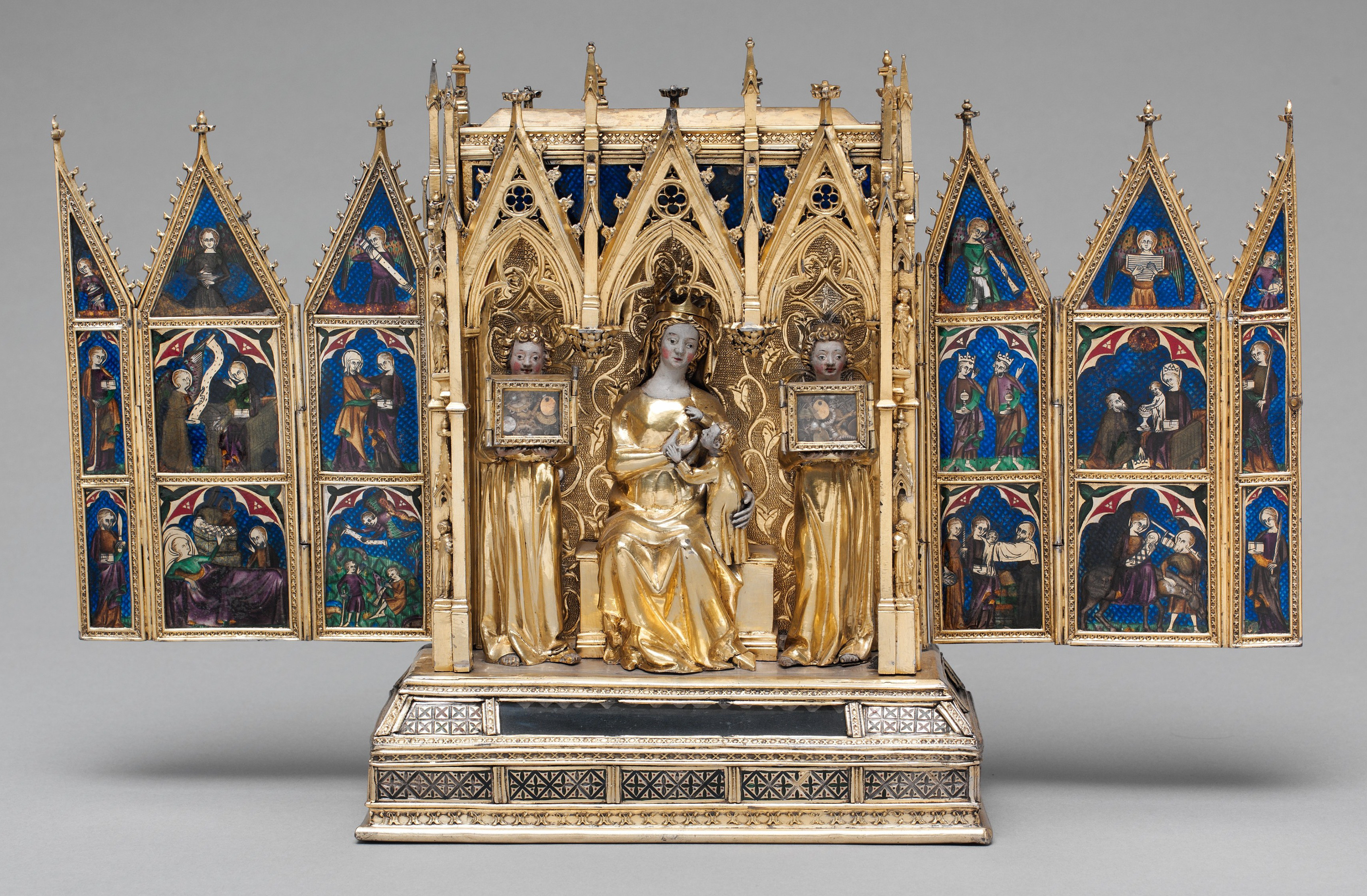
A reliquary (also referred to as a '' shrine'', by the French term ''châsse'', and historically including '' phylacteries'') is a container for relics. A portable reliquary may be called a ''fereter'', and a chapel in which it is housed a ''feretory''. Relics may be the purported or actual physical remains of saints, such as bones, pieces of clothing, or some object associated with saints or other religious figures. The authenticity of any given relic is often a matter of debate; it is for that reason, some churches require documentation of the relic's provenance. Relics have long been important to Buddhists, Christians, Hindus and to followers of many other religions. In these cultures, reliquaries are often presented in shrines, churches, or temples to which the faithful make pilgrimages in order to gain blessings. The term is sometimes used loosely of containers for the body parts of non-religious figures; in particular the Kings of France often specified that their he ... [...More Info...] [...Related Items...] OR: [Wikipedia] [Google] [Baidu] |
Stupa
A stupa ( sa, स्तूप, lit=heap, ) is a mound-like or hemispherical structure containing relics (such as '' śarīra'' – typically the remains of Buddhist monks or nuns) that is used as a place of meditation. In Buddhism, circumambulation or '' pradakhshina'' has been an important ritual and devotional practice since the earliest times, and stupas always have a ''pradakhshina'' path around them. The original South Asian form is a large solid dome above a tholobate or drum with vertical sides, which usually sits on a square base. There is no access to the inside of the structure. In large stupas there may be walkways for circumambulation on top of the base as well as on the ground below it. Large stupas have or had ''vedikā'' railings outside the path around the base, often highly decorated with sculpture, especially at the torana gateways, of which there are usually four. At the top of the dome is a thin vertical element, with one of more horizontal discs spre ... [...More Info...] [...Related Items...] OR: [Wikipedia] [Google] [Baidu] |
Tingri Town
Gangga (or ''Tingri'' according to name of region) (; ) is a town in Tingri County, in the south of the Tibet Autonomous Region. It has a population of around 523, and is often used as a base by mountain climbers preparing to ascend Mount Everest or Cho Oyu. It is known for its views of Mount Everest, Mount Lhotse, Mount Makalu, and Cho Oyu, which comprise four of the six highest mountains in the world. Tingri used to be an important trading post where Sherpas from Nepal exchanged rice, grain and iron for Tibetan wool, livestock and salt. It gives its name to the more than -high broad upland basin that is known as the Tingri Plain. One must cross the pass known as the Lak Pa La (el. ) to the north to reach the Tsangpo Valley system. Shallow, fast-flowing rivers of melted snow water make its grassy meadowland ideal for grazing by Tibetan animals. The plain used to abound with gazelles, blue sheep, antelopes and khyang or wild asses but most of the animals are gone now. The Chinese ... [...More Info...] [...Related Items...] OR: [Wikipedia] [Google] [Baidu] |
Shelkar
Shelkar or Shekar, (Tibetan: , "white crystal") also called New Tingri, is the administrative centre for Tingri County, Shigatse Prefecture in southern Tibet Autonomous Region. Location The town lies 7 km off the Friendship Highway between Lhatse and Tingri, at an altitude of about 4,300 metres (approx. 14,107 feet), at the southern foot of 5,260 m high Gyatso La. It is approximately 60 km north-west of Mount Everest and just over 50 km from the Nepali border in the Tibet Autonomous Region of China. Landmarks Shelkar is famous for the Shelkar Chode Monastery, a Gelug monastery which was completely destroyed but is being restored. Despite being founded in 1266 by a Kagyu lama, it has been a Gelugpa monastery since the 17th century, and formerly had some 400 monks. Although, destroyed by the Red Guards during the Cultural Revolution, the assembly hall has been rebuilt, and there is an active branch monastery in Boudhanath, Nepal. Shelkar-Kloster-02-Porta ... [...More Info...] [...Related Items...] OR: [Wikipedia] [Google] [Baidu] |
Friendship Highway (Tibet)
There are several highways sometimes known as Friendship highways. Note that the "friendship" name may not in all cases necessarily be the current official name or common name. * China-Laos Friendship Highway, 1963 (Chinese 中老友谊公路) * China-Nepal Friendship Highway, 1967 (Chinese 中尼友谊公路), highway connecting the Chinese Tibet Autonomous Region with Nepal *China-Pakistan Friendship Highway (Chinese 中巴友誼公路), better known as the Karakoram Highway *China-Vietnam Friendship Highway (Chinese 中越友谊公路) *Mittraphap Road Mittraphap Road (, , ) or Highway 2 (, ) is one of the four primary highways in Thailand, along with Phahonyothin Road (Highway 1), Sukhumvit Road (Highway 3), and Phetkasem Road (Highway 4). It runs from Saraburi to Nong Khai. The road was origi ... (Thailand Route 2), literally "Friendship Road" * Khmer-American Friendship Highway (National highway 4), Cambodia * Philippine-Japan Friendship Highway, Philippines * Bangladesh-Myan ... [...More Info...] [...Related Items...] OR: [Wikipedia] [Google] [Baidu] |
Rongbuk Glacier
The Rongbuk Glacier () is located in the Himalaya of southern Tibet. Two large tributary glaciers, the East Rongbuk Glacier and the West Rongbuk Glacier, flow into the main Rongbuk Glacier. It flows north and forms the Rongbuk Valley north of Mount Everest. The famous Rongbuk Monastery is located at the northern end of the Rongbuk valley. Mount Everest is the source of the Rongbuk Glacier and East Rongbuk Glacier. Discovery The English climber George Mallory first explored the main Rongbuk Valley and its glacier while searching for possible routes to the summit of Mount Everest, during the first British Everest reconnaissance expedition of 1921. On the same expedition, Oliver Wheeler first explored the East Rongbuk Glacier. His exploration below the Lhakpa La pass led him on 3 August 1921 to realise that the East Rongbuk Valley provided the key to a viable route to the summit of Everest. A few weeks later, a party consisting of George Mallory, Guy Bullock, and Oliver Wheeler ex ... [...More Info...] [...Related Items...] OR: [Wikipedia] [Google] [Baidu] |
Everest Base Camp
There are two base camps on Mount Everest, on opposite sides of the mountains: South Base Camp is in Nepal at an altitude of (), while North Base Camp is in Tibet, China at (). The base camps are rudimentary campsites at the base of Mount Everest that are used by mountain climbers during their ascent and descent; they are also visited by hikers. South Base Camp is used when climbing via the southeast ridge, while North Base Camp is used when climbing via the northeast ridge. Supplies are shipped to the South Base Camp by porters, and with the help of animals, usually yaks. The North Base Camp is accessed by a paved road that branches from China National Highway 318. Climbers typically rest at base camp for several days for acclimatization, to reduce the risk of altitude sickness. South Base Camp in Nepal The Everest Base Camp trek on the south side, at an elevation of , is one of the most popular trekking routes in the Himalayas and about 40,000 people per year make the ... [...More Info...] [...Related Items...] OR: [Wikipedia] [Google] [Baidu] |


_in_1921.jpg)