|
Rock Carvings At Møllerstufossen
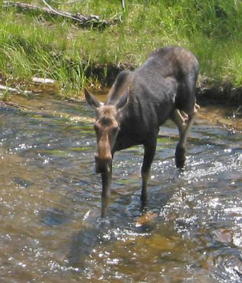
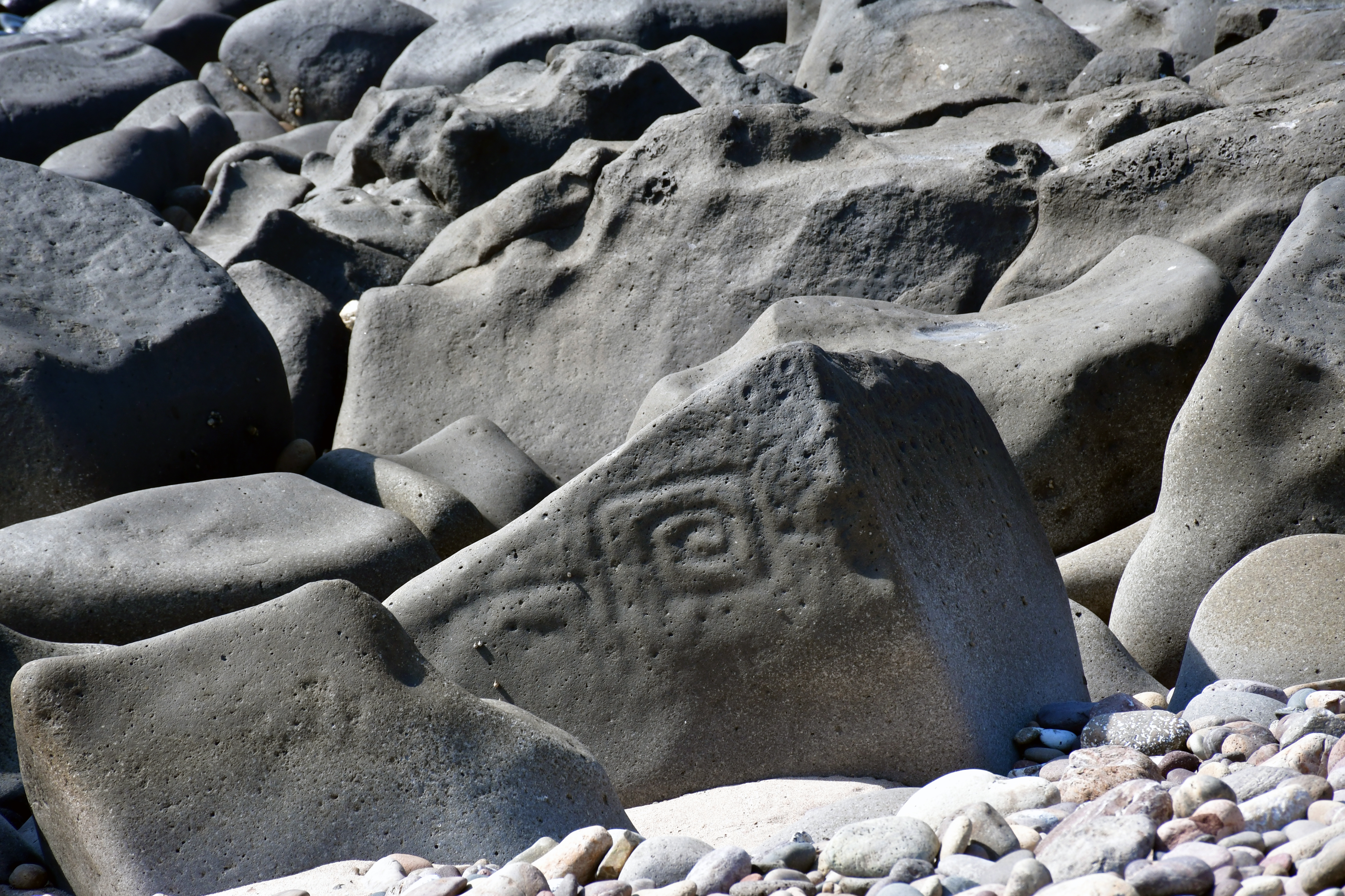
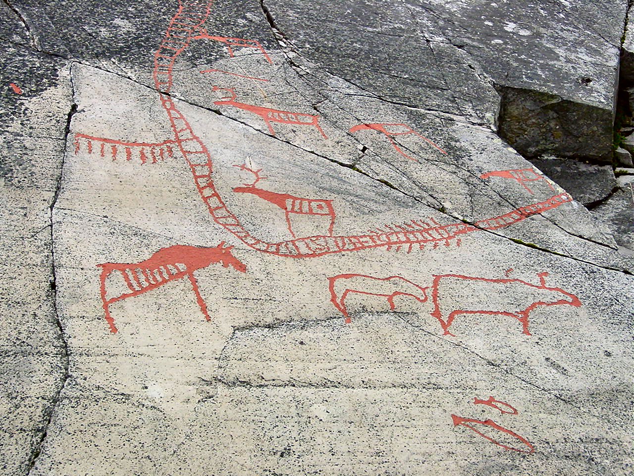
The Rock carvings at Møllerstufossen are petroglyphs found in Nord-Sinni in Nordre Land municipality in Oppland county of Norway. Description The carvings comprise several representations of moose and one other animal. The site covers about . The largest figure measures about across. The figures are easy to spot: they were carved with deep and wide strokes and have been repainted. Access The site is signposted. A small wooden boardwalk near the site provides access and helps limit wear on the carvings. The river Etna (river), Etna runs approximately away, and in spring nearly floods the site. Gallery File:Hellerisninger Etna, Nordre Land, 2005-08-13, 01.jpg File:Hellerisninger Etna, Nordre Land, 2005-08-13, 02.jpg File:Hellerisninger Etna, Nordre Land, 2005-08-13, 03.jpg File:Hellerisninger Etna, Nordre Land, 2005-08-13, 04.jpg See also *Pre-historic art *Petroglyph *History of Norway *List of World Heritage Sites in Europe *Rock carvings in Norway External links Roc ... [...More Info...] [...Related Items...] OR: [Wikipedia] [Google] [Baidu] |
Petroglyph
A petroglyph is an image created by removing part of a rock surface by incising, picking, carving, or abrading, as a form of rock art. Outside North America, scholars often use terms such as "carving", "engraving", or other descriptions of the technique to refer to such images. Petroglyphs, estimated to be 20,000 years old are classified as protected monuments and have been added to the tentative list of UNESCO's World Heritage Sites. Petroglyphs are found worldwide, and are often associated with prehistoric peoples. The word comes from the Greek prefix , from meaning " stone", and meaning "carve", and was originally coined in French as . In scholarly texts, a ''petroglyph'' is a rock engraving, whereas a '' petrograph'' (or ''pictograph'') is a rock painting. In common usage, the words are sometimes used interchangeably. Both types of image belong to the wider and more general category of rock art or parietal art. Petroforms, or patterns and shapes made by man ... [...More Info...] [...Related Items...] OR: [Wikipedia] [Google] [Baidu] |
Nordre Land
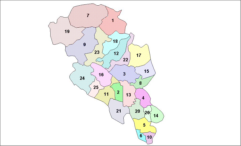
Nordre Land is a municipality in Innlandet county, Norway. It is located in the traditional district of Land. The administrative centre of the municipality is the village of Dokka. Other villages in the municipality include Vest-Torpa, Nord-Torpa, Aust-Torpa, Fagerlund, and Nordsinni. The municipality is the 122nd largest by area out of the 356 municipalities in Norway. Nordre Land is the 151st most populous municipality in Norway with a population of 6,527. The municipality's population density is and its population has decreased by 3.4% over the previous 10-year period. General information The old Land Municipality was established on 1 January 1838 after the formannskapsdistrikt law went into effect. This municipality was quite large and in less than a decade, the municipality was divided. In 1847, the old Land Municipality was divided into Nordre Land (population: 4,595) in the north and Søndre Land (population: 4,604) in the south. On 1 January 1868, a part of S� ... [...More Info...] [...Related Items...] OR: [Wikipedia] [Google] [Baidu] |
Oppland
Oppland is a former county in Norway which existed from 1781 until its dissolution on 1 January 2020. The old Oppland county bordered the counties of Trøndelag, Møre og Romsdal, Sogn og Fjordane, Buskerud, Akershus, Oslo and Hedmark. The county administration was located in the town of Lillehammer. Merger On 1 January 2020, the neighboring counties of Oppland and Hedmark were merged to form the new Innlandet county. Both Oppland and Hedmark were the only landlocked counties of Norway, and the new Innlandet county is the only landlocked county in Norway. The two counties had historically been one county that was divided in 1781. Historically, the region was commonly known as " Opplandene". In 1781, the government split the area into two: Hedemarkens amt and Kristians amt (later renamed Hedmark and Oppland). In 2017, the government approved the merger of the two counties. There were several names debated, but the government settled on ''Innlandet''. Geography Oppland ext ... [...More Info...] [...Related Items...] OR: [Wikipedia] [Google] [Baidu] |
Norway
Norway, officially the Kingdom of Norway, is a Nordic countries, Nordic country located on the Scandinavian Peninsula in Northern Europe. The remote Arctic island of Jan Mayen and the archipelago of Svalbard also form part of the Kingdom of Norway. Bouvet Island, located in the Subantarctic, is a Dependencies of Norway, dependency, and not a part of the Kingdom; Norway also Territorial claims in Antarctica, claims the Antarctic territories of Peter I Island and Queen Maud Land. Norway has a population of 5.6 million. Its capital and largest city is Oslo. The country has a total area of . The country shares a long eastern border with Sweden, and is bordered by Finland and Russia to the northeast. Norway has an extensive coastline facing the Skagerrak strait, the North Atlantic Ocean, and the Barents Sea. The unified kingdom of Norway was established in 872 as a merger of Petty kingdoms of Norway, petty kingdoms and has existed continuously for years. From 1537 to 1814, Norway ... [...More Info...] [...Related Items...] OR: [Wikipedia] [Google] [Baidu] |
Moose
The moose (: 'moose'; used in North America) or elk (: 'elk' or 'elks'; used in Eurasia) (''Alces alces'') is the world's tallest, largest and heaviest extant species of deer and the only species in the genus ''Alces''. It is also the tallest, and the second-largest, land animal in North America, falling short only to the American bison in body mass. Most adult male moose have broad, palmate ("open-hand shaped") antlers; other members of the deer family have pointed antlers with a dendritic ("twig-like") configuration. Moose inhabit the circumpolar boreal forests or temperate broadleaf and mixed forests of the Northern Hemisphere, thriving in cooler, temperate areas as well as subarctic climates. Hunting shaped the relationship between moose and humans, both in Eurasia and North America. Prior to the colonial era (around 1600–1700 CE), moose were one of many valuable sources of sustenance for certain tribal groups and First Nations. Hunting and habitat loss hav ... [...More Info...] [...Related Items...] OR: [Wikipedia] [Google] [Baidu] |
Boardwalk
A boardwalk (alternatively board walk, boarded path, or promenade) is an elevated footpath, walkway, or causeway typically built with wooden planks, which functions as a type of low water bridge or small viaduct that enables pedestrians to better cross wet, muddy or marshy lands. Such timber trackways have existed since at least Neolithic times. In many seaside resort locations, boardwalks along the beach provide access to shops, hotels, and tourist attractions. The Jersey Shore in the United States is especially noted for its abundance of boardwalks. Some wooden boardwalks have had sections replaced by concrete and even "a type of recycled plastic that looks like wood." History An early example is the Sweet Track that Neolithic people built in the Somerset levels, England, around 6000 years ago. This track consisted mainly of planks of oak laid end-to-end, supported by crossed pegs of ash, oak, and lime, driven into the underlying peat. The Wittmoor bog tra ... [...More Info...] [...Related Items...] OR: [Wikipedia] [Google] [Baidu] |
Etna (river)
Etna or Etne is a river in the Valdres region of Innlandet county, Norway. The long river flows through the municipalities of Øystre Slidre, Nord-Aurdal, Etnedal, and Nordre Land before joining the river Dokka (river), Dokka at the village of Dokka in Nordre Land Municipality. Soon after the confluence of those two rivers, they join the Randsfjorden (a long, narrow inland lake). The river begins near the mountains Skaget and Langsua inside the Langsua National Park. It then flows in a southerly direction. Much of the river runs through the Etnedalen valley (the namesake of the municipality of Etnedal). The river runs through the village of Bruflat and then shortly after this, it begins heading in a more easterly direction. The river was formally protected from hydropower development by the government in 1993. See also *List of rivers in Norway References Etnedal Nordre Land Rivers of Innlandet {{Norway-river-stub ... [...More Info...] [...Related Items...] OR: [Wikipedia] [Google] [Baidu] |
Pre-historic Art
In the history of art, prehistoric art is all art produced in preliterate, Prehistory, prehistorical cultures beginning somewhere in very late geological history, and generally continuing until that culture either develops writing or other methods of record-keeping, or makes significant contact with another culture that has, and that makes some record of major historical events. At this point ancient art begins, for the older literate cultures. The end-date for what is covered by the term thus varies greatly between different parts of the world. The earliest human artifacts showing evidence of workmanship with an artistic purpose are the subject of some debate. It is clear that such workmanship existed 40,000 years ago in the Upper Paleolithic era, although it is quite possible that it began earlier. In September 2018, scientists reported the discovery of the earliest known drawing by ''Homo sapiens'', which is estimated to be 73,000 years old, much earlier than the 43,000 year ... [...More Info...] [...Related Items...] OR: [Wikipedia] [Google] [Baidu] |
Petroglyph
A petroglyph is an image created by removing part of a rock surface by incising, picking, carving, or abrading, as a form of rock art. Outside North America, scholars often use terms such as "carving", "engraving", or other descriptions of the technique to refer to such images. Petroglyphs, estimated to be 20,000 years old are classified as protected monuments and have been added to the tentative list of UNESCO's World Heritage Sites. Petroglyphs are found worldwide, and are often associated with prehistoric peoples. The word comes from the Greek prefix , from meaning " stone", and meaning "carve", and was originally coined in French as . In scholarly texts, a ''petroglyph'' is a rock engraving, whereas a '' petrograph'' (or ''pictograph'') is a rock painting. In common usage, the words are sometimes used interchangeably. Both types of image belong to the wider and more general category of rock art or parietal art. Petroforms, or patterns and shapes made by man ... [...More Info...] [...Related Items...] OR: [Wikipedia] [Google] [Baidu] |
History Of Norway
The history of Norway has been influenced to an extraordinary degree by the terrain and the climate of the region. About 10,000 BC, following the retreat inland of the great ice sheets, the earliest inhabitants migrated north into the territory which is now Norway. They traveled steadily northwards along the coastal areas, warmed by the Gulf Stream. They were hunter-gatherers whose diet included seafood and game, particularly reindeer as staple foods. Between 5,000 BC and 4,000 BC the earliest agricultural settlements appeared around the Oslofjord. Gradually, between 1,500 BC and 500 BC, agricultural settlements spread to the entire south Norway, while the inhabitants of the regions north of Trøndelag continued to hunt and fish. The Neolithic period started in 4,000 BC. The Migration Period caused the first chieftains to take control and hilltop forts to be constructed. From the 8th century Norwegians started expanding across the seas to the British Isles and later Iceland and ... [...More Info...] [...Related Items...] OR: [Wikipedia] [Google] [Baidu] |


