|
Robert Fotherby
Robert Fotherby (died 1646) was an early 17th-century English explorer and whaler. From 1613 to 1615 he worked for the Muscovy Company, and from 1615 until his death for the East India Company. Family ties There was a family of Fotherbys in Grimsby, Lincolnshire. Robert Fotherby may have belonged to this Grimsby stock. Whaling voyages to Spitsbergen (Svalbard), 1613–1615 1613 Fotherby was among the crew of seven ships sent by the Muscovy Company to Greenland (Spitsbergen) in May 1613. He served as master's mate aboard the ship ''Matthew'' (250 tons), vice-admiral of the fleet. The only notable occurrence Fotherby spoke of in his journal was that he ascended a glacier in Josephbukta, a bay on the western side of Recherche Fjord. This is significant in that this is the first recorded glacier expedition in Spitsbergen's history. The glacier in question was probably Renardbreen (Fox glacier). 1614 In this year Fotherby sailed as master's mate in the ship ''Thomasine'', ... [...More Info...] [...Related Items...] OR: [Wikipedia] [Google] [Baidu] |
England
England is a country that is part of the United Kingdom. It shares land borders with Wales to its west and Scotland to its north. The Irish Sea lies northwest and the Celtic Sea to the southwest. It is separated from continental Europe by the North Sea to the east and the English Channel to the south. The country covers five-eighths of the island of Great Britain, which lies in the North Atlantic, and includes over 100 smaller islands, such as the Isles of Scilly and the Isle of Wight. The area now called England was first inhabited by modern humans during the Upper Paleolithic period, but takes its name from the Angles, a Germanic tribe deriving its name from the Anglia peninsula, who settled during the 5th and 6th centuries. England became a unified state in the 10th century and has had a significant cultural and legal impact on the wider world since the Age of Discovery, which began during the 15th century. The English language, the Anglican Church, and Eng ... [...More Info...] [...Related Items...] OR: [Wikipedia] [Google] [Baidu] |
Thomas Marmaduke
Thomas Marmaduke was an English explorer, sealer, and whaler in the early 17th century. Career In a list dated from September 1600 Marmaduke is mentioned as being a younger brother of the Hull Trinity House. He was master of one of the two Hull interlopers (a ship that trespasses on a trade monopoly by conducting unauthorized trade) sent to Bjørnøya in 1609. It was claimed that in this year, sailing in the ''Heartsease'', he "discovered" Spitsbergen; although there is no evidence for this claim, and the island had already been discovered by the Dutch in 1596. On this claim the merchants of Hull based their rights to fish for whales in Spitsbergen in subsequent decades. In 1611, Marmaduke was again sent up, this time in the interloper ''Hopewell'' of Hull. He hunted walrus, or "sea morses" (as they were called). In July, Marmaduke met with two shallops of the ''Mary Margaret'', a ship sent by the Muscovy Company to hunt whales, in Horn Sound. Their ship had been crushed by ice ... [...More Info...] [...Related Items...] OR: [Wikipedia] [Google] [Baidu] |
Jan Mayen
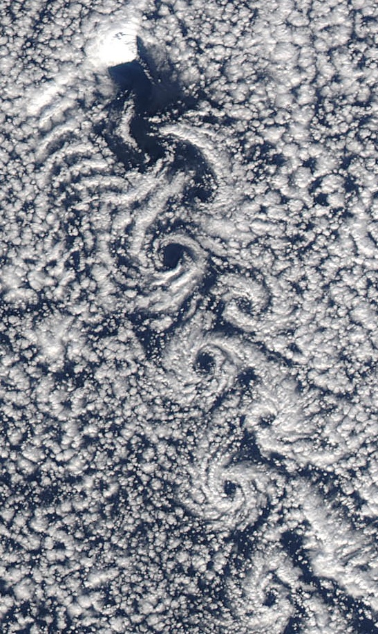
Jan Mayen () is a Norwegian volcanic island in the Arctic Ocean with no permanent population. It is long (southwest-northeast) and in area, partly covered by glaciers (an area of around the Beerenberg volcano). It has two parts: larger northeast Nord-Jan and smaller Sør-Jan, linked by a wide isthmus. It lies northeast of Iceland (495 km 05 miNE of Kolbeinsey), east of central Greenland, and west of the North Cape, Norway. The island is mountainous, the highest summit being the Beerenberg volcano in the north. The isthmus is the location of the two largest lakes of the island, Sørlaguna (South Lagoon) and Nordlaguna (North Lagoon). A third lake is called Ullerenglaguna (Ullereng Lagoon). Jan Mayen was formed by the Jan Mayen hotspot and is defined by geologists as a separate continent. Although administered separately, in the ISO 3166-1 standard, Jan Mayen and Svalbard are collectively designated as '' Svalbard and Jan Mayen'', with the two-letter country code ... [...More Info...] [...Related Items...] OR: [Wikipedia] [Google] [Baidu] |
Greenland
Greenland ( kl, Kalaallit Nunaat, ; da, Grønland, ) is an island country in North America that is part of the Kingdom of Denmark. It is located between the Arctic and Atlantic oceans, east of the Canadian Arctic Archipelago. Greenland is the world's largest island. It is one of three constituent countries that form the Kingdom of Denmark, along with Denmark and the Faroe Islands; the citizens of these countries are all citizens of Denmark and the European Union. Greenland's capital is Nuuk. Though a part of the continent of North America, Greenland has been politically and culturally associated with Europe (specifically Norway and Denmark, the colonial powers) for more than a millennium, beginning in 986.The Fate of Greenland's Vikings , by Dale Mackenzie Brown, ''Archaeological Institute of America ... [...More Info...] [...Related Items...] OR: [Wikipedia] [Google] [Baidu] |
Henry Hudson
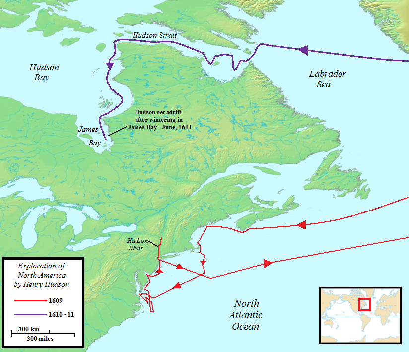
Henry Hudson ( 1565 – disappeared 23 June 1611) was an English sea explorer and navigator during the early 17th century, best known for his explorations of present-day Canada and parts of the northeastern United States. In 1607 and 1608, Hudson made two attempts on behalf of English merchants to find a rumoured Northeast Passage to Cathay via a route above the Arctic Circle. In 1609, he landed in North America on behalf of the Dutch East India Company and explored the region around the modern New York metropolitan area. Looking for a Northwest Passage to Asia on his ship '' Halve Maen'' ("Half Moon"), he sailed up the Hudson River, which was later named after him, and thereby laid the foundation for Dutch colonization of the region. On his final expedition, while still searching for the Northwest Passage, Hudson became the first European to see Hudson Strait and the immense Hudson Bay. In 1611, after wintering on the shore of James Bay, Hudson wanted to pr ... [...More Info...] [...Related Items...] OR: [Wikipedia] [Google] [Baidu] |
Full Rigged Pinnace
The full-rigged pinnace was the larger of two types of vessel called a pinnace in use from the sixteenth century. Etymology The word ''pinnace'', and similar words in many languages (as far afield as Indonesia, where the boat "pinisi" took its name from the Dutch ''pinas''), came ultimately from the Spanish ''pinaza'' c. 1240, from ''pino'' (pine tree), from the wood of which the ships were constructed. The word came into English from the Middle French ''pinasse''. Design "The pinnace is perhaps the most confusing of all the early seventeenth-century types of vessels. Pinnace was more of a use than a type name, for almost any vessel could have been a pinnace or tender to a larger one. Generally speaking, pinnaces were lightly built, single-decked, square-sterned vessels suitable for exploring, trading, and light naval duties. On equal lengths, pinnaces tended to be narrower than other types. Although primarily sailing vessels, many pinnaces carried sweeps for moving in calms o ... [...More Info...] [...Related Items...] OR: [Wikipedia] [Google] [Baidu] |
Fairhaven, Svalbard
Fairhaven is an area of Norway. Generally speaking, it is the area between Amsterdam Island and Danes Island and the mainland, while specifically it refers to the sound between Danes Island and the mainland (Albert I Land), in particular the strait between Moseøya and Danes Island. The modern name for this area is Smeerenburgfjorden (a modern blunder, as Smeerenburg was only a settlement). The fjord is 20 km long and 4 km wide. History Willem Barentsz was the first to explore the area around Fairhaven in 1596. The first indisputable visit by the English was made by Jonas Poole in the ''Amity'' in 1610. Thomas Marmaduke is known to have explored the area north of Fairhaven in 1612, and may have explored Fairhaven itself as well. Again, the following season (1613), Marmaduke explored as far north as Fairhaven. The first known whaling here occurred in 1614, with the Dutch resorting to Amsterdam Island and the English to the south. Here they both establish temporary wh ... [...More Info...] [...Related Items...] OR: [Wikipedia] [Google] [Baidu] |
Verlegenhuken
Verlegenhuken is the northernmost point of Ny-Friesland at Spitsbergen, Svalbard. It is located north of the coastal plain Verlegenhukflya at the peninsula Mosselhalvøya Mosselhalvøya is a peninsula in Ny-Friesland at Spitsbergen, Svalbard. It is located between Mosselbukta and Sorgfjorden Sorgfjorden is a fjord at the northeastern coast of Spitsbergen, Svalbard. It cuts into Ny-Friesland Ny-Friesland is .... Verlegenhuken is the most northern point of Spitsbergen. Among older names of the point are ''Verlegen hoeck'', ''Cap Vertegen'', ''Cap Lointain'', ''Point Desire'', ''Ferlejenhuk'', ''Vrangneset'', and ''Langenes''. References Headlands of Spitsbergen {{Spitsbergen-geo-stub ... [...More Info...] [...Related Items...] OR: [Wikipedia] [Google] [Baidu] |
Wijdefjorden
Wijdefjord is the longest fjord in Norway's Svalbard archipelago. Wijdefjord is located in the northern portion of the island of Spitsbergen, which lies in the Arctic Ocean about midway between Norway and the North Pole, and is the largest island in the archipelago. The fjord is long. Opening on Spitsbergen's north coast, it runs roughly southwards into the interior, separating Andrée Land in the west from Margaretas Land in the east. The southern half of the fjord is part of Indre Wijdefjorden National Park Indre Wijdefjorden National Park ( no, Indre Wijdefjorden nasjonalpark) is located in a steep fjord landscape in northern Spitsbergen in Svalbard, Norway. It covers the inner part of Wijdefjorden—the longest fjord on Svalbard. The national .... External links A detailed map of Svalbard with Wijdefjord clearly labeled Fjords of Spitsbergen {{Spitsbergen-geo-stub ... [...More Info...] [...Related Items...] OR: [Wikipedia] [Google] [Baidu] |
Richard Wyche (merchant)
Richard Wyche (pronounced Whyche) (1554–1621) was a London shipowner, explorer, and merchant. Origins Richard Wyche was born in 1554 in Davenham, Cheshire. He was the son of Richard Wyche (1525-1594) and Margaret Haughton. He was descended from a former Lord Mayor of London in the fifteenth century, Henry Wyche. Career as an adventurer He was on the first Committee of Directors of the English East India Company, assisted in the formation of the North West Company in 1612, and was among the adventurers of the Muscovy Company. ''Wiche Islands'' or ''Wiche's Land'' (discovered and named in 1617, and now erroneously called Kong Karls Land), Wichebukta (on the east coast of Spitsbergen), Wichefjellet (also on the Spitsbergen’s east coast), and ''Wiche Sound'' (named and discovered in 1614 and now called Liefdefjorden and Woodfjorden) were all named after him. Marriage and family Richard Wyche, Gentleman and Mercer, married Elizabeth Saltonstall on 18 February 1583/4 at St Du ... [...More Info...] [...Related Items...] OR: [Wikipedia] [Google] [Baidu] |


