|
Rivergate Parkway
The Rivergate Parkway, also historically known as Two Mile Parkway and Two Mile Pike, is a major north–south, four-lane thoroughfare in northern Davidson County in Middle Tennessee. The four-lane street is maintained by the local road department of the Metropolitan Nashville-Davidson County Government. Road description The road is long, and it is a connector between US 31W/ 41 ( SR 11) in the northern Nashville suburb of Goodlettsville and US 31E ( SR 6) in another north Nashville suburb, Madison. The road provides parking lot access to Rivergate Mall, one of the Nashville area's premier shopping centers. The street does not offer direct access to SR 386 (Vietnam Veterans Boulevard), but the street can be accessed to and from the interchange with Interstate 65 Interstate 65 (I-65) is a major north–south Interstate Highway in the central United States. As with most primary Interstates ending in 5, it is a major crosscountry, north–south route, connecting bet ... [...More Info...] [...Related Items...] OR: [Wikipedia] [Google] [Baidu] |
Tennessee State Route 11
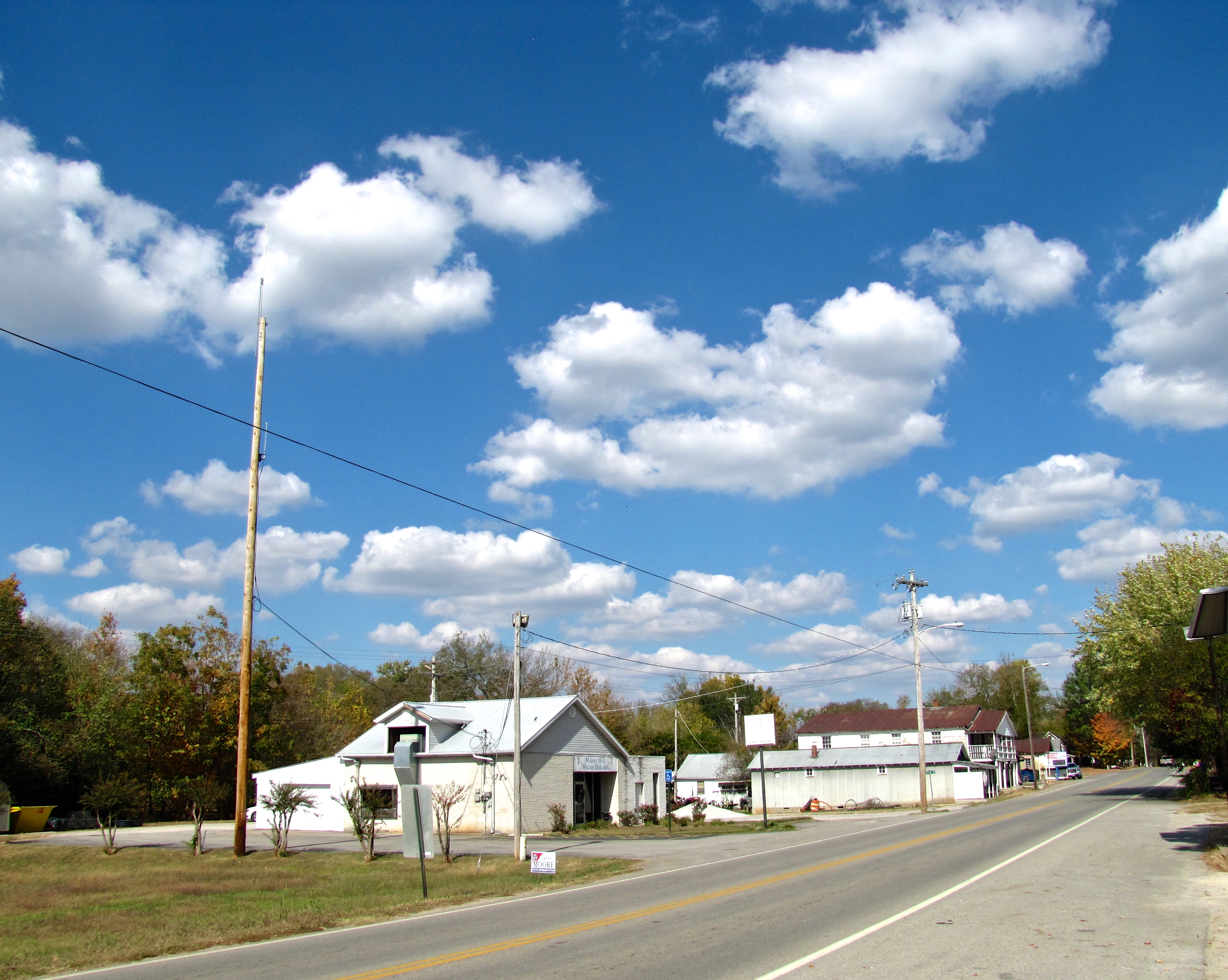
State Route 11 (SR 11) is a mostly unsigned south–north highway that goes from the Alabama border in Giles County, Tennessee to the Kentucky border in Montgomery County. Route description SR 11 begins as a signed primary highway in Giles County at the Alabama state line. It passes through rolling hills and farmland to pass through Minor Hill and Goodspring before entering the Pulaski city limits at an intersection with US 64. It then becomes concurrent with SR 166 before passing through neighborhoods and crossing a bridge over Richland Creek to enter downtown. They then come to an intersection with SR 15, where SR 11 splits from SR 166 and follows SR 15 east. They then come to an intersection with US 31 ( SR 7), where SR 11 becomes unsigned and it follows US 31/SR 7 north to US 31A. State Route 11 is mostly a primary highway, except for in Pulaski, where it turns secondary between US 64 and US 31. SR 11 is also secondary through the entirety of Rutherford County ac ... [...More Info...] [...Related Items...] OR: [Wikipedia] [Google] [Baidu] |
Goodlettsville, Tennessee
Goodlettsville is a city in Davidson and Sumner counties, Tennessee. Goodlettsville was incorporated as a city in 1958 with a population of just over 3,000 residents; at the 2010 census, the city had a total population of 15,921 and in 2020 the population was 17,789. The northern half of the city is in Sumner County, while the southern half is in Davidson County. In 1963, when the city of Nashville merged with the government of Davidson County, Goodlettsville chose to remain autonomous. Geography According to the United States Census Bureau, the city has a total area of , of which are land and is water. History Goodlettsville was named for A. G. Goodlett, pastor of the Cumberland Presbyterian Church from 1848 to 1853. After emancipation of slaves following the American Civil War, the Ku Klux Klan was organized by Confederate veterans to maintain white supremacy over the freedmen. Following the Reconstruction era, violence of whites against blacks continued, often nominall ... [...More Info...] [...Related Items...] OR: [Wikipedia] [Google] [Baidu] |
Tennessee State Route 6
State Route 6 (SR 6) is a state highway that is unsigned. It travels through the central part of the U.S. state of Tennessee. It travels from Lawrence County to Sumner County. The highway is related to the following U.S. Highways: * U.S. Route 43 (US 43) from the Alabama state line to Columbia * US 31 from Columbia to Nashville * US 31E from Nashville to the Kentucky state line TDOT Designations Most of State Route 6 is a primary highway; however, between SR 397 in Frankiln and SR 254 right past the Davidson County line to SR 155 are all the areas where State Route 6 is secondary. There is ambiguity between the two Davidson County Functional Classification Maps19b19a and thTDOT Traffic Mapinformation is not consistent designations of the Primary and Secondary route in Davidson County.{{roadindex 006 Alec Trevelyan (006) is a fictional character and the main antagonist in the 1995 James Bond film ''GoldenEye'', the first film to featu ... [...More Info...] [...Related Items...] OR: [Wikipedia] [Google] [Baidu] |
Madison, Tennessee
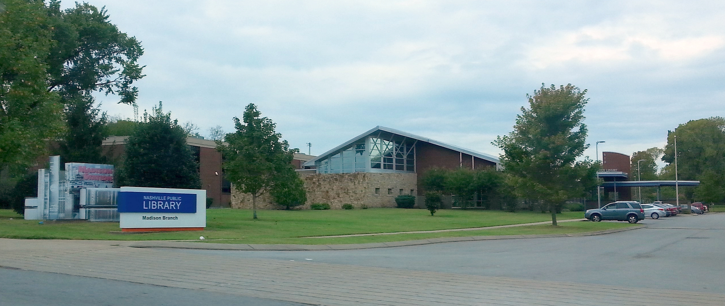
Madison (originally Madison Station) is a former settlement, now a suburban neighborhood of northeast Nashville, in the U.S. state of Tennessee. It is incorporated as part of the Metropolitan Government of Nashville and Davidson County. The population of Madison's 37115 zip code as of the US Census Bureau 2016 estimates was 40,146. Location Madison is only 8.2 miles north at its closest point to downtown Nashville. Ellington Parkway serves as a direct connection from downtown Madison to downtown Nashville with exits to Inglewood and East Nashville. Madison is located close to major highways and parkways: 65, 40, 24, Briley and local access roads St. Route 45 (Old Hickory) and Dickerson Road. It begins at Briley Parkway and extends to the Hendersonville line in Rivergate, from Dickerson Road to the Cumberland River. Madison is one of 14 Community Plan areas in the Metro Nashville-Davidson County area for which zoning and land use planning is done. The 2015-updated Communi ... [...More Info...] [...Related Items...] OR: [Wikipedia] [Google] [Baidu] |
Davidson County, Tennessee
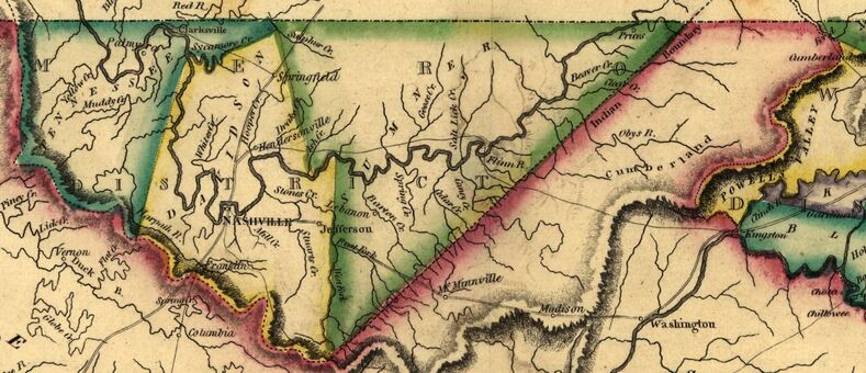
Davidson County is a county in the U.S. state of Tennessee. It is located in the heart of Middle Tennessee. As of the 2020 census, the population was 715,884, making it the second most populous county in Tennessee. Its county seat is Nashville, the state capital and largest city. Since 1963, the city of Nashville and Davidson County have had a consolidated government called the "Metropolitan Government of Nashville and Davidson County", commonly referred to as "Metro Nashville" or "Metro". Davidson County has the largest population in the 13-county Nashville-Davidson–Murfreesboro– Franklin Metropolitan Statistical Area, the state's most populous metropolitan area. Nashville has always been the region's center of commerce, industry, transportation, and culture, but it did not become the capital of Tennessee until 1827 and did not gain permanent capital status until 1843. History Davidson County is the oldest county in the 41-county region of Middle Tennessee. It dates ... [...More Info...] [...Related Items...] OR: [Wikipedia] [Google] [Baidu] |
Middle Tennessee
Middle Tennessee is one of the three Grand Divisions of the U.S. state of Tennessee that composes roughly the central portion of the state. It is delineated according to state law as 41 of the state's 95 counties. Middle Tennessee contains the state's capital and largest city, Nashville, as well as Clarksville, the state's fifth largest city, and Murfreesboro, the state's sixth largest city and largest suburb of Nashville. The Nashville metropolitan area, located entirely within the region, is the most populous metropolitan area in the state, and the Clarksville metropolitan area is the state's sixth most populous. Middle Tennessee is both the largest, in terms of land area, and the most populous of the state's three Grand Divisions. Geographically, Middle Tennessee is composed of the Highland Rim, which completely surrounds the Nashville Basin. The Cumberland Plateau is located in the eastern part of the region. Culturally, Middle Tennessee is considered part of the Up ... [...More Info...] [...Related Items...] OR: [Wikipedia] [Google] [Baidu] |
Nashville, Tennessee
Nashville is the capital city of the U.S. state of Tennessee and the seat of Davidson County. With a population of 689,447 at the 2020 U.S. census, Nashville is the most populous city in the state, 21st most-populous city in the U.S., and the fourth most populous city in the southeastern U.S. Located on the Cumberland River, the city is the center of the Nashville metropolitan area, which is one of the fastest growing in the nation. Named for Francis Nash, a general of the Continental Army during the American Revolutionary War, the city was founded in 1779. The city grew quickly due to its strategic location as a port on the Cumberland River and, in the 19th century, a railroad center. Nashville seceded with Tennessee during the American Civil War; in 1862 it was the first state capital in the Confederacy to be taken by Union forces. After the war, the city reclaimed its position and developed a manufacturing base. Since 1963, Nashville has had a consolidated city-coun ... [...More Info...] [...Related Items...] OR: [Wikipedia] [Google] [Baidu] |
Parking Lot
A parking lot (American English) or car park (British English), also known as a car lot, is a cleared area intended for parking vehicles. The term usually refers to an area dedicated only for parking, with a durable or semi-durable surface. In most countries where cars are the dominant mode of transportation, parking lots are a feature of every city and suburban area. Shopping malls, sports stadiums, megachurches and similar venues often have immense parking lots. (See also: multistorey car park) Parking lots tend to be sources of water pollution because of their extensive impervious surfaces, and because most have limited or no facilities to control runoff. Many areas today also require minimum landscaping in parking lots to provide shade and help mitigate the extent to which their paved surfaces contribute to heat islands. Many municipalities require minimum numbers of parking spaces for buildings such as stores (by floor area) and apartment complexes (by number ... [...More Info...] [...Related Items...] OR: [Wikipedia] [Google] [Baidu] |
Rivergate Mall
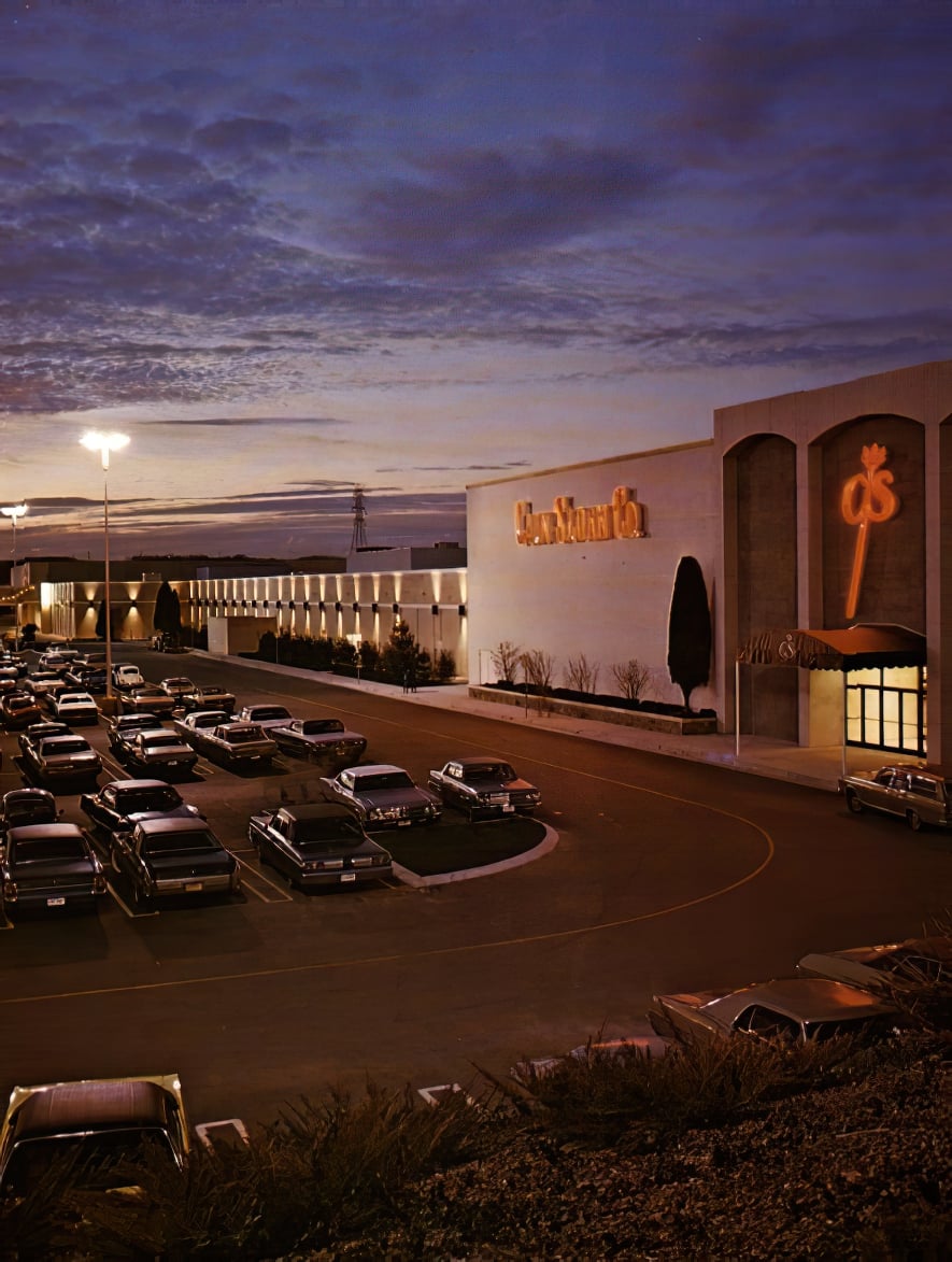
Rivergate Mall is a super-regional shopping mall located in Goodlettsville, Tennessee, United States, just outside of Nashville, the state capital of Tennessee. Opened in October 1971, the mall features of gross leasable area, with approximately 80 stores and restaurants, as well as a food court. Its original anchor stores were Cain-Sloan, Castner Knott, and JCPenney. Rivergate Mall has two anchor stores: Dillard's and JCPenney. There are two vacant anchor stores that were formerly Macy's and Sears. The mall sits in the core of a shopping district that is shared by the city of Goodlettsville and the Nashville neighborhood of Madison. This area is colloquially referred to by locals as "Rivergate," after the mall. Rivergate Mall is managed by Hendon Properties. History 1970s to 1980s Rivergate Mall was built by Retail Planning Corporation, an Atlanta-based mall developer, just outside the state capital of Nashville, Tennessee within Goodletsville along Two Mile Pike. The mal ... [...More Info...] [...Related Items...] OR: [Wikipedia] [Google] [Baidu] |
Tennessee State Route 386
State Route 386 (SR 386) is a major east–west state route, signed north-south, located in Davidson and Sumner counties in Tennessee. It is known as Vietnam Veterans Boulevard and serves as a bypass for U.S. Highway 31E (US 31E) and a connector to Hendersonville and Gallatin from Nashville. A majority of the route is a four-lane controlled-access highway. Route description SR 386 begins at a two-way partial Y interchange with Interstate 65 (I-65) in Davidson County north of Nashville. The route is only accessible from I-65 northbound, and I-65 northbound is not directly accessible from SR 386 westbound. The route begins with a speed limit in Davidson County, which reduces to upon entering Sumner County less than later. About later the route has a trumpet interchange with a connector to US 31E, signed as US 31E. The route then curves slightly to the southeast and enters the central part of Hendersonville and has interchanges with SR 258 (New Sh ... [...More Info...] [...Related Items...] OR: [Wikipedia] [Google] [Baidu] |
Interstate 65 In Tennessee
Interstate 65 (I-65) runs from Ardmore north in Tennessee to just south of Franklin, Kentucky, forming part of the national highway that goes from Mobile, Alabama, to Gary, Indiana. In Tennessee the highway's official name is the Albert Arnold Gore Sr. Memorial Highway, named for Albert Gore Sr., the former US Senator. Of the four states which I-65 runs through, the segment in Tennessee is the shortest, at long. I-65 serves the state capital and largest city of Nashville and parallels U.S. Route 31 (US 31) its entire length in Tennessee. Route description Southern section and Nashville suburbs I-65 enters Tennessee from Alabama concurrent with US 31 in rural Giles County near the town of Ardmore. About later, near the town of Elkton, is an interchange with State Route 7 (SR 7), where US 31 splits off into a concurrency with that route, heading north toward Pulaski. Continuing through mostly rural territory characterized by sligh ... [...More Info...] [...Related Items...] OR: [Wikipedia] [Google] [Baidu] |


.jpg)