|
River Glaze
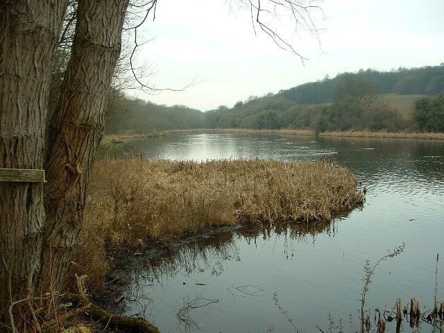
The Glaze Brook, or River Glaze, is a minor river in the River Mersey catchment area, England. From Hope Carr (just inside Leigh) to the River Mersey it forms the county boundary with Cheshire. It is about long and its main tributaries are the Astley, Bedford, Hey, Pennington, Shaw and Westleigh Brooks. Pennington Brook starts at the outflow of Pennington Flash close to Aspull Common. Pennington Flash is fed by Hey Brook, a continuation of Borsdane Brook, which runs southwards from Blackrod. Glaze Brook originates at the confluence of Pennington Brook and Moss Brook, approximately 120 m north of Hawkhurst Bridge. After picking up the waters of Bedford Brook, which runs southward from Leigh and the Black or Moss Brook coming west from Worsley via Chat Moss, the brook turns southward, ultimately draining into the River Mersey section of the Manchester Ship Canal near Cadishead. The Glaze Brook's catchment drains the flat lowland around Leigh which reaches a maximum altitude of ... [...More Info...] [...Related Items...] OR: [Wikipedia] [Google] [Baidu] |
England
England is a country that is part of the United Kingdom. It shares land borders with Wales to its west and Scotland to its north. The Irish Sea lies northwest and the Celtic Sea to the southwest. It is separated from continental Europe by the North Sea to the east and the English Channel to the south. The country covers five-eighths of the island of Great Britain, which lies in the North Atlantic, and includes over 100 smaller islands, such as the Isles of Scilly and the Isle of Wight. The area now called England was first inhabited by modern humans during the Upper Paleolithic period, but takes its name from the Angles, a Germanic tribe deriving its name from the Anglia peninsula, who settled during the 5th and 6th centuries. England became a unified state in the 10th century and has had a significant cultural and legal impact on the wider world since the Age of Discovery, which began during the 15th century. The English language, the Anglican Church, and Eng ... [...More Info...] [...Related Items...] OR: [Wikipedia] [Google] [Baidu] |
Chat Moss
Chat Moss is a large area of peat bog that makes up part of the City of Salford, Metropolitan Borough of Wigan and Trafford in Greater Manchester, England. It also makes up part of Metropolitan Borough of St Helens in Merseyside and Warrington in Cheshire. North of the Manchester Ship Canal and River Mersey, to the west of Manchester, it occupies an area of about . As it might be recognised today, Chat Moss is thought to be about 7,000 years old, but peat development seems to have begun there with the ending of the last ice age, about 10,000 years ago. The depth of peat ranges from . A great deal of reclamation work has been carried out, particularly during the 19th century, but a large-scale network of drainage channels is still required to keep the land from reverting to bog. In 1958 workers extracting peat discovered the severed head of what is believed to be a Romano-British Celt, possibly a sacrificial victim, in the eastern part of the bog near Worsley. Muc ... [...More Info...] [...Related Items...] OR: [Wikipedia] [Google] [Baidu] |
Rivers Of Cheshire
A river is a natural flowing watercourse, usually freshwater, flowing towards an ocean, sea, lake or another river. In some cases, a river flows into the ground and becomes dry at the end of its course without reaching another body of water. Small rivers can be referred to using names such as creek, brook, rivulet, and rill. There are no official definitions for the generic term river as applied to geographic features, although in some countries or communities a stream is defined by its size. Many names for small rivers are specific to geographic location; examples are "run" in some parts of the United States, "burn" in Scotland and northeast England, and "beck" in northern England. Sometimes a river is defined as being larger than a creek, but not always: the language is vague. Rivers are part of the water cycle. Water generally collects in a river from precipitation through a drainage basin from surface runoff and other sources such as groundwater recharge, springs, a ... [...More Info...] [...Related Items...] OR: [Wikipedia] [Google] [Baidu] |
Lancashire Coalfield
The Lancashire Coalfield in North West England was an important British coalfield. Its coal seams were formed from the vegetation of tropical swampy forests in the Carboniferous period over 300 million years ago. The Romans may have been the first to use coal in Lancashire and its shallow seams and outcrops were exploited on a small scale from the Middle Ages and extensively after the start of the Industrial Revolution. The coalfield was at the forefront of innovation in coal mining, prompting the country's first canals, use of steam engines and creating conditions favourable for rapid industrialisation. The pits on the coalfield were at their most productive in 1907 when more than 26 million tons of coal were produced. By 1967 just 21 collieries remained. Parkside Colliery in Newton-le-Willows, St. Helens area, the last deep mine to be sunk on the coalfield, was closed in 1993. Geology The geology of the coalfield consists of the coal seams of the Upper, Middle and Lower Coa ... [...More Info...] [...Related Items...] OR: [Wikipedia] [Google] [Baidu] |
Westleigh, Greater Manchester
Westleigh, a suburb of Leigh, Greater Manchester, England, is one of three ancient townships, Westleigh, Bedford and Pennington, that merged in 1875 to form the borough of Leigh. History Toponymy The name Westleigh derives from the Old English and refers to the locality's relative position to Leigh. The name Leigh is derived from ''leah'', meaning originally a "wood" then a "clearing" and finally a "meadow". It was recorded as Westeley in 1237, Westlegh in 1238 and Westlay in Legh in 1292. Manor The early history of Westleigh is closely involved with 'the church of Westley in Leigh', dedicated to St Peter on the Westleigh-Pennington boundary. This church was the centre of a large ecclesiastical parish, and after the Reformation dedicated to St Mary the Virgin, and is now the parish church in Leigh. The earliest recorded Lords of the Manor were the Westleigh family. They were followed by the Urmstons who held the manor for several centuries until the failure of the male line. ... [...More Info...] [...Related Items...] OR: [Wikipedia] [Google] [Baidu] |
Pennington, Greater Manchester
Pennington, a suburb of Leigh, Greater Manchester is one of six townships in the ancient ecclesiastical parish of Leigh, that with Westleigh and Bedford merged to form the town of Leigh in 1875. The township of Pennington covered most of Leigh's town centre. History Toponymy Pennington derives either from the Old English meaning "a farmstead or small holding paying a penny rent" or a "settlement associated with a man named Pinna". Pennington has been variously recorded as Pininton in 1246, Pynynton in 1360, Penynton in 1305, Pynyngton in 1351 and 1442, and Penyngton in 1443. In 1663 it was also recorded as Pinington. Parish records of Leigh, St Mary 1560 – 1682 Manor Historically Pennington comprised one manor surrounded by a small settlement. Land in Pennington was gifted to Cockersand Abbey by Margery de Pennington in the early 13th century. Adam Pennington who took his name from the township was Lord of the manor at the end of the 13th century. In 1312 the Bradshaws ... [...More Info...] [...Related Items...] OR: [Wikipedia] [Google] [Baidu] |
Flash (lake)
A flash is a body of water that forms where the land below it has subsided. Whilst these are mostly found in areas where mining has taken place, some can occur naturally. Collectively they are known as ''Flashes'' History Flash is recorded as being a dialectal word from Cheshire, which describes the water filled depressions caused by subsidence. Some have said that word was used as far back as the 17th century when describing small bodies of water across Cheshire, and was derived from a French word for puddle. Another writer states the "Flash or Plash, deriving from ''splash'', are small puddles left over after a thunderstorm". In William Gresley's book, "A Glossary of Terms Used in Coal-Mining", Gresley states that the word originated in the salt mining districts of Cheshire and defines it as: Flashes are common in former mining areas such as Cheshire, Lancashire and Yorkshire, where mining has had an effect on the landscape. In Cheshire especially, rock salt and brine extrac ... [...More Info...] [...Related Items...] OR: [Wikipedia] [Google] [Baidu] |
Ordnance Datum
In the British Isles, an ordnance datum or OD is a vertical datum used by an ordnance survey as the basis for deriving altitudes on maps. A spot height may be expressed as AOD for "above ordnance datum". Usually mean sea level (MSL) is used for the datum. In particular: * In Great Britain, OD for the Ordnance Survey is ODN (Ordnance Datum Newlyn), defined as the MSL as recorded by the tidal gauge at Newlyn in Cornwall between 1915 and 1921. **Prior to 1921, OD was defined as MSL as recorded in the Victoria Dock, Liverpool, during a short period in 1844 (ODL). * In Northern Ireland, OD for the Ordnance Survey of Northern Ireland is Belfast Ordnance Datum, the MSL at Clarendon Dock, Belfast, between 1951 and 1956. * In the Republic of Ireland, OD for the Ordnance Survey of Ireland is Malin Ordnance Datum: the MSL at Portmoor Pier, Malin Head, County Donegal, between 1960 and 1969. [...More Info...] [...Related Items...] OR: [Wikipedia] [Google] [Baidu] |
Cadishead
Cadishead is a village in the City of Salford in Greater Manchester, England, with a population of 10,739 in 2014. Within the historic county of Lancashire. History The earliest record of Cadishead date to 1212, and show that the whole of Cadishead – then called Cadewalesate – was rented from King John by Gilbert Notton for four shillings (20p) a year, a sum equivalent to about £650 today. The name derives from the Old English words ''wælla'' and ''set'', and Cada, a personal name; it means the "dwelling or fold by the stream of a man called Cada". Until the early 19th century most of the area was part of the peat bog known as Chat Moss, but by 1805 work had started to reclaim the land. The opening of the Manchester Ship Canal in 1894 had a major effect on the subsequent development of Cadishead. Governance Cadishead is represented in Westminster by Barbara Keeley MP for Worsley and Eccles South. Councillors Until 2021 the area was represented on Salford Cit ... [...More Info...] [...Related Items...] OR: [Wikipedia] [Google] [Baidu] |
Manchester Ship Canal
The Manchester Ship Canal is a inland waterway in the North West England, North West of England linking Manchester to the Irish Sea. Starting at the River Mersey, Mersey Estuary at Eastham, near Ellesmere Port, Cheshire, it generally follows the original routes of the rivers Mersey and River Irwell, Irwell through the Historic counties of England, historic counties of Cheshire and Lancashire. Several sets of locks lift vessels about to the canal's terminus in Manchester. Landmarks along its route include the Barton Swing Aqueduct, the world's only swing aqueduct, and Trafford Park, the world's first planned industrial estate and still the largest in Europe. The rivers Mersey and Irwell were first made navigable in the early 18th century. Goods were also transported on the Runcorn extension of the Bridgewater Canal (from 1776) and the Liverpool and Manchester Railway (from 1830), but by the late 19th century the Mersey and Irwell Navigation had fallen into disrepair and was ... [...More Info...] [...Related Items...] OR: [Wikipedia] [Google] [Baidu] |
Worsley
Worsley () is a village in the City of Salford, Greater Manchester, England, which in 2014 had a population of 10,090. It lies along Worsley Brook, west of Manchester. Within the boundaries of the historic county of Lancashire, there is evidence of Roman and Anglo-Saxon activity, including two Roman roads. The completion in 1761 of the Bridgewater Canal allowed Worsley to expand from a small village of cottage industries to an important town based upon cotton manufacture, iron-working, brick-making and extensive coal mining. Later expansion came after the First and Second World Wars, when large urban estates were built. Worsley Delph is a scheduled monument and a significant part of the town's historic centre is now a conservation area. History Toponymy Worsley is first mentioned in a Pipe roll of 1195–96 as ''Werkesleia'', in the claim of a Hugh Putrell to a part of the fee of two knights in nearby Barton-upon-Irwell and Worsley. There are many variation ... [...More Info...] [...Related Items...] OR: [Wikipedia] [Google] [Baidu] |
North West England
North West England is one of nine official regions of England and consists of the ceremonial counties of England, administrative counties of Cheshire, Cumbria, Greater Manchester, Lancashire and Merseyside. The North West had a population of 7,052,000 in 2011. It is the Countries of the United Kingdom by population, third-most-populated region in the United Kingdom, after the South East England, South East and Greater London. The largest settlements are Manchester and Liverpool. Subdivisions The official Regions of England, region consists of the following Subdivisions of England, subdivisions: After abolition of the Greater Manchester and Merseyside County Councils in 1986, power was transferred to the metropolitan boroughs, making them equivalent to unitary authorities. In April 2011, Greater Manchester gained a top-tier administrative body in the form of the Greater Manchester Combined Authority, which means the 10 Greater Manchester boroughs are once again second-ti ... [...More Info...] [...Related Items...] OR: [Wikipedia] [Google] [Baidu] |


.png)

