|
River Effra
The River Effra is a former stream or small river in south London, England, now culverted for most of its course. Once a tributary of the River Thames, flows from the Effra were incorporated in the Victorian era into a combined sewer draining much of the historic area of Peckham and Brixton. Etymology The etymology of the name "Effra" has been much disputed. There is no evidence that it was applied to the stream before the late 18th century, and early 19th century gazetteers gave it no name.Bonner, A. "Surrey Place-names" in ''Surrey Archaeological Collections'' v XXXVII, pp.126-7 A map of 1744 refers to it as the "Shore",manor which once covered some 70 acres south of present day Coldharbour Lane and east of present day Effra Road.''Survey of London'' (1956) v.26, The Parish of St Mary Lambeth, LCC, p.137 By the 1790s the land making up the Manor of Heathrow was known as Effra Farm. There is evidence that the name was first applied to the stream at Brixton, perhaps taken from th ... [...More Info...] [...Related Items...] OR: [Wikipedia] [Google] [Baidu] [Amazon] |
Vauxhall Bridge
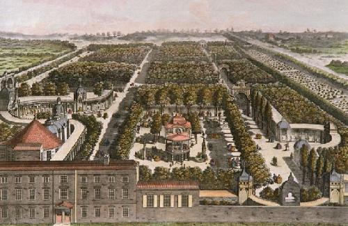
Vauxhall Bridge is a Grade II* listed steel and granite deck arch bridge in central London. It crosses the River Thames in a southeast–northwest direction between Vauxhall on the south bank and Pimlico on the north bank. Opened in 1906, it replaced an earlier bridge, originally known as Regent Bridge but later renamed Vauxhall Bridge, built between 1809 and 1816 as part of a scheme for redeveloping the south bank of the Thames. The bridge was built at a location in the river previously served by a ferry. The building of both iterations of the bridge was problematic, with both the first and second bridges requiring several redesigns from multiple architects. The original bridge, the first iron bridge over the Thames, was built by a private company and operated as a toll bridge before being taken into public ownership in 1879. The second bridge, which took eight years to build, was the first in London to carry trams and later one of the first two roads in London to have a bus l ... [...More Info...] [...Related Items...] OR: [Wikipedia] [Google] [Baidu] [Amazon] |
Manorialism
Manorialism, also known as seigneurialism, the manor system or manorial system, was the method of land ownership (or "Land tenure, tenure") in parts of Europe, notably France and later England, during the Middle Ages. Its defining features included a large, sometimes fortified manor house in which the lord of the manor and his dependants lived and administered a rural estate, and a population of labourers or Serfdom, serfs who worked the surrounding land to support themselves and the lord. These labourers fulfilled their obligations with labour time or in-kind produce at first, and later by cash payment as commercial activity increased. Manorialism was part of the Feudalism, feudal system. Manorialism originated in the Roman villa system of the Late Roman Empire, and was widely practised in Middle Ages, medieval western Europe and parts of central Europe. An essential element of feudal society, manorialism was slowly replaced by the advent of a money-based market economy and new ... [...More Info...] [...Related Items...] OR: [Wikipedia] [Google] [Baidu] [Amazon] |
Joseph Bazalgette
Sir Joseph William Bazalgette (; 28 March 1819 – 15 March 1891) was an English civil engineering, civil engineer. As Chief Engineer of London's Metropolitan Board of Works, his major achievement was the creation of the London Main Drainage, the London sewerage system, sewerage system for central London, in response to the Great Stink of 1858, which was instrumental in relieving the Capital city, city of cholera epidemics, while beginning to clean the Thames, River Thames. He later designed the second and current Hammersmith Bridge, which opened in 1887. Early life Bazalgette was born at Hill Lodge, Clay Hill, London, Clay Hill, Enfield, London, Enfield, the son of Joseph William Bazalgette (1783–1849), a retired Captain (Royal Navy), Royal Navy captain, and Theresa Philo ''née'' Pilton (1796–1850). His grandfather, Louis Bazalgette, a tailor and financier, was an economic migrant from Ispagnac in Lozere, France, who became principal tailor to the Prince of Wales, the futu ... [...More Info...] [...Related Items...] OR: [Wikipedia] [Google] [Baidu] [Amazon] |
London Sewerage System
The London sewer system is part of the water infrastructure serving London, England. The modern system was developed during the late 19th century, and as London has grown the system has been expanded. It is currently owned and operated by Thames Water and serves almost all of Greater London. History During the early 19th century the River Thames was an open sewer, with disastrous consequences for public health in London, including cholera epidemics. These were caused by enterotoxin-producing strains of the bacterium ''Vibrio cholerae''. Although the contamination of the water supply was correctly diagnosed by John Snow (physician), Dr John Snow in 1849 as the method of communication, up to the outbreak of 1866 it was believed that Miasma theory, miasma, or bad air, was responsible. Proposals to modernise the sewerage system had been made in the early 1700s but the costs of such a project deterred progress. Further proposals followed in 1856, but were again neglected due to the c ... [...More Info...] [...Related Items...] OR: [Wikipedia] [Google] [Baidu] [Amazon] |
Joseph Gwilt
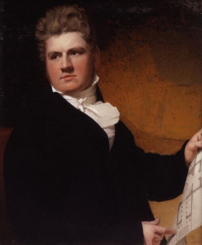
Joseph Gwilt (11 January 1784 – 14 September 1863) was an English architect and writer. He was the son of George Gwilt, architect surveyor to the county of Surrey, and was born at Southwark. George Gwilt the Younger, was his elder brother. He was educated at St Paul's School, and after a short course of instruction in his father's office was in 1801 admitted a student of the Royal Academy, where in the same year he gained the silver medal for his drawing of the tower and steeple of St Dunstan-in-the-East. In 1811 he published a ''Treatise on the Equilibrium of Arches'', and in 1815 he was elected FSA. After a visit to Italy in 1816, he published in 1818 ''Notitia architectonica italiana'', or ''Concise Notices of the Buildings and Architects of Italy''. In 1825 he published an edition of Sir William Chambers's ''Treatise on Civil Architecture''; and among his other principal contributions to the literature of his profession are a translation of the ''Architecture'' of Vit ... [...More Info...] [...Related Items...] OR: [Wikipedia] [Google] [Baidu] [Amazon] |
Herne Hill
Herne Hill () is a district in South London, approximately four miles from Charing Cross and bordered by Brixton, Camberwell, Dulwich, and Tulse Hill. It sits to the north and east of Brockwell Park and straddles the boundary between the London borough, boroughs of London Borough of Lambeth, Lambeth and London Borough of Southwark, Southwark. There is a road of the same name in the area (which is part of the A215 road, A215), as well as a Herne Hill railway station, railway station. Toponymy In John Rocque's Map of London, 1746, Rocque's 1746 map, the area is shown as "Island Green", probably reflecting the presence of the River Effra and smaller tributaries.''The Story of Norwood'' J.B. Wilson & H.A. Wilson Early references to the area also use the form "Ireland Green". The earliest documented reference to "Herne Hill" is in two fire insurance policies issued by the Sun Alliance (company), Sun Insurance Company in 1792 (where the spelling is "Hearns" and "Herns" Hill). Hist ... [...More Info...] [...Related Items...] OR: [Wikipedia] [Google] [Baidu] [Amazon] |
John Ogilby
John Ogilby, Ogelby, or Oglivie (17 November 16004 September 1676) was a Scottish translator, impresario, publisher and cartographer. He was probably at least a half-brother to James Ogilvy, 1st Earl of Airlie, though neither overtly acknowledged this. Ogilby's most-noted works include translations of the works of Virgil and Homer, and his version of the Fables of Aesop. Ogilby established Ireland's first theatre in Werburgh Street, Dublin, and following the Restoration, that country's first Theatre Royal. Ogilby played a significant part in arrangements for the coronation of King Charles II. Following the Great Fire of 1666, Ogilby's large-scale map of the City of London was founded on precise survey work, and his ''Britannia'' is the first road atlas of England and Wales to be based on surveys and measurements, and drawn to scale. Life Childhood and youth (1600–1618) John Ogilby's birthplace and parentage are historically uncertain; most early biographies of Ogil ... [...More Info...] [...Related Items...] OR: [Wikipedia] [Google] [Baidu] [Amazon] |
Earl's Sluice
Earl's Sluice is an underground river in south-east London, England. Its source is Ruskin Park on Denmark Hill. In South Bermondsey it is joined by the River Peck before emptying into the Thames at Deptford Wharf. Earl's Creek marks the boundary between St Mary's parish, Rotherhithe and St Paul's parish, Deptford and their successors the London Borough of Southwark and the London Borough of Lewisham. It also marks the boundary between the historic counties of Kent and Surrey. The river is named after the Earl of Gloucester in the time of Henry I. See also * Subterranean rivers of London * Thames Tideway Scheme The Thames Tideway Tunnel is a deep-level sewer along the tidal section of the River Thames in London, running from Acton in the west to Abbey Mills in the east, where it joins the Lee Tunnel which connects to Beckton Sewage Treatment Wor ... References Further reading * London's Lost Rivers' by Paul Talling External links on Diamond Geezer blog. ... [...More Info...] [...Related Items...] OR: [Wikipedia] [Google] [Baidu] [Amazon] |
Bermondsey
Bermondsey ( ) is a district in southeast London, part of the London Borough of Southwark, England, southeast of Charing Cross. To the west of Bermondsey lies Southwark, to the east Rotherhithe and Deptford, to the south Walworth and Peckham, and to the north is Wapping across the River Thames. It lies within the historic county boundaries of Surrey. During the Industrial Revolution Bermondsey became a centre for manufacturing, particularly in relation to tanning. More recently it has experienced regeneration including Loft, warehouse conversions to flats and the provision of new transport links. History Toponymy Bermondsey may be understood to mean ''Beornmund''s island; but, while ''Beornmund'' represents an Old English language, Old English personal name, identifying an individual once associated with the place, the element "-ey" represents Old English ''eg'', for "island", "piece of firm land in a fen", or simply a "place by a stream or river". Thus Bermondsey need n ... [...More Info...] [...Related Items...] OR: [Wikipedia] [Google] [Baidu] [Amazon] |
Dulwich
Dulwich (; ) is an area in south London, England. The settlement is mostly in the London Borough of Southwark, with parts in the London Borough of Lambeth, and consists of Dulwich Village, East Dulwich, West Dulwich, and the Southwark half of Herne Hill (which is often referred to as the North Dulwich triangle). Dulwich lies in a valley between the neighbouring districts of Camberwell (to the north), Crystal Palace, London, Crystal Palace, Denmark Hill, Forest Hill, London, Forest Hill, Peckham, Sydenham Hill, and Tulse Hill. For the last four centuries Dulwich has been centred on the College of God's Gift, also known as the "Old College", which owned most of the land in the area today known as the Dulwich Estate. The College, founded with educational and charitable aims, established three large Private schools in the United Kingdom, private schools in the 19th century (Dulwich College, Alleyn's School and James Allen's Girls' School). In recent decades four large state secondar ... [...More Info...] [...Related Items...] OR: [Wikipedia] [Google] [Baidu] [Amazon] |
London Clay
The London Clay Formation is a Sediment#Shores and shallow seas, marine formation (geology), geological formation of Ypresian (early Eocene Epoch, c. 54-50 million years ago) age which outcrop, crops out in the southeast of England. The London Clay is well known for its fossil content. The fossils from the lower Eocene rocks indicate a moderately warm climate, the tropical or subtropical flora. Though sea levels changed during the deposition of the clay, the habitat was generally a lush forest – perhaps like in Indonesia or East Africa today – bordering a warm, shallow ocean. The London Clay is a stiff bluish clay which becomes brown when weathered and oxidized. Nodular lumps of pyrite are frequently found in the clay layers. Pyrite was produced by microbial activity (sulfate reducing bacteria) during clay sedimentation. Once clay is exposed to atmospheric oxygen, framboidal pyrite with a great specific surface is rapidly oxidized. Acid mine drainage, Pyrite oxidation produce ... [...More Info...] [...Related Items...] OR: [Wikipedia] [Google] [Baidu] [Amazon] |
Great North Wood
The Great North Wood was a natural oak woodland that started south-east of central London and scaled the Norwood Ridge. At its full extent, the wood's boundaries stretched almost as far as Croydon and as far north as Camberwell. It had occasional landownings as large clearings, well-established by the Middle Ages such as the hamlets of Penge and Dulwich. Twenty small fragments or re-plantations remain including Dulwich Wood, Sydenham Hill Wood, Biggin Wood and Beaulieu Heights. Many placenames refer to the Great North Wood. Today's suburban placenames that contain the contraction ''Norwood'' include South Norwood, Upper Norwood and West Norwood (known as Lower Norwood until 1885). Other settlements that reflect the area's woodland past are Woodside, Forest Hill, Honor Oak and Penge, which is from Celtic ''penceat'', meaning "edge of wood" ( modern Welsh ''Pencoed''). History The earliest surviving mention of the wood dates from assize records in 1272, and it was ... [...More Info...] [...Related Items...] OR: [Wikipedia] [Google] [Baidu] [Amazon] |


