|
Rio Grande (Jamaica)
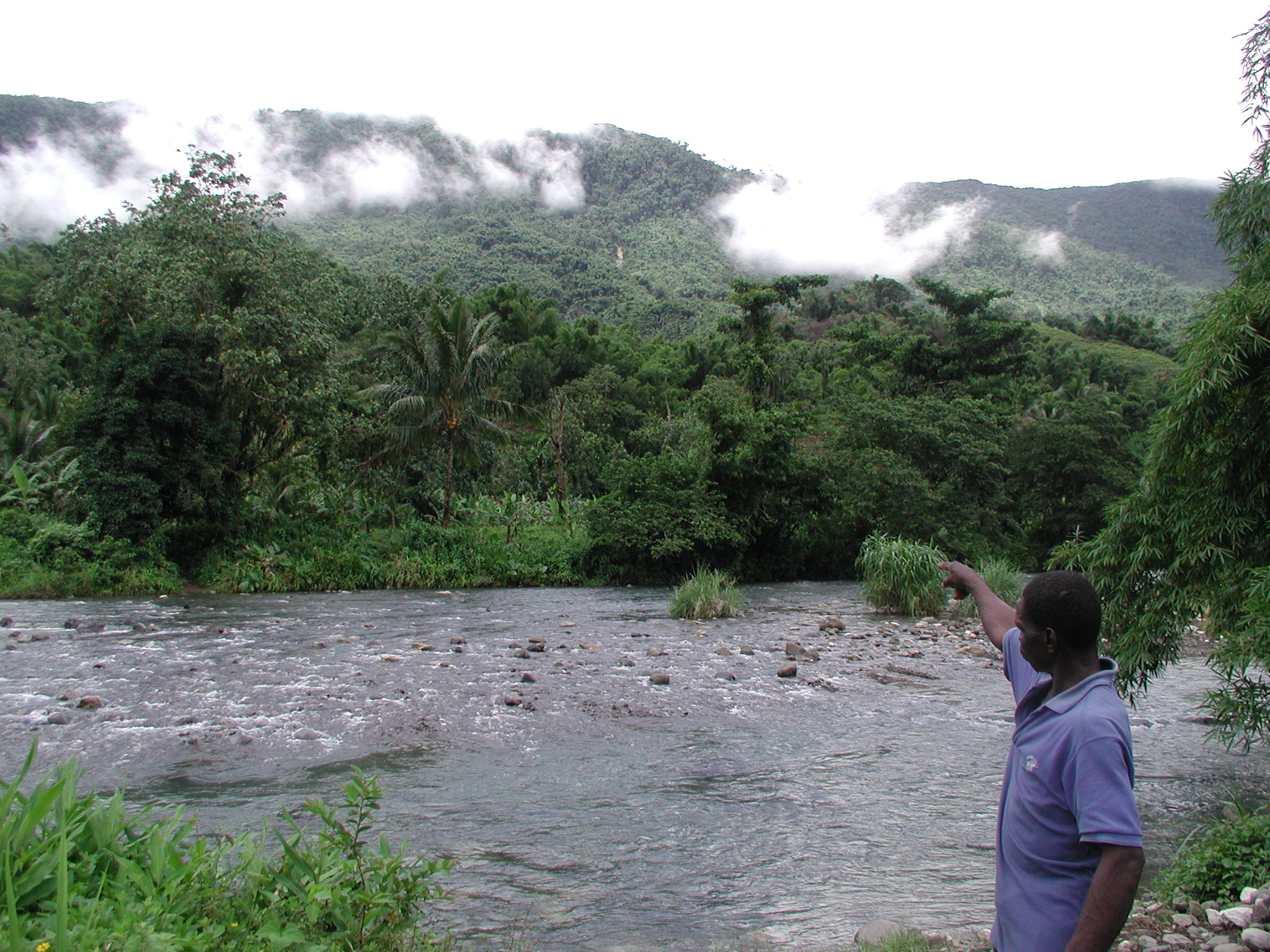
The Rio Grande is a river of Jamaica, found in the parish of Portland. One of the largest rivers in Jamaica, it was named "Big River" (''Rio Grande'') by the Spanish, who controlled Jamaica in the 15th and 16th centuries. It is one of the many tourist attractions in Portland and is used mainly for rafting. See also *List of rivers of Jamaica This is a list of rivers of Jamaica, arranged from west to east, with respective tributaries indented under each larger stream's name. North Coast *South Negril River **Unnamed *Middle River **Unnamed **Unnamed *North Negril River *Orange River ... References GEOnet Names Server* OMC MapCIA Map*Ford, Jos C. and Finlay, A.A.C. (1908).''The Handbook of Jamaica.'' Jamaica Government Printing Office Rivers of Jamaica {{Jamaica-river-stub ... [...More Info...] [...Related Items...] OR: [Wikipedia] [Google] [Baidu] |
Jamaica
Jamaica (; ) is an island country situated in the Caribbean Sea. Spanning in area, it is the third-largest island of the Greater Antilles and the Caribbean (after Cuba and Hispaniola). Jamaica lies about south of Cuba, and west of Hispaniola (the island containing the countries of Haiti and the Dominican Republic); the British Overseas Territory of the Cayman Islands lies some to the north-west. Originally inhabited by the indigenous Taíno peoples, the island came under Spanish rule following the arrival of Christopher Columbus in 1494. Many of the indigenous people either were killed or died of diseases, after which the Spanish brought large numbers of African slaves to Jamaica as labourers. The island remained a possession of Spain until 1655, when England (later Great Britain) conquered it, renaming it ''Jamaica''. Under British colonial rule Jamaica became a leading sugar exporter, with a plantation economy dependent on the African slaves and later their descenda ... [...More Info...] [...Related Items...] OR: [Wikipedia] [Google] [Baidu] |
Portland Parish
Portland, with its capital town Port Antonio, is a parish located on Jamaica's northeast coast. It is situated to the north of St Thomas and to the east of St Mary in Surrey County. It is one of the rural areas of Jamaica, containing part of the Blue Mountains, where the Jamaican Maroon communities of Moore Town and Charles Town are located. Geography and demography The parish is situated at latitude 18°10' N and longitude 75°27'W. It extends from the highest peaks of the Blue Mountains, above sea level, down to the north coast, and is noted for its fertile soil, scenery, and beaches. The parish lies in the direct path of the northeast trade winds, and the Blue Mountain ridge to its south traps the moisture. This parish has the highest rainfall in the island. Port Antonio, its chief town and capital, has two harbours, the western one being sheltered by a small islet, Navy Island. Portland covers an area of 814 square kilometers, making it Jamaica's seventh-largest p ... [...More Info...] [...Related Items...] OR: [Wikipedia] [Google] [Baidu] |
Rafting
Rafting and whitewater rafting are recreational outdoor activities which use an inflatable raft to navigate a river or other body of water. This is often done on whitewater or different degrees of rough water. Dealing with risk is often a part of the experience. This activity as an adventure sport has become popular since the 1950s, if not earlier, evolving from individuals paddling to rafts with double-bladed paddles or oars to multi-person rafts propelled by single-bladed paddles and steered by a person at the stern, or by the use of oars. Rafting on certain sections of rivers is considered an extreme sport and can be fatal, while other sections are not so extreme or difficult. Rafting is also a competitive sport practiced around the world which culminates in a world rafting championship event between the participating nations. The International Rafting Federation, often referred to as the IRF, is the worldwide body which oversees all aspects of the sport. Equip ... [...More Info...] [...Related Items...] OR: [Wikipedia] [Google] [Baidu] |
List Of Rivers Of Jamaica
This is a list of rivers of Jamaica, arranged from west to east, with respective tributaries indented under each larger stream's name. North Coast * South Negril River **Unnamed *Middle River **Unnamed **Unnamed *North Negril River *Orange River **Unnamed **New Found RiverUK Directorate of Overseas Surveys 1:50,000 map of Jamaica sheet A, 1959 **Cave River ***Fish River * Green Island River * Lucea West River * Lucea East River *Flint River * Great River * Montego River *Martha Brae River * Rio Bueno ** Cave River (underground connection) * Roaring River * Llandovery River * Dunn River * White River * Rio Nuevo * Oracabessa River * Port Maria River * PageeUK Directorate of Overseas Surveys 1:50,000 map of Jamaica sheet K, 1966. *Wag Water River (Agua Alta) **Flint River *Annotto River * Dry River *Buff Bay River * Spanish River * Swift River *Rio Grande ** Black River ** Stony River ** Guava River * Plantain Garden River South Coast *New Savannah River * Cabarita River **Thicke ... [...More Info...] [...Related Items...] OR: [Wikipedia] [Google] [Baidu] |

