|
Ringwould With Kingsdown
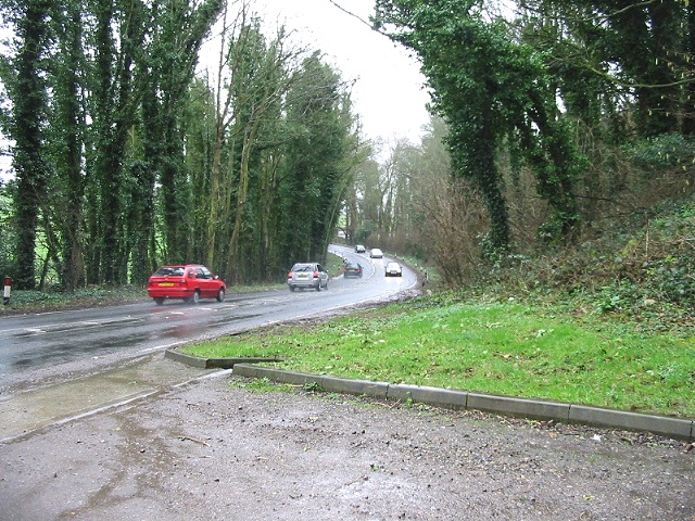
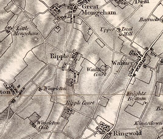
Ringwould with Kingsdown is a coastal civil parish in the Dover District of Kent, England. The parish contains the villages of Ringwould and Kingsdown. Ringwould with Kingsdown is approximately east from the county town of Maidstone. The south of the parish is approximately north-east from the channel port of Dover, and the north, south from the coastal town of Deal. The A258 Sandwich to Dover road runs through the parish. Parishes surrounding Ringwould with Kingsdown are Walmer at the north; Ripple at the west; Langdon at the south-west; and St Margaret's at Cliffe at the south. The coastal east of the parish is against the English Channel The English Channel, "The Sleeve"; nrf, la Maunche, "The Sleeve" ( Cotentinais) or (Jèrriais), ( Guernésiais), "The Channel"; br, Mor Breizh, "Sea of Brittany"; cy, Môr Udd, "Lord's Sea"; kw, Mor Bretannek, "British Sea"; nl, Het Kan .... At the south-east of the parish, and against the coast, is Walmer and Kingsdown G ... [...More Info...] [...Related Items...] OR: [Wikipedia] [Google] [Baidu] |
Dover (district)
Dover is a local government district in Kent, England. The port town of Dover is its administrative centre. It was formed on 1 April 1974 by the merger of the boroughs of Deal, Dover, and Sandwich along with Dover Rural District and most of Eastry Rural District. Settlements There are three towns within the district: Deal, Dover and Sandwich; and the parishes below: * Alkham * Ash * Aylesham * Capel-le-Ferne * Denton with Wootton * Eastry * Eythorne * Goodnestone * Great Mongeham * Guston * Hougham Without * Langdon * Lydden * Nonington * Northbourne * Preston * Ringwould with Kingsdown * Ripple * River * Shepherdswell with Coldred * Sholden * St Margaret's at Cliffe * Staple * Stourmouth * Sutton * Temple Ewell * Tilmanstone * Walmer * Whitfield * Wingham * Woodnesborough * Worth The northern boundary of the district is the River Stour; on its western side is the district of Canterbury; to the south the parish of Capel-le-Ferne; and to the east the Strai ... [...More Info...] [...Related Items...] OR: [Wikipedia] [Google] [Baidu] |
A258 Road
The A258 road is an A road in England, running through East Kent from Dover to Sandwich. It is in Zone 2 of the Great Britain numbering scheme. It begins at the A256 within Dover, running up Castle Hill and passing Dover Castle on its eastern side and the Duke of York's Royal Military School on its western side. It then crosses the A2 at a four-way roundabout (called Guston Roundabout) at the top of Jubilee Way before running behind the East Kent coast, with turn-offs to Westcliffe, Martin Mill and St Margaret's at Cliffe. It then runs through Ringwould (passing Ripple Mill), Walmer and Deal. Whilst in Deal it is named 'the Strand' and it passes Deal Castle, then becomes part of a one-way traffic system in Deal, it heads up 'Victoria Road', then right onto 'Ranelagh Road' then left onto 'Prince of Wales Terrace' (beside the coastline). 'Deal Castle Road' leads back to the Ringwould/Dover route. The route heads away from the coast on 'Broad Street', where it cr ... [...More Info...] [...Related Items...] OR: [Wikipedia] [Google] [Baidu] |
English Channel
The English Channel, "The Sleeve"; nrf, la Maunche, "The Sleeve" ( Cotentinais) or (Jèrriais), ( Guernésiais), "The Channel"; br, Mor Breizh, "Sea of Brittany"; cy, Môr Udd, "Lord's Sea"; kw, Mor Bretannek, "British Sea"; nl, Het Kanaal, "The Channel"; german: Ärmelkanal, "Sleeve Channel" (French: ''la Manche;'' also called the British Channel or simply the Channel) is an arm of the Atlantic Ocean that separates Southern England from northern France. It links to the southern part of the North Sea by the Strait of Dover at its northeastern end. It is the busiest shipping area in the world. It is about long and varies in width from at its widest to at its narrowest in the Strait of Dover."English Channel". ''The Columbia Encyclopedia'', 2004. It is the smallest of the shallow seas around the continental shelf of Europe, covering an area of some . The Channel was a key factor in Britain becoming a naval superpower and has been utilised by Britain as a natural d ... [...More Info...] [...Related Items...] OR: [Wikipedia] [Google] [Baidu] |
St Margaret's At Cliffe
St. Margaret's at Cliffe is a three-part village situated just off the coast road between Deal and Dover in Kent, England. The centre of the village is about ¾ mile (1km) from the sea, with the residential area of Nelson Park further inland, and St Margaret's Bay situated along and below the cliffs north of South Foreland. The parish church, dedicated to St Margaret of Antioch, is a Grade I listed building. Channel swimmers and submarine telephone cables start from St Margaret's Bay. At the north end of the bay is Leathercote Point (sometimes spelt Leathercoat Point or Lethercote Point), where there is the Dover Patrol Monument war memorial commemorating the Dover Patrol. According to the International Hydrographic Organization, Leathercote Point marks the western end of the line which defines the divide between the North Sea and the English Channel, the opposite end being at the Walde Lighthouse near Calais. History In 1851, the first successfully laid international submari ... [...More Info...] [...Related Items...] OR: [Wikipedia] [Google] [Baidu] |
Langdon, Kent
Langdon is a civil parish in the Dover district of Kent, England, and contains the villages of East Langdon and West Langdon, and the hamlets of Martin and Martin Mill. Langdon was the site of Langdon Abbey which was dissolved in 1535. History The word Langdon comes from the original Old English meaning, 'Long Down' or 'Long Hill'. The name 'Langdon' is an Anglo-Saxon origin and one of the oldest names recorded. It is a common surname, as well as a locational name from places in Devon, Dorset, Warwickshire, Essex and Kent. However, East and West Langdon in Kent is the earliest recorded use of the place name Langdon, at the time of the 861 Saxon Charters the place was recorded as "Langandune". The original meaning of Langdon suggests that the parish lies along a 'long hill' or 'long down' between Deal and Whitfield. The remains of the historical Langdon Abbey lie between West Langdon and East Langdon. The abbey was founded in 1198 by Sir William de Auberville of Westenhanger ... [...More Info...] [...Related Items...] OR: [Wikipedia] [Google] [Baidu] |
Ripple, Kent
Ripple, also known as 'Ripple Vale', is a village and civil parish in the Dover District of Kent, England. Ripple parish church is dedicated to St Mary the Virgin; the village pub is The Plough. History The meaning of the word Ripple, stems from Old English, meaning 'A strip of land'. In the 1870s, Ripple was described as: RIPPLE, a parish in Eastry district, Kent; near the coast, 2½ miles S W of Deal r. station. Post-town, Deal. Acres, 1, 134. Real property, £2, 676. Pop., 254. Houses, 51. The property is divided among a few. R. House, R. Court, and R. Vale are chief residences. Traces of a Roman entrenchment are a little to the N of the church; and another ancient entrenchment, anoblong of about ½ an acre, is called Dane Pits. The living is a rectory in the diocese of Canterbury. Value, £278.* Patron, J. A. Johnson, Esq. The church was rebuilt in 1861; is in a mixed style, chiefly Norman; and has a tower and spire. John French, 1st Earl of Ypres, the commander of the fi ... [...More Info...] [...Related Items...] OR: [Wikipedia] [Google] [Baidu] |
Walmer
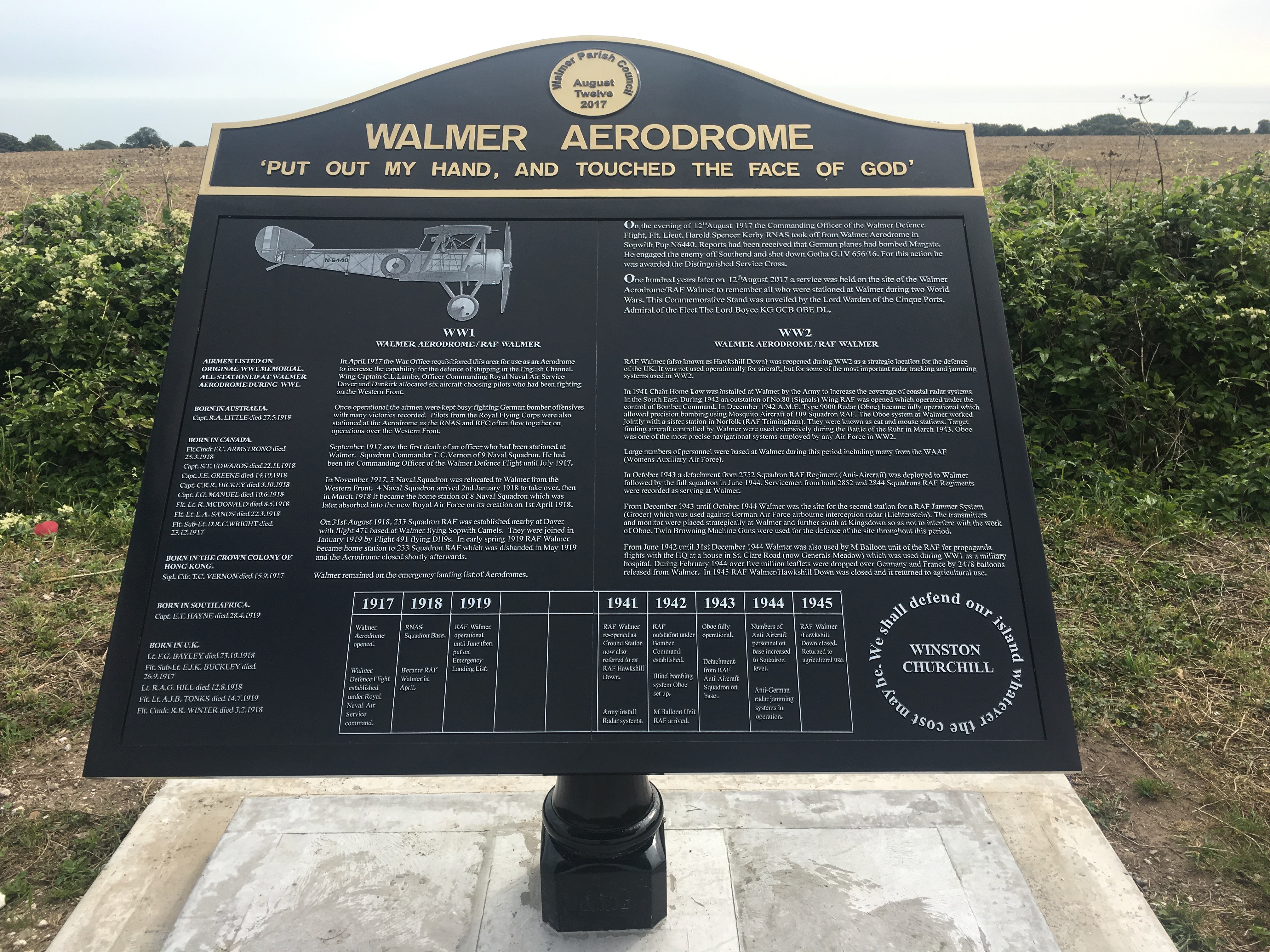
Walmer is a town in the district of Dover, Kent, in England. Located on the coast, the parish of Walmer is south-east of Sandwich, Kent. Largely residential, its coastline and castle attract many visitors. It has a population of 6,693 (2001), increasing to 8,178 at the 2011 Census. Walmer is closely associated with its adjoining neighbour, the town of Deal - sharing many amenities and services and benefiting from Deal's High Street shopping area. Walmer railway station is on the Kent Coast Line. History Julius Caesar Julius Caesar reputedly landed on the beach here in 55 BC and 54 BC. It is only one possible landing place, proposed judging from the distances given in his account of the landings in his ''Gallic Wars''. In the 19th century it was thought that he had landed by Deal Castle – hence a house there with SPQR emblazoned on its gate – but in 1907 the landing point has been proposed to be half a mile further south, beyond the lifeboat station, and marked by a c ... [...More Info...] [...Related Items...] OR: [Wikipedia] [Google] [Baidu] |
Sandwich, Kent
Sandwich is a town and civil parish in the Dover District of Kent, south-east England. It lies on the River Stour and has a population of 4,985. Sandwich was one of the Cinque Ports and still has many original medieval buildings, including several listed public houses and gates in the old town walls, churches, almshouses and the White Mill. While once a major port, it is now two miles from the sea due to the disappearance of the Wantsum Channel. Its historic centre has been preserved. Sandwich Bay is home to nature reserves and two world-class golf courses, Royal St George's and Prince's. The town is also home to many educational and cultural events. Sandwich also gave its name to the food by way of John Montagu, 4th Earl of Sandwich, and the word ''sandwich'' is now found in several languages. Etymology The place-name 'Sandwich' is first attested in the ''Anglo-Saxon Chronicle'', where it appears as ' in 851 and ' in 993. In the ''Domesday Book'' of 1086 it appears as '. ... [...More Info...] [...Related Items...] OR: [Wikipedia] [Google] [Baidu] |
Deal, Kent
Deal is a coastal town in Kent, England, which lies where the North Sea and the English Channel meet, north-east of Dover and south of Ramsgate. It is a former fishing, mining and garrison town whose history is closely linked to the anchorage in the Downs. Close to Deal is Walmer, a possible location for Julius Caesar's first arrival in Britain. Deal became a 'limb port' of the Cinque Ports in 1278 and grew into the busiest port in England; today it is a seaside resort, its quaint streets and houses a reminder of its history along with many ancient buildings and monuments. In 1968, Middle Street was the first conservation area in Kent. The coast of France is approximately from the town and is visible on clear days. The Tudor-era Deal Castle, commissioned by then- King, Henry VIII, has a rose floor plan. History Deal is first mentioned as a village in the Domesday Book of 1086, where it appears as ''Addelam''. It is referred to as ''Dela'' in 1158, and ''Dale'' i ... [...More Info...] [...Related Items...] OR: [Wikipedia] [Google] [Baidu] |
Kent
Kent is a county in South East England and one of the home counties. It borders Greater London to the north-west, Surrey to the west and East Sussex to the south-west, and Essex to the north across the estuary of the River Thames; it faces the French department of Pas-de-Calais across the Strait of Dover. The county town is Maidstone. It is the fifth most populous county in England, the most populous non-Metropolitan county and the most populous of the home counties. Kent was one of the first British territories to be settled by Germanic tribes, most notably the Jutes, following the withdrawal of the Romans. Canterbury Cathedral in Kent, the oldest cathedral in England, has been the seat of the Archbishops of Canterbury since the conversion of England to Christianity that began in the 6th century with Saint Augustine. Rochester Cathedral in Medway is England's second-oldest cathedral. Located between London and the Strait of Dover, which separates England from mainla ... [...More Info...] [...Related Items...] OR: [Wikipedia] [Google] [Baidu] |
Dover
Dover () is a town and major ferry port in Kent, South East England. It faces France across the Strait of Dover, the narrowest part of the English Channel at from Cap Gris Nez in France. It lies south-east of Canterbury and east of Maidstone. The town is the administrative centre of the Dover District and home of the Port of Dover. Archaeological finds have revealed that the area has always been a focus for peoples entering and leaving Britain. The name derives from the River Dour that flows through it. In recent times the town has undergone transformations with a high-speed rail link to London, new retail in town with St James' area opened in 2018, and a revamped promenade and beachfront. This followed in 2019, with a new 500m Pier to the west of the Harbour, and new Marina unveiled as part of a £330m investment in the area. It has also been a point of destination for many illegal migrant crossings during the English channel migrant crisis. The Port of Dover provides mu ... [...More Info...] [...Related Items...] OR: [Wikipedia] [Google] [Baidu] |
Maidstone
Maidstone is the largest Town status in the United Kingdom, town in Kent, England, of which it is the county town. Maidstone is historically important and lies 32 miles (51 km) east-south-east of London. The River Medway runs through the centre of the town, linking it with Rochester, Kent, Rochester and the Thames Estuary. Historically, the river carried much of the town's trade as the centre of the agricultural county of Kent, known as the Garden of England. There is evidence of settlement in the area dating back before the Stone Age. The town, part of the borough of Maidstone, had an approximate population of 100,000 in 2019. Since World War II, the town's economy has shifted from heavy industry towards light industry and services. Toponymy Anglo-Saxon period of English history, Saxon charters dating back to ca. 975 show the first recorded instances of the town's name, ''de maeides stana'' and ''maegdan stane'', possibly meaning ''stone of the maidens'' or ''stone of the ... [...More Info...] [...Related Items...] OR: [Wikipedia] [Google] [Baidu] |

_-_geograph.org.uk_-_650895.jpg)
.jpg)
