|
Ridley Road
Ridley Road Market (known locally as Ridley Road) but often referred to as "Dalston Market" is the central marketplace in Dalston in the London Borough of Hackney. It is opposite Dalston Kingsland railway station, just off the Kingsland High Street section of the A10, about three miles north of the City of London. It sells a wide range of commodities, including food. Goods, particularly fruit and vegetables, are sold from traditional barrows (trolleys) in the pedestrianised street from 8am to 6pm daily (not Sundays or bank holidays). There is a large range of traditional and exotic produce from around the world. Other stalls and many other shops lining the street sell a wide variety of foods and household goods. New style stalls have recently been introduced by the local council. See also * List of markets in London This is a list of markets in London. Greater London is home to a wealth of covered, outdoor and street markets. Many specialise in a particular type of goo ... [...More Info...] [...Related Items...] OR: [Wikipedia] [Google] [Baidu] |
Dalston
Dalston () is an area of East London, in the London Borough of Hackney. It is northeast of Charing Cross. Dalston began as a hamlet on either side of Dalston Lane, and as the area urbanised the term also came to apply to surrounding areas including Kingsland and Shacklewell, all three of which being part of the Ancient Parish of Hackney. The area has experienced a high degree of gentrification in recent years, a process accelerated by the East London line extension, now part of London Overground, and the reopening of Dalston Junction railway station, part of London's successful bid to host the 2012 Olympics. Bounds Dalston has never been an administrative unit, and partly for this reason the boundaries are not formally defined. There are generally understood boundaries in the south and west, but less clarity to the north and east. There is an electoral ward of the same name which covers a part of the northwest of Dalston. Dalston's boundaries (taking in Kingsland and ... [...More Info...] [...Related Items...] OR: [Wikipedia] [Google] [Baidu] |
Marketplace
A marketplace, market place, or just market, is a location where people regularly gather for the purchase and sale of provisions, livestock, and other goods. In different parts of the world, a marketplace may be described as a ''souk'' (from Arabic language, Arabic), ''bazaar'' (from Farsi language, Persian), a fixed ''mercado (other), mercado'' (Spanish language, Spanish), itinerant ''tianguis'' (Mexico), or ''palengke'' (Philippines). Some markets operate daily and are said to be ''permanent'' markets while others are held once a week or on less frequent specified days such as festival days and are said to be ''periodic markets.'' The form that a market adopts depends on its locality's population, culture, ambient, and geographic conditions. The term ''market'' covers many types of trading, such as market squares, market halls, food halls, and their different varieties. Thus marketplaces can be both outdoors and indoors, and in the modern world, online marketplaces. ... [...More Info...] [...Related Items...] OR: [Wikipedia] [Google] [Baidu] |
London Borough Of Hackney
The London Borough of Hackney ( ) is a London boroughs, London borough in Inner London, England. The historical and administrative heart of Hackney is Mare Street, which lies north-east of Charing Cross. The borough is named after Hackney, London, Hackney, its principal district. Southern and eastern parts of the borough are popularly regarded as being part of east London that spans some of the traditional East End of London with the northwest belonging to north London. Its population is estimated to be 281,120. The London Plan issued by the Greater London Authority assigns whole boroughs to List of sub regions used in the London Plan, sub-regions for statutory monitoring, engagement and resource allocation purposes. The most recent (2011) iteration of this plan assigns Hackney to the 'East' sub-region, while the 2008 and 2004 versions assigned the borough to "North" and "East" sub-regions respectively. The modern borough was formed in 1965 by the merger of the Metropolitan Boro ... [...More Info...] [...Related Items...] OR: [Wikipedia] [Google] [Baidu] |
Dalston Kingsland Railway Station
Dalston Kingsland is a station on the Mildmay line of the London Overground, located on the western side of Kingsland High Street in the Dalston area of the London Borough of Hackney. Situated in Travelcard Zone 2, the station straddles the boundary with the London Borough of Islington, with part of the platforms falling within Islington. The station is located opposite Ridley Road Market. Ticket barriers are in operation. ''Kingsland railway station'' was opened on the site in 1850. It was closed and replaced by Dalston Junction station, approximately walk away, in 1865. The current station was opened by British Rail in 1983. There is now an official out-of-station interchange with Dalston Junction, which is served by the Windrush line of the London Overground. History A station was first opened on the site on 9 November 1850 by the North London Railway. It closed on 1 November 1865 when an extension was built to Broad Street in the City of London and a triangular jun ... [...More Info...] [...Related Items...] OR: [Wikipedia] [Google] [Baidu] |
Kingsland High Street
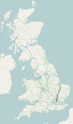
The A10 is a major road in England which runs between The City of London and King's Lynn in Norfolk. At its southern terminus, the route meets the A3 directly north of London Bridge, above Monument London Underground station. At its northern end, the A10 meets the A47 and A149 roads south-west of King's Lynn town centre. The route passes through or around primary destinations in Greater London, Hertfordshire, Cambridgeshire and Norfolk, including Dalston, Enfield, Hertford, Cambridge, Ely and Downham Market. The route between Bishopsgate in the City of London and Royston, Hertfordshire, roughly follows the path of Ermine Street, a Roman road. Route City of London At its southern end, the A10 begins at a junction with the A3, on the northern bank of the River Thames. The A3 runs southbound over London Bridge towards Elephant and Castle, before continuing to Clapham, Kingston upon Thames, Guildford and Portsmouth. At the junction the A10 also meets Cannon Street (t ... [...More Info...] [...Related Items...] OR: [Wikipedia] [Google] [Baidu] |
A10 Road (England)
The A10 is a major road in England which runs between The City of London and King's Lynn in Norfolk. At its southern terminus, the route meets the A3 directly north of London Bridge, above Monument London Underground station. At its northern end, the A10 meets the A47 and A149 roads south-west of King's Lynn town centre. The route passes through or around primary destinations in Greater London, Hertfordshire, Cambridgeshire and Norfolk, including Dalston, Enfield, Hertford, Cambridge, Ely and Downham Market. The route between Bishopsgate in the City of London and Royston, Hertfordshire, roughly follows the path of Ermine Street, a Roman road. Route City of London At its southern end, the A10 begins at a junction with the A3, on the northern bank of the River Thames. The A3 runs southbound over London Bridge towards Elephant and Castle, before continuing to Clapham, Kingston upon Thames, Guildford and Portsmouth. At the junction the A10 also meets Cannon Street ... [...More Info...] [...Related Items...] OR: [Wikipedia] [Google] [Baidu] |
City Of London
The City of London, also known as ''the City'', is a Ceremonial counties of England, ceremonial county and Districts of England, local government district with City status in the United Kingdom, city status in England. It is the Old town, historic centre of London, though it forms only a small part of the larger Greater London metropolis. The City of London had a population of 8,583 at the 2021 United Kingdom census, 2021 census, however over 500,000 people were employed in the area as of 2019. It has an area of , the source of the nickname ''the Square Mile''. The City is a unique local authority area governed by the City of London Corporation, which is led by the Lord Mayor of London, Lord Mayor of the City of London. Together with Canary Wharf and the West End of London, West End, the City of London forms the primary central business district of London, which is one of the leading financial centres of the world. The Bank of England and the London Stock Exchange are both ba ... [...More Info...] [...Related Items...] OR: [Wikipedia] [Google] [Baidu] |
List Of Markets In London
This is a list of markets in London. Greater London is home to a wealth of covered, outdoor and street markets. Many specialise in a particular type of goods or sell different things on different days. Most open very early in the morning and close early or late afternoon. Markets in London have their origins in the Middle Ages and ancient charter; set up to serve the population of the City of London. Over time, some emerged as wholesale markets serving specific market segments — such as the sale of vegetables, meat, or fish. With an expanding metropolis in the 18th and 19th centuries, street markets were set up to meet the needs of the new suburbs. With the introduction of trams on the streets of London, these were moved (sometimes forcibly) into neighbouring side streets, or new covered markets. [...More Info...] [...Related Items...] OR: [Wikipedia] [Google] [Baidu] |
Retail Markets In London
Retail is the sale of goods and Service (economics), services to consumers, in contrast to wholesaling, which is the sale to business or institutional customers. A retailer purchases goods in large quantities from manufacturing, manufacturers, directly or through a wholesaler, and then sells in smaller quantities to consumers for a Profit (accounting), profit. Retailers are the final link in the supply chain from producers to consumers. Retail markets and shops have a long history, dating back to antiquity. Some of the earliest retailers were itinerant peddlers. Over the centuries, retail shops were transformed from little more than "rude booths" to the sophisticated shopping malls of the modern era. In the digital age, an increasing number of retailers are seeking to reach broader markets by selling through multiple channels, including both bricks and mortar store, bricks and mortar and Online shopping, online retailing. Digital technologies are also affecting the way that co ... [...More Info...] [...Related Items...] OR: [Wikipedia] [Google] [Baidu] |
Streets In The London Borough Of Hackney
Streets is the plural of street, a type of road. Streets or The Streets may also refer to: Music * Streets (band), a rock band fronted by Kansas vocalist Steve Walsh * ''Streets'' (punk album), a 1977 compilation album of various early UK punk bands * '' Streets...'', a 1975 album by Ralph McTell * '' Streets: A Rock Opera'', a 1991 album by Savatage * "Streets" (Doja Cat song), from the album ''Hot Pink'' (2019) * "Streets", a song by Avenged Sevenfold from the album ''Sounding the Seventh Trumpet'' (2001) * The Streets, alias of Mike Skinner, a British rapper * "The Streets" (song) by WC featuring Snoop Dogg and Nate Dogg, from the album ''Ghetto Heisman'' (2002) Other uses * ''Streets'' (film), a 1990 American horror film * Streets (ice cream), an Australian ice cream brand owned by Unilever * Streets (solitaire), a variant of the solitaire game Napoleon at St Helena * Tai Streets (born 1977), American football player * Will Streets (1886–1916), English soldier and poet ... [...More Info...] [...Related Items...] OR: [Wikipedia] [Google] [Baidu] |


