|
Religion In Brunei
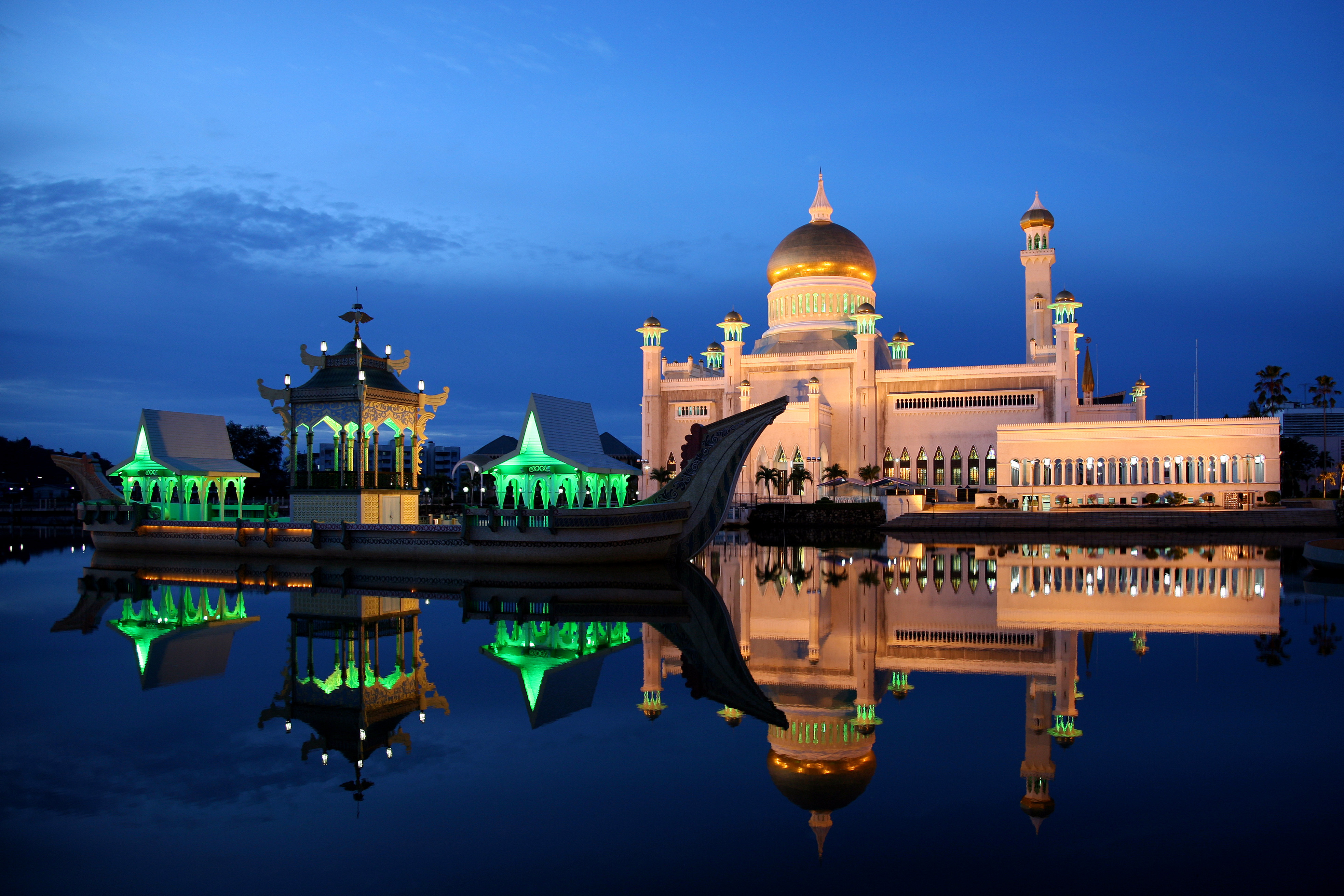
Among religions in Brunei, Sunni Islam is predominant. In 2021, the government census showed that 82.1% of Brunei's population is Muslim. However, other religions also have a considerable foothold in Brunei: 6.7% of the population is Christian and another 6.3% is Buddhist. The remaining 4.9% subscribe to various religions, including indigenous religions. Islam is the state religion of Brunei. Freedom of religion and the right to practice privately are nominally guaranteed. Furthermore, some non-Islamic holidays, such as Lunar New Year, Christmas, Vesak day and Gawai Dayak, are recognised. These rights, however, are limited in practice: religious education is controlled, even in the Chinese, Christian and private schools, and it is illegal to distribute any non-Islamic religious materials. Under the 2014 Shariah Penal Code Ordinance, such materials will immediately be confiscated, and the punishment for those distributing them is death. The state madh'hab of Islam is the Sha ... [...More Info...] [...Related Items...] OR: [Wikipedia] [Google] [Baidu] |
Sunni
Sunni Islam is the largest branch of Islam and the largest religious denomination in the world. It holds that Muhammad did not appoint any successor and that his closest companion Abu Bakr () rightfully succeeded him as the caliph of the Muslim community, being appointed at the meeting of Saqifa. This contrasts with the Shia view, which holds that Muhammad appointed Ali ibn Abi Talib () as his successor. Nevertheless, Sunnis revere Ali, along with Abu Bakr, Umar () and Uthman () as ' rightly-guided caliphs'. The term means those who observe the , the practices of Muhammad. The Quran, together with hadith (especially the Six Books) and (scholarly consensus), form the basis of all traditional jurisprudence within Sunni Islam. Sharia legal rulings are derived from these basic sources, in conjunction with consideration of public welfare and juristic discretion, using the principles of jurisprudence developed by the four legal schools: Hanafi, Hanbali, Maliki ... [...More Info...] [...Related Items...] OR: [Wikipedia] [Google] [Baidu] |
Seria
Seria or officially known as Seria Town (), is a town in Belait District, Brunei. It is located about west from the country's capital Bandar Seri Begawan. The total population was 3,625 in 2016. It was where oil was first struck in Brunei in 1929 and has since become a centre for the country's oil and gas industry. Etymology The town's name was derived from that of the river near where oil was first discovered in 1929. In the past, Seria used to be known as , the local name which has been translated as 'Wild Pigeon's Field', and referred to the area between the Bera and Seria rivers. However, the original name has become forgotten today. is also a word of Indonesian origin, meaning low ground (usually in coastal areas) and flooded with water, usually with lots of aquatic plants, an apt description of what Seria had been in the past. Thus suggesting as well that the original name may have Indonesian or Javanese influence. Geography Seria is located within a mangrove sw ... [...More Info...] [...Related Items...] OR: [Wikipedia] [Google] [Baidu] |
Seria, Belait
Mukim Seria is a mukim in Belait District, Brunei. It has an area of ; the population was 21,214 in 2016. The mukim encompasses Seria, one of the only two towns in the district. It is home to the oil and gas industry of the country. Geography The mukim is located in the north-west of the Belait District, bordering the South China Sea to the north, Mukim Liang to the east, Mukim Labi to the south-east, Mukim Kuala Balai to the south and Mukim Kuala Belait to the west. Demographics As of 2016 census, the population was 21,214 with males and females. The mukim had 4,471 households occupying 4,297 dwellings. Among the population, lived in urban areas, while the remainder of lived in rural areas. Mukim Seria has a total of more than 1,000 elderly people who are recorded as entitled to old age pensions every month and the majority are Malays and Chinese. Administration The mukim contains seven villages namely Kampong Baru (formerly known as Kampong Badas), Sungai Bera, ... [...More Info...] [...Related Items...] OR: [Wikipedia] [Google] [Baidu] |
Tamils
The Tamils ( ), also known by their endonym Tamilar, are a Dravidian peoples, Dravidian ethnic group who natively speak the Tamil language and trace their ancestry mainly to the southern part of the Indian subcontinent. The Tamil language is one of the longest-surviving classical languages, with over two thousand years of Tamil literature, written history, dating back to the Sangam period (between 300 BCE and 300 CE). Tamils constitute about 5.7% of the Indian population and form the majority in the South Indian state of Tamil Nadu and the union territory of Puducherry (union territory), Puducherry. They also form significant proportions of the populations in Sri Lankan Tamils, Sri Lanka (15.3%), Tamil Malaysians, Malaysia (7%) and Indian Singaporeans, Singapore (5%). Tamils have migrated world-wide since the 19th century CE and a significant population exists in South Africa, Mauritius, Fiji, as well as other regions such as the Southeast Asia, Middle East, Caribbean and parts ... [...More Info...] [...Related Items...] OR: [Wikipedia] [Google] [Baidu] |
Census
A census (from Latin ''censere'', 'to assess') is the procedure of systematically acquiring, recording, and calculating population information about the members of a given Statistical population, population, usually displayed in the form of statistics. This term is used mostly in connection with Population and housing censuses by country, national population and housing censuses; other common censuses include Census of agriculture, censuses of agriculture, traditional culture, business, supplies, and traffic censuses. The United Nations (UN) defines the essential features of population and housing censuses as "individual enumeration, universality within a defined territory, simultaneity and defined periodicity", and recommends that population censuses be taken at least every ten years. UN recommendations also cover census topics to be collected, official definitions, classifications, and other useful information to coordinate international practices. The United Nations, UN's Food ... [...More Info...] [...Related Items...] OR: [Wikipedia] [Google] [Baidu] |
Temple
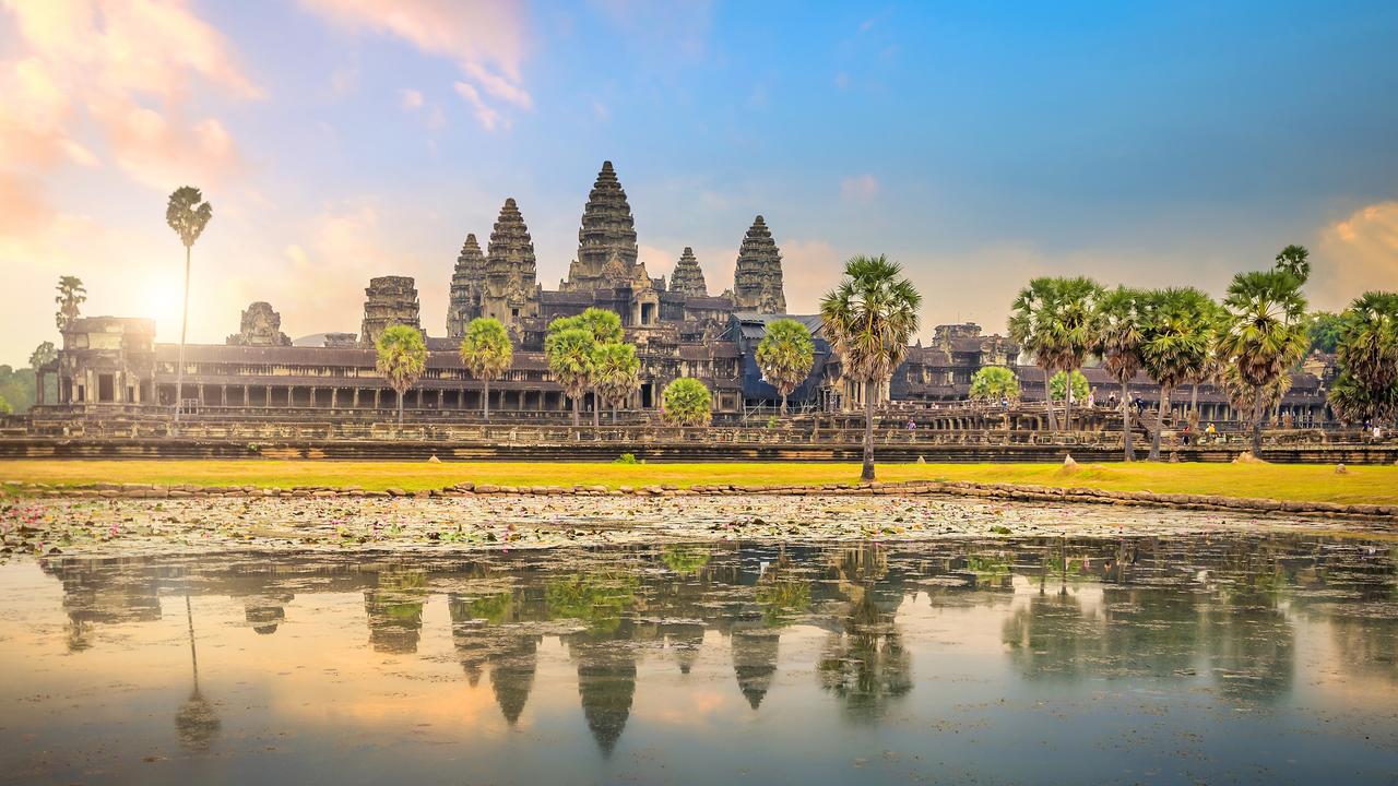
A temple (from the Latin ) is a place of worship, a building used for spiritual rituals and activities such as prayer and sacrifice. By convention, the specially built places of worship of some religions are commonly called "temples" in English, while those of other religions are not, even though they fulfill very similar functions. The religions for which the terms are used include the great majority of ancient religions that are now extinct, such as the Ancient Egyptian religion and the Ancient Greek religion. Among religions still active: Hinduism (whose temples are called Mandir or Kovil), Buddhism (whose temples are called Vihar), Sikhism (whose temples are called gurudwara), Jainism (whose temples are sometimes called derasar), Zoroastrianism (whose temples are sometimes called Agiary), the Baháʼí Faith (which are often simply referred to as Baháʼí House of Worship), Taoism (which are sometimes called Daoguan), Shinto (which are often called Jinja), C ... [...More Info...] [...Related Items...] OR: [Wikipedia] [Google] [Baidu] |
India
India, officially the Republic of India, is a country in South Asia. It is the List of countries and dependencies by area, seventh-largest country by area; the List of countries by population (United Nations), most populous country since 2023; and, since its independence in 1947, the world's most populous democracy. Bounded by the Indian Ocean on the south, the Arabian Sea on the southwest, and the Bay of Bengal on the southeast, it shares land borders with Pakistan to the west; China, Nepal, and Bhutan to the north; and Bangladesh and Myanmar to the east. In the Indian Ocean, India is near Sri Lanka and the Maldives; its Andaman and Nicobar Islands share a maritime border with Thailand, Myanmar, and Indonesia. Modern humans arrived on the Indian subcontinent from Africa no later than 55,000 years ago., "Y-Chromosome and Mt-DNA data support the colonization of South Asia by modern humans originating in Africa. ... Coalescence dates for most non-European populations averag ... [...More Info...] [...Related Items...] OR: [Wikipedia] [Google] [Baidu] |
Hindu
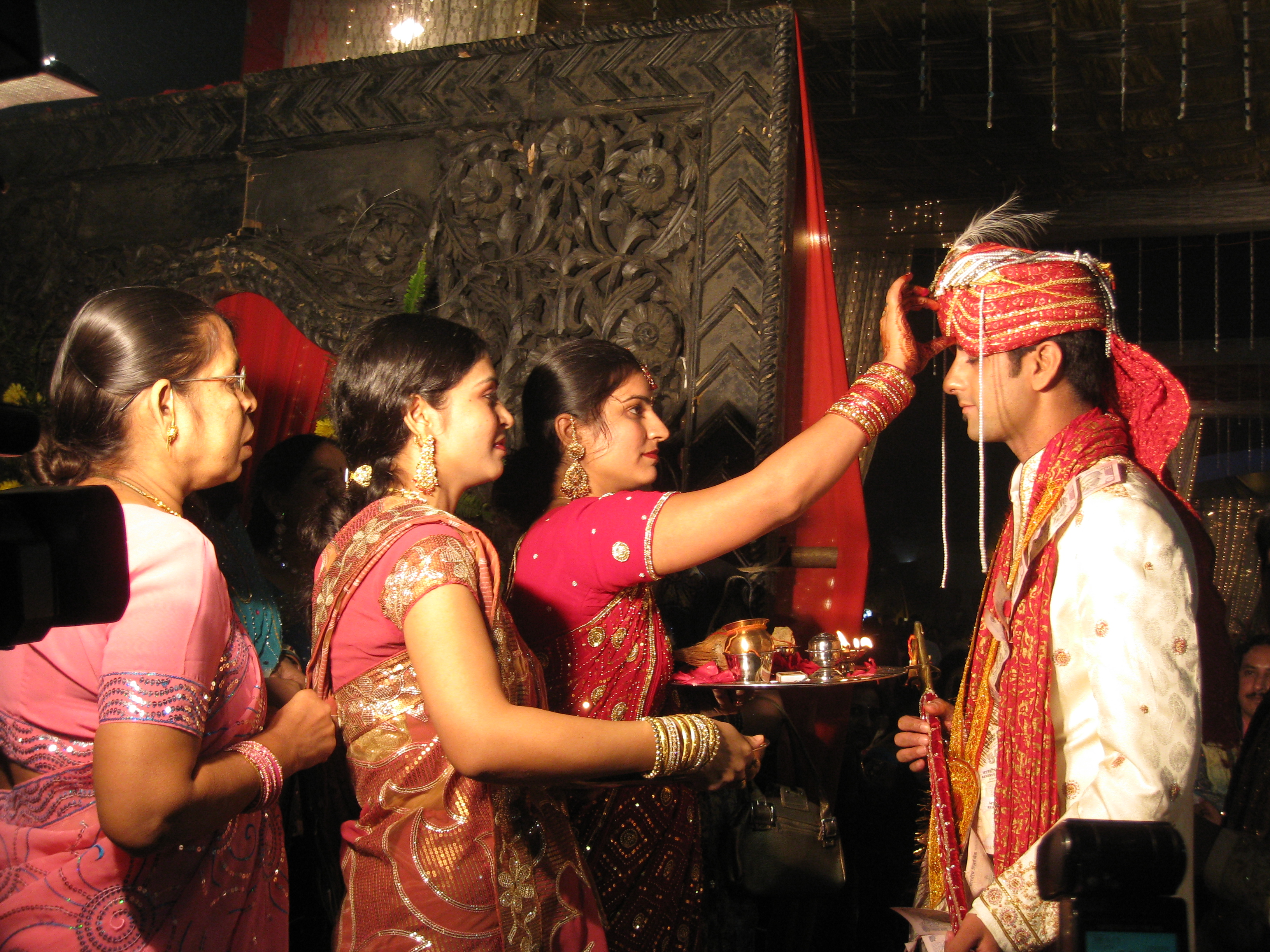
Hindus (; ; also known as Sanātanīs) are people who religiously adhere to Hinduism, also known by its endonym Sanātana Dharma. Jeffery D. Long (2007), A Vision for Hinduism, IB Tauris, , pp. 35–37 Historically, the term has also been used as a geographical, cultural, and later religious identifier for people living in the Indian subcontinent. It is assumed that the term ''"Hindu"'' traces back to Avestan scripture Vendidad which refers to land of seven rivers as Hapta Hendu which itself is a cognate to Sanskrit term ''Sapta Sindhuḥ''. (The term ''Sapta Sindhuḥ'' is mentioned in Rig Veda and refers to a North western Indian region of seven rivers and to India as a whole.) The Greek cognates of the same terms are "''Indus''" (for the river) and "''India''" (for the land of the river). Likewise the Hebrew cognate ''hōd-dū'' refers to India mentioned in Hebrew BibleEsther 1:1. The term "''Hindu''" also implied a geographic, ethnic or cultural identifier for ... [...More Info...] [...Related Items...] OR: [Wikipedia] [Google] [Baidu] |
Temburong District
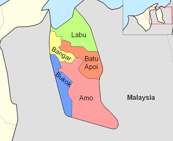
Temburong District (; Jawi script, Jawi: دائيره تمبوروڠ) or simply known as Temburong ('; ), is the second largest and least populated districts of Brunei, district in Brunei. It has an area of and the population of 9,444 as of 2021. The district is also home to its administrative centre, Bangar Town (), as well as the Temburong River and Ulu Temburong National Park, the country's List of rivers of Brunei, third longest river and a national parkUNEP-WCMC (2023)Protected Area Profile for Ulu Temburongfrom the World Database on Protected Areas. Accessed 18 March 2023. in Brunei respectively. Geography The Malaysian district of Limbang divided the Temburong District, an exclave, from the rest of Brunei. It is a location for ecotourism and is home to a large portion of the Sultanate's virgin rainforests. Nestled between the Limbang River, Limbang and Trusan Rivers on all sides, Bukit Pagon (1,850 m) dominates the eastern region of Brunei. The Royal Geographical Soci ... [...More Info...] [...Related Items...] OR: [Wikipedia] [Google] [Baidu] |
Tutong District
Tutong District (; Jawi script, Jawi: دائيره توتوڠ) or simply known as Tutong ('), is the third largest and populated districts of Brunei, district in Brunei. It has an area of and the population of 47,210 as of 2021. The district is also home to its administrative centre is Tutong (town), Tutong Town (), as well as the Tutong River and Tasek Merimbun, the country's List of rivers of Brunei, second longest river and the only ASEAN Heritage Parks in Brunei respectively. Geography The district borders the South China Sea to the north, Brunei–Muara District to the northeast, Sarawak to the east and south, and Belait District to the west. Covering , it is the third-largest district in Brunei. The 137 kilometre Tutong River, the district's primary river, flows from the interior in the south to the South China Sea. Bukit Bedawan, the district's highest point, stands at 529 meters. The district also hosts Tasek Merimbun, Brunei's largest natural lake, designated as an A ... [...More Info...] [...Related Items...] OR: [Wikipedia] [Google] [Baidu] |
Belait District
Belait District (; Jawi: دأيره بلأيت) or simply known as Belait ('; ), is the largest as well as the westernmost district in Brunei. It has an area of and the population of 65,531 as of 2021. The administrative town is Kuala Belait, located at the mouth of the long Belait River. The district is commonly associated with the oil and gas industry of the country, mainly concentrated near the town of Seria. Geography The South China Sea borders Belait District to the north, Tutong District to the northeast, and Sarawak, Malaysia to the west and south. The district's lowlands are steep and below an elevation of . Areas along the shore, which are mostly characterised by marshy plains with slender alluvial valleys that extend to the major rivers, are the exception. Bukit Teraja, the district's highest point, stands at 417 meters. With multiple offshore installations and pipeline connections, the district is situated on the northwest coast of Borneo, is a vital hub fo ... [...More Info...] [...Related Items...] OR: [Wikipedia] [Google] [Baidu] |


