|
Regosols
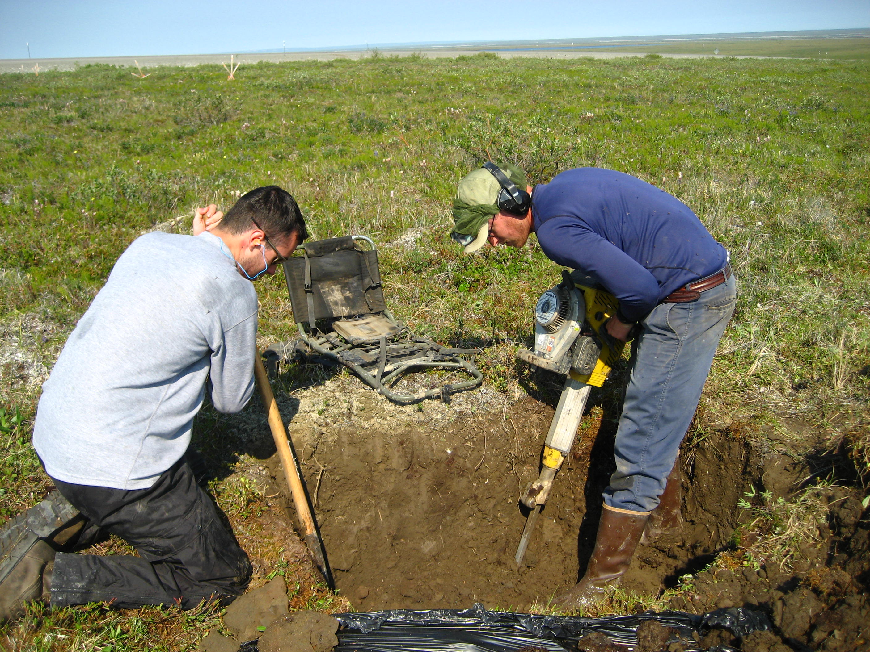
A Regosol in the World Reference Base for Soil Resources (WRB) is very weakly developed mineral soil in unconsolidated materials. Regosols are extensive in eroding lands, in particular in arid and semi-arid areas and in mountain regions. Internationally, Regosols correlate with soil taxa that are marked by incipient soil formation such as Entisols in the USDA soil taxonomy or Rudosols and possibly some Tenosols in the Australian Soil Classification. The group of Regosols is a taxonomic rest group containing all soils that could not be accommodated in any of the other groups. Excluded from the Regosols are weakly developed soils that classify as Leptosols (very shallow soils), Arenosols (sandy soils) or Fluvisols (in recent alluvial deposits). These soils have AC- profiles. Profile development is minimal as a consequence of young age and/or slow soil formation. Land use and management of Regosols vary widely. Some Regosols are used for capital-intensive irrigated farming but ... [...More Info...] [...Related Items...] OR: [Wikipedia] [Google] [Baidu] |
Soil Profile
A soil horizon is a layer parallel to the soil surface whose physical, chemical and biological characteristics differ from the layers above and beneath. Horizons are defined in many cases by obvious physical features, mainly colour and texture. These may be described both in absolute terms (particle size distribution for texture, for instance) and in terms relative to the surrounding material, i.e. 'coarser' or 'sandier' than the horizons above and below. The identified horizons are indicated with symbols, which are mostly used in a hierarchical way. Master horizons (main horizons) are indicated by capital letters. Suffixes, in form of lowercase letters and figures, further differentiate the master horizons. There are many different systems of horizon symbols in the world. No one system is more correct—as artificial constructs, their utility lies in their ability to accurately describe local conditions in a consistent manner. Due to the different definitions of the horizon sym ... [...More Info...] [...Related Items...] OR: [Wikipedia] [Google] [Baidu] |
Soil Classification
Soil classification deals with the systematic categorization of soils based on distinguishing characteristics as well as criteria that dictate choices in use. Overview Soil classification is a dynamic subject, from the structure of the system, to the definitions of classes, to the application in the field. Soil classification can be approached from the perspective of soil as a material and soil as a resource. Inscriptions at the temple of Horus at Edfu outline a soil classification used by Tanen to determine what kind of temple to build at which site. Ancient Greek scholars produced a number of classification based on several different qualities of the soil. Engineering Geotechnical engineers classify soils according to their engineering properties as they relate to use for foundation support or building material. Modern engineering classification systems are designed to allow an easy transition from field observations to basic predictions of soil engineering properties and ... [...More Info...] [...Related Items...] OR: [Wikipedia] [Google] [Baidu] |
Pedology (soil Study)
Pedology (from Greek: πέδον, ''pedon'', "soil"; and λόγος, ''logos'', "study") is a discipline within soil science which focuses on understanding and characterizing soil formation, evolution, and the theoretical frameworks for modeling soil bodies, often in the context of the natural environment. Pedology is often seen as one of two main branches of soil inquiry, the other being edaphology which is traditionally more agronomically oriented and focuses on how soil properties influence plant communities (natural or cultivated). In studying the fundamental phenomenology of soils, e.g. soil formation (aka pedogenesis), pedologists pay particular attention to observing soil morphology and the geographic distributions of soils, and the placement of soil bodies into larger temporal and spatial contexts. In so doing, pedologists develop systems of soil classification, soil maps, and theories for characterizing temporal and spatial interrelations among soils. There are a fe ... [...More Info...] [...Related Items...] OR: [Wikipedia] [Google] [Baidu] |
Pedogenesis
Soil formation, also known as pedogenesis, is the process of soil genesis as regulated by the effects of place, environment, and history. Biogeochemical processes act to both create and destroy order (anisotropy) within soils. These alterations lead to the development of layers, termed soil horizons, distinguished by differences in color, structure, texture, and chemistry. These features occur in patterns of soil type distribution, forming in response to differences in soil forming factors. Pedogenesis is studied as a branch of pedology, the study of soil in its natural environment. Other branches of pedology are the study of soil morphology and soil classification. The study of pedogenesis is important to understanding soil distribution patterns in current ( soil geography) and past ( paleopedology) geologic periods. Overview Soil develops through a series of changes. The starting point is weathering of freshly accumulated parent material. A variety of soil microbes (ba ... [...More Info...] [...Related Items...] OR: [Wikipedia] [Google] [Baidu] |
Near East
The Near East () is a transcontinental region around the Eastern Mediterranean encompassing the historical Fertile Crescent, the Levant, Anatolia, Egypt, Mesopotamia, and coastal areas of the Arabian Peninsula. The term was invented in the 20th century by modern Western geographers and was originally applied to the Ottoman Empire, but today has varying definitions within different academic circles. The term ''Near East'' was used in conjunction with the ''Middle East'' and the ''Far East'' (China and beyond), together known as the "three Easts"; it was a separate term from the ''Middle East'' during earlier times and official British usage. As of 2024, both terms are used interchangeably by politicians and news reporters to refer to the same region. ''Near East'' and ''Middle East'' are both Eurocentrism, Eurocentric terms. According to the National Geographic Society, the terms ''Near East'' and ''Middle East'' denote the same territories and are "generally accepted as comprisin ... [...More Info...] [...Related Items...] OR: [Wikipedia] [Google] [Baidu] |
Northern Africa
North Africa (sometimes Northern Africa) is a region encompassing the northern portion of the African continent. There is no singularly accepted scope for the region. However, it is sometimes defined as stretching from the Atlantic shores of the Western Sahara in the west, to Egypt and Sudan's Red Sea coast in the east. The most common definition for the region's boundaries includes Algeria, Egypt, Libya, Morocco, Tunisia, and Western Sahara, the territory disputed between Morocco and the partially recognized Sahrawi Arab Democratic Republic. The United Nations’ definition includes all these countries as well as Sudan. The African Union defines the region similarly, only differing from the UN in excluding the Sudan and including Mauritania. The Sahel, south of the Sahara Desert, can be considered as the southern boundary of North Africa. North Africa includes the Spanish cities of Ceuta and Melilla, and the plazas de soberanía. It can also be considered to include Malta, ... [...More Info...] [...Related Items...] OR: [Wikipedia] [Google] [Baidu] |
Dry Tropics
NQ Dry Tropics (formerly Burdekin Dry Tropics NRM) is the natural resource management body for the Burdekin Dry Tropics region. Based in Townsville, it is an independent, community based, not-for-profit organisation that has been delivering on-ground Natural Resource Management (NRM) activities since 2005 to enhance the sustainability of the region's natural resources including water, soil and biodiversity. The economy of the NQ Dry Tropics region is heavily reliant upon natural resources based industries, particularly agriculture. Agriculture is by far the most important employer in the rural areas of the region with well established grazing, sugarcane and horticultural industries. Other major industries include mining, energy and tourism. History The National Action Plan for Salinity and Water Quality (NAPSWQ) and the Natural Heritage Trust Extension (NHT2) were natural resource management programs established by the Australian Government, in partnership with State Government ... [...More Info...] [...Related Items...] OR: [Wikipedia] [Google] [Baidu] |
Permafrost
Permafrost () is soil or underwater sediment which continuously remains below for two years or more; the oldest permafrost has been continuously frozen for around 700,000 years. Whilst the shallowest permafrost has a vertical extent of below a meter (3 ft), the deepest is greater than . Similarly, the area of individual permafrost zones may be limited to narrow mountain summits or extend across vast Arctic regions. The ground beneath glaciers and ice sheets is not usually defined as permafrost, so on land, permafrost is generally located beneath a so-called active layer of soil which freezes and thaws depending on the season. Around 15% of the Northern Hemisphere or 11% of the global surface is underlain by permafrost, covering a total area of around . This includes large areas of Alaska, Canada, Greenland, and Siberia. It is also located in high mountain regions, with the Tibetan Plateau being a prominent example. Only a minority of permafrost exists in the Southern Hemi ... [...More Info...] [...Related Items...] OR: [Wikipedia] [Google] [Baidu] |
Climate Zone
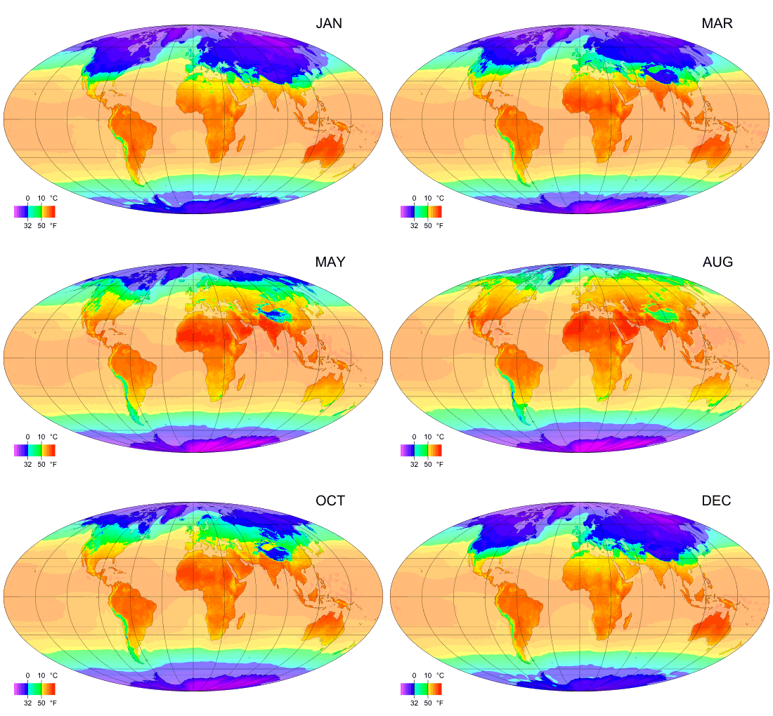
Climate zones are systems that categorize the world's climates. A climate classification may correlate closely with a biome classification, as climate is a major influence on life in a region. The most used is the Köppen climate classification scheme first developed in 1884. There are several ways to classify climates into similar regimes. Originally, climes were defined in Ancient Greece to describe the weather depending upon a location's latitude. Modern climate classification methods can be broadly divided into ''genetic'' methods, which focus on the causes of climate, and ''empiric'' methods, which focus on the effects of climate. Examples of genetic classification include methods based on the relative frequency of different air mass types or locations within synoptic weather disturbances. Examples of empiric classifications include climate zones defined by plant hardiness, evapotranspiration, or associations with certain biomes, as in the case of the Köppen climate cl ... [...More Info...] [...Related Items...] OR: [Wikipedia] [Google] [Baidu] |
Forest
A forest is an ecosystem characterized by a dense ecological community, community of trees. Hundreds of definitions of forest are used throughout the world, incorporating factors such as tree density, tree height, land use, legal standing, and ecological function. The United Nations' Food and Agriculture Organization (FAO) defines a forest as, "Land spanning more than 0.5 hectares with trees higher than 5 meters and a Canopy (biology), canopy cover of more than 10 percent, or trees able to reach these thresholds ''in situ''. It does not include land that is predominantly under agricultural or urban use." Using this definition, ''Global Forest Resources Assessment (FRA), Global Forest Resources Assessment 2020'' found that forests covered , or approximately 31 percent of the world's land area in 2020. Forests are the largest Terrestrial ecosystem, terrestrial ecosystems of Earth by area, and are found around the globe. 45 percent of forest land is in the Tropical forest, trop ... [...More Info...] [...Related Items...] OR: [Wikipedia] [Google] [Baidu] |
Grazing
In agriculture, grazing is a method of animal husbandry whereby domestic livestock are allowed outdoors to free range (roam around) and consume wild vegetations in order to feed conversion ratio, convert the otherwise indigestible (by human digestive system, human gut) cellulose within grass and other forages into meat, milk, wool and other animal products, often on land that is unsuitable for arable farming. Farmers may employ many different strategies of grazing for crop yield, optimum production: grazing may be continuous, seasonal, or rotational grazing, rotational within a grazing period. Longer rotations are found in ley farming, alternating arable and fodder crops; in rest rotation, deferred rotation, and mob grazing, giving grasses a longer time to recover or leaving land fallow. Patch-burn sets up a rotation of fresh grass after burning with two years of rest. Conservation grazing proposes to use grazing animals to improve the biodiversity of a site. Grazing has existed ... [...More Info...] [...Related Items...] OR: [Wikipedia] [Google] [Baidu] |


