|
Ralph Covell
Ralph George Covington Covell (6 May 1911 – 16 December 1988) was an English modern architect, active during the post-war period to the early 1970s. Early life and family Ralph was born in Lee, London, on 6 May 1911, the son of George William and Elsie Covell née Covington. The family lived in Lee High Road in the 1930s In late 1935 Ralph married Marguerite Latter but, after World War II, they had separated and both remarried. Covell married Lurline Stanley Knowles (1913–2005) in 1947. Early career and military service Covell won the Ashpitel Prize in 1934 and was admitted ARIBA the following year. Covell founded an architectural practice in 1937 in Westminster where he worked until drafted into the Army. During this period he taught architecture at Croydon College of Art. citing: During World War II he served with the Royal Engineers and was promoted to the rank of second lieutenant in 1940. He was evacuated from Dunkirk and later posted to Orkney where he was invol ... [...More Info...] [...Related Items...] OR: [Wikipedia] [Google] [Baidu] |
Lee, London
Lee, also known as Lee Green, is an area of South East London, England, straddling the border of the London Borough of Lewisham and the Royal Borough of Greenwich. It is located northwest of Eltham and southeast of Lewisham. It is within the historic county of Kent. The churchyard of St Margaret's Church (current church rebuilt 1839–41, architect: John Brown) is the burial place of three Astronomers Royal: Edmond Halley, Nathaniel Bliss and John Pond. History Early history The Manor of Lee was a historic parish of the Blackheath hundred and existed up to 1900 when it was merged with the parish of Lewisham to create the Metropolitan Borough of Lewisham. While modern Lee is centred on Lee railway station and the road of Burnt Ash Hill, the parish was based around Lee High Road which today stretches into the town centre of Lewisham. The River Quaggy formed much of the boundary between the two parishes, though at Lee Bridge (at the western end of Lee High Road) it is ... [...More Info...] [...Related Items...] OR: [Wikipedia] [Google] [Baidu] |
Dunkirk
Dunkirk (french: Dunkerque ; vls, label= French Flemish, Duunkerke; nl, Duinkerke(n) ; , ;) is a commune in the department of Nord in northern France.Commune de Dunkerque (59183) INSEE It lies from the Belgian border. It has the third-largest French harbour. The population of the commune in 2019 was 86,279. Etymology and language use The name of Dunkirk derives from West Flemish '' or ' dun' and 'church', thus 'church in the dune ...[...More Info...] [...Related Items...] OR: [Wikipedia] [Google] [Baidu] |
Soho
Soho is an area of the City of Westminster, part of the West End of London. Originally a fashionable district for the aristocracy, it has been one of the main entertainment districts in the capital since the 19th century. The area was developed from farmland by Henry VIII in 1536, when it became a royal park. It became a parish in its own right in the late 17th century, when buildings started to be developed for the upper class, including the laying out of Soho Square in the 1680s. St Anne's Church was established during the late 17th century, and remains a significant local landmark; other churches are the Church of Our Lady of the Assumption and St Gregory and St Patrick's Church in Soho Square. The aristocracy had mostly moved away by the mid-19th century, when Soho was particularly badly hit by an outbreak of cholera in 1854. For much of the 20th century Soho had a reputation as a base for the sex industry in addition to its night life and its location for the headq ... [...More Info...] [...Related Items...] OR: [Wikipedia] [Google] [Baidu] |
Glulam Beam
Glued laminated timber, commonly referred to as glulam, is a type of structural engineered wood product constituted by layers of dimensional lumber bonded together with durable, moisture-resistant structural adhesives so that all of the grain runs parallel to the longitudinal axis. In North America, the material providing the laminations is termed ''laminating stock'' or ''lamstock''. History The principles of glulam construction are believed to date back to the 1860s, in the assembly room of King Edward VI College, a school in Southampton, England. The first patent however emerged in 1901 when Otto Karl Freidrich Hetzer, a carpenter from Weimar, Germany, patented this method of construction. Approved in Switzerland, Hetzer’s patent explored creating a straight beam out of several laminations glued together. In 1906 he received a patent in Germany for curved sections of glulam. Other countries in Europe soon began approving patents and by 1922, glulam had been used in 14 cou ... [...More Info...] [...Related Items...] OR: [Wikipedia] [Google] [Baidu] |
Printed Circuit Board
A printed circuit board (PCB; also printed wiring board or PWB) is a medium used in electrical and electronic engineering to connect electronic components to one another in a controlled manner. It takes the form of a laminated sandwich structure of conductive and insulating layers: each of the conductive layers is designed with an artwork pattern of traces, planes and other features (similar to wires on a flat surface) etched from one or more sheet layers of copper laminated onto and/or between sheet layers of a non-conductive substrate. Electrical components may be fixed to conductive pads on the outer layers in the shape designed to accept the component's terminals, generally by means of soldering, to both electrically connect and mechanically fasten them to it. Another manufacturing process adds vias: plated-through holes that allow interconnections between layers. Printed circuit boards are used in nearly all electronic products. Alternatives to PCBs include wire ... [...More Info...] [...Related Items...] OR: [Wikipedia] [Google] [Baidu] |
City Tower, Manchester
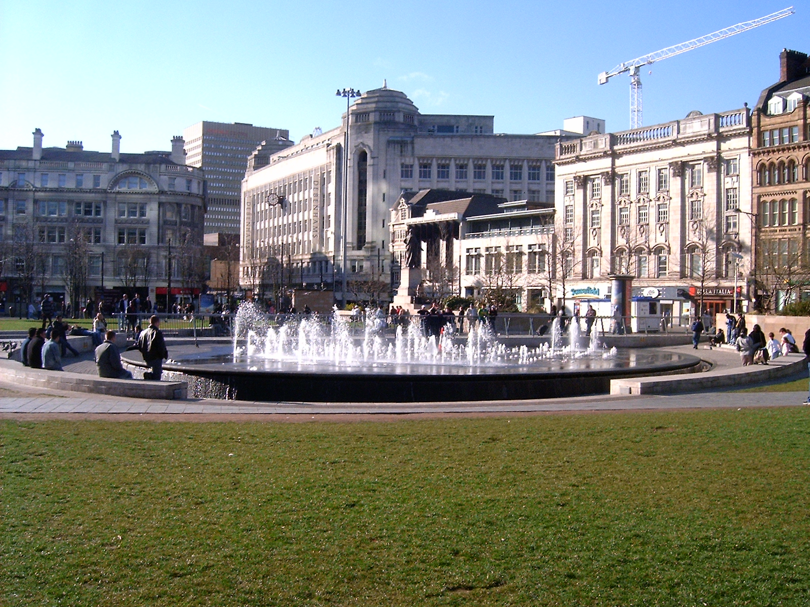
City Tower (formerly Sunley House) is a 30-storey skyscraper situated in the Piccadilly Gardens area of Manchester city centre in England. As of 2022, it is the tallest office building in Manchester and outside London, and the eighth-tallest building in Manchester, with a roof height of 107 metres (351 ft). History City Tower was completed in 1965, one of three buildings forming the Piccadilly Plaza complex which was designed by Covell, Matthews & Partners and developed by Bernard Sunley & Sons between 1959 and 1965.Hartwell, Clare; Hyde, Matthew; Pevsner, Nikolaus (2004), ''Lancashire: Manchester and the South-East'', (The Buildings of England), Yale University Press, ; p. 326 The Piccadilly Plaza was remodelled by Leslie Jones Architects in 2001-02. City Tower stands at right angles to Piccadilly and the north-facing wall is covered with designs based on circuit boards. During the remodelling of the building to the west of City Tower, Eagle Star House was replaced by a b ... [...More Info...] [...Related Items...] OR: [Wikipedia] [Google] [Baidu] |
Manchester City Centre
Manchester City Centre is the central business district of Manchester in Greater Manchester, England situated within the confines of Great Ancoats Street, A6042 Trinity Way, and A57(M) Mancunian Way which collectively form an inner ring road. The City Centre ward had a population of 17,861 at the 2011 census. Manchester city centre evolved from the civilian '' vicus'' of the Roman fort of Mamucium, on a sandstone bluff near the confluence of the rivers Medlock and Irwell. This became the township of Manchester during the Middle Ages, and was the site of the Peterloo Massacre of 1819. Manchester was granted city status in 1853, after the Industrial Revolution, from which the city centre emerged as the global centre of the cotton trade which encouraged its "splendidly imposing commercial architecture" during the Victorian era, such as the Royal Exchange, the Corn Exchange, the Free Trade Hall, and the Great Northern Warehouse. After the decline of the cotton trade an ... [...More Info...] [...Related Items...] OR: [Wikipedia] [Google] [Baidu] |
Piccadilly Gardens
Piccadilly Gardens is a green space in Manchester city centre, England, on the edge of the Northern Quarter. It takes its name from the adjacent street, Piccadilly, which runs across the city centre from Market Street to London Road. The gardens also contain a bus station and a tram stop. Piccadilly Gardens were laid out after World War I on the former site of the Manchester Royal Infirmary. Originally landscaped as an ornamental sunken garden, the area was levelled out and reconfigured in 2002 with a water feature and concrete pavilion by Japanese architect Tadao Ando. Location Piccadilly Gardens are located in Manchester city centre, just to the south of the Northern Quarter. The green space is bounded on four sides by streets: Mosley Street to the west, Parker Street to the south and Portland Street to the east; along the northern side is Piccadilly, a street that runs eastwards from the junction of Market Street to the junction of London Road with Ducie Street. T ... [...More Info...] [...Related Items...] OR: [Wikipedia] [Google] [Baidu] |
Gibraltar
) , anthem = " God Save the King" , song = " Gibraltar Anthem" , image_map = Gibraltar location in Europe.svg , map_alt = Location of Gibraltar in Europe , map_caption = United Kingdom shown in pale green , mapsize = , image_map2 = Gibraltar map-en-edit2.svg , map_alt2 = Map of Gibraltar , map_caption2 = Map of Gibraltar , mapsize2 = , subdivision_type = Sovereign state , subdivision_name = , established_title = British capture , established_date = 4 August 1704 , established_title2 = , established_date2 = 11 April 1713 , established_title3 = National Day , established_date3 = 10 September 1967 , established_title4 = Accession to EEC , established_date4 = 1 January 1973 , established_title5 = Withdrawal from the EU , established_date5 = 31 January 2020 , official_languages = English , languages_type = Spoken languages , languages = , capital = Westside, Gibraltar (de facto) , coordinates = , largest_settlement_type = largest district , larg ... [...More Info...] [...Related Items...] OR: [Wikipedia] [Google] [Baidu] |
Bernard Montgomery
Field Marshal Bernard Law Montgomery, 1st Viscount Montgomery of Alamein, (; 17 November 1887 – 24 March 1976), nicknamed "Monty", was a senior British Army officer who served in the First World War, the Irish War of Independence and the Second World War. Montgomery first saw action in the First World War as a junior officer of the Royal Warwickshire Regiment. At Méteren, near the Belgian border at Bailleul, he was shot through the right lung by a sniper, during the First Battle of Ypres. On returning to the Western Front as a general staff officer, he took part in the Battle of Arras in AprilMay 1917. He also took part in the Battle of Passchendaele in late 1917 before finishing the war as chief of staff of the 47th (2nd London) Division. In the inter-war years he commanded the 17th (Service) Battalion, Royal Fusiliers and, later, the 1st Battalion, Royal Warwickshire Regiment before becoming commander of the 9th Infantry Brigade and then General officer co ... [...More Info...] [...Related Items...] OR: [Wikipedia] [Google] [Baidu] |
Ministry Of Defence (United Kingdom)
The Ministry of Defence (MOD or MoD) is the department responsible for implementing the defence policy set by His Majesty's Government, and is the headquarters of the British Armed Forces. The MOD states that its principal objectives are to defend the United Kingdom of Great Britain and Northern Ireland and its interests and to strengthen international peace and stability. The MOD also manages day-to-day running of the armed forces, contingency planning and defence procurement. The expenditure, administration and policy of the MOD are scrutinised by the Defence Select Committee, except for Defence Intelligence which instead falls under the Intelligence and Security Committee of Parliament. History During the 1920s and 1930s, British civil servants and politicians, looking back at the performance of the state during the First World War, concluded that there was a need for greater co-ordination between the three services that made up the armed forces of the United Kingdom: t ... [...More Info...] [...Related Items...] OR: [Wikipedia] [Google] [Baidu] |
.jpg)
_OSM_map.png)


_(Tony_Radakin_cropped).jpg)