|
Pusta Ves
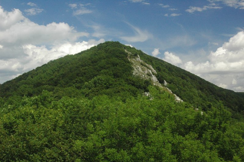
Pusta Ves is a village in the municipality of Prašník in Piešťany District in the Trnava Region of western Slovakia. It is a hub of marked hiking trails through the surrounding forests. Pusta Ves is located at an altitude of 250 meters at the foot of the Little Carpathians, 18 km west of the spa town of Piestany. Pusta Ves means remote village. The small community is surrounded by high hills and vast forests. The village is divided into an upper and lower part: Horna Pusta Ves and Dolná Pusta Ves. During Slovak independence from 1939 to 1945, people with Czech or Jewish background found refuge in and around the village. Since Slovakia August 29. 1944 was at war with Germany the remote village immediately was a gathering and command center for partisans who fought against German soldiers. The village men were imprisoned in Trenčín and two houses were burned by fascists. The village women organized catering, maintenance of uniforms and transporting weapons for ... [...More Info...] [...Related Items...] OR: [Wikipedia] [Google] [Baidu] |
Village
A village is a human settlement or community, larger than a hamlet but smaller than a town with a population typically ranging from a few hundred to a few thousand. Although villages are often located in rural areas, the term urban village is also applied to certain urban neighborhoods. Villages are normally permanent, with fixed dwellings; however, transient villages can occur. Further, the dwellings of a village are fairly close to one another, not scattered broadly over the landscape, as a dispersed settlement. In the past, villages were a usual form of community for societies that practice subsistence agriculture and also for some non-agricultural societies. In Great Britain, a hamlet earned the right to be called a village when it built a church.-4; we might wonder whether there's a point at which it's appropriate to talk of the beginnings of French, that is, when it wa ... ''village'', from Latin ''villāticus'', ultimately from Latin ''villa'' (English ''vi ... [...More Info...] [...Related Items...] OR: [Wikipedia] [Google] [Baidu] |
Municipality
A municipality is usually a single administrative division having municipal corporation, corporate status and powers of self-government or jurisdiction as granted by national and regional laws to which it is subordinate. The term ''municipality'' may also mean the governing body of a given municipality. A municipality is a general-purpose administrative subdivision, as opposed to a special district (United States), special-purpose district. The English language, English word is derived from French language, French , which in turn derives from the Latin language, Latin , based on the word for social contract (), referring originally to the Latin communities that supplied Rome with troops in exchange for their own incorporation into the Roman state (granting Roman citizenship to the inhabitants) while permitting the communities to retain their own local governments (a limited autonomy). A municipality can be any political jurisdiction (area), jurisdiction, from a sovereign state s ... [...More Info...] [...Related Items...] OR: [Wikipedia] [Google] [Baidu] |
Prašník
Prašník () is a village and municipality in Piešťany District in the Trnava Region of western Slovakia. History In historical records, the village was first mentioned in 1958. Geography The municipality lies at an altitude of 189 metres and covers an area of 27.881 km². It has a population Population is a set of humans or other organisms in a given region or area. Governments conduct a census to quantify the resident population size within a given jurisdiction. The term is also applied to non-human animals, microorganisms, and pl ... of about 851 people. The village of Pusta Ves pertains to the municipality of Prašník. References External links * Statistics Villages and municipalities in Piešťany District {{Trnava-geo-stub ... [...More Info...] [...Related Items...] OR: [Wikipedia] [Google] [Baidu] |
Piešťany District
Piešťany District (''okres Piešťany'') is a district in the Trnava Region of western Slovakia, with the town of Piešťany being as its seat, cultural and economic center. Geography The district lies in the northern part of the Trnava Region. It is bordered by the Trnava District in the west and southwest, Hlohovec District in the south, Topoľčany District in the Nitra Region in the southeast and east, Nové Mesto nad Váhom District in the northeast and north and by the Myjava District in the northwest (both previous belong to the Trenčín Region). The main geographical features are the Little Carpathians in the west, Váh Inovec in the east, Danubian Hills in the center and south and the Váh and Dudváh rivers. Piešťany District has an area of 381 km2 and a population of 64,019. History The lands of the current Pieštany District have been inhabited since the Paleolithic era, but many archaeological findings are dated even earlier, for example the known ... [...More Info...] [...Related Items...] OR: [Wikipedia] [Google] [Baidu] |
Trnava Region
The Trnava Region (, ; ; ) is one of the eight Slovak administrative regions. It was established in 1996, before which date, most of its districts were parts of Bratislava Region which was established on the founding of Czechoslovakia in 1923. It consists of 251 municipalities, from which 16 have a town status. It is the second most densely populated region in Slovakia. Geography In the lower, west part of Slovakia, the Trnava region forms a territorial band between the Bratislava Region and the rest of Slovakia, between Austrian and Czech borders in the north and north-west and the Hungarian border in the south. The part north of the Little Carpathians is part of the Záhorie Lowland, with its two subdivisions: hilly Chvojnická pahorkatina and flat Borská nížina. In addition to these, the Myjava Hills and the White Carpathians reach into the area. The fertile Danubian Lowland is located south of the Little Carpathians, again with two subdivisions: the Danubian Flat ... [...More Info...] [...Related Items...] OR: [Wikipedia] [Google] [Baidu] |
Slovakia
Slovakia, officially the Slovak Republic, is a landlocked country in Central Europe. It is bordered by Poland to the north, Ukraine to the east, Hungary to the south, Austria to the west, and the Czech Republic to the northwest. Slovakia's mostly mountainous territory spans about , hosting a population exceeding 5.4 million. The capital and largest city is Bratislava, while the second largest city is Košice. The Slavs arrived in the territory of the present-day Slovakia in the 5th and 6th centuries. From the late 6th century, parts of modern Slovakia were incorporated into the Pannonian Avars, Avar Khaghanate. In the 7th century, the Slavs played a significant role in the creation of Samo's Empire. When the Avar Khaghanate dissolved in the 9th century, the Slavs established the Principality of Nitra before it was annexed by the Great Moravia, Principality of Moravia, which later became Great Moravia. When Great Moravia fell in the 10th century, the territory was integrated i ... [...More Info...] [...Related Items...] OR: [Wikipedia] [Google] [Baidu] |
Little Carpathians
The Little Carpathians (also: ''Lesser Carpathians'', ; ; ) are a low mountain range, about 100 km long, and part of the Carpathian Mountains. The mountains are situated in Western Slovakia, covering the area from Bratislava to Nové Mesto nad Váhom, and northeastern Austria, where a very small part called Hundsheimer Berge (or Hainburger Berge) is located south of the Devín Gate. The Little Carpathians are bordered by the Záhorie, Záhorie Lowland in the west and the Danubian Lowland in the east. In 1976, the Little Carpathians were declared a protected area under the name Little Carpathians Protected Landscape Area, covering . The area is rich in floral and faunal diversity and contains numerous castles, most notably the Bratislava Castle, and natural caves. Driny is the only cave open to the public. The three highest mountains are Záruby at , Vysoká (Little Carpathians), Vysoká at , and Vápenná at . Description Geomorphologically, the Little Carpathians belong t ... [...More Info...] [...Related Items...] OR: [Wikipedia] [Google] [Baidu] |
Slovak Partisans
Slovak partisans were fighters in irregular military groups participating in the Slovak resistance movement, including against Nazi Germany and collaborationism during World War II. Beginning Slovak partisans were an anti-fascist militia formed immediately following the creation of the First Slovak Republic in 1939, to fight against Nazis and their collaborators. Men and women both fought in the ranks of partisan units, as well as Jews and Christians alike. Slovak partisans had mixed loyalties as many were deeply nationalistic and wanted to maintain an independent Slovak Republic free of fascism, while many others were socialists who forged strong links with the Soviet Union and Soviet partisans. Slovak partisans mainly carried out acts of sabotage. Their largest anti-Nazi military engagement was the Slovak National Uprising in 1944, in which Slovak partisans were aided by the Slovak Army and Soviet partisans. Ján Golian and Rudolf Viest, generals in the Slovak Army, led the up ... [...More Info...] [...Related Items...] OR: [Wikipedia] [Google] [Baidu] |
Trenčín
Trenčín (, also known by other #Names and etymology, alternative names) is a List of towns in Slovakia, city in western Slovakia of the central Váh River valley near the Czech Republic, Czech border, around from Bratislava. It has a population of more than 55,000, which makes it the eighth largest municipality of the country and is the seat of the Trenčín Region and the Trenčín District. It has a medieval castle, Trenčín Castle, on a rock above the city. Trenčín is chosen as the European Capital of Culture in 2026. Names and etymology Trenčín was first mentioned under the Greek name ''Leukaristos'' (Λευκάριστος), depicted on the Ptolemy world map around 150 AD . During the course of the Marcomannic Wars between the Roman Empire and Germanic Quadi, the Romans carved an inscription on the rock under the present-day castle in 179 AD and the place was mentioned as ''Laugaricio''. For a long time it was considered the northernmost known presence of the Roma ... [...More Info...] [...Related Items...] OR: [Wikipedia] [Google] [Baidu] |
Fascists
Fascism ( ) is a far-right, authoritarian, and ultranationalist political ideology and movement. It is characterized by a dictatorial leader, centralized autocracy, militarism, forcible suppression of opposition, belief in a natural social hierarchy, subordination of individual interests for the perceived interest of the nation or race, and strong regimentation of society and the economy. Opposed to communism, democracy, liberalism, pluralism, and socialism, fascism is at the far right of the traditional left–right spectrum.; ; ; ; ; ; ; ; ; ; ; ; ; Fascism rose to prominence in early-20th-century Europe. The first fascist movements emerged in Italy during World War I, before spreading to other European countries, most notably Germany. Fascism also had adherents outside of Europe. Fascists saw World War I as a revolution that brought massive changes to the nature of war, society, the state, and technology. The advent of total war and the mass mobilization of society e ... [...More Info...] [...Related Items...] OR: [Wikipedia] [Google] [Baidu] |


