|
Pumori
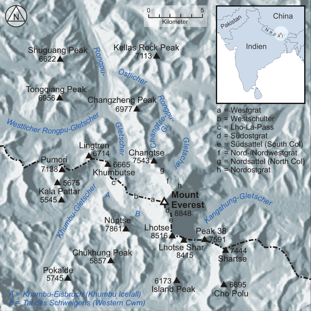
Pumori (, ) (or Pumo Ri) is a mountain on the Nepal–China border in the Mahalangur section of the Himalayas. Pumori lies just eight kilometres west of Mount Everest. Pumori, meaning "the Mountain Daughter" in Sherpa language, was named by George Mallory. "Pumo" means young girl or daughter and "Ri" means mountain in Sherpa language. Climbers sometimes refer to Pumori as "Everest's Daughter". Mallory also called it Clare Peak, after his daughter. Pumori is a popular climbing peak. The easiest route is graded class 3, although with significant avalanche danger. Pumori was first climbed on May 17, 1962, by Gerhard Lenser on a German-Swiss expedition. Two Czechs (Leopold Sulovský and Zdeněk Michalec) climbed a new route on the south face in the spring of 1996. An outlier of Pumori is Kala Patthar (), which appears as a brown bump below the south face of Pumori. Many trekkers going to see Mount Everest up close will attempt to climb to the top of Kala Patthar. Trekking and mou ... [...More Info...] [...Related Items...] OR: [Wikipedia] [Google] [Baidu] |
Lingtren
Lingtren (), , is a mountain in the Mahalangur Himal area of Himalaya, about distant in a direct line from Mount Everest. It lies on the international border between Nepal and the Tibet Autonomous Region of China and it was first climbed in 1935. A mountain nearby to the west was originally named Lingtrennup but is now more commonly called Xi Lingchain. Geography A long chain of mountains extends generally somewhat north of west from Mount Everest whose west ridge descends to the col of Lho La () before rising to Khumbutse (). The ridge drops to an unnamed col at and then ascends to Lingtren from where it continues to another unnamed col at and then to Pumori (). Bounded on the north by this chain of mountains is the Western Cwm in Nepal down which the Khumbu Glacier descends to the northwest over the Icefall before it turns sharply southwest. Lingtren lies at the apex of this right-angled bend. North of the mountain chain in Tibet the West Rongbuk Glacier flows east to ... [...More Info...] [...Related Items...] OR: [Wikipedia] [Google] [Baidu] |
Khangri Shar
Khangri Shar is a mountain in Nepal and China. Description Khangri Shar is a summit in the Khumbu region of the Himalayas on the China–Nepal border. It is situated west of Mount Everest and west of Pumori on the boundary that Sagarmatha National Park shares with Qomolangma National Nature Preserve. Precipitation runoff from the mountain's slopes drains south to the Dudh Koshi and north to the Rong River in Tibet, both of which are tributaries of the Arun River. Topographic relief is significant as the summit rises over 1,250 metres (4,100 ft) above the Khangri Glacier in less than . The mountain awaits a first ascent, as attempts in 2003 by a Japanese team, 2004 by British, 2018 by Swedish, and South Koreans in 2024 all failed to reach the summit. [...More Info...] [...Related Items...] OR: [Wikipedia] [Google] [Baidu] |
Kala Patthar
Kala Patthar () is a notable landmark located on the south ridge of Pumori in the Nepali Himalayas above Gorakshep. Although not a proper mountain, with a prominence of only , the ascent of Kala Patthar is very popular with trekkers in the region of Mount Everest since it provides the most accessible closeup view of Everest. Due to the structure of the Everest Massif, its high summit is blocked by Nuptse from much of the surrounding region. The views of Everest, Nuptse and Changtse are spectacular from Kala Patthar and there are glimpses of the northern flank and summit of Lhotse. The world's highest webcam, Mount Everest webcam, was located here. Kala Patthar is considered the highest altitude most will reach without a climbing permit, which must be obtained in Kathmandu, at the Nepal Mountaineering Association. Description The ascent of Kala Patthar begins at Gorakshep (), the original base camp for Mt. Everest. After a brief dip to an ancient lake bed (which now conta ... [...More Info...] [...Related Items...] OR: [Wikipedia] [Google] [Baidu] |
2015 Mount Everest Avalanches
In the afternoon of 25 April 2015, a April 2015 Nepal earthquake, MW 7.8 earthquake struck Nepal and surrounding countries. Tremors from the quake triggered an avalanche from Pumori into Everest Base Camp#South Base Camp in Nepal, Base Camp on Mount Everest. At least 22 people were killed, surpassing the toll of an 2014 Mount Everest avalanche, avalanche that occurred in 2014 as the deadliest disaster on the mountain. Avalanches Mount Everest was approximately east of the epicentre, and between 700 and 1,000 people were on or near the mountain when the earthquake struck, including 359 climbers at Base Camp, many of whom had returned after the 2014 Mount Everest avalanche, aborted 2014 season. The earthquake triggered several large avalanches on and around the mountain. One avalanche, originating on the nearby peak of Pumori, swept into Base Camp and blew many tents across the Khumbu Glacier towards the lower Icefall. No longer available An Indian Army mountaineering team reco ... [...More Info...] [...Related Items...] OR: [Wikipedia] [Google] [Baidu] |
Khumbutse
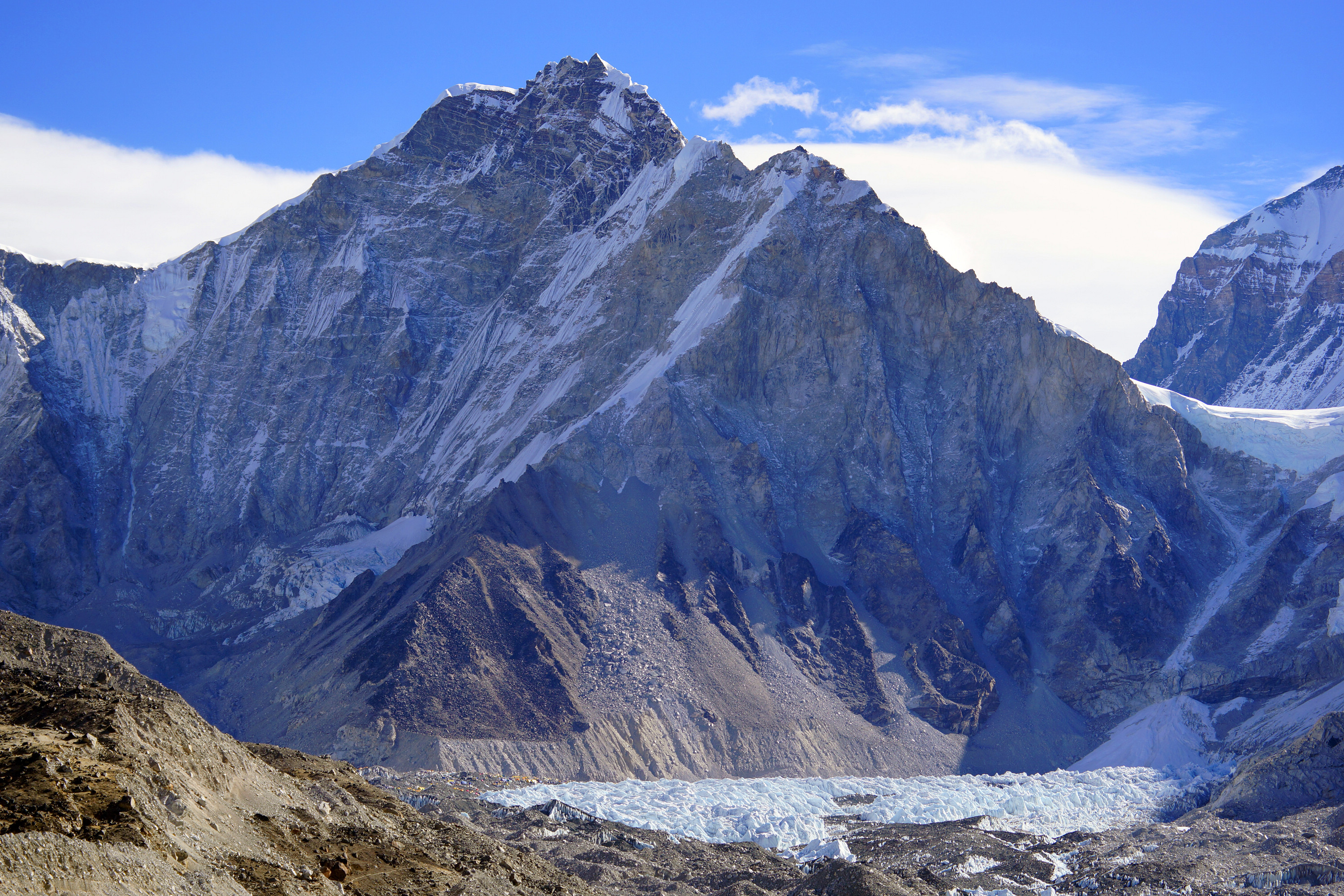
Khumbutse (; ; ) is the first mountain west (6 km) of Mount Everest. It lies at the border between Nepal and China. Overview Khumbutse's name indicates its location at the head of the Khumbu valley, down which the Khumbu Glacier flows. It is one of the prominent mountains above the southern Everest Base Camp, and is seen in many views from the nearby trekking routes, including at Gorak Shep. Gallery File:Pumori-Langtren-Khumbutse.jpg, File:Sagarmatha National Park-Gorak Shep to Pheriche 2013-05-06 08-05-31.jpg, Lingtren, Khumbutse, and Everest West Shoulder overlook base camp and the Khumbu Icefall. Mount Everest South-West face (above the west shoulder) and Nuptse's side to right File:Everest Base Camp.jpg, Left to right: Lingtren-Khumbutse - Everest west shoulder. See also * List of mountains in China * List of mountains in Nepal Most of Nepal is mountainous, and it contains a large section of the Himalayas, the highest mountain range in the world. Eight of the f ... [...More Info...] [...Related Items...] OR: [Wikipedia] [Google] [Baidu] |
Koshi Province
Koshi Province () is an autonomous Provinces of Nepal, province of Nepal adopted by the Constitution of Nepal on 20 September 2015. It covers an area of , about 17.5% of the country's total area. With the industrial city of Biratnagar as its capital, the province includes the towns of Birtamod, Sundar Haraincha, Damak, Dharan, Itahari, Triyuga Municipality and Mechinagar, and Mount Everest, Kangchenjunga and Ama Dablam. Koshi River, the largest river of the nation, forms the province's western boundary. Under the First-past-the-post voting system issued by the Constituency Delimitation Commission, Nepal, the province hosts 28 parliamentary seats and 56 provincial assembly seats. The province is bordered by the Tibet Autonomous Region of China to the north, the Indian states of Sikkim and West Bengal to the east, Bihar to the south, and Bagmati Province and Madhesh Province to the west. According to the 2021 Nepal census, there are around five million people in the province, with a ... [...More Info...] [...Related Items...] OR: [Wikipedia] [Google] [Baidu] |
Everest Base Camp
There are two Base camp#Shelter, base camps on Mount Everest, on opposite sides of the mountains: #South Base Camp in Nepal, South Base Camp is in Nepal at an altitude of (), while #North Base Camp in Tibet, North Base Camp is in Tibet at (). The base camps are rudimentary campsites at the base of Mount Everest that are used by mountain climbers during their ascent and descent. They are also visited by hikers. South Base Camp is used when climbing via the Mount Everest#Southeast ridge, southeast ridge, while North Base Camp is used when climbing via the Mount Everest#North ridge route, northeast ridge. Supplies are shipped to the South Base Camp by Porter (carrying), porters, and with the help of animals, usually yaks. The North Base Camp is accessed by a Everest road, paved road that branches from China National Highway 318. Climbers typically rest at base camp for several days for acclimatization, to reduce the risk of altitude sickness. South Base Camp in Nepal The Everest ... [...More Info...] [...Related Items...] OR: [Wikipedia] [Google] [Baidu] |
Mount Everest
Mount Everest (), known locally as Sagarmatha in Nepal and Qomolangma in Tibet, is Earth's highest mountain above sea level. It lies in the Mahalangur Himal sub-range of the Himalayas and marks part of the China–Nepal border at its summit. Its height was most recently measured in 2020 by Chinese and Nepali authorities as . Mount Everest attracts many climbers, including highly experienced mountaineers. There are two main climbing routes, one approaching the summit from the southeast in Nepal (known as the standard route) and the other from the north in Tibet. While not posing substantial technical climbing challenges on the standard route, Everest presents dangers such as altitude sickness, weather, and wind, as well as hazards from avalanches and the Khumbu Icefall. As of May 2024, 340 people have died on Everest. Over 200 bodies remain on the mountain and have not been removed due to the dangerous conditions. Climbers typically ascend only part of Mount Eve ... [...More Info...] [...Related Items...] OR: [Wikipedia] [Google] [Baidu] |
Ali Sadpara
Muhammad Ali Sadpara (; – ) was a Pakistani high-altitude mountaineer. He was part of the team (which included Italian alpinist Simone Moro and Spanish alpinist Alex Txikon) that completed the first winter ascent of Nanga Parbat in 2016. Throughout his career, Sadpara successfully climbed a total of eight eight-thousanders, four of which he ascended in a single calendar year. Early life Sadpara was born on 2 February 1976 in the village of Sadpara, located near Skardu in Gilgit−Baltistan, Pakistan. He was the youngest of eleven children, and eight of his siblings did not survive childhood. He married his wife, Fatima, when he was 19 and had his first son, Sajid, shortly afterwards; he had a total of three children. He completed his FA from a government college in Skardu and was a member of his college football team. He began his career as a high-altitude porter, serving as an assistant in mountain-climbing expeditions. Like most other porters, Sadpara traversed the Bal ... [...More Info...] [...Related Items...] OR: [Wikipedia] [Google] [Baidu] |
Mahalangur Himal
Mahālangūr Himāl (, ''Mahālaṅgūra himāla'') is a section of the Himalayas in northeast Nepal and south-central Tibet of China extending east from the pass Nangpa La between Rolwaling Himal and Cho Oyu, to the Arun River. It includes Mount Everest, Lhotse, Makalu, and Cho Oyu — four of Earth's six highest peaks. On the Tibetan side it is drained by the Rongbuk and Kangshung Glaciers and on the Nepali side by Barun, Ngojumba and Khumbu Glaciers and others. All are tributaries to the Koshi River via Arun River on the north and east or Dudh Kosi on the south. Mahalangur Himal can be divided into three subsections: *Makālu () nearest the Arun River and along the Nepal-China border including Makalu 8463 m, Chomo Lonzo 7790 m south of the Kama valley in Tibet, Kangchungtse or Makalu II 7678 m, Peak 7199 and some ten others over 6000 metres. *Barun (, ''Baruṇa'') inside Nepal and south of the Makālu section. It includes Chamlang 7319 m and ... [...More Info...] [...Related Items...] OR: [Wikipedia] [Google] [Baidu] |
Jim Bridwell
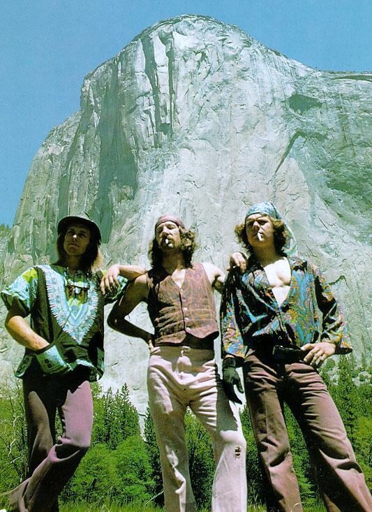
Jim Bridwell (July 29, 1944 – February 16, 2018) was an American rock climber and mountaineer, active from 1965 in Yosemite Valley, but later in Patagonia and Alaska. He was noted for pushing the standards of both aid climbing and big wall climbing, and later alpine climbing. He wrote numerous articles on climbing and developed several important pieces of aid climbing equipment. Bridwell was an apprentice to Royal Robbins and Warren Harding, and later the unofficial leader of the Stonemasters. Climbing career Bridwell is credited with over 100 first ascents (FA) in Yosemite Valley, in addition to conducting the first one-day ascent of '' The Nose'' on El Capitan on May 26, 1975, with John Long and Billy Westbay. He founded Yosemite National Park's Search and Rescue Team (YOSAR), spearheading many rescues. He was a leading force in the evolving techniques of aid climbing and an innovator and inventor of widely used and copied aid climbing equipment, including copperheads ... [...More Info...] [...Related Items...] OR: [Wikipedia] [Google] [Baidu] |
Mountains Of Koshi Province
A mountain is an elevated portion of the Earth's crust, generally with steep sides that show significant exposed bedrock. Although definitions vary, a mountain may differ from a plateau in having a limited summit area, and is usually higher than a hill, typically rising at least above the surrounding land. A few mountains are isolated summits, but most occur in mountain ranges. Mountains are formed through tectonic forces, erosion, or volcanism, which act on time scales of up to tens of millions of years. Once mountain building ceases, mountains are slowly leveled through the action of weathering, through slumping and other forms of mass wasting, as well as through erosion by rivers and glaciers. High elevations on mountains produce colder climates than at sea level at similar latitude. These colder climates strongly affect the ecosystems of mountains: different elevations have different plants and animals. Because of the less hospitable terrain and climate, mountains te ... [...More Info...] [...Related Items...] OR: [Wikipedia] [Google] [Baidu] |


