|
Prusik Peak
Prusik Peak is an granite summit located at the west end of The Temple in Chelan County of Washington state. Prusik Peak is part of The Enchantments within the Alpine Lakes Wilderness and is often the iconic photographic image of both areas. Prusik Peak belongs to the Stuart Range which is a subset of the Cascade Range. The toponym honors Dr. Karl Prusik (1896–1961) who was an Austrian mountaineer, known as the inventor of the prusik, a rope knot which happened to be used to gain access to the summit horn during the first ascent by Fred Beckey in 1948. Precipitation runoff drains into Icicle Creek which is a tributary of the Wenatchee River. Climate According to the Köppen climate classification system, Prusik Peak is located in an alpine climate zone. Weather fronts originating in the north Pacific Ocean travel east toward the Cascade Mountains. As fronts approach, they are forced upward by the peaks (orographic lift), causing them to drop their moisture in the fo ... [...More Info...] [...Related Items...] OR: [Wikipedia] [Google] [Baidu] |
The Temple (Washington)
The Temple is an granite mountain summit located in Chelan County of Washington state. The Temple is part of The Enchantments, set within the Alpine Lakes Wilderness. The Temple belongs to the Stuart Range which is a subset of the Cascade Range. The nearest higher peak is Enchantment Peak, to the west, and the nearest town is Leavenworth, to the northeast. The mountain hosts many granite spires with names like The High Priest, The Boxtop, Flake Tower, Comet Spire, Razorback Spire, The Meteor, The Professor, Lighthouse Tower, Black Pyramid, and the most recognizable Prusik Peak. The highest point of the mountain is called Mt. Temple. Precipitation runoff from the mountain drains into Snow Creek which is a tributary of Icicle Creek. Climate Weather fronts coming off the Pacific Ocean travel east toward the Cascade Mountains. As fronts approach, they are forced upward by the peaks of the Cascade Range, causing them to drop their moisture in the form of rain or snow ont ... [...More Info...] [...Related Items...] OR: [Wikipedia] [Google] [Baidu] |
Icicle Creek
Icicle Creek is a non navigable stream in the U.S. state of Washington (U.S. state), Washington. It originates at Josephine Lake near the crest of the Cascade Range and flows generally east to join the Wenatchee River near Leavenworth, Washington, Leavenworth. Icicle Creek's drainage basin is mountainous and mostly undeveloped land within the Wenatchee National Forest and the Alpine Lakes Wilderness. The final of the creek are moderately developed with scattered homes and pasture, a golf course, children's camp, a small housing development called Icicle Island Club, and the Leavenworth National Fish Hatchery. Some water is diverted from the creek for municipal use by the City of Leavenworth at Icicle Creek river mile 5.6. Near Leavenworth, the wheelchair-accessible Icicle Creek Nature Trail, a National Recreation Trail designated in 2005, runs along a historic creek channel. Icicle Creek's name comes from the Indian word ''na-sik-elt'', meaning narrow canyon. According to Albert ... [...More Info...] [...Related Items...] OR: [Wikipedia] [Google] [Baidu] |
Volcano
A volcano is commonly defined as a vent or fissure in the crust of a planetary-mass object, such as Earth, that allows hot lava, volcanic ash, and gases to escape from a magma chamber below the surface. On Earth, volcanoes are most often found where tectonic plates are diverging or converging, and because most of Earth's plate boundaries are underwater, most volcanoes are found underwater. For example, a mid-ocean ridge, such as the Mid-Atlantic Ridge, has volcanoes caused by divergent tectonic plates whereas the Pacific Ring of Fire has volcanoes caused by convergent tectonic plates. Volcanoes resulting from divergent tectonic activity are usually non-explosive whereas those resulting from convergent tectonic activity cause violent eruptions."Mid-ocean ridge tectonics, volcanism and geomorphology." Geology 26, no. 455 (2001): 458. https://macdonald.faculty.geol.ucsb.edu/papers/Macdonald%20Mid-Ocean%20Ridge%20Tectonics.pdf Volcanoes can also form where there is str ... [...More Info...] [...Related Items...] OR: [Wikipedia] [Google] [Baidu] |
Eocene
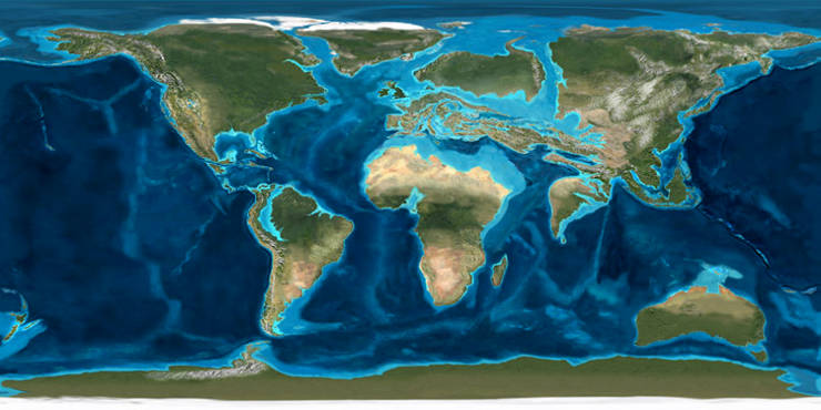
The Eocene ( ) is a geological epoch (geology), epoch that lasted from about 56 to 33.9 million years ago (Ma). It is the second epoch of the Paleogene Period (geology), Period in the modern Cenozoic Era (geology), Era. The name ''Eocene'' comes from the Ancient Greek (''Ēṓs'', 'Eos, Dawn') and (''kainós'', "new") and refers to the "dawn" of modern ('new') fauna that appeared during the epoch.See: *Letter from William Whewell to Charles Lyell dated 31 January 1831 in: * From p. 55: "The period next antecedent we shall call Eocene, from ήως, aurora, and χαινος, recens, because the extremely small proportion of living species contained in these strata, indicates what may be considered the first commencement, or ''dawn'', of the existing state of the animate creation." The Eocene spans the time from the end of the Paleocene Epoch to the beginning of the Oligocene Epoch. The start of the Eocene is marked by a brief period in which the concentration of the carbon isoto ... [...More Info...] [...Related Items...] OR: [Wikipedia] [Google] [Baidu] |
Glacial Valley
U-shaped valleys, also called trough valleys or glacial troughs, are formed by the process of glaciation. They are characteristic of mountain glaciation in particular. They have a characteristic U shape in cross-section, with steep, straight sides and a flat or rounded bottom (by contrast, valleys carved by rivers tend to be V-shaped in cross-section). Glaciated valleys are formed when a glacier travels across and down a slope, carving the valley by the action of scouring. When the ice recedes or thaws, the valley remains, often littered with small boulders that were transported within the ice, called glacial till or glacial erratic. Examples of U-shaped valleys are found in mountainous regions throughout the world including the Andes, Alps, Caucasus Mountains, Himalaya, Rocky Mountains, New Zealand and the Scandinavian Mountains. They are found also in other major European mountains including the Carpathian Mountains, the Pyrenees, the Rila and Pirin mountains in Bulgari ... [...More Info...] [...Related Items...] OR: [Wikipedia] [Google] [Baidu] |
Avalanche
An avalanche is a rapid flow of snow down a Grade (slope), slope, such as a hill or mountain. Avalanches can be triggered spontaneously, by factors such as increased precipitation or snowpack weakening, or by external means such as humans, other animals, and earthquakes. Primarily composed of flowing snow and air, large avalanches have the capability to capture and move ice, rocks, and trees. Avalanches occur in two general forms, or combinations thereof: slab avalanches made of tightly packed snow, triggered by a collapse of an underlying weak snow layer, and loose snow avalanches made of looser snow. After being set off, avalanches usually accelerate rapidly and grow in mass and volume as they capture more snow. If an avalanche moves fast enough, some of the snow may mix with the air, forming a powder snow avalanche. Though they appear to share similarities, avalanches are distinct from slush flows, Mudflow, mudslides, Landslide#Debris landslide, rock slides, and serac collap ... [...More Info...] [...Related Items...] OR: [Wikipedia] [Google] [Baidu] |
Oceanic Climate
An oceanic climate, also known as a marine climate or maritime climate, is the temperate climate sub-type in Köppen climate classification, Köppen classification represented as ''Cfb'', typical of west coasts in higher middle latitudes of continents, generally featuring cool to warm summers and cool to mild winters (for their latitude), with a relatively narrow annual temperature range and few extremes of temperature. Oceanic climates can be found in both hemispheres generally between 40 and 60 degrees latitude, with subpolar versions extending to 70 degrees latitude in some coastal areas. Other varieties of climates usually classified together with these include subtropical highland climates, represented as ''Cwb'' or ''Cfb'', and subpolar oceanic or cold subtropical highland climates, represented as ''Cfc'' or ''Cwc''. Subtropical highland climates occur in some mountainous parts of the subtropics or tropics, some of which have monsoon influence, while their cold variants an ... [...More Info...] [...Related Items...] OR: [Wikipedia] [Google] [Baidu] |
Orographic Lift
Orographic lift occurs when an air mass is forced from a low elevation to a higher elevation as it moves over rising terrain. As the air mass gains altitude it quickly cools down adiabatically, which can raise the relative humidity to 100% and create clouds and, under the right conditions, precipitation. Orographic lifting can have a number of effects, including precipitation, rain shadowing, leeward winds, and associated clouds. Precipitation Precipitation induced by orographic lift occurs in many places throughout the world. Examples include: * The Mogollon Rim in central Arizona * The western slope of the Sierra Nevada range in California. * The western slope of the Wasatch Range in Utah. Specifically the Little and Big Cottonwood Canyons. * The mountains near Baja California North – specifically La Bocana to Laguna Hanson. * The windward slopes of Khasi and Jayantia Hills (see Mawsynram) in the state of Meghalaya in India. * The Western Highlands of Yemen, which rece ... [...More Info...] [...Related Items...] OR: [Wikipedia] [Google] [Baidu] |
Cascade Mountains
The Cascade Range or Cascades is a major mountain range of western North America, extending from southern British Columbia through Washington and Oregon to Northern California. It includes both non-volcanic mountains, such as many of those in the North Cascades, and the notable volcanoes known as the High Cascades. The small part of the range in British Columbia is referred to as the Canadian Cascades or, locally, as the Cascade Mountains. The highest peak in the range is Mount Rainier in Washington at . part of the Pacific Ocean's Ring of Fire, the ring of volcanoes and associated mountains around the Pacific Ocean. All of the eruptions in the contiguous United States over the last 200 years have been from the Cascade Volcanoes. The two most recent were Lassen Peak from 1914 to 1921 and a major eruption of Mount St. Helens in 1980. Minor eruptions of Mount St. Helens have also occurred since, most recently from 2004 to 2008. The Cascade Range is a part of the American Cordil ... [...More Info...] [...Related Items...] OR: [Wikipedia] [Google] [Baidu] |
Weather Front
A weather front is a boundary separating air masses for which several characteristics differ, such as air density, wind, temperature, and humidity. Disturbed and unstable weather due to these differences often arises along the boundary. For instance, cold fronts can bring bands of thunderstorms and cumulonimbus precipitation or be preceded by squall lines, while warm fronts are usually preceded by stratiform precipitation and fog. In summer, subtler humidity gradients known as dry lines can trigger severe weather. Some fronts produce no precipitation and little cloudiness, although there is invariably a wind shift. Cold fronts generally move from west to east, whereas warm fronts move poleward, although any direction is possible. Occluded fronts are a hybrid merge of the two, and stationary fronts are stalled in their motion. Cold fronts and cold occlusions move faster than warm fronts and warm occlusions because the dense air behind them can lift as well as push the warme ... [...More Info...] [...Related Items...] OR: [Wikipedia] [Google] [Baidu] |


