|
Prunus Maximowiczii
''Prunus maximowiczii'', known as Korean cherry, Korean mountain cherry, or Miyama cherry, is a small (about 7.5 m), fruiting cherry tree that can be found growing wild in northeastern Asia and Eurasia. Taxonomy The species was first described in 1857 by Franz Josef Ruprecht. It was treated in the genus ''Cerasus'' (now generally accepted as a subgenus of ''Prunus'') by Vladimir Leontyevich Komarov in 1927, but the original ''P. maximowiczii'' remains the widely accepted binomial. Description ''P. maximowiczii'' has white, insect-pollinated, hermaphroditic flowers, blooming in May in the Northern Hemisphere, November in the Southern Hemisphere. The edible fruits (cherries) are about 5 mm in diameter, containing one large seed each. They ripen in August in the Northern Hemisphere, February in the Southern Hemisphere. Range and habitat Korea, China ( Heilong Jiang, Jilin, Liaoning, and Zhejiang), Russia (Khabarovsk, Primorye, and Sakhalin), and Japan (Hokkaido, ... [...More Info...] [...Related Items...] OR: [Wikipedia] [Google] [Baidu] |
Morton Arboretum
The Morton Arboretum, in Lisle, Illinois, United States, is a public garden and outdoor museum with a library, herbarium, and program in tree research including the Center for Tree Science. Its grounds, covering 1,700 acres (6.9 square kilometres), include cataloged collections of trees and other living plants, gardens, and restored areas, among which is a restored tallgrass prairie. The living collections include more than 4,100 different plant species. There are more than 200,000 cataloged plants. As a place of recreation, the Arboretum has hiking trails, roadways for driving and bicycling, a interactive children's garden and a maze. The Schulenberg Prairie at the Arboretum was one of the earliest prairie restoration projects in the Midwest, begun in 1962. It is one of the largest Prairie restoration, restored prairies in the Chicago suburban area. Three dozen cuttings from the old bur oak, burr oak that had been in Lincoln Park Zoo will be grafted onto rootstocks at the Ar ... [...More Info...] [...Related Items...] OR: [Wikipedia] [Google] [Baidu] |
Fruit
In botany, a fruit is the seed-bearing structure in flowering plants (angiosperms) that is formed from the ovary after flowering. Fruits are the means by which angiosperms disseminate their seeds. Edible fruits in particular have long propagated using the movements of humans and other animals in a symbiotic relationship that is the means for seed dispersal for the one group and nutrition for the other; humans, and many other animals, have become dependent on fruits as a source of food. Consequently, fruits account for a substantial fraction of the world's agricultural output, and some (such as the apple and the pomegranate) have acquired extensive cultural and symbolic meanings. In common language and culinary usage, ''fruit'' normally means the seed-associated fleshy structures (or produce) of plants that typically are sweet (or sour) and edible in the raw state, such as apples, bananas, grapes, lemons, oranges, and strawberries. In botanical usage, the term ''fruit'' als ... [...More Info...] [...Related Items...] OR: [Wikipedia] [Google] [Baidu] |
Hokkaido
is the list of islands of Japan by area, second-largest island of Japan and comprises the largest and northernmost prefectures of Japan, prefecture, making up its own list of regions of Japan, region. The Tsugaru Strait separates Hokkaidō from Honshu; the two islands are connected by railway via the Seikan Tunnel. The largest city on Hokkaido is its capital, Sapporo, which is also its only cities designated by government ordinance of Japan, ordinance-designated city. Sakhalin lies about to the north of Hokkaidō, and to the east and northeast are the Kuril Islands, which are administered by Russia, though the four most southerly are Kuril Islands dispute, claimed by Japan. The position of the island on the northern end of the archipelago results in a colder climate, with the island seeing significant snowfall each winter. Despite the harsher climate, it serves as an agricultural breadbasket for many crops. Hokkaido was formerly known as ''Ezo'', ''Yezo'', ''Yeso'', or ''Yes ... [...More Info...] [...Related Items...] OR: [Wikipedia] [Google] [Baidu] |
Japan
Japan is an island country in East Asia. Located in the Pacific Ocean off the northeast coast of the Asia, Asian mainland, it is bordered on the west by the Sea of Japan and extends from the Sea of Okhotsk in the north to the East China Sea in the south. The Japanese archipelago consists of four major islands—Hokkaido, Honshu, Shikoku, and Kyushu—and List of islands of Japan, thousands of smaller islands, covering . Japan has a population of over 123 million as of 2025, making it the List of countries and dependencies by population, eleventh-most populous country. The capital of Japan and List of cities in Japan, its largest city is Tokyo; the Greater Tokyo Area is the List of largest cities, largest metropolitan area in the world, with more than 37 million inhabitants as of 2024. Japan is divided into 47 Prefectures of Japan, administrative prefectures and List of regions of Japan, eight traditional regions. About three-quarters of Geography of Japan, the countr ... [...More Info...] [...Related Items...] OR: [Wikipedia] [Google] [Baidu] |
Sakhalin
Sakhalin ( rus, Сахали́н, p=səxɐˈlʲin) is an island in Northeast Asia. Its north coast lies off the southeastern coast of Khabarovsk Krai in Russia, while its southern tip lies north of the Japanese island of Hokkaido. An island of the West Pacific, Sakhalin divides the Sea of Okhotsk to its east from the Sea of Japan to its southwest. It is administered as part of Sakhalin Oblast and is the largest island of Russia, with an area of . The island has a population of roughly 500,000, the majority of whom are Russians. The indigenous peoples of the island are the Ainu, Oroks, and Nivkhs, who are now present in very small numbers. The island's name is derived from the Manchu word ''Sahaliyan'' (), which was the name of the Qing dynasty city of Aigun. The Ainu people of Sakhalin paid tribute to the Yuan, Ming, and Qing dynasties and accepted official appointments from them. Sometimes the relationship was forced but control from dynasties in China was loose ... [...More Info...] [...Related Items...] OR: [Wikipedia] [Google] [Baidu] |
Primorsky Krai
Primorsky Krai, informally known as Primorye, is a federal subjects of Russia, federal subject (a krais of Russia, krai) of Russia, part of the Far Eastern Federal District in the Russian Far East. The types of inhabited localities in Russia, city of Vladivostok on the southern coast of the krai is its administrative center, and the second largest city in the Russian Far East, behind Khabarovsk in the neighbouring Khabarovsk Krai. Primorsky Krai has the largest economy among the federal subjects in the Russian Far East, and a list of federal subjects of Russia by population, population of 1,845,165 as of the Russian Census (2021), 2021 Census. The krai has Russia's only North Korea–Russia border, border with North Korea, along the Tumen River in Khasansky District in the southwestern corner of the krai. Peter the Great Gulf, the largest gulf in the Sea of Japan, is on the south coast. The territory of the krai was historically part of Manchuria. It was Convention of Pek ... [...More Info...] [...Related Items...] OR: [Wikipedia] [Google] [Baidu] |
Khabarovsk Krai
Khabarovsk Krai (, ) is a federal subjects of Russia, federal subject (a krai) of Russia. It is located in the Russian Far East and is administratively part of the Far Eastern Federal District. The administrative centre of the krai is the types of inhabited localities in Russia, city of Khabarovsk, which is home to roughly half of the krai's population and the largest city in the Russian Far East (just ahead of Vladivostok). Khabarovsk Krai is the fourth-largest federal subject by area, and had a population of 1,343,869 as of 2010. Being dominated by the Siberian High winter cold, the continental climates of the krai see extreme freezing for an area adjacent to the sea near the mid-latitudes, but also warm summers in the interior. The southern region lies mostly in the drainage basin, basin of the lower Amur River, with the River mouth, mouth of the river located at Nikolaevsk-on-Amur draining into the Strait of Tartary, which separates Khabarovsk Krai from the island of Sakha ... [...More Info...] [...Related Items...] OR: [Wikipedia] [Google] [Baidu] |
Russia
Russia, or the Russian Federation, is a country spanning Eastern Europe and North Asia. It is the list of countries and dependencies by area, largest country in the world, and extends across Time in Russia, eleven time zones, sharing Borders of Russia, land borders with fourteen countries. Russia is the List of European countries by population, most populous country in Europe and the List of countries and dependencies by population, ninth-most populous country in the world. It is a Urbanization by sovereign state, highly urbanised country, with sixteen of its urban areas having more than 1 million inhabitants. Moscow, the List of metropolitan areas in Europe, most populous metropolitan area in Europe, is the capital and List of cities and towns in Russia by population, largest city of Russia, while Saint Petersburg is its second-largest city and Society and culture in Saint Petersburg, cultural centre. Human settlement on the territory of modern Russia dates back to the ... [...More Info...] [...Related Items...] OR: [Wikipedia] [Google] [Baidu] |
Zhejiang
) , translit_lang1_type2 = , translit_lang1_info2 = ( Hangzhounese) ( Ningbonese) (Wenzhounese) , image_skyline = 玉甑峰全貌 - panoramio.jpg , image_caption = View of the Yandang Mountains , image_map = Zhejiang in China (+all claims hatched).svg , mapsize = 275px , map_caption = Location of Zhejiang in China , coordinates = , subdivision_type = Country , subdivision_name = China , named_for = Old name of Qiantang River , seat_type = Capital and largest city , seat = Hangzhou , established_title = Annexation by the Qin dynasty , established_date = 222 BC , established_title2 = Jiangnandong Circuit , established_date2 = 626 , established_title3 = Liangzhe Circuit , established_date3 = 997 , established_title4 = Zhejiang Province formed , established_date4 = 1368 , established_title5 = Republican Period , established_date5 = 1 January 1912 , established_title6 ... [...More Info...] [...Related Items...] OR: [Wikipedia] [Google] [Baidu] |
Liaoning
) , image_skyline = , image_alt = , image_caption = Clockwise: Mukden Palace in Shenyang, Xinghai Square in Dalian, Dalian coast, Yalu River at Dandong , image_map = Liaoning in China (+all claims hatched).svg , mapsize = 275px , map_alt = Map showing the location of Liaoning Province , map_caption = Map showing the location of Liaoning Province , coordinates = , subdivision_type = Country , subdivision_name = China , named_for = —"Liao River, Liao (River)" —"pacification" "Pacified of the Liao (River)" , seat_type = Capital , seat = Shenyang , seat1_type = , seat1 = , parts_type = Divisions , parts_style = para , p1 = 14 Prefectures of China, prefectures , p2 = 100 Counties of China, counties , p3 = 1511 Townships of China, townships , government_type = Provinces of ... [...More Info...] [...Related Items...] OR: [Wikipedia] [Google] [Baidu] |
Jilin
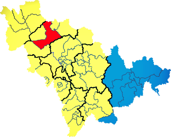
) , image_skyline = Changbaishan Tianchi from western rim.jpg , image_alt = , image_caption = View of Heaven Lake , image_map = Jilin in China (+all claims hatched).svg , mapsize = 275px , map_alt = Map showing the location of Jilin Province , map_caption = Map showing the location of Jilin Province , coordinates = , subdivision_type = Country , subdivision_name = China , named_for = from ''girin ula'', a Manchu language, Manchu phrase meaning "along the river" , seat_type = Capital , seat = , seat1_type = , seat1 = , parts_type = Divisions , parts_style = para , p1 = 9 Prefectures of China, prefectures , p2 = 60 Counties of China, counties , p3 = 1006 Townships of China, townships , government_type = Provinces of China, Province , governing_body = Jilin Provinci ... [...More Info...] [...Related Items...] OR: [Wikipedia] [Google] [Baidu] |
Heilong Jiang
The Amur River () or Heilong River ( zh, s=黑龙江) is a perennial river in Northeast Asia, forming the natural border between the Russian Far East and Northeast China (historically the Outer and Inner Manchuria). The Amur ''proper'' is long, and has a drainage basin of .Амур (река в Азии) If including its main stem , the Argun, the Amu ... [...More Info...] [...Related Items...] OR: [Wikipedia] [Google] [Baidu] |


