|
Provinces Of Libya
The Provinces of Libya were prescribed in 1934, during the last period of colonial Italian Libya, and continued through post-independence Libya until 1963 when the Governorates system was instituted. The three main provinces of the country follow the original colonial divisions of Italian Libya: Tripolitania province, Cyrenaica province and Fezzan province. Italian colonial era After Italy took the area from the Ottoman Empire in 1912, it was administered as a single administrative unit, called Italian North Africa. Then, from 1927 to 1934, the territory was split into two separate colonies, each of which run by its own Italian governor: Italian Cyrenaica and Italian Tripolitania. In 1934, Italy adopted the name "Libya" (Italian Libya) as the official name of the reunified area and administratively divided it up into the three provinces of Cyrenaica, Tripolitania and Fezzan. In 1937, the Cyrenaica and Tripolitania provinces split, with northern Cyrenaica becoming Benghazi Pro ... [...More Info...] [...Related Items...] OR: [Wikipedia] [Google] [Baidu] |
Map Of Traditional Provinces Of Libye-en
A map is a symbolic depiction of interrelationships, commonly spatial, between things within a space. A map may be annotated with text and graphics. Like any graphic, a map may be fixed to paper or other durable media, or may be displayed on a transitory medium such as a computer screen. Some maps change interactively. Although maps are commonly used to depict geographic elements, they may represent any space, real or fictional. The subject being mapped may be two-dimensional such as Earth's surface, three-dimensional such as Earth's interior, or from an abstract space of any dimension. Maps of geographic territory have a very long tradition and have existed from ancient times. The word "map" comes from the , wherein ''mappa'' meant 'napkin' or 'cloth' and ''mundi'' 'of the world'. Thus, "map" became a shortened term referring to a flat representation of Earth's surface. History Maps have been one of the most important human inventions for millennia, allowing humans t ... [...More Info...] [...Related Items...] OR: [Wikipedia] [Google] [Baidu] |
Tripoli Province
Tripoli Province (''Provincia di Tripoli'' in Italian) was one of the provinces of Libya under Italian rule. It was established in 1937, with the official name: ''Commissariato Generale Provinciale di Tripoli''. It lasted until 1947. Characteristics The "Provincia di Tripoli" was located in northern Italian Libya, next to Tunisia. Its administrative center was the city of Tripoli on the Mediterranean coast and was administratively divided in 6 sections (called "Circondari" in Italian): *Tripoli * Zauia * Sugh el Giumaa * Zuara *Nalut * Garian The province experienced a huge economic growth in the late 1930s, with a great urban development of Tripoli while Italian colonists cultivated lands (that had returned to native desert for many centuries) and improved Italian Libya's agriculture to international standards. This was accomplished even with the creation of new farm villages. Most of the population was Muslim, but there was a growing community of Catholics due to the Italian ... [...More Info...] [...Related Items...] OR: [Wikipedia] [Google] [Baidu] |
Aouzou Strip
The Aouzou Strip (; , ) is a strip of land in northern Chad that lies along the Chad–Libya border, border with Libya, extending south to a depth of about 100 kilometers into Chad's Borkou, Ennedi Ouest, Ennedi Est, and Tibesti regions for an area of 114,000 km2. It is named after the small town and oasis of Aouzou, Chad, Aouzou. The strip played a significant role in the Chadian–Libyan War when it was claimed by Libya. Inclusion in Italian Libya The Aouzou strip was defined for the first time in the discussions between France and Italy after World War I, in relation to an award to Italy for the victory in that war. At the Paris Peace Conference (1919–1920), the Kingdom of Italy did not receive any of the German Empire, German colonies, but instead was given the Oltre Giuba from the United Kingdom of Great Britain and Ireland, United Kingdom, and French Third Republic, France agreed to give some Saharan territories to Italian Libya. After many discussions during the 1 ... [...More Info...] [...Related Items...] OR: [Wikipedia] [Google] [Baidu] |
El Tag
El Tag (; also ''Al-Tag'', ''Al-Taj'') is a village and holy site in the Kufra Oasis, within the Libyan Desert subregion of the Sahara. It is in the Kufra District in the southern Cyrenaica region of southeastern Libya. The Arabic ''el tag'' translates as "crown" in English, and derives from the site's position above the Kufra basin.Bertarelli (1929), p. 515. El Tag, being on a rise, is without an oasis spring and native date palm habitat. Senussi El-Tag was founded in 1895 by Muhammad El-Mahdi es-Senussi (1844–1902), after the Ottomans forced him and the Senussi Order from Jaghbub in the Cyrenaican desert to Kufra. He was the son of the founder and the supreme leader (1859-1902) of the Order. El-Mahdi founded a Zaouia (''madrassa''—school) with a mosque with a low octagonal minaret tower here. He also built several tombs of the Senussi family here, which later included his own, therefore making El-Tag a Senussi holy place. Italians and World War II During the colonial Ital ... [...More Info...] [...Related Items...] OR: [Wikipedia] [Google] [Baidu] |
Libyan Desert
The Libyan Desert (not to be confused with the Libyan Sahara) is a geographical region filling the northeastern Sahara Desert, from eastern Libya to the Western Desert (Egypt), Western Desert of Egypt and far northwestern Sudan. On medieval maps, its use predates today's Sahara, and parts of the Libyan Desert include the Sahara's most arid and least populated regions; this is chiefly what sets the Libyan Desert apart from the greater Sahara. The consequent absence of grazing, and near absence of waterholes or wells needed to sustain camel caravans, prevented Trans-Saharan trade between Kharga (the Darb al Arbein) close to the Nile, and Murzuk in the Libyan Fezzan. This obscurity saw the region overlooked by early European explorers, and it was not until the early 20th century and the advent of the motor car before the Libyan Desert started to be fully explored. Nomenclature The term ''Libyan Desert'' began to appear widely on European maps in the last decades of the 19th centu ... [...More Info...] [...Related Items...] OR: [Wikipedia] [Google] [Baidu] |
Kufra
Kufra () is a basinBertarelli (1929), p. 514. and oasis group in the Kufra District of southeastern Cyrenaica in Libya. At the end of the 19th century, Kufra became the centre and holy place of the Senussi order. It also played a minor role in the Western Desert Campaign of World War II. It is located in a particularly isolated area, not only because it is in the middle of the Sahara Desert but also because it is surrounded on three sides by depressions which make it dominate the passage of the east-west land traffic across the desert. For the colonial Italians, it was also important as a station on the north-south air route to Italian East Africa. These factors, along with Kufra's dominance of the southeastern Cyrenaica region of Libya, highlight the strategic importance of the oasis and why it was a point of conflict during World War II. Etymology The folk etymology associates the word "Kufra" as coming from the Arabic ''word kafir'' (كافر), meaning "disbeliever" or " ... [...More Info...] [...Related Items...] OR: [Wikipedia] [Google] [Baidu] |
Senussi
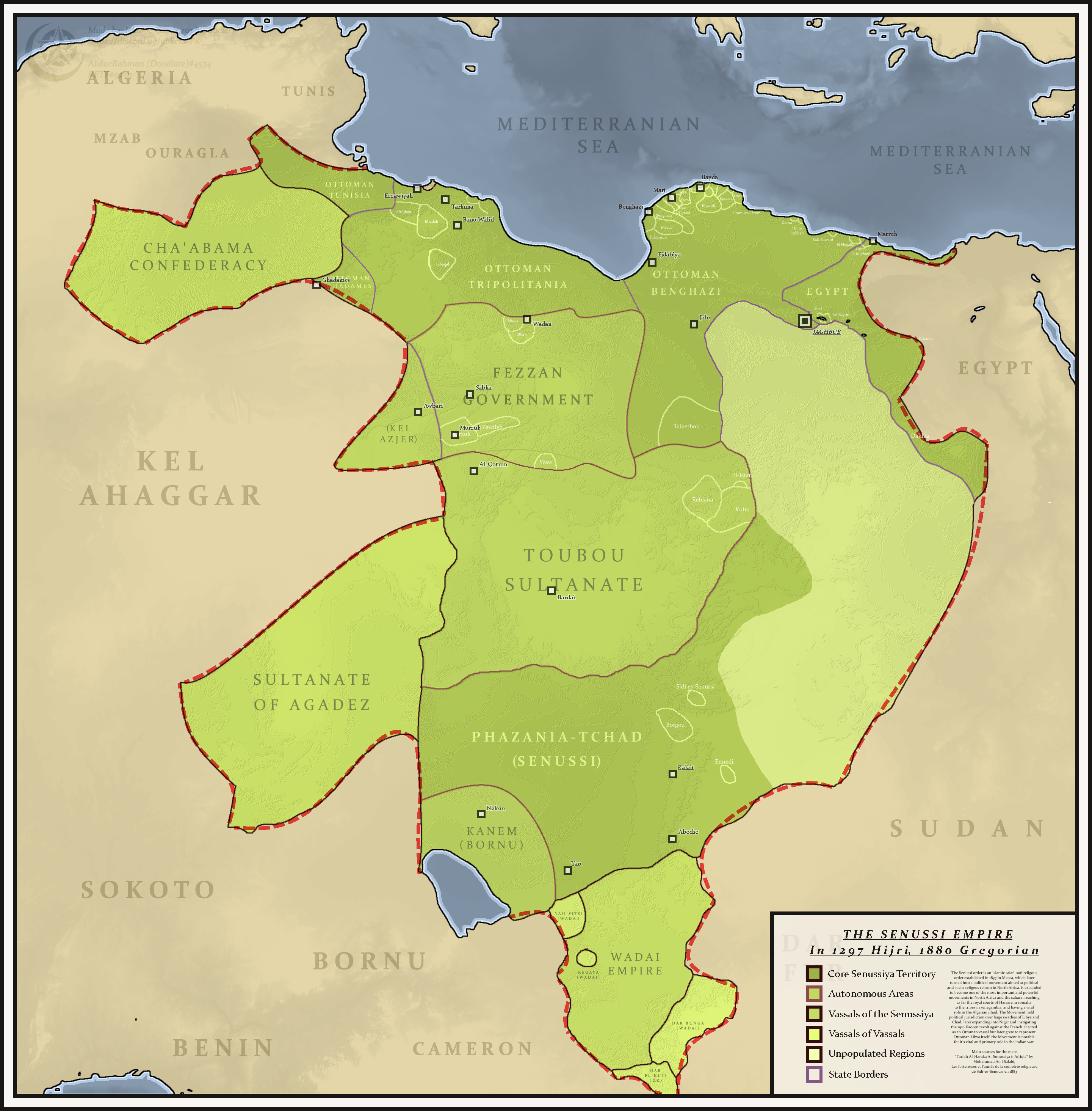
The Senusiyya, Senussi or Sanusi () are a Muslim political-religious Sufi order and clan in Libya and surrounding regions founded in Mecca in 1837 by the Grand Sanussi ( ''as-Sanūssiyy al-Kabīr''), the Algerian Muhammad ibn Ali al-Sanusi. During World War I the Senussis fought against both Italy and Britain. During World War II, the Senussis provided support to the British Eighth Army in North Africa against Nazi and Fascist Italian forces. The Grand Senussi's grandson became King Idris I of Libya in 1951. The 1969 Libyan revolution led by Muammar Gaddafi overthrew him, ending the Libyan monarchy. The movement remained active despite sustained persecution by Gaddafi's government. The Senussi spirit and legacy continue to be prominent in today's Libya, mostly in Cyrenaica. History Beginnings: 1787–1859 The Senussi order has been historically closed to Europeans and outsiders, leading reports of their beliefs and practices to vary immensely. Though it is possible to ga ... [...More Info...] [...Related Items...] OR: [Wikipedia] [Google] [Baidu] |
Hun, Libya
Hun or Houn () () is an oasis town in the northern Fezzan region of southwest Libya. The town is the capital of the Jufra District. The "International Autumn Tourism Festival" is an annual festival usually held at the end of September. History During the colonial Italian Libya period, Hun was the administrative capital of the Italian Fezzan region, called '' Territorio del Sahara Libico''. Hun was the Italian military center of southern Italian Libya, and was not part of the national Fourth Shore territory of the Kingdom of Italy as Italian Tripolitania and Italian Cyrenaica. In the 1939 census Italians were 3% of the total population of 35,316 in the city. They disappeared from Hun after Italy's loss of Libya in World War II. An important Libyan Italian born in Hun was the internationally renowned painter Mario Schifano (1934–1998). In the 1930s the Italian government made some important improvements to the small town, including a connection to the coast via the new Fezz ... [...More Info...] [...Related Items...] OR: [Wikipedia] [Google] [Baidu] |
Murzuk
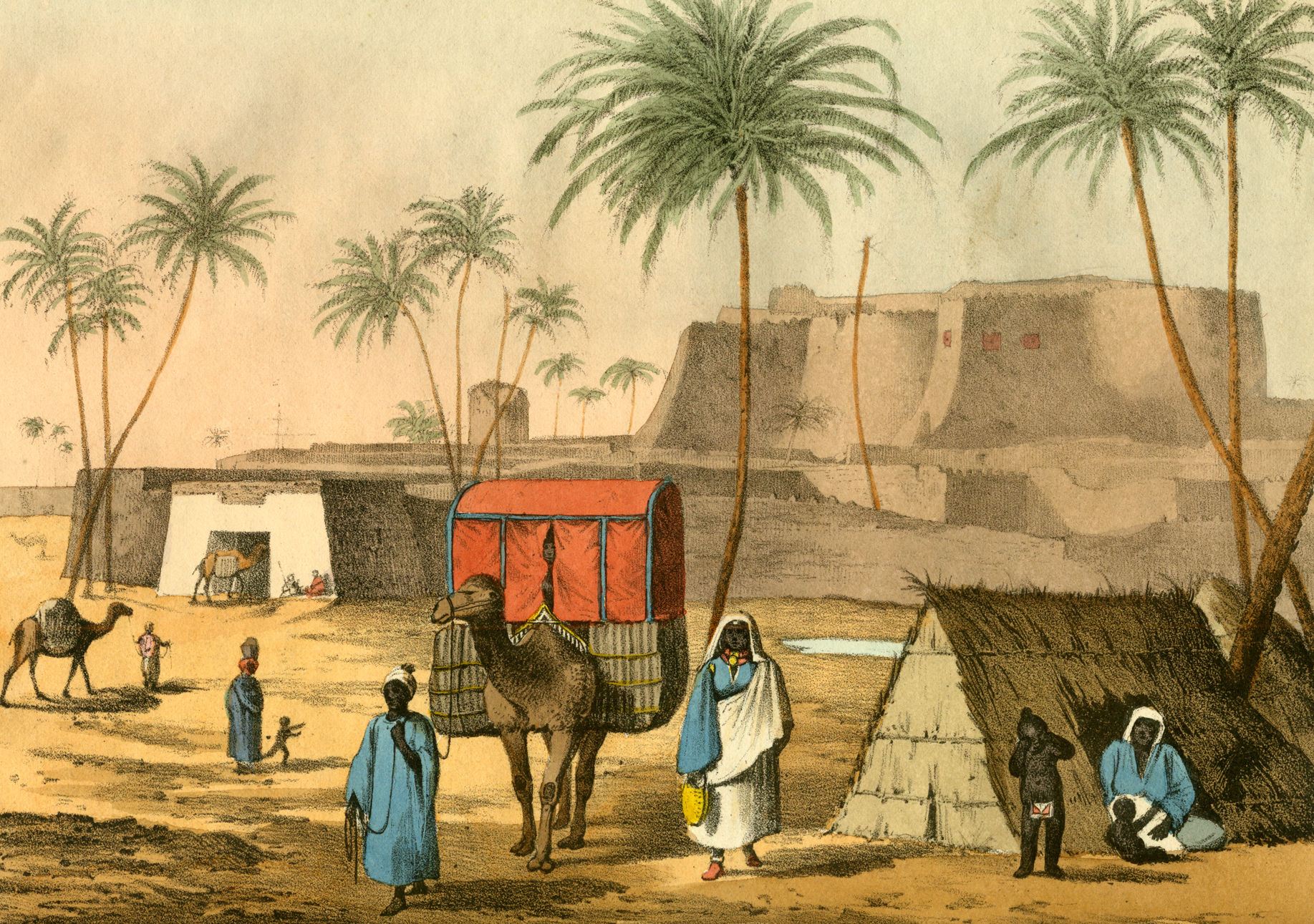
Murzuk, Murzuq, Murzug or Merzug () is an oasis town and the capital of the Murzuq District in the Fezzan region of southwest Libya.Robinson, Harry (1960) "Murzuq" ''The Mediterranean Lands'' University Tutorial Press, London, p. 414 It lies on the northern edge of the Murzuq Desert, an extremely arid region of ergs or great sand dunes which is part of the greater Sahara Desert. History Murzuk developed around an oasis which served as a stop on the north-south trade route across the Sahara Desert. From the 5th century BC to the 5th century AD, Marzuk was home to the Garamantian Empire, a city state which operated the Trans-Saharan trade routes between the Carthaginians—and later the Roman Empire—and the Sahelian states of West and Central Africa. By 1300, the area was ruled by the Arab Banu Sulaym tribe. According to Helmuth Kanter, a Moroccan tribe overran the area in 1310 and established Murzuk as the capital of their sultanate. The fortress, now in ruins, was built aroun ... [...More Info...] [...Related Items...] OR: [Wikipedia] [Google] [Baidu] |
Brak, Libya
Brak (sometimes written Biraq or Birak () is a town in the Wadi al Shatii District in west-central Libya. It is the administrative center of the district. Overview The town has a population of 39,444 () and is home to a technical college of Sabha University. Much of the new development in the town is occurring to the north of the old town center, which features gardens and forts from the Italian and Ottoman eras. The technical college "Faculty of Engineering and Technology", now a college of Sebha University, was previously known as the "Higher Institute of Technology", and it is this college that gives much value to the town, as it is a well-known research and academic organization. The college comprises ten distinct departments; six of which are specialized in the engineering arm of the college, namely: *Department of Electronic & Electrical Engineering *Department of Civil Engineering *Department of Petroleum Engineering *Department of Chemistry and materials science *Departme ... [...More Info...] [...Related Items...] OR: [Wikipedia] [Google] [Baidu] |
Ghat, Libya
Ghat () is the capital of the Ghat District in the Fezzan region of southwestern Libya, located just east of the Algerian Algeria–Libya border, border. History In historical times, Ghat was an important terminal point on a trans-Saharan trade route and a major administrative center in the Fezzan. It was a stronghold for the Kel Ajjer Tuareg people, Tuareg federation whose territory covered most of south-western Libya—including Ubari, Sabha, Libya, Sabha and Ghadames, plus south-eastern Algeria (Djanet and Illizi). From the 5th century BC to the 5th century AD, the Fezzan was home to the Garamantian Empire, a city state which operated the Trans-Saharan trade routes between the Carthaginians—and later the Roman Empire—and the Sahelian states of West Africa, West and Central Africa. During the 13th and 14th centuries, portions of the Fezzan were part of the Kanem Empire, while the Ottoman Empire, Ottoman rulers of North Africa asserted their control over the region ... [...More Info...] [...Related Items...] OR: [Wikipedia] [Google] [Baidu] |
Oasis
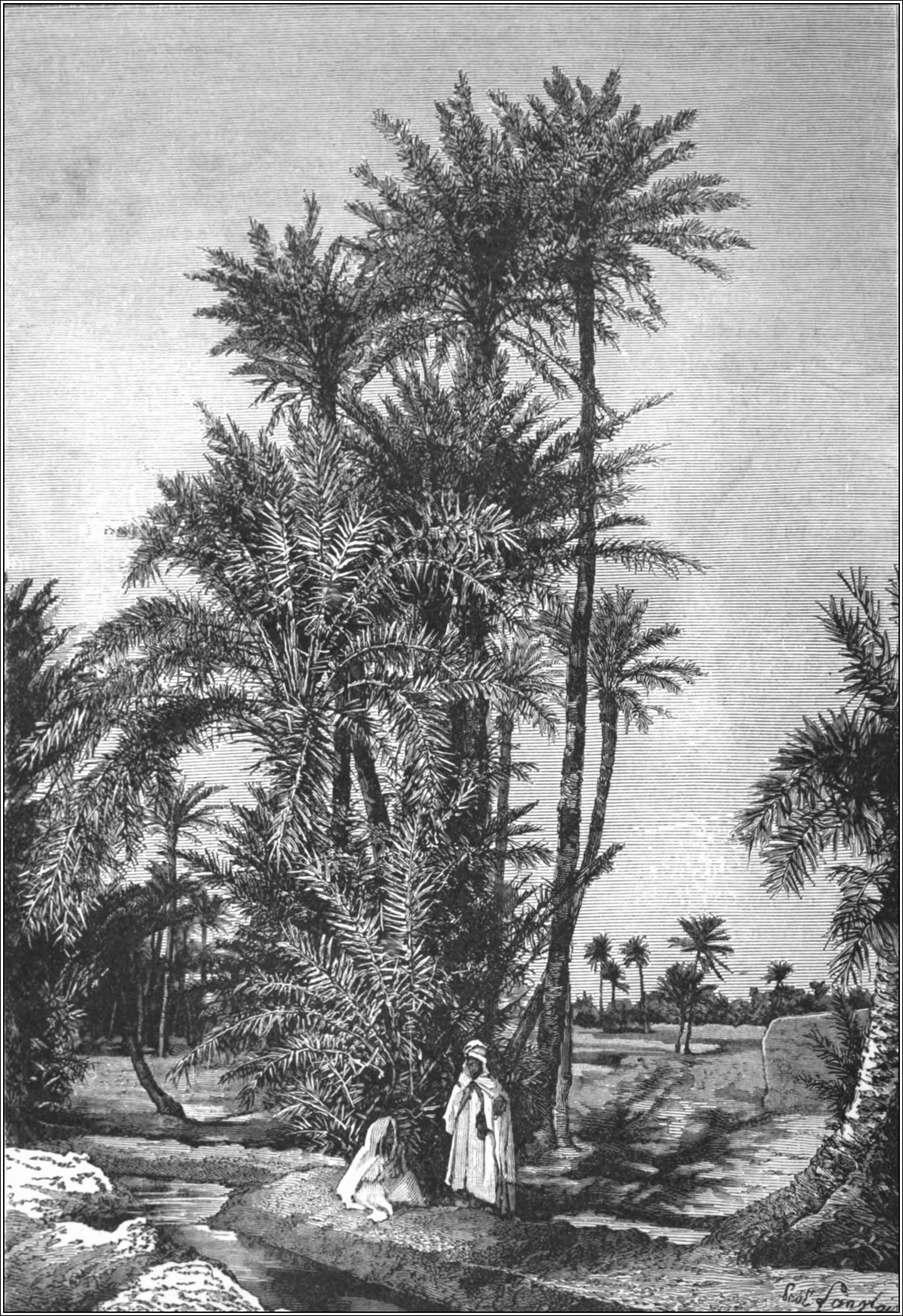
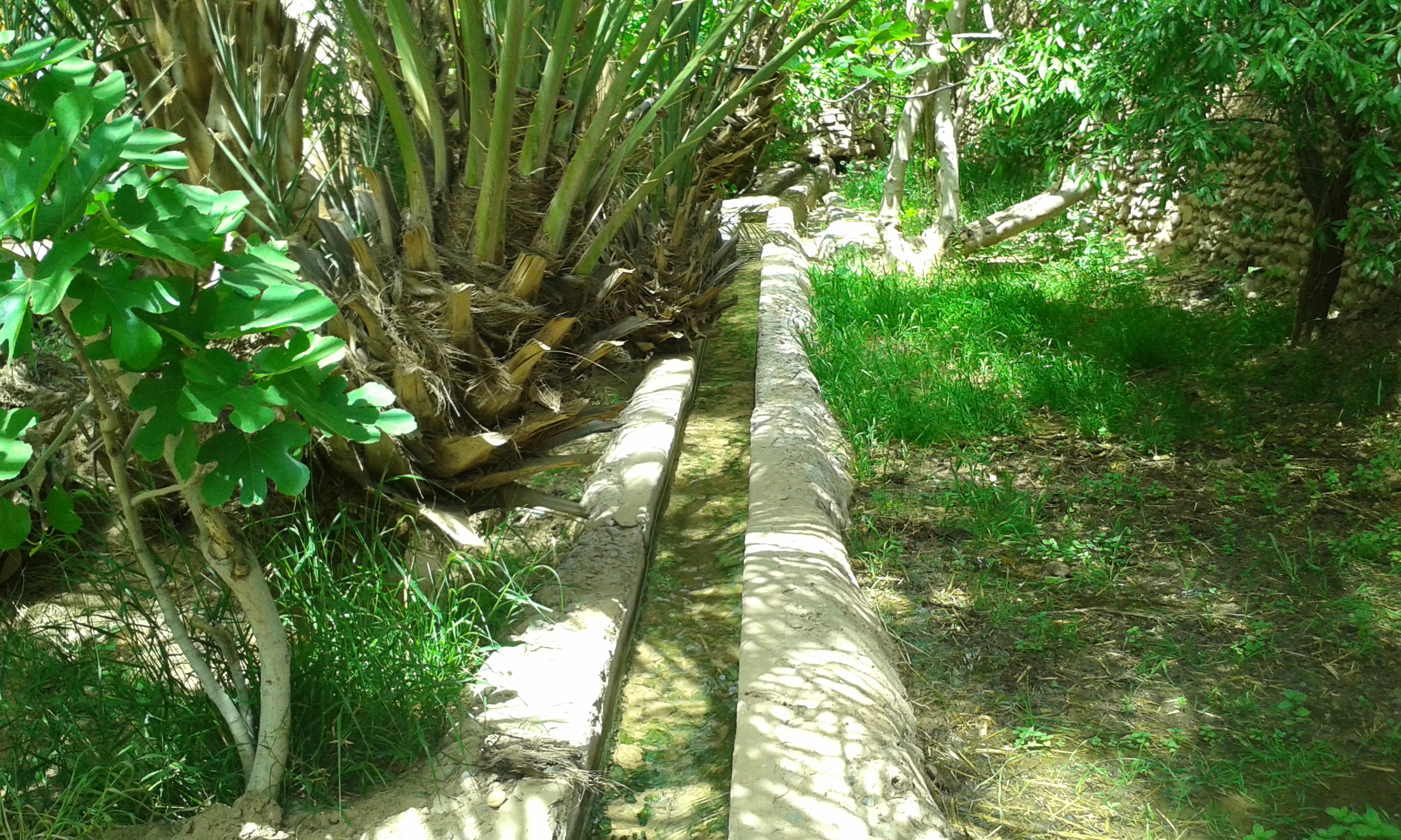
In ecology, an oasis (; : oases ) is a fertile area of a desert or semi-desert environmentBattesti, Vincent (2005) Jardins au désert: Évolution des pratiques et savoirs oasiens: Jérid tunisien. Paris: IRD éditions. . that sustains plant life and provides habitat for animals. Surface water may be present, or water may only be accessible from wells or underground channels created by humans. In geography, an oasis may be a current or past rest stop on a transportation route, or less-than-verdant location that nonetheless provides access to underground water through deep wells created and maintained by humans. Although they depend on a natural condition, such as the presence of water that may be stored in reservoirs and us ... [...More Info...] [...Related Items...] OR: [Wikipedia] [Google] [Baidu] |


