|
Prees Higher Heath
Prees Higher Heath (commonly shortened to Higher Heath) is a large village located within the civil parish of Prees in north Shropshire, England. Location Prees Higher Heath is south of the town of Whitchurch, northeast of the small town of Wem and the village of Prees and west of Market Drayton. It is also north of the village of Prees Green and south of the villages of Tilstock and Prees Heath. The villages of Whixall and Edstaston are also west of the village. Population The population in 2001 was recorded at 1,151, increasing to 1,163 Census. Transport Roads The A49 and A41 roads pass on either side of the village. Railway There are two railway stations within a close distance to the village, the first of which is the railway station of Prees and the second is railway station of Whitchurch. Bus The village is served by the 511 bus route, operated by Arriva Midlands North, which runs between Shrewsbury and Whitchurch via Wem. Some services terminate in Wem and ... [...More Info...] [...Related Items...] OR: [Wikipedia] [Google] [Baidu] |
Prees
Prees () is a village and civil parish in north Shropshire, near the border between England and Wales. Its name is Celtic and means "brushwood". Prees civil parish The civil parish includes many other villages and hamlets as well as the namesake Prees Village. Examples include the villages Prees Higher Heath and Prees Green and the hamlets of Prees Lower Heath and Prees Wood (which all share the name Prees). Sandford, Darliston, Fauls and Mickley to the east of the village are also included in the parish. Prees Heath, a nearby village, despite its name, is not part of the civil parish and is actually contained within the neighbouring Whitchurch civil parish. The population of the civil parish in 2001 was recorded at 2688, increasing to 2,895 Census. Prees village Prees is northeast of the small town of Wem. It is also west of Market Drayton and south of Whitchurch. The population in 2001 was recorded at 814, increasing to 939 Census. History The church in the village date ... [...More Info...] [...Related Items...] OR: [Wikipedia] [Google] [Baidu] |
Hadnall
Hadnall is a village and civil parish in Shropshire, England. It lies on the A49, some 9 km north-north-east of Shrewsbury. The population of the civil parish at the 2011 census was 688. The Welsh Marches Line runs just outside the village and there was once a railway station. Today, Hadnall has a primary school, a successful village shop, a pub and two AA rosette restaurants. The village church is dedicated to St. Mary Magdalene. General Sir Rowland Hill, 1st Viscount Hill, who lived at nearby Hardwick Grange, is buried here, as was writer Charles Hulbert who lived at Providence Grove. John Bromley, future trade union leader and Labour MP, whose parents lived at Haston Grove in the parish, was born and baptised here in 1876. Hadnall was formerly part of the old parish of Myddle.Middle, Shropshire , [...More Info...] [...Related Items...] OR: [Wikipedia] [Google] [Baidu] |
Shrewsbury
Shrewsbury ( , also ) is a market town, civil parish, and the county town of Shropshire, England, on the River Severn, north-west of London; at the 2021 census, it had a population of 76,782. The town's name can be pronounced as either 'Shrowsbury' or 'Shroosbury', the correct pronunciation being a matter of longstanding debate. The town centre has a largely unspoilt medieval street plan and over 660 listed buildings, including several examples of timber framing from the 15th and 16th centuries. Shrewsbury Castle, a red sandstone fortification, and Shrewsbury Abbey, a former Benedictine monastery, were founded in 1074 and 1083 respectively by the Norman Earl of Shrewsbury, Roger de Montgomery. The town is the birthplace of Charles Darwin and is where he spent 27 years of his life. east of the Welsh border, Shrewsbury serves as the commercial centre for Shropshire and mid-Wales, with a retail output of over £299 million per year and light industry and distributi ... [...More Info...] [...Related Items...] OR: [Wikipedia] [Google] [Baidu] |
Arriva Midlands
Arriva Midlands is a bus operator providing services in the East Midlands and West Midlands areas of England. It is a subsidiary of Arriva UK Bus. Arriva Midlands North Operations In September 1981 Midland Red North was formed with 230 buses operating from six depots in Shropshire, Staffordshire and the West Midlands as part of the breakup of the Midland Red bus company.Midland Red Depots MidlandRed.net In May 1983 the Ludlow depot was closed. In January 1988 Midland Red North was sold to the Drawlane Transport Group. In November 1992 it was sold to British Bus which in August 1996 was sold to the [...More Info...] [...Related Items...] OR: [Wikipedia] [Google] [Baidu] |
Whitchurch Railway Station (Shropshire)
Whitchurch (Shropshire) railway station serves the town of Whitchurch in Shropshire, England. The station is 18¾ miles (30 km) north of Shrewsbury on the Welsh Marches Line. The station is maintained and served by Transport for Wales. History The station opened on 1 September 1858 by the LNWR-backed Crewe and Shrewsbury Railway. It was once the junction for the Cambrian Railways Oswestry, Ellesmere and Whitchurch Railway line to Oswestry and Welshpool (the former Cambrian mainline to ), and the Whitchurch and Tattenhall Railway. The former was closed as a result of the Beeching Axe in January 1965, whilst the latter was closed to passengers by the British Transport Commission in September 1957Disused Stations - Whitchurch Retrieved 11 November 2013 and completely in January 1963. The site of t ... [...More Info...] [...Related Items...] OR: [Wikipedia] [Google] [Baidu] |
Prees Railway Station
Prees railway station serves the village of Prees in Shropshire, England, although the station is a mile to the west of the village and in the parish of Wem Rural. The station is from South Junction (approximately north of Shrewsbury) on the Welsh Marches Line. It was opened by the Crewe and Shrewsbury Railway in 1858. The station has two platforms and trains only stop here upon request. It is managed by Transport for Wales Facilities It is unstaffed and has no ticketing provision - tickets must be bought on the train or prior to travel. The old buildings that once stood here have been demolished (as has the signal box following resignalling work in 2013) and only standard waiting shelters are now provided. Train running information is offered via CIS displays, timetable posters and customer help points on each side (there is also a payphone on platform 2). Step-free access is available to both platforms via ramps and the road crossing at the north end. Services Mo ... [...More Info...] [...Related Items...] OR: [Wikipedia] [Google] [Baidu] |
A41 Road
The A41 is a trunk road between London and Birkenhead, England. Now in parts replaced by motorways, it passes through or near Watford, Kings Langley, Hemel Hempstead, Aylesbury, Bicester, Solihull, Birmingham, West Bromwich, Wolverhampton, Newport, Whitchurch, Chester and Ellesmere Port. With the opening of the M40 extension in 1990 from junction 8, much of the route was downgraded. The sections between Bicester and the M42 near Solihull in the Midlands have been re-classified B4100, A4177 and A4141. Route London to Kings Langley The route begins at Marble Arch from its junction on the A40 road in London with Portman Street/Gloucester Place (northbound) and Baker Street/Orchard Street (southbound). Named the Finchley Road, the A41 is dual-carriageway through Swiss Cottage and Hendon Way and intersects with the North Circular Road near Brent Cross shopping centre. The road passes through Hendon and after the junction with the A5150, (close to the Metro ... [...More Info...] [...Related Items...] OR: [Wikipedia] [Google] [Baidu] |
A49 Road
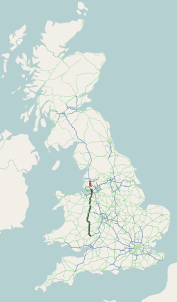
The A49 is an A road in western England, which traverses the Welsh Marches region. It runs north from Ross-on-Wye in Herefordshire via Hereford, Leominster, Ludlow, Shrewsbury and Whitchurch, then continues through central Cheshire to Warrington and Wigan before terminating at its junction with the A6 road just south of Bamber Bridge, near the junction of the M6, M65 and M61 motorways. The stretch between Ross-on-Wye and the A5 at Shrewsbury is a trunk road, maintained by National Highways. Lancashire From the A6 at Bamber Bridge, south of Preston, the road runs parallel to the M6 motorway, through Leyland towards Wigan. Through Ashton in Makerfield and Newton-le-Willows, reaching Warrington via Winwick. In June 2020, a new section of the A49 opened forming part of a link between Wigan town centre and junction 25 on the M6, the section it replaced being renumbered B5386. Cheshire From junction 9 of the M62, there is a dual-carriageway through Warrington, as far as L ... [...More Info...] [...Related Items...] OR: [Wikipedia] [Google] [Baidu] |
Whixall
Whixall is, by land area, the third largest inland village in England and a civil parish in Shropshire, England. It is documented in the Domesday Book as having been in existence in 1086. The nearest towns are Whitchurch, to the north, and Wem, to the south. The parish lies on the border with the county borough of Wrexham, Wales. Its close proximity to Wales is shown by a hamlet called Welsh End. Within the parish boundaries (encompassing seven square miles) are various hamlets including Abbey Green, Hollinwood, Welsh End, Stanley Green, Dobson's Bridge, Far End and Waterloo. Whixall village contains a Church of England village church, and primary school. The village's outdoor war memorial, a square-section obelisk, stands in fenced area on the roadside by the school. In July 2021 a Bronze Age stone artwork that became known as the "Whixall Monolith" or Whixall Stone, was discovered in the creation of a drive at a house in the village. Adorned with cup and ring carving ... [...More Info...] [...Related Items...] OR: [Wikipedia] [Google] [Baidu] |
Shropshire (district)
Shropshire is a district with the status of a unitary authority in the ceremonial county of Shropshire, in the West Midlands region of England. It is named after the historic county of Shropshire. It covers the former districts of Bridgnorth, North Shropshire, Oswestry, Shrewsbury and Atcham and South Shropshire. These were merged into the modern-day unitary authority of Shropshire. The large town of Telford was not affected by this as it has been a unitary authority since 1996 under Telford and Wrekin borough. It contains 188 civil parishes. History The district was created on the 1 April 2009, following the merger of the former districts, and upon the formation of Shropshire Council, which replaced the district councils and also Shropshire County Council. Geography The district covers the towns of Oswestry, Church Stretton, Craven Arms, Ellesmere, Wem, Whitchurch, Much Wenlock, Shifnal, Bridgnorth, Broseley, Clun, Knighton (part), Bishop's Castle, Cleobury Mo ... [...More Info...] [...Related Items...] OR: [Wikipedia] [Google] [Baidu] |
Prees Heath
Prees () is a village and civil parish in north Shropshire, near the border between England and Wales. Its name is Celtic and means "brushwood". Prees civil parish The civil parish includes many other villages and hamlets as well as the namesake Prees Village. Examples include the villages Prees Higher Heath and Prees Green and the hamlets of Prees Lower Heath and Prees Wood (which all share the name Prees). Sandford, Darliston, Fauls and Mickley to the east of the village are also included in the parish. Prees Heath, a nearby village, despite its name, is not part of the civil parish and is actually contained within the neighbouring Whitchurch civil parish. The population of the civil parish in 2001 was recorded at 2688, increasing to 2,895 Census. Prees village Prees is northeast of the small town of Wem. It is also west of Market Drayton and south of Whitchurch. The population in 2001 was recorded at 814, increasing to 939 Census. History The church in the village dates ... [...More Info...] [...Related Items...] OR: [Wikipedia] [Google] [Baidu] |


