|
Poor Knights Island
The Poor Knights Islands (Māori: ''Tawhiti Rahi)'' are a group of islands off the east coast of the Northland Region of the North Island of New Zealand. They lie to the northeast of Whangarei, and offshore halfway between Bream Head and Cape Brett. Uninhabited since the 1820s, they are a nature reserve and popular underwater diving spot, with boat tours typically departing from Tutukaka. The Poor Knights Islands Marine Reserve surrounds the island. Beaglehole (1955) comments that the origin of the island name is not clear, and speculates that the name could be related to the Poor Knights of Windsor, or that the islands were named for their resemblance to Poor Knight's Pudding, a bread-based dish topped with egg and fried, popular at the time of discovery by Europeans. Description The chain consists of two large islands (Tawhiti Rahi, the larger at , and Aorangi () to the south), and several smaller islands. Aorangaia and Archway Island lie to the southwest of A ... [...More Info...] [...Related Items...] OR: [Wikipedia] [Google] [Baidu] |
Māori Language
Māori (), or ('the Māori language'), also known as ('the language'), is an Eastern Polynesian language spoken by the Māori people, the indigenous population of mainland New Zealand. Closely related to Cook Islands Māori, Tuamotuan, and Tahitian, it gained recognition as one of New Zealand's official languages in 1987. The number of speakers of the language has declined sharply since 1945, but a Māori-language revitalisation effort has slowed the decline. The 2018 New Zealand census reported that about 186,000 people, or 4.0% of the New Zealand population, could hold a conversation in Māori about everyday things. , 55% of Māori adults reported some knowledge of the language; of these, 64% use Māori at home and around 50,000 people can speak the language "very well" or "well". The Māori language did not have an indigenous writing system. Missionaries arriving from about 1814, such as Thomas Kendall, learned to speak Māori, and introduced the Latin alphabet. ... [...More Info...] [...Related Items...] OR: [Wikipedia] [Google] [Baidu] |
John Beaglehole
John Cawte Beaglehole (13 June 1901 – 10 October 1971) was a New Zealand historian whose greatest scholastic achievement was the editing of James Cook's three journals of exploration, together with the writing of an acclaimed biography of Cook, published posthumously. He had a lifelong association with Victoria University College, which became Victoria University of Wellington, and after his death it named the archival collections after him. Early life and career Beaglehole was born and grew up in Wellington, New Zealand, the second of the four sons of David Ernest Beaglehole, a clerk, and his wife, Jane Butler. His younger brother was Ernest Beaglehole, who became a psychologist and ethnologist. John was educated at Mount Cook School and Wellington College before being enrolled at Victoria University College, Wellington of the University of New Zealand, which later became an independent university, and where he subsequently spent most of his academic career. After his grad ... [...More Info...] [...Related Items...] OR: [Wikipedia] [Google] [Baidu] |
Important Bird Area
An Important Bird and Biodiversity Area (IBA) is an area identified using an internationally agreed set of criteria as being globally important for the conservation of bird populations. IBA was developed and sites are identified by BirdLife International. There are over 13,000 IBAs worldwide. These sites are small enough to be entirely conserved and differ in their character, habitat or ornithological importance from the surrounding habitat. In the United States the Program is administered by the National Audubon Society. Often IBAs form part of a country's existing protected area network, and so are protected under national legislation. Legal recognition and protection of IBAs that are not within existing protected areas varies within different countries. Some countries have a National IBA Conservation Strategy, whereas in others protection is completely lacking. History In 1985, following a specific request from the European Economic Community, Birdlife International ... [...More Info...] [...Related Items...] OR: [Wikipedia] [Google] [Baidu] |
Feral Pig
The feral pig is a domestic pig which has gone feral, meaning it lives in the wild. They are found mostly in the Americas and Australia. Razorback and wild hog are Americanisms applied to feral pigs or boar-pig hybrids. Definition A feral pig is a domestic pig that has escaped or been released into the wild, and is living more or less as a wild animal, or one that is descended from such animals. Zoologists generally exclude from the ''feral'' category animals that, although captive, were genuinely wild before they escaped. Accordingly, Eurasian wild boar, released or escaped into habitats where they are not native, such as in North America, are not generally considered feral, although they may interbreed with feral pigs. Likewise, reintroduced wild boars in Western Europe are also not considered feral, despite the fact that they were raised in captivity prior to their release. In the New World North America Domestic pigs were first introduced to the Americas in the 16t ... [...More Info...] [...Related Items...] OR: [Wikipedia] [Google] [Baidu] |
Xeronema Callistemon
''Xeronema callistemon'' is a species of flowering plant endemic to the Poor Knights Islands and Taranga Island in the north of New Zealand.Xeronema callistemon f. callistemon /ref> It was discovered in 1924 and has a common name Poor Knights lily. The plant is listed as vulnerable in the 1997 IUCN Red List of Plants,1997 IUCN red list of threatened plants p.746 but as of October 2010 is not listed in the [...More Info...] [...Related Items...] OR: [Wikipedia] [Google] [Baidu] |
Taupō Volcanic Zone
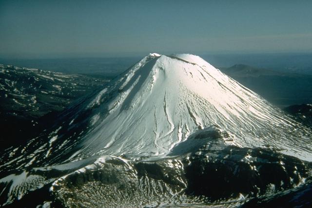
The Taupō Volcanic Zone (TVZ) is a volcanic area in the North Island of New Zealand that has been active for the past two million years and is still highly active. Mount Ruapehu marks its south-western end and the zone runs north-eastward through the Taupō and Rotorua areas and offshore into the Bay of Plenty. It is part of the larger Central Volcanic Region that extends further westward through the western Bay of Plenty to the eastern side of the Coromandel Peninsula and has been active for four million years. At Taupō the rift volcanic zone is widening east–west at the rate of about 8 mm per year while at Mount Ruapehu it is only 2–4 mm per year but this increases at the north eastern end at the Bay of Plenty coast to 10–15 mm per year. It is named after Lake Taupō, the flooded caldera of the largest volcano in the zone, the Taupō Volcano and contains a large central volcanic plateau as well as other landforms associated with its containing tecton ... [...More Info...] [...Related Items...] OR: [Wikipedia] [Google] [Baidu] |
Internal Wave
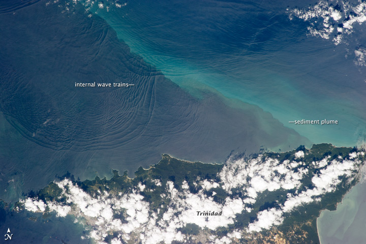
Internal waves are gravity waves that oscillate within a fluid medium, rather than on its surface. To exist, the fluid must be stratified: the density must change (continuously or discontinuously) with depth/height due to changes, for example, in temperature and/or salinity. If the density changes over a small vertical distance (as in the case of the thermocline in lakes and oceans or an atmospheric inversion), the waves propagate horizontally like surface waves, but do so at slower speeds as determined by the density difference of the fluid below and above the interface. If the density changes continuously, the waves can propagate vertically as well as horizontally through the fluid. Internal waves, also called internal gravity waves, go by many other names depending upon the fluid stratification, generation mechanism, amplitude, and influence of external forces. If propagating horizontally along an interface where the density rapidly decreases with height, they are specifically ... [...More Info...] [...Related Items...] OR: [Wikipedia] [Google] [Baidu] |
Internal Tides
Internal tides are generated as the surface tides move stratified water up and down sloping topography, which produces a wave in the ocean interior. So internal tides are internal waves at a tidal frequency. The other major source of internal waves is the wind which produces internal waves near the inertial frequency. When a small water parcel is displaced from its equilibrium position, it will return either downwards due to gravity or upwards due to buoyancy. The water parcel will overshoot its original equilibrium position and this disturbance will set off an internal gravity wave. Munk (1981) notes, "Gravity waves in the ocean's interior are as common as waves at the sea surface-perhaps even more so, for no one has ever reported an interior calm." Simple explanation The surface tide propagates as a surface wave, wave in which water parcels in the whole water column oscillate in the same direction at a given phase (i.e., in the trough or at the crest, Fig. 1, top). This ... [...More Info...] [...Related Items...] OR: [Wikipedia] [Google] [Baidu] |
Tide
Tides are the rise and fall of sea levels caused by the combined effects of the gravitational forces exerted by the Moon (and to a much lesser extent, the Sun) and are also caused by the Earth and Moon orbiting one another. Tide tables can be used for any given locale to find the predicted times and amplitude (or "tidal range"). The predictions are influenced by many factors including the alignment of the Sun and Moon, the phase and amplitude of the tide (pattern of tides in the deep ocean), the amphidromic systems of the oceans, and the shape of the coastline and near-shore bathymetry (see '' Timing''). They are however only predictions, the actual time and height of the tide is affected by wind and atmospheric pressure. Many shorelines experience semi-diurnal tides—two nearly equal high and low tides each day. Other locations have a diurnal tide—one high and low tide each day. A "mixed tide"—two uneven magnitude tides a day—is a third regular category. Tides va ... [...More Info...] [...Related Items...] OR: [Wikipedia] [Google] [Baidu] |
Tourism New Zealand
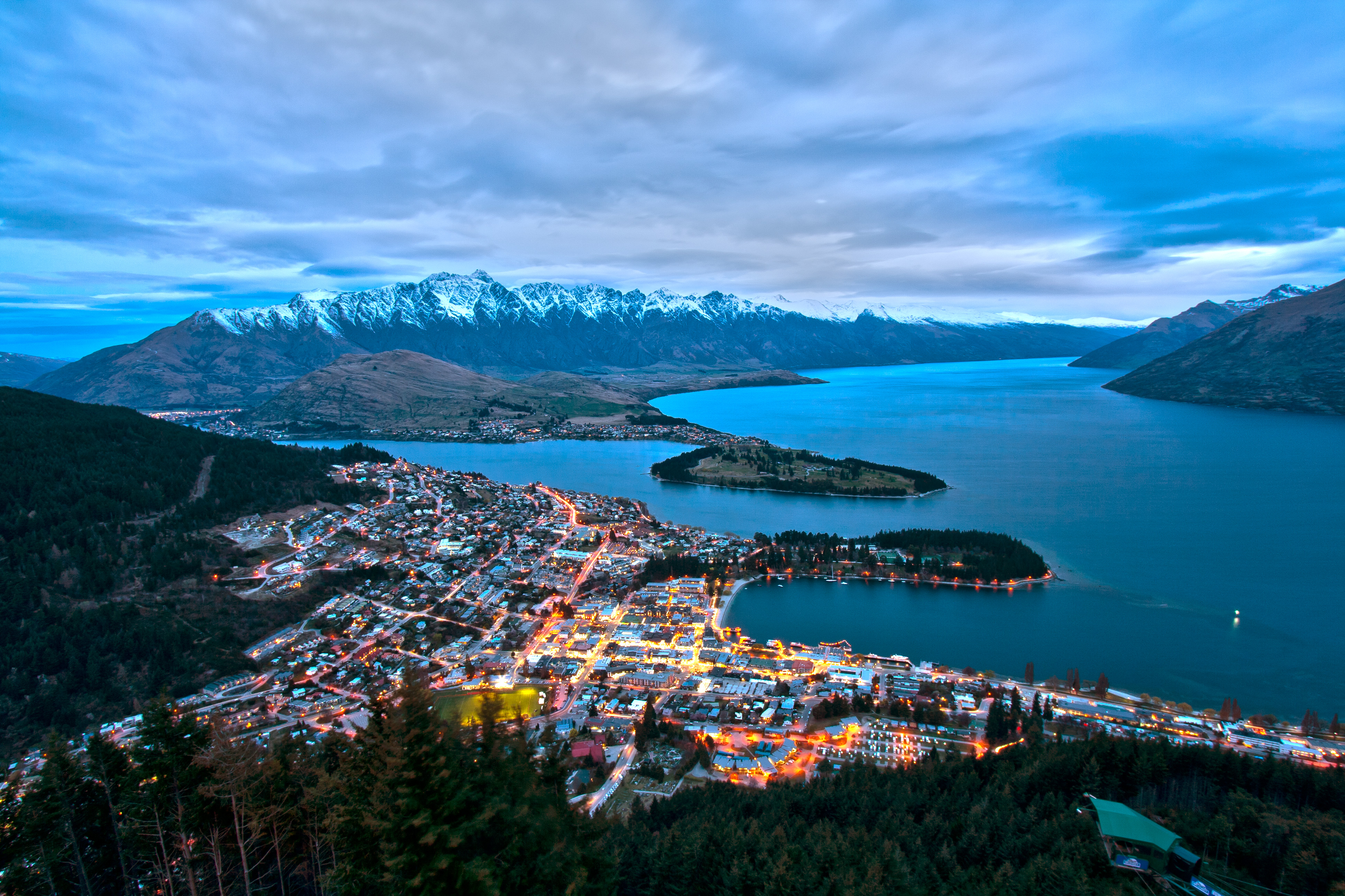
Tourism New Zealand is the marketing agency responsible for promoting New Zealand as a tourism destination internationally. It is the trading name of the New Zealand Tourism Board, a Crown entity A Crown entity (from the Commonwealth term ''Crown'') is an organisation that forms part of New Zealand's state sector established under the Crown Entities Act 2004, a unique umbrella governance and accountability statute. The Crown Entities Act i ... established under the New Zealand Tourism Board Act 1991. The Ministry of Business, Innovation and Employment; (previously the New Zealand Ministry of Tourism) is the government department tasked with tourism policy and research. History New Zealand was the first country to dedicate a government department to tourism. In 1901, the Department of Tourist and Health Resorts came into being. Through most of the 20th century, its role was tactical - running hotels and putting together itineraries around New Zealand as well as advertising. T ... [...More Info...] [...Related Items...] OR: [Wikipedia] [Google] [Baidu] |
Volcano
A volcano is a rupture in the crust of a planetary-mass object, such as Earth, that allows hot lava, volcanic ash, and gases to escape from a magma chamber below the surface. On Earth, volcanoes are most often found where tectonic plates are diverging or converging, and most are found underwater. For example, a mid-ocean ridge, such as the Mid-Atlantic Ridge, has volcanoes caused by divergent tectonic plates whereas the Pacific Ring of Fire has volcanoes caused by convergent tectonic plates. Volcanoes can also form where there is stretching and thinning of the crust's plates, such as in the East African Rift and the Wells Gray-Clearwater volcanic field and Rio Grande rift in North America. Volcanism away from plate boundaries has been postulated to arise from upwelling diapirs from the core–mantle boundary, deep in the Earth. This results in hotspot volcanism, of which the Hawaiian hotspot is an example. Volcanoes are usually not created where two tectonic ... [...More Info...] [...Related Items...] OR: [Wikipedia] [Google] [Baidu] |
Rhyolite
Rhyolite ( ) is the most silica-rich of volcanic rocks. It is generally glassy or fine-grained ( aphanitic) in texture, but may be porphyritic, containing larger mineral crystals ( phenocrysts) in an otherwise fine-grained groundmass. The mineral assemblage is predominantly quartz, sanidine, and plagioclase. It is the extrusive equivalent to granite. Rhyolitic magma is extremely viscous, due to its high silica content. This favors explosive eruptions over effusive eruptions, so this type of magma is more often erupted as pyroclastic rock than as lava flows. Rhyolitic ash-flow tuffs are among the most voluminous of continental igneous rock formations. Rhyolitic tuff has been extensively used for construction. Obsidian, which is rhyolitic volcanic glass, has been used for tools from prehistoric times to the present day because it can be shaped to an extremely sharp edge. Rhyolitic pumice finds use as an abrasive, in concrete, and as a soil amendment. Description R ... [...More Info...] [...Related Items...] OR: [Wikipedia] [Google] [Baidu] |


