|
Pookode
Pookode is a village in Vythiri Taluk in Wayanad district of Kerala state in India. Pookode is known for Pookode Lake and as the headquarters of Kerala Veterinary and Animal Sciences University. Geography Pookode is situated in the south west region of Wayanad district, about 14 km away from district headquarters Kalpetta. It lies on the Kozhikode-Mysore National Highway NH 766 (Old NH 212) between Kozhikode and Kalpetta. Pookode is 58 km from Kozhikode and is adjacent to the gateway of Wayanad, Lakkidi. Next to Pookode on the NH766 is Vythiri town. Transport Pookode is well connected by road. Frequent buses are available from Kozhikode and Kalpetta. Nearest railway station is Kozhikode at a distance of 58 km. Calicut International Airport at Karipur is located 86 km away from Pookode. Education The main campus of the Kerala Veterinary and Animal Sciences University is located at Pookode. Apart from the administrative offices of the university, two con ... [...More Info...] [...Related Items...] OR: [Wikipedia] [Google] [Baidu] |
Pookode Lake
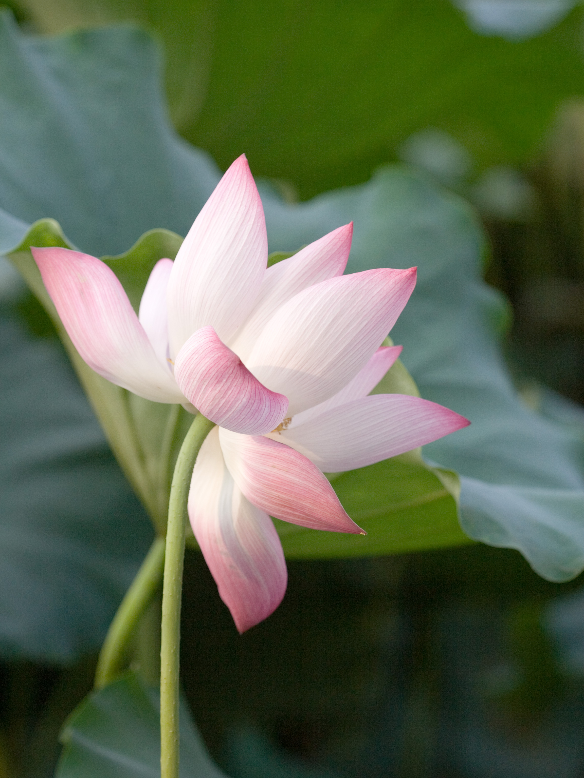
Pookode Lake is a scenic freshwater lake in the Wayanad district in Kerala, South India. A major tourist destination in the district, Pookode is a natural freshwater lake nestling amid evergreen forests and mountain slopes at an elevation of 770 meters above sea level. It is 15 km away from Kalpetta. It is the smallest and highest elevation freshwater lake in Kerala. Origin Panamaram, the rivulet which ultimately becomes Kabani River, originates from the Pookode lake. It is spread across an area of 8.5 hectares and with a maximum depth of 6.5 metres. Lying 3 km south of Vythiri town, the lake is one of the most popular tourist spots in Wayanad. Features The lake has the natural shape of India's map in aerial view. This perennial fresh water lake, nestled among wooded hills, is only one of its kind in Kerala. Pethia pookodensis, is a species of cyprinid fish known to occur only in Pookode Lake. The lake has abundance of blue lotus and fresh water fishes. Boating facili ... [...More Info...] [...Related Items...] OR: [Wikipedia] [Google] [Baidu] |
Kerala Veterinary And Animal Sciences University
Kerala Veterinary and Animal Sciences University (KVASU) is a university established by the Government of Kerala in December 2010 to further education, research and extension services in the field of Veterinary and Animal Sciences. The territorial jurisdiction of the university extends to the whole of the State of Kerala. Its headquarters is located at Pookode near Kalpetta in Wayanad District in Kerala State. Constituent colleges There are eight constituent colleges of the university: * College of Veterinary and Animal Sciences, Mannuthy, Thrissur *College of Dairy Science and Technology, Kolahalamedu, Idukki *College of Dairy Science and Technology, Pookode, Wayanad *College of Dairy Science and Technology, Mannuthy, Thrissur *College of Veterinary and Animal Sciences, Pookode, Wayanad *College of Avian Sciences and Management, Thiruvazhamkunnu, Palakkad *College of Dairy Science and Technology, BSNL RTTC, Kaimanam, Thiruvananthapuram. *College of Food Technology, Thumbur ... [...More Info...] [...Related Items...] OR: [Wikipedia] [Google] [Baidu] |
Kalpetta
Kalpetta is a major town and municipality in the Wayanad district, state of Kerala, India. Kalpetta is the headquarters of Wayanad district, as well as the headquarters of Vythiri taluk. It is a bustling town surrounded by dense coffee and tea plantations and mountains. It lies on the Kozhikode-Mysore National Highway NH 766 (formerly NH 212) at an altitude of about 780 m above sea level. Kalpetta is 72 km from Kozhikode and 140 km from Mysore. Apart from being the administrative capital of the district, Kalpetta is also the main hub of tourism activities in Wayanad due to its central location within the district and its proximity to most visited tourist sites. There is a good number of hotels and resorts within and surrounding the city of Kalpetta. Etymology It is believed that the early Jain residents who migrated from Karnataka had named the place "Kalpetta". In Kannada, the words "Kal" and "Pettah" mean "deposits of stones". Rocks, large and small, are found thro ... [...More Info...] [...Related Items...] OR: [Wikipedia] [Google] [Baidu] |
Vythiri
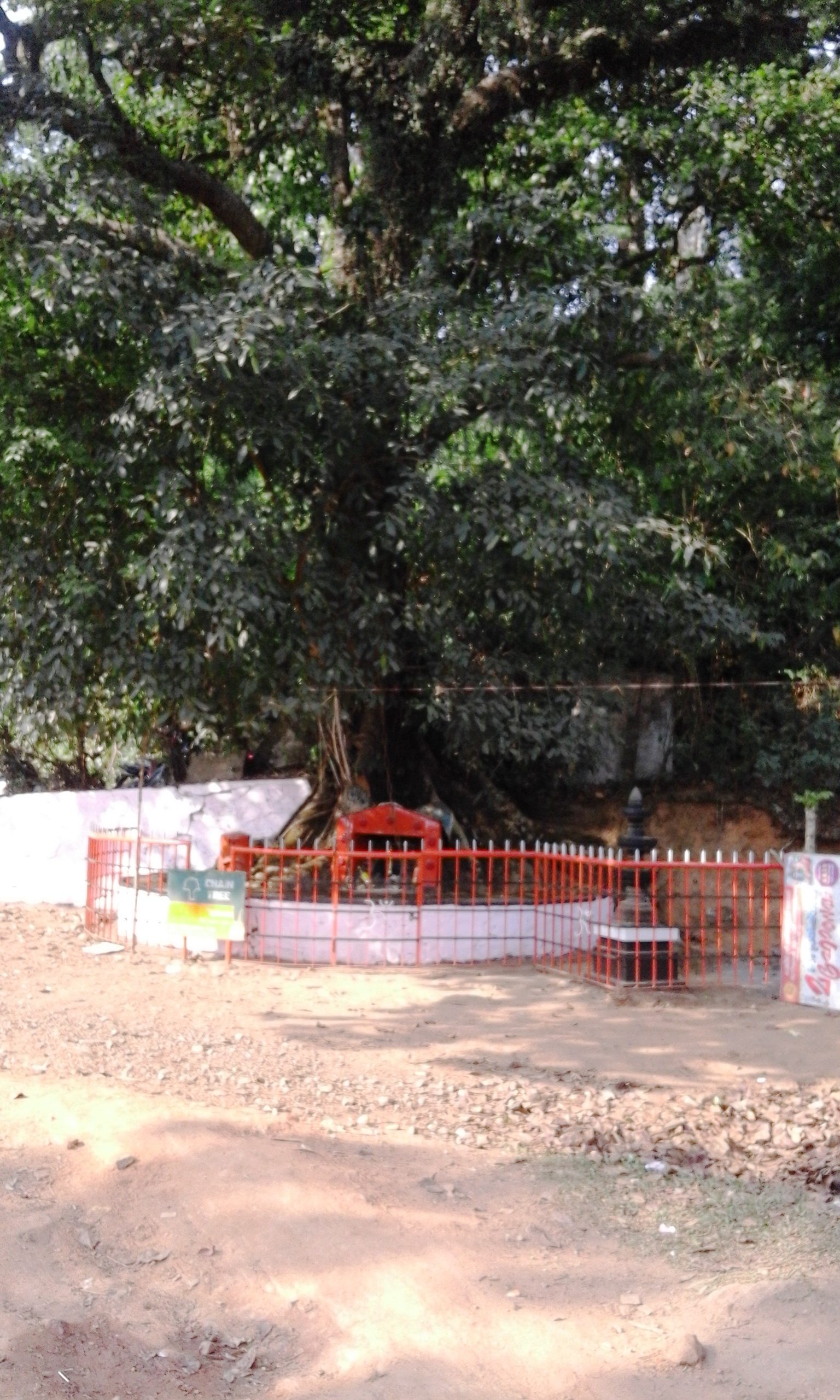
Vythiri is a small town and tourist destination located in the Wayanad district in the Indian state of Kerala. It is one of the three Taluks in the district with the other two being Mananthavady and Sulthan Bathery. Suburbs and villages Vythiri area has 18 villages. Towns in this taluk include Lakkidi, Vythiri, Chundale, Meppadi, Kalpetta, and Kaniyambetta. Vythiri is the headquarters of Vythiri Taluk. Vythiri as a favorite tourist destination The all season attractive weather, greenery and the terrain of this place makes Vythiri a major tourist destination in Kerala. Tourists from all parts of the world visits and stays in Vythiri to enjoy the beauty of Vythiri and other tourist destinations in Wayanad. The Chain Tree Legend According to the local legend, an English engineer built the Ghat road to Vythiri on the basis of the information given by a tribal youth. After getting the necessary guidance, the English people killed the tribal guide. The spirit of the tribal y ... [...More Info...] [...Related Items...] OR: [Wikipedia] [Google] [Baidu] |
States And Territories Of India
India is a federal union comprising 28 states and 8 union territories, with a total of 36 entities. The states and union territories are further subdivided into districts and smaller administrative divisions. History Pre-independence The Indian subcontinent has been ruled by many different ethnic groups throughout its history, each instituting their own policies of administrative division in the region. The British Raj The British Raj (; from Hindi language, Hindi ''rāj'': kingdom, realm, state, or empire) was the rule of the British The Crown, Crown on the Indian subcontinent; * * it is also called Crown rule in India, * * * * or Direct rule in India, * Q ... mostly retained the administrative structure of the preceding Mughal Empire. India was divided into provinces (also called Presidencies), directly governed by the British, and princely states, which were nominally controlled by a local prince or raja loyal to the British Empire, which held ''de f ... [...More Info...] [...Related Items...] OR: [Wikipedia] [Google] [Baidu] |
Nelumbo Nucifera
''Nelumbo nucifera'', also known as sacred lotus, Laxmi lotus, Indian lotus, or simply lotus, is one of two extant species of aquatic plant in the family Nelumbonaceae. It is sometimes colloquially called a water lily, though this more often refers to members of the family Nymphaeaceae. Lotus plants are adapted to grow in the flood plains of slow-moving rivers and delta areas. Stands of lotus drop hundreds of thousands of seeds every year to the bottom of the pond. While some sprout immediately, and most are eaten by wildlife, the remaining seeds can remain dormant for an extensive period of time as the pond silts in and dries out. During flood conditions, sediments containing these seeds are broken open, and the dormant seeds rehydrate and begin a new lotus colony. Under favorable circumstances, the seeds of this aquatic perennial may remain viable for many years, with the oldest recorded lotus germination being from seeds 1,300 years old recovered from a dry lakebed in ... [...More Info...] [...Related Items...] OR: [Wikipedia] [Google] [Baidu] |
Jawahar Navodaya Vidyalaya
Jawahar Navodaya Vidyalayas (JNVs) is a system of central schools for talented students predominantly from rural areas in India. They are run by Navodaya Vidyalaya Samiti, Noida, an autonomous organization under the Department of School Education and Literacy, Ministry of Education (MoE), Government of India. JNVs are fully residential and co-educational schools affiliated to Central Board of Secondary Education (CBSE), New Delhi, with classes from VI to XII standard. JNVs are specifically tasked with finding talented children in rural areas of India through JNVST (JNV Selection Test) and providing them with an education equivalent to the best residential school system, without regard to their families' socio-economic condition. The Budget for Education, Boarding and activities at JNVs are provided by the Ministry of Education, Government of India and it's free of cost for the students during the 7 years of stay. JNVs exist all over India, with the exception of Tamil Nadu ... [...More Info...] [...Related Items...] OR: [Wikipedia] [Google] [Baidu] |
Calicut International Airport
Calicut International Airport , also known as Kozhikode Airport or Karipur Airport, is an international airport located in Karipur, Malappuram district of Kerala, India. It serves the Malabar region of Kozhikode, Malappuram, Wayanad and Palakkad. It is situated 28 kilometers away from Kozhikode city and 25 kilometers away from Malappuram city. It serves two of the seven metropolitan areas in the state - Kozhikode metropolitan area and Malappuram metropolitan area. The airport opened on 13 April 1988. The airport serves as an operating base for Air India Express and operates Hajj Pilgrimage services to Medina and Jeddah from Kerala. It is the twenty first–busiest airport in India in terms of overall passenger traffic and also the sixth-busiest airport in India after Delhi, Mumbai, Kochi, Chennai and Hyderabad in terms of international traffic. It received international airport status on 2 February 2006. It is one of a few airports in the country with a tabletop runwa ... [...More Info...] [...Related Items...] OR: [Wikipedia] [Google] [Baidu] |
Kozhikode Railway Station
Kozhikode railway station also known as Calicut railway station is one of the largest railway stations in the state of Kerala, India. At in financial year 2018–19, it is the largest in terms of passenger revenue in Palakkad division. The station has four platforms, two terminals and a total number of six tracks. The first platform has a capacity to accommodate trains with 24 coaches and second & third platform has the capacity to accommodate 20 coaches; and the fourth one has the capacity to accommodate 24 coaches. It heralds as the only A1-graded station in Palghat railway division with a daily turnout exceeding 25,000 passengers. It is one of the major railway stations in Kerala with trains connecting the city to other major cities in India such as Thiruvananthapuram, Chennai, Bengaluru, New Delhi, Mumbai, Pune, Hyderabad, Coimbatore, Visakhapatnam, Kolkata, Mangaluru, Jammu Tawi, Goa, Ernakulam and so forth. The other railway stations in the city include (''code: F ... [...More Info...] [...Related Items...] OR: [Wikipedia] [Google] [Baidu] |
Lakkidi, Wayanad
Lakkidi is a rain forest located in a gateway of the Wayanad district of the Indian state of Kerala. During British Raj, a horse track in Wayanad attracted European investors and traders. They cultivated Malabar pepper, spices, tea, and coffee. National Highway 766 connects Kozhikode in Kerala with Kollegal in Karnataka via Mysore, creating business opportunities in tourism and agriculture. Lakkidi is surrounded by a biodiverse environment and unspoiled nature which attracts visitors interested in bird-watching, trekking, and off-roading. Jawahar Navodaya Vidyalaya is situated there. Geography Lakkidi is situated at one of the highest locations in Wayanad, above mean sea level, above Thamarassery ghat pass. Vythiri is the nearest town, 5 km from Lakkidi. Chain tree, Pookot Lake and a mile-long viewing side-walk are within five km. Pookot Lake is 3 km away from Lakkidi. It is a rain-fed lake spread across 15 acres. It is one of the few fresh-water reservoirs in ... [...More Info...] [...Related Items...] OR: [Wikipedia] [Google] [Baidu] |
NH 766
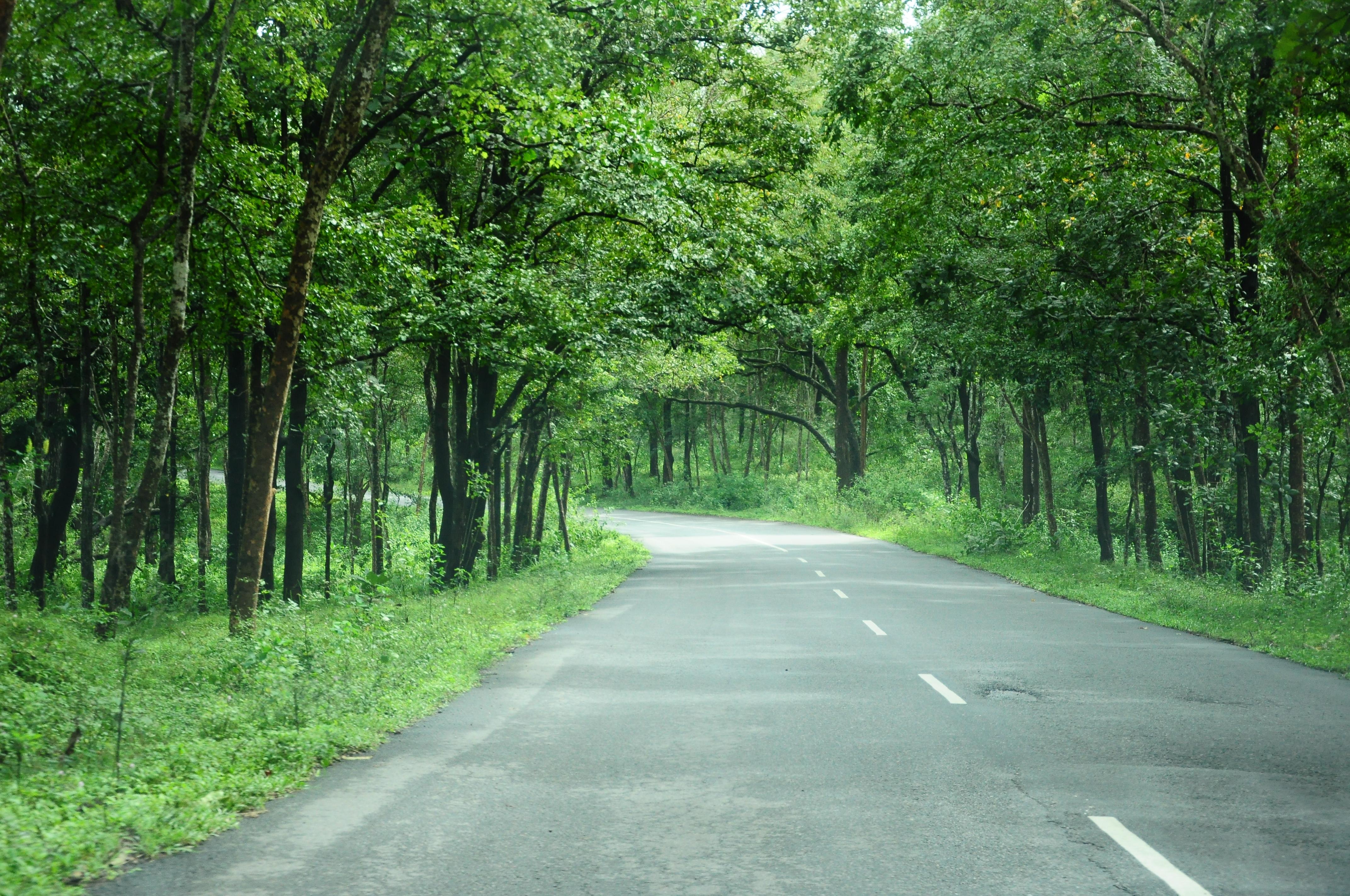
National Highway 766 (NH 766) (previously NH-212) is a National Highway in Southern India. NH 766 connects Kozhikode in Kerala with Kollegal in Karnataka via Mysore. Of the total distance of 272 km, 117 km is in Kerala and 155 is in Karnataka. At Kollegal, it joins National Highway 948, which connects Bengaluru and Coimbatore. The highway passes through dense forests of Western ghats of India. The NH-766 passes through 19.7 km Bandipur National Park and Wayanad wild life sanctuary. The section of the road from Lakkidi in Wayanad to Adivaram (Thamarassery) called as Thamarassery Churam (A hill highway with nine hairpin bends) offers a scenic drive. Route In Kerala * Kozhikode * Kunnamangalam * Koduvally * Thamarassery * Vythiri * Kalpetta * Meenangadi * Sultan Bathery * Muthanga In Karnataka * Gundlupete * Begur * Nanjangud * Mysore * T Narsipur * Kollegal Night Traffic ban at Bandipura The Karnataka government banned night traffic through the road passin ... [...More Info...] [...Related Items...] OR: [Wikipedia] [Google] [Baidu] |
Mysore
Mysore (), officially Mysuru (), is a city in the southern part of the state of Karnataka, India. Mysore city is geographically located between 12° 18′ 26″ north latitude and 76° 38′ 59″ east longitude. It is located at an altitude of above mean sea level. Mysore is situated at the foothills of Chamundi Hills about towards the southwest of Bangalore and spread across an area of . Mysore City Corporation is responsible for the civic administration of the city, which is also the headquarters of Mysore district and Mysore division. It served as the capital city of the Kingdom of Mysore for nearly six centuries from 1399 until 1956. The Kingdom was ruled by the Wadiyar dynasty, with a brief period of interregnum in the late 18th century when Hyder Ali and Tipu Sultan were in power. The Wadiyars were patrons of art and culture. Tipu Sultan and Hyder Ali also contributed significantly to the cultural and economic growth of the city and the state by planting ... [...More Info...] [...Related Items...] OR: [Wikipedia] [Google] [Baidu] |


