|
Pointe-aux-Outardes
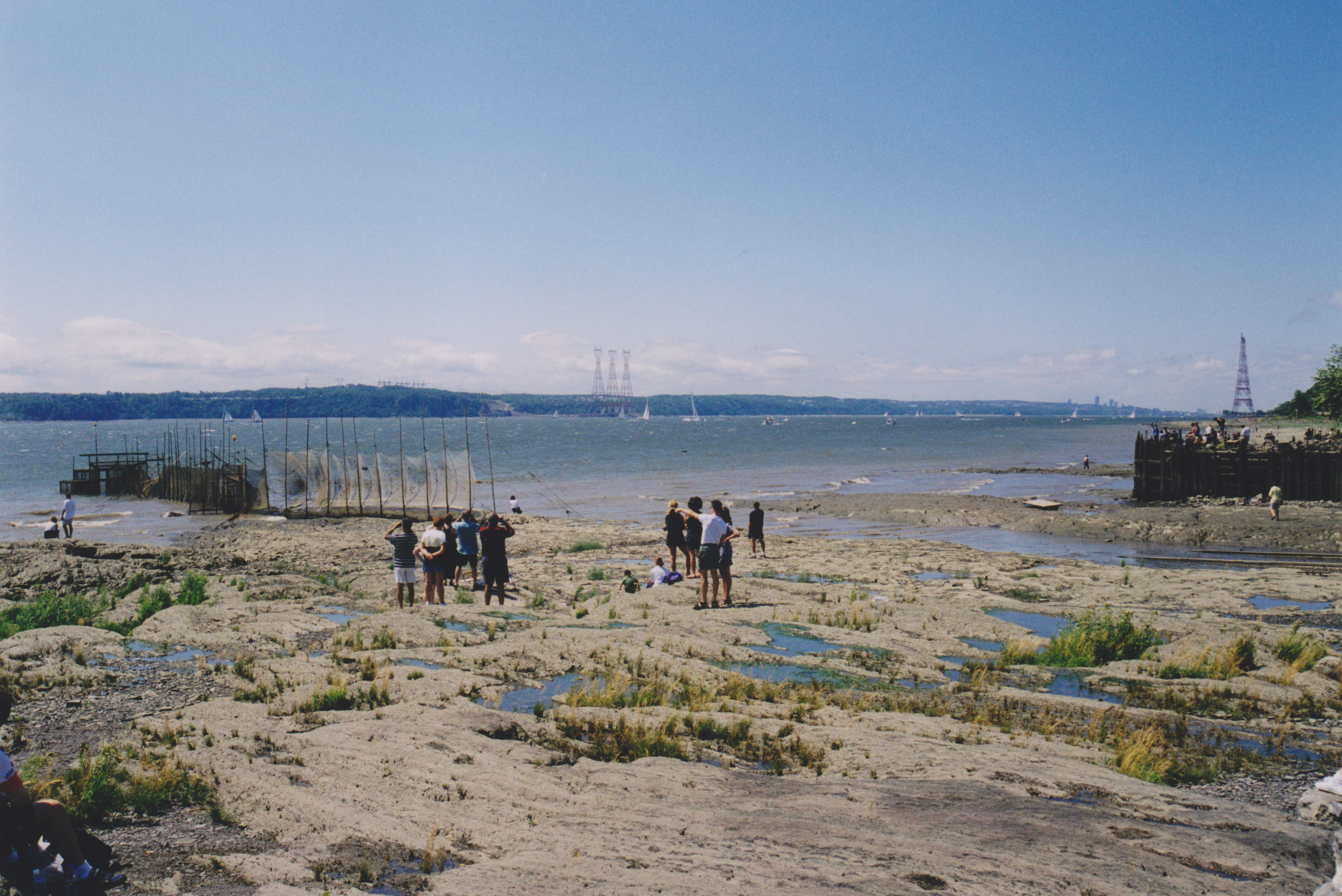
Pointe-aux-Outardes () is a village municipality in Quebec, Canada, on the southern point of the Manicouagan Peninsula between the mouths of the Outardes and Manicouagan Rivers. The place is named after a piece of land that juts out into the Saint Lawrence River and partially encloses the Outardes Bay: ''Pointe aux Outardes''. It literally means "Point of Bustards", but ''Outarde'' can also be translated as "Canada goose".Office québécois de la langue française Le grand dictionnaire terminologique/ref> In fact, Canada geese and snow geese use the nearby Manicouagan River as a corridor in their annual migration and stopover at the point. The Innu called it ''Piletipistu Neshkâu'', meaning "point of the Partridge River". But the term ''Outardes'' was used on Guérard's map of 1631 and on Franquelin's map of 1685 to identify the river that flows past the point into the St. Lawrence. Pointe-aux-Outardes is exceptionally rich in flora and fauna. Among its salt marshes, more t ... [...More Info...] [...Related Items...] OR: [Wikipedia] [Google] [Baidu] |
Area Codes 418 And 581
Area codes 418, 581, and 367 are telephone area codes in the North American Numbering Plan (NANP) for the eastern portion of the Canadian province of Quebec. Area code 418 was originally assigned to the numbering plan area, but all three area codes now form an overlay plan for this territory. Cities in the numbering plan area include Quebec City, Saguenay, Lévis, Rimouski, Saint-Georges, Alma, Thetford Mines, Sept-Îles, Baie-Comeau and Rivière-du-Loup. Also served are the Gaspé Peninsula, Côte-Nord, southeastern Mauricie, and the tiny hamlet of Estcourt Station, in the U.S. state of Maine. History Ontario and Quebec were the only provinces that received assignments of multiple area codes by the American Telephone and Telegraph Company (AT&T) when the original North American area codes were created in 1947. The eastern part of Quebec received area code 418, while area code 514 was assigned for the western part. Nominally, northwestern Quebec, one of the few a ... [...More Info...] [...Related Items...] OR: [Wikipedia] [Google] [Baidu] |
List Of G Postal Codes Of Canada
__NOTOC__ This is a list of postal codes in Canada where the first letter is G. Postal codes beginning with G are located within the Canadian province of Quebec. Only the first three characters are listed, corresponding to the Canadian postal code#Forward sortation areas, Forward Sortation Area (FSA). Canada Post provides a free postal code look-up tool on its website, via its mobile apps for such smartphones as the iPhone and BlackBerry, and sells hard-copy directories and CD-ROMs. Many vendors also sell validation tools, which allow customers to properly match addresses and postal codes. Hard-copy directories can also be consulted in all post offices, and some libraries. Eastern Quebec There are currently 140 FSAs in this list. Urban Rural References {{Canadian postal codes Communications in Quebec Quebec-related lists, Postal codes G Postal codes in Canada, G ... [...More Info...] [...Related Items...] OR: [Wikipedia] [Google] [Baidu] |
René-Lévesque (provincial Electoral District)
René-Lévesque is a provincial electoral district in the Côte-Nord region of Quebec, Canada, which elects members to the National Assembly of Quebec. It notably includes the municipalities of Baie-Comeau, Forestville and Pointe-Lebel as well as the reserve of Pessamit. It was created for the 1948 election under the name Saguenay from part of the former Charlevoix–Saguenay electoral district. The predecessor to Charlevoix-Saguenay (before 1912) was Chicoutimi-Saguenay. Despite its former name, the district has not included the Saguenay–Lac-Saint-Jean region since at least the 1994 election. It was renamed René-Lévesque for the 2003 election, after former Quebec Premier René Lévesque, although its territory was unchanged. It remained unchanged after the change from the 2001 to the 2011 electoral map. Members of the National Assembly Election results René-Lévesque, 2001 - present By-election required due to the resi ... [...More Info...] [...Related Items...] OR: [Wikipedia] [Google] [Baidu] |
Manicouagan Regional County Municipality
Manicouagan () is a regional county municipality in the Côte-Nord region of Quebec, Canada. It is located on the north shore of the St. Lawrence River with its seat in Baie-Comeau. It was created in 1981, and named after the Manicouagan River. Subdivisions There are 9 subdivisions and one native reserve within the RCM: ;Cities & Towns (1) * Baie-Comeau ;Municipalities (1) * Franquelin ;Parishes (1) * Ragueneau ;Villages (5) * Baie-Trinité * Chute-aux-Outardes * Godbout * Pointe-aux-Outardes * Pointe-Lebel ;Unorganized Territory (1) * Rivière-aux-Outardes ;Native Reserves (1)(not associated with RCM) * Pessamit Demographics Population Language Transportation Access Routes Highways and numbered routes that run through the municipality, including external routes that start or finish at the county border: * Autoroutes ** None * Principal Highways ** * Secondary Highways ** * External Routes ** None See also * List of regional county municipalities ... [...More Info...] [...Related Items...] OR: [Wikipedia] [Google] [Baidu] |
Snow Goose
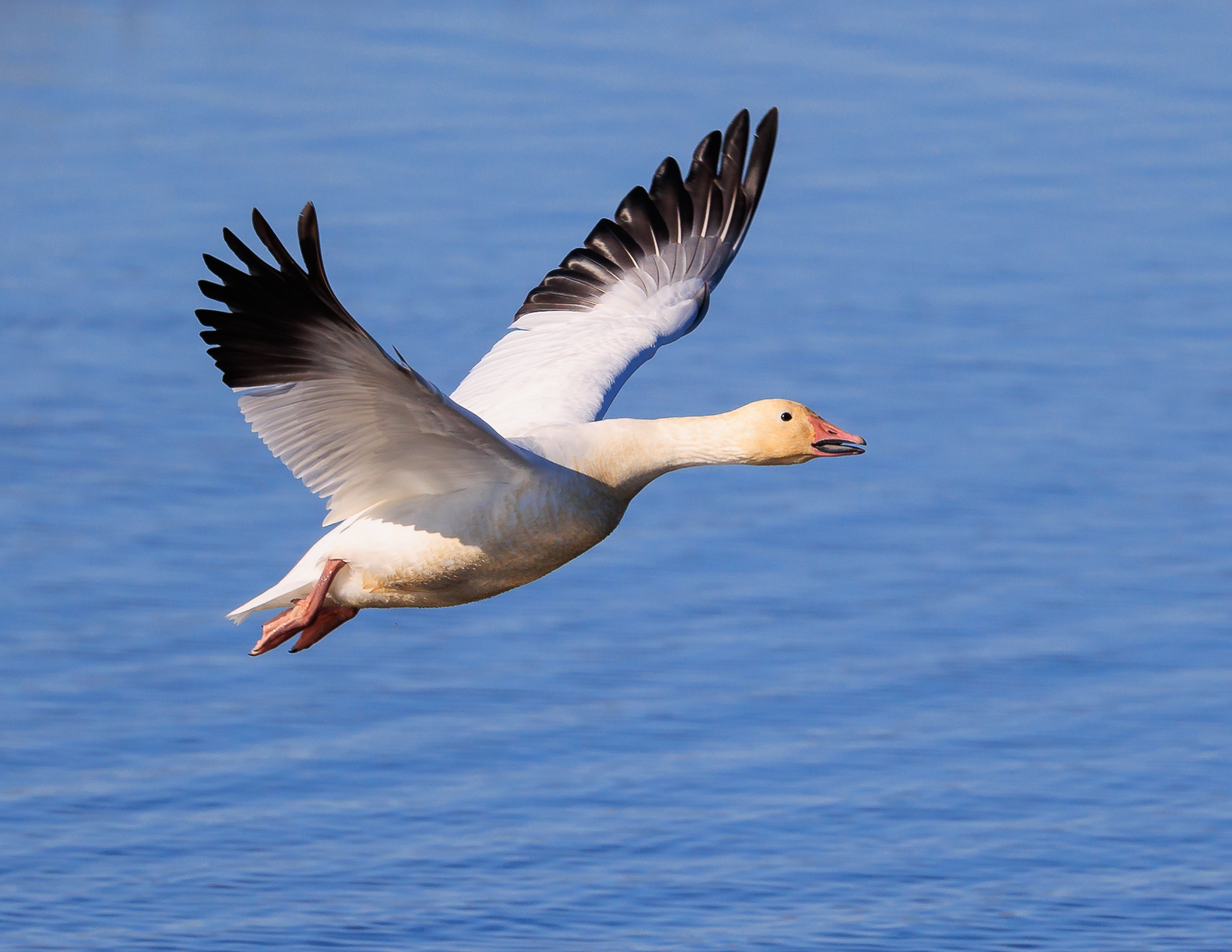
The snow goose (''Anser caerulescens'') is a species of goose native to North America. Both white and dark morphs exist, the latter often known as blue goose. Its name derives from the typically white plumage. The species was previously placed in the Chen (genus), genus ''Chen'', but is now typically included in the "gray goose" genus ''Anser (genus), Anser''. Snow geese breed north of the tree line, timberline in Greenland, Canada, Alaska, and the northeastern tip of Siberia, and spend winters in warm parts of North America from southwestern British Columbia through parts of the United States to Mexico. Taxonomy In 1750 the English naturalist George Edwards (naturalist), George Edwards included an illustration and a description of the snow goose in the third volume of his ''A Natural History of Uncommon Birds''. He used the English name "The blue-winged goose". Edwards based his hand-coloured etching on a preserved specimen that had been brought to London from the Hudson Bay ... [...More Info...] [...Related Items...] OR: [Wikipedia] [Google] [Baidu] |
Saint Lawrence River
The St. Lawrence River (, ) is a large international river in the middle latitudes of North America connecting the Great Lakes to the North Atlantic Ocean. Its waters flow in a northeasterly direction from Lake Ontario to the Gulf of St. Lawrence, traversing Ontario and Quebec in Canada and New York (state), New York in the United States. A section of the river demarcates the Canada–United States border, Canada–U.S. border. As the primary Discharge (hydrology), drainage outflow of the Great Lakes Basin, the St. Lawrence has the List of rivers by discharge, second-highest discharge of any river in North America (after the Mississippi River) and the 16th-highest in the world. The estuary of St. Lawrence, estuary of the St. Lawrence is often cited by scientists as the largest in the world. Significant natural landmarks of the river and estuary include the 1,864 river islands of the Thousand Islands, the endangered whales of Saguenay–St. Lawrence Marine Park, and the limestone ... [...More Info...] [...Related Items...] OR: [Wikipedia] [Google] [Baidu] |
Bustard
Bustards, including floricans and korhaans, are large, terrestrial birds living mainly in dry grassland areas and in steppe regions. They range in length from . They make up the family Otididae (, formerly known as Otidae). Bustards are omnivorous and opportunistic, eating leaves, buds, seeds, fruit, small vertebrates, and invertebrates.del Hoyo, J. Elliott, A. & Sargatal, J. (editors). (1996) ''Handbook of the Birds of the World. Volume 3: Hoatzin to Auks''. Lynx Edicions. There are 26 species currently recognised. Etymology The word ''bustard'' comes from the Old French ''bistarda'' and some other languages: ''abetarda'' ( pt), ''abetarda'' ( gl), ''avutarda'' ( es) used for the great bustard. The naturalist William Turner listed the English spelling "bustard" and "bistard" in 1544. All of the common names above are derived from Latin ''avis tarda'' or ''aves tardas'' given by Pliny the Elder, these names were mentioned by the Pierre Belon in 1555 and Ulisse ... [...More Info...] [...Related Items...] OR: [Wikipedia] [Google] [Baidu] |
Canada Goose
The Canada goose (''Branta canadensis''), sometimes called Canadian goose, is a large species of goose with a black head and neck, white cheeks, white under its chin, and a brown body. It is native to the arctic and temperate regions of North America, and it is occasionally found during bird migration, migration across the Atlantic in northern Europe. It has been introduced to France, the United Kingdom, Ireland, Scandinavia, New Zealand, Japan, Chile, Argentina, and the Falkland Islands. Like most geese, the Canada goose is primarily herbivorous and normally migratory; often found on or close to fresh water, the Canada goose is also common in Brackish water, brackish marshes, estuaries, and lagoons. Extremely adept at urban wildlife, living in human-altered areas, Canada geese have established breeding colonies in urban and cultivated habitats, which provide food and few natural predators. The success of this common park species has led to it often being considered a pest (orga ... [...More Info...] [...Related Items...] OR: [Wikipedia] [Google] [Baidu] |
Jean-Baptiste-Louis Franquelin
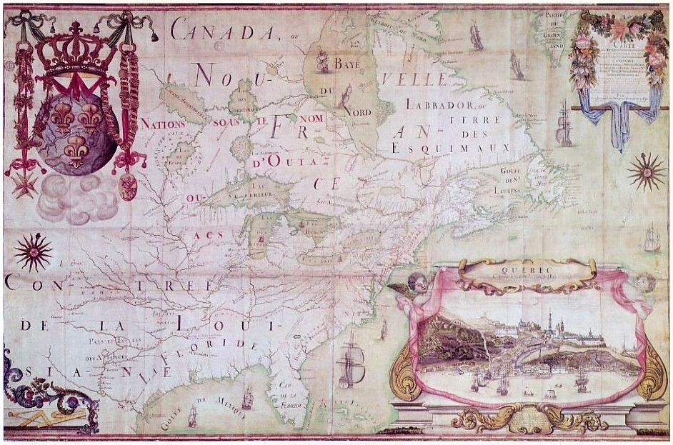
Jean-Baptiste-Louis Franquelin (; 1650-c.1712) was a French trader who was appointed in the early 1670s as the first Cartography, cartographer in ''Nouvelle France'' (Canada) by the colony's governor. He was appointed in 1688 as a royal Hydrography, hydrographer by Louis XIV. Franquelin was born in the commune of Pallauau-sur-Indre in central France. He migrated to New France in 1671 where he was soon appointed as the colony's cartographer. He documented a decade of Louis Jolliet and René-Robert Cavelier, Sieur de La Salle, René-Robert Cavelier de La Salle's explorations in North America. He also completed other projects for the Crown and served the king's military engineer. After returning to France in 1692, he never lived in Canada again. Biography Born at Palluau-sur-Indre, Saint-Michel de Villebernin, he grew up in the village in the small commune of Palluau-sur-Indre in central France. Having developed drawing and mapmaking skills, Franquelin migrated in 1671 from the Indr ... [...More Info...] [...Related Items...] OR: [Wikipedia] [Google] [Baidu] |
Innu
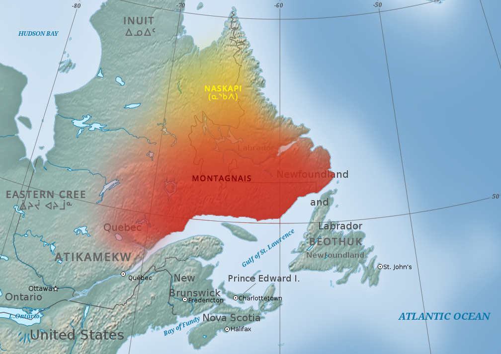
The Innu/Ilnu ('man, person'), formerly called Montagnais (French for ' mountain people'; ), are the Indigenous Canadians who inhabit northeastern Labrador in present-day Newfoundland and Labrador and some portions of Quebec. They refer to their traditional homeland as ''Nitassinan'' ('Our Land', ᓂᑕᔅᓯᓇᓐ) or ''Innu-assi'' ('Innu Land'). The ancestors of the modern First Nations were known to have lived on these lands as hunter-gatherers for many thousands of years. To support their seasonal hunting migrations, they created portable tents made of animal skins. Their subsistence activities were historically centred on hunting and trapping caribou, moose, deer, and small game. Their language, which changed over time from Old Montagnais to Innu-aimun (popularly known since the French colonial era as Montagnais), is spoken throughout Nitassinan, with certain dialect differences. It is part of the Cree–Montagnais– Naskapi dialect continuum, and is unrelated to ... [...More Info...] [...Related Items...] OR: [Wikipedia] [Google] [Baidu] |
2021 Canadian Census
The 2021 Canadian census was a detailed enumeration of the Canada, Canadian population with a reference date of May 11, 2021. It follows the 2016 Canadian census, which recorded a population of 35,151,728. The overall response rate was 98%, which is slightly lower than the response rate for the 2016 census. It recorded a population of 36,991,981, a 5.2% increase from 2016. It will be succeeded by 2026 Canadian census, Canada's 2026 census. Planning Consultation on census program content was from September 11 to December 8, 2017. The census was conducted by Statistics Canada, and was contactless as a result of the COVID-19 pandemic in Canada. The agency had considered delaying the census until 2022. About 900 supervisors and 31,000 field enumerators were hired to conduct the door-to-door survey of individuals and households who had not completed the census questionnaire by late May or early June. Canvassing agents wore masks and maintained a physical distance to comply with COV ... [...More Info...] [...Related Items...] OR: [Wikipedia] [Google] [Baidu] |


