|
Pindus Mountains
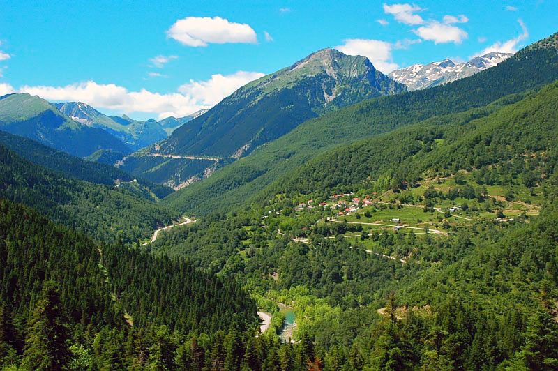
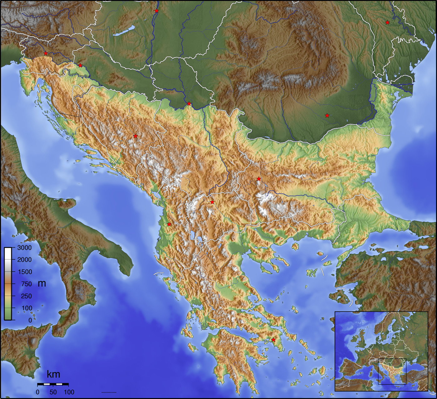
The Pindus (also Pindos or Pindhos; ; ; ) is a mountain range located in Northern Greece and Southern Albania. It is roughly long, with a maximum elevation of ( Mount Smolikas). Because it runs along the border of Thessaly and Epirus, the Pindus range is known colloquially as the ''spine of Greece''. The mountain range stretches from near the Greek-Albanian border in southern Albania, entering the Epirus and Macedonia regions in northern Greece down to the north of the Peloponnese. Geologically, it is an extension of the Dinaric Alps, which dominate the western region of the Balkan Peninsula. History of the name Historically, the name Pindos refers to the mountainous territory that separates the greater Epirus region from the regions of Macedonia and Thessaly. According to John Tzetzes (a 12th-century Byzantine writer), the Pindos range was then called Metzovon. When translated (between 1682/83 and 1689) to a more conversational (colloquial) language the initial praise ... [...More Info...] [...Related Items...] OR: [Wikipedia] [Google] [Baidu] |
Epirus
Epirus () is a Region#Geographical regions, geographical and historical region, historical region in southeastern Europe, now shared between Greece and Albania. It lies between the Pindus Mountains and the Ionian Sea, stretching from the Bay of Vlorë and the Ceraunian Mountains, Acroceraunian Mountains in the north to the Ambracian Gulf and the ruined Roman Empire, Roman city of Nicopolis in the south.. It is currently divided between the Modern regions of Greece, region of Epirus (region), Epirus in northwestern Greece and the counties of Gjirokastër County, Gjirokastër and Vlorë County, Vlorë in southern Albania. The largest city in Epirus is Ioannina, seat of the Greek region of Epirus, with Gjirokastër the largest city in the Albanian part of Epirus. A rugged and mountainous region, Epirus was the north-west area of ancient Greece. It was inhabited by the Greek tribes of the Chaonians, Molossians, and Thesprotians. It was home to the sanctuary of Dodona, the oldest o ... [...More Info...] [...Related Items...] OR: [Wikipedia] [Google] [Baidu] |
Balkans
The Balkans ( , ), corresponding partially with the Balkan Peninsula, is a geographical area in southeastern Europe with various geographical and historical definitions. The region takes its name from the Balkan Mountains that stretch throughout the whole of Bulgaria. The Balkan Peninsula is bordered by the Adriatic Sea in the northwest, the Ionian Sea in the southwest, the Aegean Sea in the south, the Turkish straits in the east, and the Black Sea in the northeast. The northern border of the peninsula is variously defined. The highest point of the Balkans is Musala, , in the Rila mountain range, Bulgaria. The concept of the Balkan Peninsula was created by the German geographer August Zeune in 1808, who mistakenly considered the Balkan Mountains the dominant mountain system of southeastern Europe spanning from the Adriatic Sea to the Black Sea. In the 19th century the term ''Balkan Peninsula'' was a synonym for Rumelia, the parts of Europe that were provinces of the Ottoman E ... [...More Info...] [...Related Items...] OR: [Wikipedia] [Google] [Baidu] |
Agrafa
Agrafa (, ) is a mountainous region in Evrytania and Karditsa regional units in mainland Greece, consisting mainly of small villages. It is the southernmost part of the Pindus range. There is also a municipality with the same name, the Municipality of Agrafa, but it covers only a small percentage of the area. History "Agrafa" in Greek means "unwritten", a reference to the region's remoteness and difficult terrain. As a result, the Ottomans were never able to successfully control the region. Agrafa maintained a form of self-governance and semi-independence, which included having its own militias and dispute arbitration systems. These privileges were recognized by the Ottomans in a treaty in 1525. The fiercely independent spirit of its people, known as ''Agrafiotes,'' is matched by a harsh and forbidding landscape. The central Agrafiotis River valley is surrounded on three sides by a steep 2,000-metre wall of mountains, and on its south side the river drains via a series ... [...More Info...] [...Related Items...] OR: [Wikipedia] [Google] [Baidu] |
Vardousia
Vardousia () is a mountain in northwestern Phocis and southwestern Phthiotis, Greece. Its highest peak, Korakas (; also known as Korax) reaches above sea level, making it the second-tallest summit in Central Greece after Giona. It is a southern extension of the Pindus mountains. It is divided into three main parts: Northern Vardousia, whose highest peak is Sinani at , the very steep Western Vardousia, whose highest peak is ''Soufles'' at , and Southern Vardousia, with the highest peak of ''Korakas''. The whole range measures about from north to south. The Vardousia is drained by tributaries of the river Spercheios to the north, the Mornos to the east and south, and the Evinos to the west. The Panaitoliko mountains are to the west, Tymfristos to the northwest, Oeta to the east and Giona to the southeast. Flora Vardousia is home to approximately 1,200 plant species, of which 110 are endemic to Greece and four are local endemics. The Mediterranean maquis dominates the l ... [...More Info...] [...Related Items...] OR: [Wikipedia] [Google] [Baidu] |
Athamanika
Athamanika or Tzoumerka ( Greek: Αθαμανικά or Τζουμέρκα) is a mountain range in northwestern Greece, part of the wider Pindus mountain range. Its highest point is the mountain Kakarditsa, at 2,429 m. Its length is approximately 40 km from north to south and its width is approximately 15 to 20 km from east to west. The only major road crossing the Athamanika is the Greek National Road 30 (Arta - Trikala - Karditsa - Volos). Geography The Athamanika is situated on the borders of the regional units of Arta, Ioannina, Karditsa and Trikala. It covers (part of) the municipalities North Tzoumerka, Central Tzoumerka, Pyli and Argithea. It has a low population density. Forests dominate the low-lying areas of the mountain. Grasslands, shrubs and barren rocks dominate the higher elevations. The main rivers draining the Athamanika are the Arachthos in the west, and the Achelous in the east. History The Athamanika mountain range became the main base of ... [...More Info...] [...Related Items...] OR: [Wikipedia] [Google] [Baidu] |
Tymfi
Tymphe (in Latin and English usage) or Tymfi (in the Greek government's preferred transliteration), Timfi, also Tymphi (, ) is a mountain in the northern Pindus mountain range, in northwestern Greece. It is part of the regional units of Greece, regional unit of Ioannina (regional unit), Ioannina and lies in the region of Zagori, just a few metres south of the 40° Parallel (latitude), parallel. Tymphe forms a massif with its highest peak, Gamila, at . The massif of Tymphe includes in its southern part the Vikos Gorge, while they both form part of the Vikos–Aoös National Park which accepts over 100,000 visitors per year. The former municipality of Tymfi (municipal unit), Tymfi owed its name to the mountain. Etymology The exact meaning of the name is not known but has been in use since ancient times. The name "Tymphe" or "Stymphe" is mentioned by ancient geographer Strabo, Book 7, Ch. 7, and is associated with the ancient land of Tymphaea and the Tymphaeans, one of the tribes o ... [...More Info...] [...Related Items...] OR: [Wikipedia] [Google] [Baidu] |
Mount Vasilitsa
Vasilitsa is a ski resort in Greece. The ski center is located in the middle of Pindos (40.033N, 21.083E), approximately 42km away from Grevena and 417km from Athens Athens ( ) is the Capital city, capital and List of cities and towns in Greece, largest city of Greece. A significant coastal urban area in the Mediterranean, Athens is also the capital of the Attica (region), Attica region and is the southe .... The ski resorts currently has five lifts and 16 ski trails. The summit of the resort is 2113m above sea level and the total vertical drop about 450m. The quality and quantity of snowfall at Vasilitsa allow for many off-piste routes. Black-pine trees surround the ski trails. Lifts and ski trails * Philippos (1642-1825m), with two intermediate-easy trails and one very easy trail. * Alexander the Great (1800–2113m), with two hard and two intermediate trails. * Elimeia (1788–2060m), with one intermediate, three intermediate-easy and one very easy trail. * Midganis ... [...More Info...] [...Related Items...] OR: [Wikipedia] [Google] [Baidu] |
Mount Smolikas
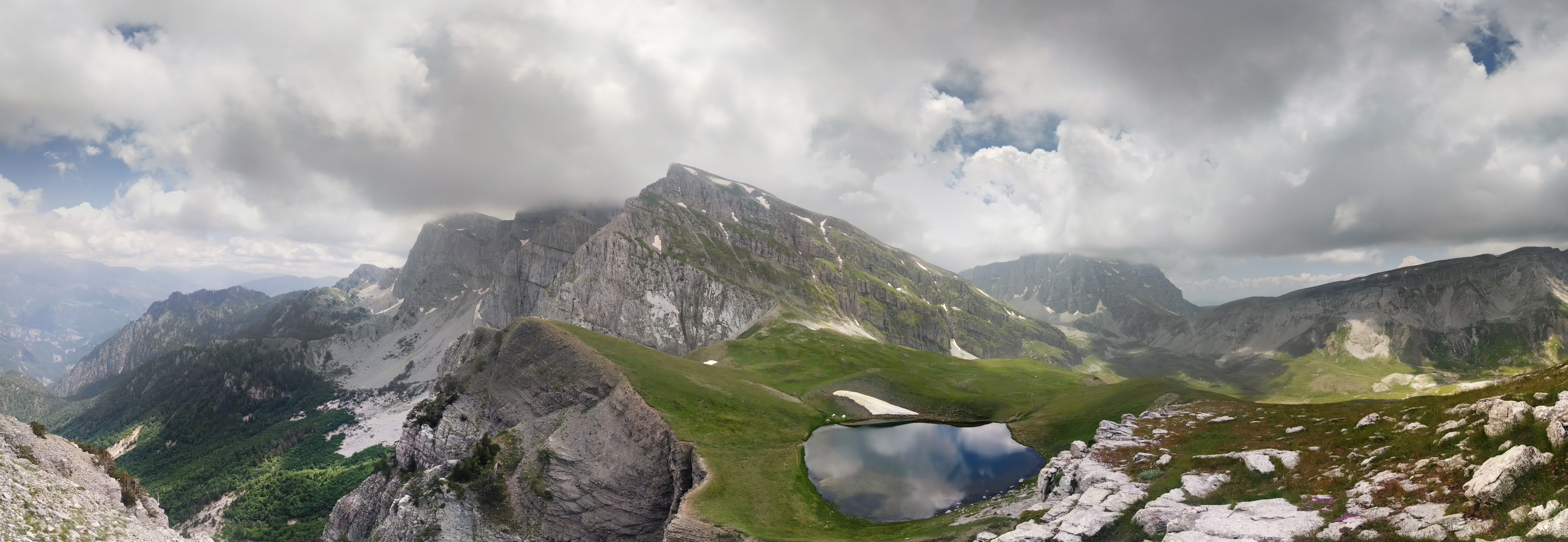
Mount Smolikas (; ) is a mountain in the Ioannina (regional unit), Ioannina regional unit, northwestern Greece. At a height of 2,637 metres above sea level, it is the highest of the Pindus Mountains, and the second highest mountain in Greece after Mount Olympus. The mountain consists of ophiolite rocks. During several periods in the Pleistocene the northern and eastern cirques and valleys were glaciated. The last glaciers of this area retreated around 11,500 years ago. It is drained by the river Vjosa to the south, and the river Vourkopotamo (a tributary of the Sarantaporos (Epirus), Sarantaporos) to the north. There is a small alpine lake called "Drakolimni Smolika" near the summit, at about 2,200 metres elevation. Nearby mountain ranges are Tymfi to the south, Gramos to the northwest, Vasilitsa to the southeast and Voio to the northeast. The higher elevations, above 2,000 metres, consist of grasslands and rocks, and there are deciduous and conifer forests at lower elevations. T ... [...More Info...] [...Related Items...] OR: [Wikipedia] [Google] [Baidu] |
Mount Grammos
Gramos ( or Γράμμος; ; , , or ) is a mountain chain situated on the border of Albania and Greece. Part of the larger northern Pindus mountain range, its highest peak, ''Maja e Çukapeçit'', rises at an elevation of . Geography From the Albanian side, Gramos lies on the eastern edge of Kolonjë municipality, bounded in the northwest by the Morava mountain and in the southeast by Kamenik. It continues beyond the state border, into Greece, extending along the boundaries of Ioannina and Kastoria regional units, neighboured by the Smolikas chain to the south and Voio to the east. Geology The mountain mass consists mainly of paleogene flysch, with smaller amounts of lower flysch and limestone, resulting in a complex tectonic structure. Above heights of , various glacial features such as cirques and glacial valleys can be observed. The western and northwestern slopes of the mountain give rise to various branches of the Osum and Devoll rivers. Conversely, the northeaste ... [...More Info...] [...Related Items...] OR: [Wikipedia] [Google] [Baidu] |
Aoös
The Vjosa (; indefinite form: ) or Aoös () is a river in northwestern Greece and southwestern Albania. Its total length is about , of which the first are in Greece, and the remaining in Albania. Its drainage basin is and its average discharge is . The main tributaries are Voidomatis, Sarantaporos, Drino and Shushicë. The river arises in the Pindus mountains of Epirus, Greece, and generally flows northwest. It enters Albania near Çarshovë, and empties into the Adriatic Sea just north of Vlorë. Generally wild and unpolluted, the river is surrounded by the Vikos–Aoös National Park in Greece, and the Vjosa-Narta Protected Landscape near its mouth. In December 2020, the Albanian portion of the river was designated a "Managed Nature Reserve" by the government. A campaign by the environmentalist groups to designate the whole Albanian part of the course a national park, to guard against the prospective hydroelectric projects, ultimately resulted in the creation of the V ... [...More Info...] [...Related Items...] OR: [Wikipedia] [Google] [Baidu] |
Aspropotamos, Trikala
Aspropotamos (Greek: Ασπροπόταμος meaning "white river") is a former community in the Trikala regional unit, Thessaly, Greece. Since the 2011 local government reform it is part of the municipality Meteora, of which it is a municipal unit. The 2021 census recorded 218 residents in the municipal unit. The seat of the community was in Kallirroi. Name The community was named after the river Aspropotamos, a tributary of the Acheloos. Geography Aspropotamos is located in the southern Pindus mountains, in the westernmost part of Trikala regional unit, about 40 km west of Trikala and 20 km southeast of Metsovo. Aspropotamos covers an area of 297.082 km2. The largest community in the municipal unit is Kallirroi (pop. 55). Subdivisions The municipal unit Aspropotamos is subdivided into the following communities (constituent villages in parentheses): *Agia Paraskevi Agia Paraskevi (, ''Agía Paraskeví'') is a suburb and a municipality in the northeastern p ... [...More Info...] [...Related Items...] OR: [Wikipedia] [Google] [Baidu] |
John Cam Hobhouse
John Cam Hobhouse, 1st Baron Broughton, (27 June 1786 – 3 June 1869), known as Sir John Hobhouse, Bt, from 1831 to 1851, was an English politician and diarist. Early life Born at Redland near Bristol, Broughton was the eldest son of Sir Benjamin Hobhouse, 1st Baronet, and Charlotte, daughter of Samuel Cam. He was educated at Westminster School, and at Trinity College, Cambridge where he graduated in 1808. Broughton took the Hulsean prize in 1808 for his ''Essay on the Origin and Intention of Sacrifices''. At Cambridge he founded the Whig Club and the Amicable Society. Friendship with Lord Byron and mainland European journeys While at Cambridge Broughton became good friends with Lord Byron, who accompanied him on a tour through Spain, Greece and Turkey in 1809. Hobhouse was present at the Battle of Dresden in August 1813, and, following the Coalition armies into France, he saw Louis XVIII enter Paris in May 1814. In 1815 Broughton was again in Paris after the return of ... [...More Info...] [...Related Items...] OR: [Wikipedia] [Google] [Baidu] |


