|
Peterborough Rural District
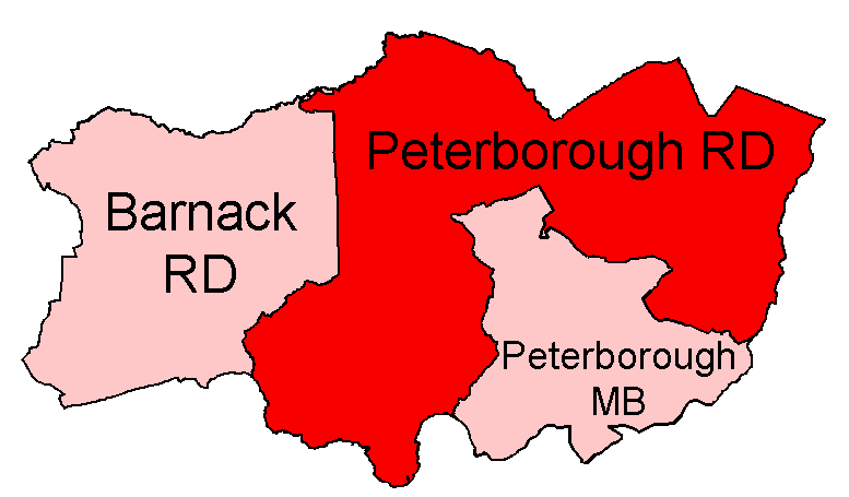
Peterborough was a rural district adjoining the city and municipal borough of Peterborough, England, from 1894 to 1974. The council offices were at 51 Priestgate, in the city of Peterborough. The rural district was created under the Local Government Act 1894, from the part of the Peterborough rural sanitary district that was in the administrative county of Soke of Peterborough (the rest, in Huntingdonshire, formed the Norman Cross Rural District). In 1929 the city's boundaries were extended, with six of the rural district's parishes being absorbed. Local government reorganisation abolished the Soke in 1965 and the rural district was transferred to the new administrative county of Huntingdon and Peterborough. The rural district was abolished under the Local Government Act 1972, becoming part of the Peterborough district of the new non-metropolitan county of Cambridgeshire.Frederic A Youngs Jr., ''Guide to the Local Administrative Units of England'', Volume II: Northern Englan ... [...More Info...] [...Related Items...] OR: [Wikipedia] [Google] [Baidu] |
Peterborough
Peterborough () is a cathedral city in Cambridgeshire, east of England. It is the largest part of the City of Peterborough unitary authority district (which covers a larger area than Peterborough itself). It was part of Northamptonshire until 1974, when county boundary change meant the city became part of Cambridgeshire instead. The city is north of London, on the River Nene which flows into the North Sea to the north-east. In 2020 the built-up area subdivision had an estimated population of 179,349. In 2021 the Unitary Authority area had a population of 215,671. The local topography is flat, and in some places, the land lies below sea level, for example in parts of the Fens to the east and to the south of Peterborough. Human settlement in the area began before the Bronze Age, as can be seen at the Flag Fen archaeological site to the east of the current city centre, also with evidence of Roman occupation. The Anglo-Saxon period saw the establishment of a monastery, Medesh ... [...More Info...] [...Related Items...] OR: [Wikipedia] [Google] [Baidu] |
Civil Parish
In England, a civil parish is a type of Parish (administrative division), administrative parish used for Local government in England, local government. It is a territorial designation which is the lowest tier of local government below districts of England, districts and metropolitan and non-metropolitan counties of England, counties, or their combined form, the Unitary authorities of England, unitary authority. Civil parishes can trace their origin to the ancient system of Parish (Church of England), ecclesiastical parishes, which historically played a role in both secular and religious administration. Civil and religious parishes were formally differentiated in the 19th century and are now entirely separate. Civil parishes in their modern form came into being through the Local Government Act 1894, which established elected Parish councils in England, parish councils to take on the secular functions of the vestry, parish vestry. A civil parish can range in size from a sparsely ... [...More Info...] [...Related Items...] OR: [Wikipedia] [Google] [Baidu] |
Newborough, Cambridgeshire
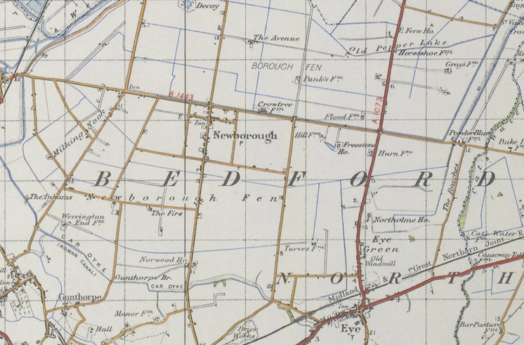
Newborough is a village and a civil parish in the Peterborough district, in the ceremonial county of Cambridgeshire, England. Newborough is situated 7.62 km (4.74 mi) north of Peterborough. Newborough has a population of 1,670 according to the 2011 census Newborough is located along the B1443 and is a short distance away from the A16. History Newborough means ‘new fortification’ in old English. Newborough was part of the Borough Fen, which was formed into a new parish in 1822. The land has been much improved by draining, and is now principally arable. During the Saxon and Medieval periods Borough Fen lay underwater. In the 17th century, a Dutch engineer, Cornelius Vermuyden, began to drain the fenland. One of the earliest dykes cut was the Highland Drain, which runs parallel to the Thorney Road. More efficient drainage systems have led the way to mixed and arable farming. Today the main crops are cereals and sugar beet. However, with the decline of sugar re ... [...More Info...] [...Related Items...] OR: [Wikipedia] [Google] [Baidu] |
Maxey, Cambridgeshire
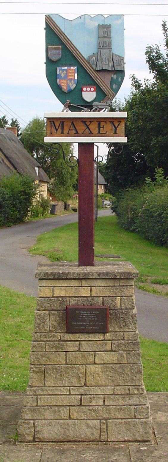
Maxey is a village in the Peterborough unitary authority, in the ceremonial county of Cambridgeshire, England, located between Peterborough and Stamford and southwest of The Deepings. It is home to nearly 700 residents. The main focal points are the one remaining public house (Blue Bell), the Church (St Peter's) and the village hall. Each provides a range of social functions throughout the year. There are a surprising number of businesses based in the village, including a few working farms. History Once part of the Soke of Peterborough in Northamptonshire, Maxey can trace its 'modern' roots back over 1,000 years. However, archaeological excavation of the area has provided ample evidence of continuous occupation for over 4,000 years. Lolham Bridges, on the outskirts of Maxey between Helpston and Bainton, were originally built in the Roman era to carry King Street over the floodplain of the River Welland. Rescue archaeology before gravel workings began revealed details ... [...More Info...] [...Related Items...] OR: [Wikipedia] [Google] [Baidu] |
Marholm, Cambridgeshire
Marholm is a village and civil parish in the Peterborough district, in the ceremonial county of Cambridgeshire, England. West of Peterborough and 1 mile from the seat of the Fitzwilliam family at Milton Hall. The parish covers some 1,400 acres, with the village positioned roughly in the centre. For electoral purposes it forms part of Northborough ward in North West Cambridgeshire constituency. According to the 2011 census there were 76 males and 75 females living in the parish. Peterborough Crematorium, a holder of the prestigious Green Flag Award, is located in approximately 26 acres (10.52 ha) of land in the parish, much of it left as original ancient woodland. Located just north is Woodcroft Castle. History In 1870-72, John Marius Wilson's ''Imperial Gazetteer of England and Wales'' described Marholm like this:MARHOLM, a parish in Peterborough district, Northampton; adjacent to the Great Northern railway, 4½ miles NW by N of Peterborough r. station. Post town, Peterb ... [...More Info...] [...Related Items...] OR: [Wikipedia] [Google] [Baidu] |
Longthorpe, Peterborough
Longthorpe is an area of the city of Peterborough, in the Peterborough district, in the ceremonial county of Cambridgeshire, England. Located west from the city centre, the area covers . For electoral purposes it forms part of Peterborough West ward. A 1st century Roman fort In the Roman Republic and the Roman Empire, the Latin word ''castrum'', plural ''castra'', was a military-related term. In Latin usage, the singular form ''castrum'' meant 'fort', while the plural form ''castra'' meant 'camp'. The singular and ... was established at Longthorpe, it may have been as early as around AD 44–48 but was certainly present by 61–62. The first phase covered , this was later replaced by another fort measuring . The ecclesiastical parish was formed in 1850 from the parish of Saint John the Baptist. The church of Saint Botolph is a plain building of coarse rubble, dating from the 13th century, consisting of chancel, nave, aisles and a western bell cote, ... [...More Info...] [...Related Items...] OR: [Wikipedia] [Google] [Baidu] |
Helpston, Cambridgeshire
Helpston (also, formerly, "Helpstone") is an English village formerly in the Soke of Peterborough, geographically in Northamptonshire, subsequently (1965–1974) in Huntingdon and Peterborough, then in Cambridgeshire, and administered by the City of Peterborough unitary authority. The civil parish of Helpston covers an area of and had an estimated population in 2011 of 981. The parish church is dedicated to St Botolph; the chancel window was created by Francis Skeat and depicts "Christ in Majesty". The poet John Clare was born in Helpston in 1793 and is buried in the churchyard of St Botolph's. The thatched cottage where he was born was bought by the John Clare Trust in 2005. The John Clare Cottage, at 12 Woodgate, has been restored using traditional building methods and is open to the public. In 2013 the John Clare Trust received a grant from the Heritage Lottery Fund to help preserve the building and provide educational activities for youngsters visiting the cottage. John C ... [...More Info...] [...Related Items...] OR: [Wikipedia] [Google] [Baidu] |
Gunthorpe, Peterborough
Gunthorpe is a residential area of the city of Peterborough, in the unparished area of Peterborough, in the Peterborough district, in the ceremonial county of Cambridgeshire Cambridgeshire (abbreviated Cambs.) is a Counties of England, county in the East of England, bordering Lincolnshire to the north, Norfolk to the north-east, Suffolk to the east, Essex and Hertfordshire to the south, and Bedfordshire and North ..., England. Since 2015 Gunthorpe has its own ward within Peterborough City Council that also encompasses parts of South Werrington. Development in Gunthorpe has been ongoing since the 1950s. The new Roman Fields development is in progress across the A15 and will include parks and a new academy. Development at the Roman Fields has been concurrent since 2006. There has also been activity in the north of Paston which is now Gunthorpe Ridings- a large development dating back to 1982 to 1988 by Wilcon Homes. Previously Wilcon Homes's area office was located on Meal' ... [...More Info...] [...Related Items...] OR: [Wikipedia] [Google] [Baidu] |
Glinton, Cambridgeshire
Glinton is a village in the north of the City of Peterborough unitary authority area in Cambridgeshire, England. Historically in Northamptonshire, it has a population of 3,130 (2001 Census) and consists of about 1,200 dwellings. It is separated from the urban sprawl of Peterborough and the new township of Werrington by the A15, the Peterborough bypass. History The origin of the place name Glinton is uncertain. It may mean "village on the Glym brook" (i.e. the Brook Drain) or could possibly be derived from the Old Danish ''klint'' (hill), or Middle Low German ''glinde'' (enclosure or fence) or the Old English ''glente'', meaning look-out place. Glinton was mentioned in the ''Domesday Book'' and evidence suggests that it dates from prehistory. There is evidence of early settlement at Glinton, dating back to the Iron Age. Extensive Roman remains, including a preserved well, were found during construction of the A15 bypass in 1996, as well as a fine example of a medi ... [...More Info...] [...Related Items...] OR: [Wikipedia] [Google] [Baidu] |
Eye, Cambridgeshire
Eye is a village in the unitary authority area of Peterborough, in the ceremonial county of Cambridgeshire, England. The village is south from Crowland. The hamlet of Eye Green is 1⁄2 mile (800 m) to the north, separated by the A47 trunk road. History According to ''A Dictionary of British Place Names'', Eye derives from the Old English ''ēg'', meaning a place at "the island or well-watered land, or dry ground in marsh". In the 10th century, this particular 'Eye' was spelt "Ege". There has been a church at Eye since at least 1543. The present church, St Matthew's, was built in 1846. Originally built with a spire, this was removed for safety reasons and now has a roofed tower. Adjoined to the southeast corner of the churchyard, and on Back Lane, stands the former village fire station dating from 1826 when it housed a Merryweather fire engine. Closed after 1945, it was repaired by the parish council in 2011. Eye Cornmill was a windmill with eight sails. Eye was pre ... [...More Info...] [...Related Items...] OR: [Wikipedia] [Google] [Baidu] |
Etton, Cambridgeshire
Etton is a village and civil parish in the unitary authority area of the city of Peterborough, Cambridgeshire, in England. For electoral purposes it forms part of Northborough ward in North West Cambridgeshire constituency. The parish had a population of 158 persons and 58 households in 2001. Woodcroft is a deserted medieval village and site of Woodcroft Castle. History A mysterious Neolithic settlement at Etton Woodgate was excavated by Francis Pryor in 1982. He reported that the site was in two halves, with each working building on one side mirrored by an unused 'ritual' copy on the other. Woodcroft Castle was built and moated about 1280. The medieval west range and corner tower survive along with an early Tudor (late 1400s) north wing. During the civil war A civil war or intrastate war is a war between organized groups within the same state (or country). The aim of one side may be to take control of the country or a region, to achieve independence for a region ... [...More Info...] [...Related Items...] OR: [Wikipedia] [Google] [Baidu] |
Deeping Gate, Cambridgeshire
Deeping Gate is a village and civil parish, lying on the River Welland in Cambridgeshire. Traditionally, the area was part of the Soke of Peterborough, geographically considered a part of Northamptonshire; it now falls within the City of Peterborough unitary authority area of Cambridgeshire. With a very small population, void of any major services, including a post office or even a chapel, the community depends on nearby Market Deeping, north of the river in Lincolnshire, for economic and market services. The parish had a population of 258 males and 257 females according to the 2011 Census. Renaissance composer Robert Fayrfax (Fairfax) was a native of the villageFairfax House the most prominent and grand property in the village, was home to the Fairfax Family. In the 1870s Wilson described Deeping Gate as:a hamlet in Maxey parish, Northampton; at the boundary with Lincoln, 1 mile SE of Market-Deeping. Real property, £1, 867. Pop., 224. Houses, 47St. Peter's, Maxey, the most n ... [...More Info...] [...Related Items...] OR: [Wikipedia] [Google] [Baidu] |


.jpg)
