|
Peschel Island
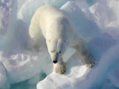
Peschel IslandKoldewey, Carl. 2015. ''The German Arctic Expedition 1869/1870: Narrative of the Wreck of the Hansa in the Ice''. Reprint (London, 1874). Bremen: Maritime Press, p. 442. ( no, Pescheløya) is the third-largest of the Bastian Islands in the Svalbard archipelago. It lies east of Wilhelm Island and northeast of Spitsbergen. The island consists of low basalt cliffs that attain an elevation of above sea level in the northern part of the island, in the east, and in the south. The closest neighboring islands are Lange Island about to the north and Wilhelm Island about to the northwest. The wildlife consists largely of polar bears. The Bastian Islands were discovered in 1867 by the Swedish-Norwegian polar explorer Nils Fredrik Rønnbeck, who was the first to sail around Spitsbergen. Most of the Bastian Islands were named during the First German North Polar Expedition in 1868, led by Carl Koldewey. This island is named after Oscar Peschel Oscar Ferdinand Peschel (17 M ... [...More Info...] [...Related Items...] OR: [Wikipedia] [Google] [Baidu] |
Bastian Islands
The Bastian Islands ( no, Bastianøyane) are a group of islands in Hinlopen Strait The Hinlopen Strait ( no, Hinlopenstretet) is the strait between Spitsbergen and Nordaustlandet in Svalbard, Norway. It is long and wide. The strait is difficult to pass because of pack ice. It is believed to have been named after Thijmen J ..., Svalbard. The islands are located southeast of Wilhelm Island. The islands are named after German explorer Adolf Bastian. The Bastian Islands are the northern islands of a larger group, and the southern islands of this group are called the Rønnbeck Islands. References Islands of Svalbard {{svalbard-geo-stub ... [...More Info...] [...Related Items...] OR: [Wikipedia] [Google] [Baidu] |
Svalbard
Svalbard ( , ), also known as Spitsbergen, or Spitzbergen, is a Norway, Norwegian archipelago in the Arctic Ocean. North of continental Europe, mainland Europe, it is about midway between the northern coast of Norway and the North Pole. The islands of the group range from 74th parallel north, 74° to 81st parallel north, 81° north latitude, and from 10th meridian east, 10° to 35th meridian east, 35° east longitude. The largest island is Spitsbergen, followed by Nordaustlandet and . The largest settlement is Longyearbyen. The islands were first used as a base by the Whaling, whalers who sailed far north in the 17th and 18th centuries, after which they were abandoned. Coal mining started at the beginning of the 20th century, and several permanent communities were established. The Svalbard Treaty of 1920 recognizes Norwegian sovereignty, and the 1925 Svalbard Act made Svalbard a full part of the Kingdom of Norway. They also established Svalbard as a free economic zone and a ... [...More Info...] [...Related Items...] OR: [Wikipedia] [Google] [Baidu] |
Wilhelm Island
Wilhelm Island ( no, Wilhelmøya) is an island in the Svalbard archipelago. It is situated northeast of Olav V Land on Spitsbergen, in Hinlopen Strait. Its area is 120 km². About 33.5 % of the island is covered with ice. The island was named after Wilhelm I. See also * List of islands of Norway This is a list of islands of Norway sorted by name. For a list sorted by area, see List of islands of Norway by area. A * Alden * Aldra * Algrøy * Alsta * Altra * Anda * Andabeløya * Andørja * Andøya, Vesterålen * Andøya, Agder ... References Islands of Svalbard Uninhabited islands of Norway {{svalbard-geo-stub ... [...More Info...] [...Related Items...] OR: [Wikipedia] [Google] [Baidu] |
Spitsbergen
Spitsbergen (; formerly known as West Spitsbergen; Norwegian: ''Vest Spitsbergen'' or ''Vestspitsbergen'' , also sometimes spelled Spitzbergen) is the largest and the only permanently populated island of the Svalbard archipelago in northern Norway. Constituting the westernmost bulk of the archipelago, it borders the Arctic Ocean, the Norwegian Sea, and the Greenland Sea. Spitsbergen covers an area of , making it the largest island in Norway and the 36th-largest in the world. The administrative centre is Longyearbyen. Other settlements, in addition to research outposts, are the Russian mining community of Barentsburg, the research community of Ny-Ålesund, and the mining outpost of Sveagruva. Spitsbergen was covered in of ice in 1999, which was approximately 58.5% of the island's total area. The island was first used as a whaling base in the 17th and 18th centuries, after which it was abandoned. Coal mining started at the end of the 19th century, and several permanent com ... [...More Info...] [...Related Items...] OR: [Wikipedia] [Google] [Baidu] |
Lange Island
Lange Island ( no, Langeøya) is the largest of the Bastian Islands in the Svalbard archipelago. It lies east of Wilhelm Island and northeast of Spitsbergen. The island is essentially a long series of low basalt cliffs measuring from east to west, connected by sand bars. Its highest points, both unnamed, stand at its west and east ends, both reaching an elevation of above sea level. The cliffs between then reach elevations of . The northwest end of the island is named Dove Spit ( no, Doveneset) and the southwest end Lange Point ( no, Langesporden, literally 'Lange Fishtail'). The closest neighboring islands are Ehrenberg Island about to the north and Peschel Island about to the southwest. The wildlife consists largely of polar bears. The Bastian Islands were discovered in 1867 by the Swedish-Norwegian polar explorer Nils Fredrik Rønnbeck, who was the first to sail around Spitsbergen. Most of the Bastian Islands were named during the First German North Polar Expedition in 1 ... [...More Info...] [...Related Items...] OR: [Wikipedia] [Google] [Baidu] |
Polar Bears
The polar bear (''Ursus maritimus'') is a hypercarnivorous bear whose native range lies largely within the Arctic Circle, encompassing the Arctic Ocean, its surrounding seas and surrounding land masses. It is the largest extant bear species, as well as the largest extant land carnivore. A boar (adult male) weighs around , while a sow (adult female) is about half that size. Although it is the sister species of the brown bear, it has evolved to occupy a narrower ecological niche, with many body characteristics adapted for cold temperatures, for moving across snow, ice and open water, and for hunting seals, which make up most of its diet. Although most polar bears are born on land, they spend most of their time on the sea ice. Their scientific name means "maritime bear" and derives from this fact. Polar bears hunt their preferred food of seals from the edge of sea ice, often living off fat reserves when no sea ice is present. Because of their dependence on the sea ice, pol ... [...More Info...] [...Related Items...] OR: [Wikipedia] [Google] [Baidu] |
Nils Fredrik Rønnbeck
Nils Fredrik Røn(n)beck ( sv, Rönnbäck, March 22, 1820 – January 4, 1891) was a Swedish-Norwegian polar skipper and ice pilot. He discovered Franz Josef Land in 1865. Life Rønnbeck was born Nils Johansson Söderlund in Storön in Kalix, in Norrbotten County, Sweden,Sivertsen, Jørgen. 1973. ''Hammerfest: 1789–1914''. Hammerfest: Hammerfest kommune, p. 131. the third child of Johan Olofsson Söderlund and Anna Lisa Olofsdotter. In 1830 the family moved from Storön to Kamlunge, also located in Kalix, and adopted the oeconym ''Rönnbäck'' as the family's surname. At age 17, Rønnbeck made his way to Haparanda and then traveled via Karesuando, Kautokeino, and Alta to Hammerfest Hammerfest (; sme, Hámmerfeasta ) is a municipality in Troms og Finnmark county, Norway. Hammerfest is the northernmost town in the world with more than 10,000 inhabitants. The administrative centre of the municipality is the town of Hammerfe ... in 1838 by following the old 80- Norwegian mil ... [...More Info...] [...Related Items...] OR: [Wikipedia] [Google] [Baidu] |
German North Polar Expedition
The German North Polar Expeditions were a short series of mid-19th century German expeditions to the Arctic. The aim was to explore the North Pole region and to brand the newly united, Prussian-led German Empire as a great power. In 1866, German geographer August Petermann wrote a pamphlet strongly advocating German participation in the international quest for the North Pole, which stimulated a German expedition. First German North Polar Expedition The first expedition took place in the summer of 1868 and was led by Carl Koldewey on the vessel ''Grönland''. The expedition explored some hitherto unknown coastal tracts of northeastern Spitsbergen, but did otherwise not lead to any new scientific knowledge. However, it served as preparation for the second expedition. Second German North Polar Expedition The second expedition consisted of a two-vessel convoy: * – a schooner specifically constructed for the expedition, with a crew of 15 men commanded by Carl Koldewey * '' ... [...More Info...] [...Related Items...] OR: [Wikipedia] [Google] [Baidu] |
Carl Koldewey
Carl Christian Koldewey (26 October 1837 – 17 May 1908) was a German Arctic explorer. He led both German North Polar Expeditions. Life and career Koldewey was the son of merchant Johann Christian Koldewey and his wife Wilhelmine Meyer. Koldewey enrolled as a sailor in 1853 immediately after Grammar school at Clausthal. At age 22, he attended the Naval school in Bremen, where he was among Arthur Breusing's best pupils. Later he went to sea again but returned to Naval school in 1861. After becoming a captain, Koldewey studied mathematics, physics, and astronomy at the universities of Hanover and Göttingen between 1866 and 1867. Expeditions Through his teacher Breusing and encouraged by August Petermann Koldewey was given the leadership of the first Arctic expedition as captain of ship ''Grönland''. He had the choice of either advancing northwards as far as possible along Greenland's east coast or to reach so-called Gillis-Land by travelling around Spitsbergen. But adverse c ... [...More Info...] [...Related Items...] OR: [Wikipedia] [Google] [Baidu] |
Oscar Peschel
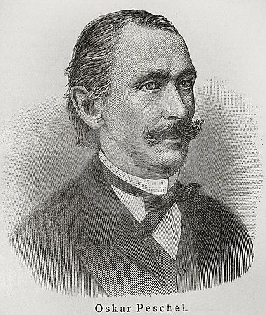
Oscar Ferdinand Peschel (17 March 1826, Dresden – 13 August 1875, Leipzig) was a German geographer and anthropologist. Biography As the son of an officer and teacher at the local military school, Peschel studied law from 1845 to 1848 in Leipzig and Heidelberg. In 1850 he joined the editorial staff of the ''Augsburger Allgemeine Zeitung''. In 1854 he took over the editorship for the journal ''Das Ausland'',Peschel, Oscar Ferdinand @ NDB/ADB Deutsche Biographie of which he continued until the end of March 1871. In 1871 he became a full professor of the newly established chair of geography at the . This is thus the fourth oldest chair of geography in ... [...More Info...] [...Related Items...] OR: [Wikipedia] [Google] [Baidu] |


