|
Permian Basin (North America)
The Permian Basin is a large sedimentary basin in the southwestern part of the United States. It is the highest-producing Petroleum reservoir, oil field in the US, producing an average of 4.2 million barrels of crude oil per day in 2019. This sedimentary basin is located in western Texas and far-southeastern New Mexico. It is named after the Permian geologic period, the final period of the Paleozoic era, as it contains some of the world's thickest deposits of Rock (geology), rocks from the period. The Permian Basin comprises several component basins, including the Midland Basin, which is the largest; Delaware Basin, the second largest; and Marfa, Texas, Marfa Basin, the smallest. The Permian Basin covers more than ,Ball - The Permian Basin - USGS and extends across an area approximately wide and lon ... [...More Info...] [...Related Items...] OR: [Wikipedia] [Google] [Baidu] |
Permian
The Permian ( ) is a geologic period and System (stratigraphy), stratigraphic system which spans 47 million years, from the end of the Carboniferous Period million years ago (Mya), to the beginning of the Triassic Period 251.902 Mya. It is the sixth and last period of the Paleozoic Era; the following Triassic Period belongs to the Mesozoic Era. The concept of the Permian was introduced in 1841 by geologist Sir Roderick Murchison, who named it after the Perm Governorate, region of Perm in Russia. The Permian witnessed the diversification of the two groups of amniotes, the synapsids and the Sauropsida, sauropsids (reptiles). The world at the time was dominated by the supercontinent Pangaea, which had formed due to the collision of Euramerica and Gondwana during the Carboniferous. Pangaea was surrounded by the superocean Panthalassa. The Carboniferous rainforest collapse left behind vast regions of desert within the continental interior. Amniotes, which could better cope with these ... [...More Info...] [...Related Items...] OR: [Wikipedia] [Google] [Baidu] |
Petroleum Reservoir
A petroleum reservoir or oil and gas reservoir is a subsurface accumulation of hydrocarbons contained in porous or fractured rock formations. Such reservoirs form when kerogen (ancient plant matter) is created in surrounding rock by the presence of high heat and pressure in the Earth's crust. Reservoirs are broadly classified as ''conventional'' and '' unconventional'' reservoirs. In conventional reservoirs, the naturally occurring hydrocarbons, such as crude oil (petroleum) or natural gas, are trapped by overlying rock formations with lower permeability, while in unconventional reservoirs the rocks have high porosity and low permeability, which keeps the hydrocarbons trapped in place, therefore not requiring a cap rock. Reservoirs are found using hydrocarbon exploration methods. Oil field An oil field is an area of accumulated liquid petroleum underground in multiple (potentially linked) reservoirs, trapped as it rises to impermeable rock formations. In industrial te ... [...More Info...] [...Related Items...] OR: [Wikipedia] [Google] [Baidu] |
Delaware Basin Stratigraphic Formations
Delaware ( ) is a state in the Mid-Atlantic and South Atlantic regions of the United States. It borders Maryland to its south and west, Pennsylvania to its north, New Jersey to its northeast, and the Atlantic Ocean to its east. The state's name derives from the adjacent Delaware Bay, which in turn was named after Thomas West, 3rd Baron De La Warr, an English nobleman and the Colony of Virginia's first colonial-era governor. Delaware occupies the northeastern portion of the Delmarva Peninsula, and some islands and territory within the Delaware River. It is the second-smallest and sixth-least populous state, but also the sixth-most densely populated. Delaware's most populous city is Wilmington, and the state's capital is Dover, the second-most populous city in Delaware. The state is divided into three counties, the fewest number of counties of any of the 50 U.S. states; from north to south, the three counties are: New Castle County, Kent County, and Sussex County. Th ... [...More Info...] [...Related Items...] OR: [Wikipedia] [Google] [Baidu] |
Halite
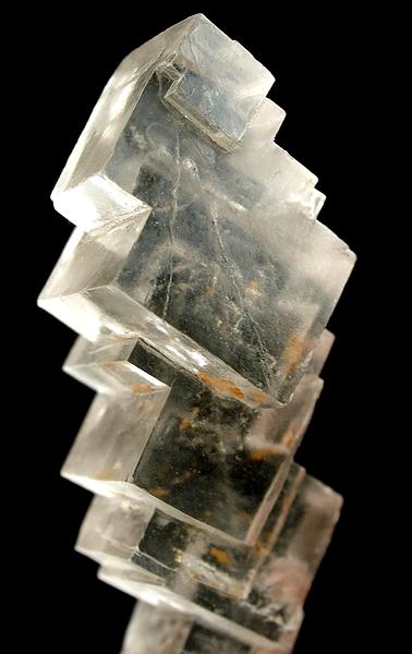
Halite ( ), commonly known as rock salt, is a type of salt, the mineral (natural) form of sodium chloride ( Na Cl). Halite forms isometric crystals. The mineral is typically colorless or white, but may also be light blue, dark blue, purple, pink, red, orange, yellow or gray depending on inclusion of other materials, impurities, and structural or isotopic abnormalities in the crystals. It commonly occurs with other evaporite deposit minerals such as several of the sulfates, halides, and borates. The name ''halite'' is derived from the Ancient Greek word for "salt", ἅλς (''háls''). Occurrence Halite dominantly occurs within sedimentary rocks where it has formed from the evaporation of seawater or salty lake water. Vast beds of sedimentary evaporite minerals, including halite, can result from the drying up of enclosed lakes and restricted seas. Such salt beds may be hundreds of meters thick and underlie broad areas. Halite occurs at the surface today in playas in reg ... [...More Info...] [...Related Items...] OR: [Wikipedia] [Google] [Baidu] |
Room And Pillar
Room and pillar or pillar and stall is a variant of breast stoping. It is a mining system in which the mined material is extracted across a horizontal plane, creating horizontal arrays of rooms and pillars. To do this, "rooms" of ore are dug out while "pillars" of untouched material are left to support the roof – overburden. Calculating the size, shape, and position of pillars is a complicated procedure, and an area of active research. The technique is usually used for relatively flat-lying deposits, such as those that follow a particular stratum. Room and pillar mining can be advantageous because it reduces the risk of surface subsidence compared to other underground mining techniques. It is also advantageous because it can be mechanized, and is relatively simple. However, because significant portions of ore may have to be left behind, recovery and profits can be low. Room and pillar mining was one of the earliest methods used, although with significantly more manpower. The room ... [...More Info...] [...Related Items...] OR: [Wikipedia] [Google] [Baidu] |
Eddy County, New Mexico
Eddy County is a List of counties in New Mexico, county located in the U.S. state of New Mexico. As of the 2020 United States census, 2020 census, the population was 62,314. Its county seat and largest city is Carlsbad, New Mexico, Carlsbad. The county was created in 1891 and later organized in 1892. It is north of the Texas state line. Eddy County comprises the Carlsbad-Artesia, New Mexico, Artesia, NM Micropolitan Statistical Area. Carlsbad Caverns National Park is located in this county. Eddy County is the location of the Waste Isolation Pilot Plant. History In 1866, Charles Goodnight and Oliver Loving drove vast herds of cattle along the Pecos and set up "cow camps" in Seven Rivers, New Mexico, Seven Rivers and what is now Carlsbad. John Chisum soon joined them and brought an estimated 100,000 head of cattle of his own through the Pecos Valley. In 1881, Charles B. Eddy came to the area, and with his brother, John, and partner Amos Bissell, developed the Eddy-Bissell Catt ... [...More Info...] [...Related Items...] OR: [Wikipedia] [Google] [Baidu] |
Lea County, New Mexico
Lea County (, ) is a county located in the U.S. state of New Mexico. As of the 2020 census, its population was 74,455. Its county seat is Lovington. It is both west and north of the Texas state line. Lea County comprises the Hobbs, NM micropolitan statistical area. Geography According to the U.S. Census Bureau, the county has a total area of , of which are land and (0.07%) are covered by water. Lea County is located in the southeast corner of New Mexico and borders Texas to the south and east. The Permian Basin, wide and long, underlies Lea County and adjacent Eddy County, as well as a large portion of West Texas. It produces 500,000 barrels of crude a day, and this number was expected to double in 2019. The shale in this basin lies below the surface, below a salt bed and a groundwater aquifer. Adjacent counties * Roosevelt County – north * Chaves County – northwest * Eddy County – west * Loving County, Texas – south * Winkler County, Texas – southeast ... [...More Info...] [...Related Items...] OR: [Wikipedia] [Google] [Baidu] |
Potash
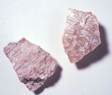
Potash ( ) includes various mined and manufactured salts that contain potassium in water- soluble form.Potash , USGS 2008 Minerals Yearbook The name derives from ''pot ash'', plant ashes or soaked in water in a pot, the primary means of manufacturing potash before the Industrial Era. The word '''' is derived from ''potash''. Potash is produced worldwide in amounts exceeding 71.9 million |
Potassium
Potassium is a chemical element; it has Symbol (chemistry), symbol K (from Neo-Latin ) and atomic number19. It is a silvery white metal that is soft enough to easily cut with a knife. Potassium metal reacts rapidly with atmospheric oxygen to form flaky white potassium peroxide in only seconds of exposure. It was first isolated from potash, the ashes of plants, from which its name derives. In the periodic table, potassium is one of the alkali metals, all of which have a single valence electron in the outer electron shell, which is easily removed to create cation, an ion with a positive charge (which combines with anions to form salts). In nature, potassium occurs only in ionic salts. Elemental potassium reacts vigorously with water, generating sufficient heat to ignite hydrogen emitted in the reaction, and burning with a lilac-flame color, colored flame. It is found dissolved in seawater (which is 0.04% potassium by weight), and occurs in many minerals such as orthoclase, a ... [...More Info...] [...Related Items...] OR: [Wikipedia] [Google] [Baidu] |
San Angelo, Texas
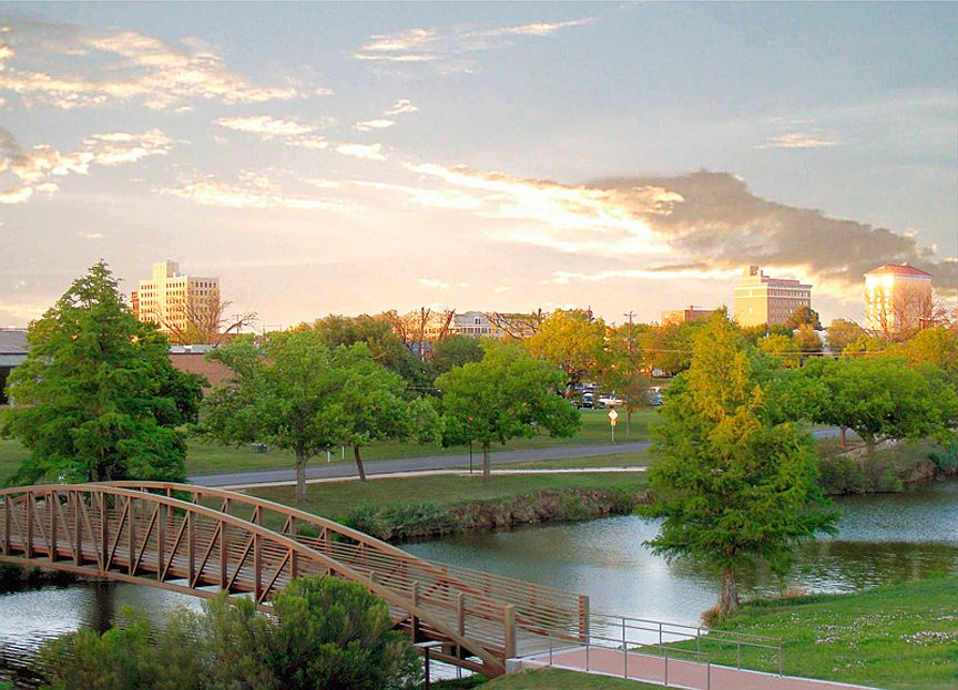
San Angelo ( ) is a city in and the county seat of Tom Green County, Texas, United States. Its location is in the Concho Valley, a region of West Texas between the Permian Basin (North America), Permian Basin to the northwest, Chihuahuan Desert to the southwest, Osage Plains to the northeast, and Central Texas to the southeast. According to the 2020 United States Census, San Angelo had a total population of 99,893. It is the principal city and center of the San Angelo metropolitan area, which had a population of 121,516. San Angelo is home to Angelo State University, historic Fort Concho, and Goodfellow Air Force Base. It is the seat of the Roman Catholic Diocese of San Angelo. History In 1632, a short-lived mission of Franciscans under Spanish auspices was founded in the area to serve native people. The mission was led by the friars Juan de Salas (friar), Juan de Salas and Juan de Ortega, with Ortega remaining for six months. The area was visited by the Castillo-Martin expedit ... [...More Info...] [...Related Items...] OR: [Wikipedia] [Google] [Baidu] |
USGS
The United States Geological Survey (USGS), founded as the Geological Survey, is an government agency, agency of the United States Department of the Interior, U.S. Department of the Interior whose work spans the disciplines of biology, geography, geology, and hydrology. The agency was founded on March 3, 1879, to study the landscape of the United States, its natural resources, and the natural hazards that threaten it. The agency also makes maps of planets and moons, based on data from List of NASA missions, U.S. space probes. The sole scientific agency of the U.S. Department of the Interior, USGS is a fact-finding research organization with no regulatory responsibility. It is headquartered in Reston, Virginia, with major offices near Lakewood, Colorado; at the Denver Federal Center; and in NASA Research Park in California. In 2009, it employed about 8,670 people. The current motto of the USGS, in use since August 1997, is "science for a changing world". The agency's previous s ... [...More Info...] [...Related Items...] OR: [Wikipedia] [Google] [Baidu] |
Marfa, Texas
Marfa is a city in the high desert of the Trans-Pecos in far West Texas, United States, between the Davis Mountains and Big Bend National Park, at an elevation of 4685 feet. It is the county seat of Presidio County, Texas, Presidio County. The city was founded in the early 1880s as a water stop. The population of Marfa peaked in the 1930s and as of the 2020 United States Census the population is 1,788. Today Marfa is a tourist destination and a major center for Minimalism (visual arts), minimalist art. Major attractions include Building 98, the Chinati Foundation, and the Marfa lights. History Marfa was founded in the early 1880s as a railroad water stop. The town was named "Marfa" (Russian for "Martha") at the suggestion of the wife of a railroad executive. Although some historians have hypothesized that the name came from a character in Fyodor Dostoevsky's novel ''The Brothers Karamazov'', Marfa was actually named after Marfa Strogoff, a character in Jules Verne's novel ''Mi ... [...More Info...] [...Related Items...] OR: [Wikipedia] [Google] [Baidu] |


