|
Penpethy
Penpethy is a hamlet in the parish of Tintagel, Cornwall, England. Penpethy is south of Condolden and east of Trebarwith Strand Trebarwith Strand ( kw, Trebervedh Sian; locally sometimes shortened to ''The Strand'') is a section of coastline located near the coastal settlement of Trebarwith on the north coast of Cornwall, England, UK, south of Tintagel. It has 800m of san .... References Hamlets in Cornwall {{Cornwall-geo-stub ... [...More Info...] [...Related Items...] OR: [Wikipedia] [Google] [Baidu] |
Condolden
Condolden is a hill in north Cornwall, England, UK. The summit is 308 metres (1010 feet) above ordnance datum. Condolden is two miles (3 km) southeast of Tintagel village and is on the eastern border of Tintagel civil parish between Waterpit Down (to the east) and Penpethy (to the west). It is the highest point in the parish. The largest of the Bronze Age barrows in Tintagel is at Condolden (another is at Menadue). On the edges of the hill are (from the north) Halgabron, Trenale, Downrow, Truas, Menadue and Trewarmett. Near Trenale was the Iron Age fort of Trenale Bury which was ploughed up during the Second World War. The barrow has not been excavated and is topped by an Ordnance Survey triangulation point A triangulation station, also known as a trigonometrical point, and sometimes informally as a trig, is a fixed surveying station, used in geodetic surveying and other surveying projects in its vicinity. The nomenclature varies regionally: they .... The land is ... [...More Info...] [...Related Items...] OR: [Wikipedia] [Google] [Baidu] |
Trebarwith Strand
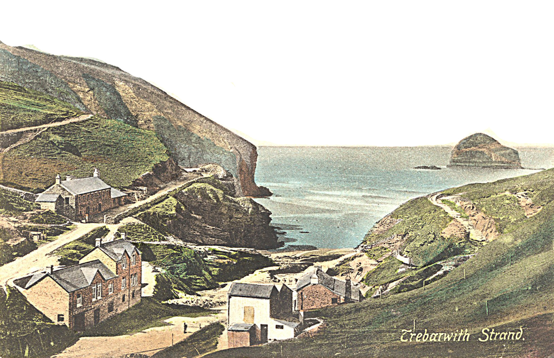
Trebarwith Strand ( kw, Trebervedh Sian; locally sometimes shortened to ''The Strand'') is a section of coastline located near the coastal settlement of Trebarwith on the north coast of Cornwall, England, UK, south of Tintagel. It has 800m of sandy beach contained by cliffs in which natural caves are found. The beach can only be accessed at low tide. The strand was once used to land ships to export slate from the nearby quarries while sand from the beach was used for agricultural purposes. The view from the beach is dominated by rocks 300m offshore known as Gull Rock or Otterham Rocks. History The name Trebarwith was first associated with the village on the higher ground to the south of the valley which is the most southerly part of Tintagel parish. Land at Trebarwith is first mentioned in records of 1284 and was held from 1329 until the early 16th century by the Lercedekne family. Trebarwith Farm is a Grade II listed building. The road along the valley from Penpethy to the Str ... [...More Info...] [...Related Items...] OR: [Wikipedia] [Google] [Baidu] |
Cornwall Council
Cornwall Council ( kw, Konsel Kernow) is the unitary authority for Cornwall in the United Kingdom, not including the Isles of Scilly, which has its own unitary council. The council, and its predecessor Cornwall County Council, has a tradition of large groups of independent councillors, having been controlled by independents in the 1970s and 1980s. Since the 2021 elections, it has been under the control of the Conservative Party. Cornwall Council provides a wide range of services to the approximately half a million people who live in Cornwall. In 2014 it had an annual budget of more than £1 billion and was the biggest employer in Cornwall with a staff of 12,429 salaried workers. It is responsible for services including: schools, social services, rubbish collection, roads, planning and more. History Establishment of the unitary authority On 5 December 2007, the Government confirmed that Cornwall was one of five councils that would move to unitary status. This was enacted b ... [...More Info...] [...Related Items...] OR: [Wikipedia] [Google] [Baidu] |
Cornwall
Cornwall (; kw, Kernow ) is a historic county and ceremonial county in South West England. It is recognised as one of the Celtic nations, and is the homeland of the Cornish people. Cornwall is bordered to the north and west by the Atlantic Ocean, to the south by the English Channel, and to the east by the county of Devon, with the River Tamar forming the border between them. Cornwall forms the westernmost part of the South West Peninsula of the island of Great Britain. The southwesternmost point is Land's End and the southernmost Lizard Point. Cornwall has a population of and an area of . The county has been administered since 2009 by the unitary authority, Cornwall Council. The ceremonial county of Cornwall also includes the Isles of Scilly, which are administered separately. The administrative centre of Cornwall is Truro, its only city. Cornwall was formerly a Brythonic kingdom and subsequently a royal duchy. It is the cultural and ethnic origin of the Cor ... [...More Info...] [...Related Items...] OR: [Wikipedia] [Google] [Baidu] |
Tintagel
Tintagel () or Trevena ( kw, Tre war Venydh, meaning ''Village on a Mountain'') is a civil parish and village situated on the Atlantic coast of Cornwall, England. The village and nearby Tintagel Castle are associated with the legends surrounding King Arthur and in recent times has become a tourist attraction. Toponymy Toponymists have had difficulty explaining the origin of 'Tintagel': the probability is that it is Norman French, as the Cornish of the 13th century would have lacked the soft 'g' ('i/j' in the earliest forms: see also Tintagel Castle). If it is Cornish then 'Dun' would mean ''Fort''. Oliver Padel proposes 'Dun' '-tagell' meaning ''narrow place'' in his book on place names. There is a possible cognate in the Channel Islands named ''Tente d'Agel'', but that still leaves the question subject to doubt. The name first occurs in Geoffrey of Monmouth Geoffrey of Monmouth ( la, Galfridus Monemutensis, Galfridus Arturus, cy, Gruffudd ap Arthur, Sieffre o Fy ... [...More Info...] [...Related Items...] OR: [Wikipedia] [Google] [Baidu] |


_(9458675814).jpg)