|
Parc Of The Kabir Kouba Cliff And Waterfall
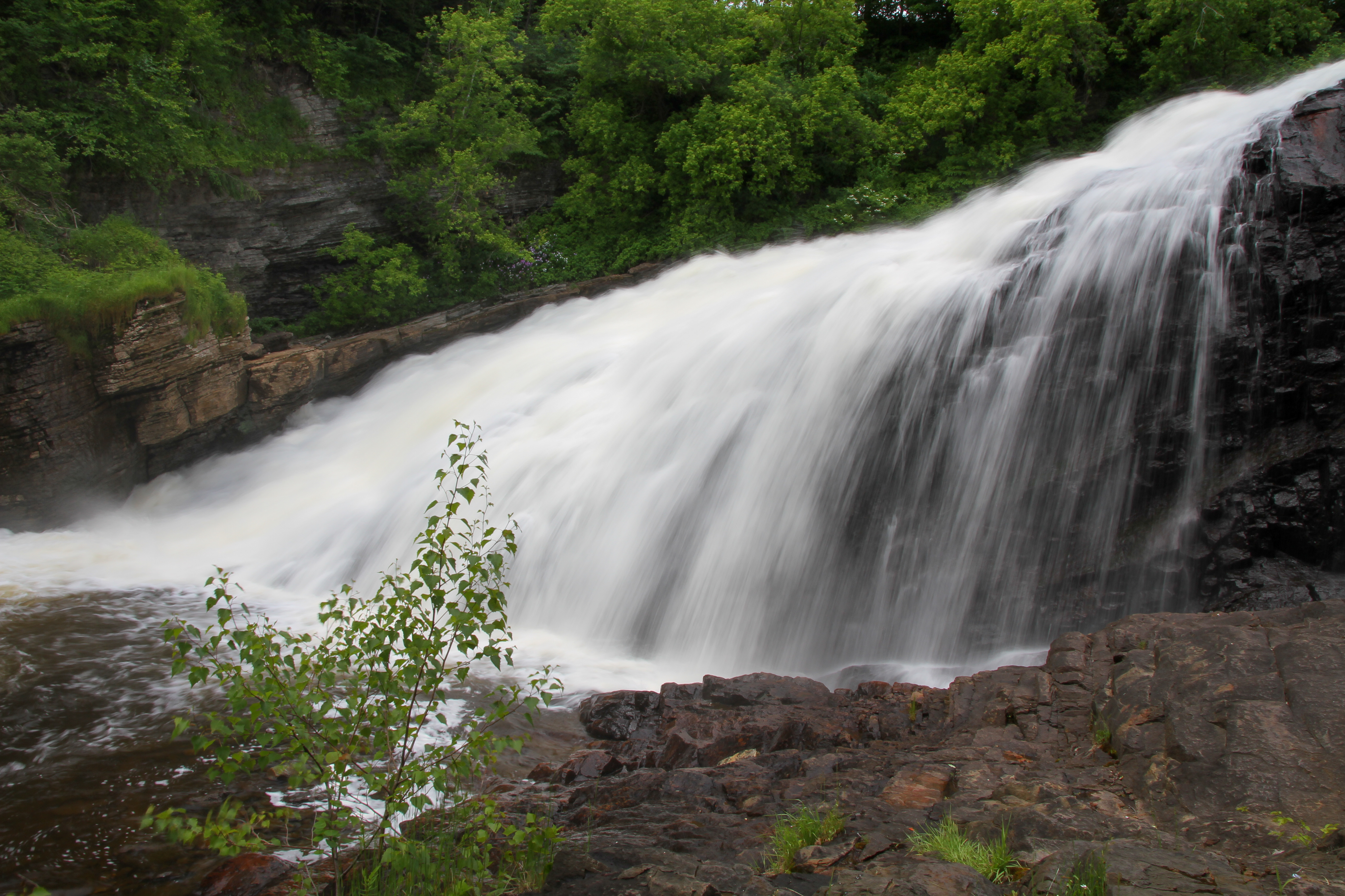
The Park of the Kabir Kouba Cliff and Waterfall is a public park in Quebec City, Quebec crossed by the Saint-Charles River (Quebec City), Saint-Charles River. The rapids and falls of this section of the river are called ''Kabir Kouba'' the «river of a thousand bends» in the Montagnais language. An interpretive center and trails permit the observation of the Kabir Kouba waterfall that has a height of 28 metres. The trails also provide a view of the canyon which at its highest point measures 42 metres as well as a rich variety of flora, fauna and fossils dating over 455 million years old. The interpretive center also offers services such as Kabir Kouba by Lantern, A Day at Loretteville package as well as guided visits of the falls. A song by the singer Claire Pelletier, ''Kabir Kouba'', evoques the many Huron legends that honour the river and the waterfall. Geology The waterfall is the point of encounter between two geological regions: The Saint-Lawrence lowlands (the park) and the ... [...More Info...] [...Related Items...] OR: [Wikipedia] [Google] [Baidu] |
Chute De Montmorency
The Montmorency Falls (french: Chute Montmorency) is a large waterfall on the Montmorency River in Quebec, Canada. Location The falls are located on the boundary between the borough of Beauport, and Boischatel, about from the heart of old Quebec City. The area surrounding the falls is protected within the Montmorency Falls Park (french: Parc de la Chute-Montmorency). The falls are at the mouth of the Montmorency River where it drops over the cliff shore into the Saint Lawrence River, opposite the western end of the Île d'Orleans. The waterfalls are 83 m (272') tall, a full 30 m (99') higher than Niagara Falls. Access and tourism Around 970,000 visitors a year visit Montmorency Falls. There are staircases that allow visitors to view the falls from several different perspectives. A suspension bridge over the crest of the falls provides access to both sides of the park. There is also a funitel that carries passengers between the base and the top of the falls. In the summer the ... [...More Info...] [...Related Items...] OR: [Wikipedia] [Google] [Baidu] |
Rivière Saint-Charles
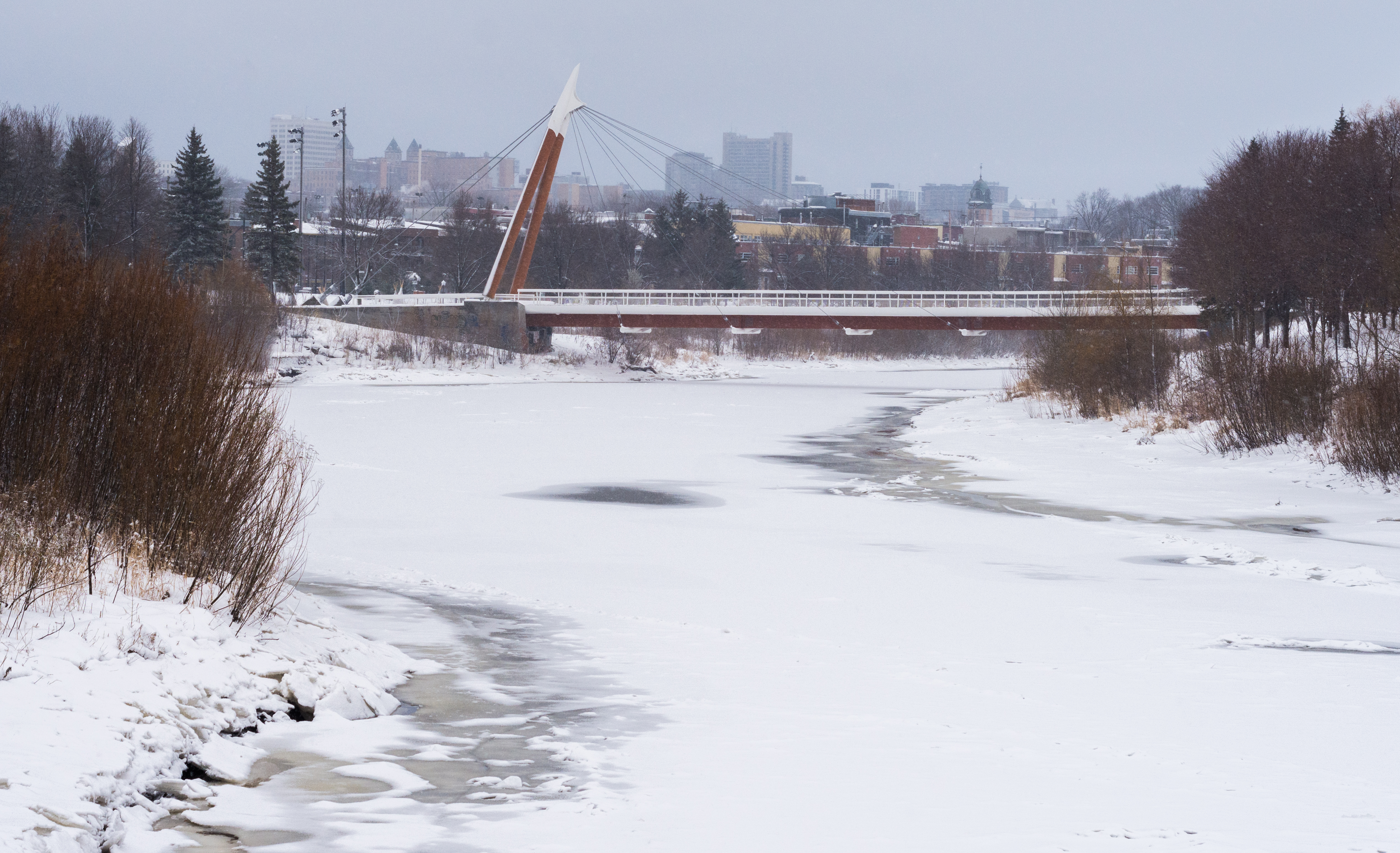
The Saint-Charles River (Huron-Wendat name is ''Akiawenrahk'') is the main watercourse crossing Quebec City, Quebec, Canada. The surface of the Saint-Charles River (except the rapids areas) is generally frozen from the beginning of December to the end of March; however, safe circulation on the ice is generally done from the end of December to the beginning of March. The water level of the river varies with the seasons and the precipitation; the spring flood occurs in March or April. Geography It springs from Saint-Charles Lake, follows a course of approximately and ends into Saint Lawrence River. Its drainage basin is large and a population of 350,000 persons live on its shores, in Quebec City and the Regional County Municipality of La Jacques-Cartier. It is the most densely populated drainage basin of any Quebec river, with an average population density of 600 inhabitants per square kilometer, mostly concentrated in the last third of its length. This makes its banks a popular ... [...More Info...] [...Related Items...] OR: [Wikipedia] [Google] [Baidu] |
Québec
Quebec ( ; )According to the Canadian government, ''Québec'' (with the acute accent) is the official name in Canadian French and ''Quebec'' (without the accent) is the province's official name in Canadian English is one of the thirteen provinces and territories of Canada. It is the largest province by area and the second-largest by population. Much of the population lives in urban areas along the St. Lawrence River, between the most populous city, Montreal, and the provincial capital, Quebec City. Quebec is the home of the Québécois nation. Located in Central Canada, the province shares land borders with Ontario to the west, Newfoundland and Labrador to the northeast, New Brunswick to the southeast, and a coastal border with Nunavut; in the south it borders Maine, New Hampshire, Vermont, and New York in the United States. Between 1534 and 1763, Quebec was called ''Canada'' and was the most developed colony in New France. Following the Seven Years' War, Quebec became ... [...More Info...] [...Related Items...] OR: [Wikipedia] [Google] [Baidu] |
Loretteville
Loretteville is a former city in central Quebec, Canada. It was amalgamated into Quebec City on January 1, 2002. It is located within the borough of La Haute-Saint-Charles, and also contains the upmarket neighbourhood of Montchâtel. Its population in 2001 was 13,737 residents. Loretteville is the birthplace of pop singer Mitsou and Rockford Ice Hogs goalie Jean-François Rivard and poet/musician Geneviève Castrée Geneviève Elverum ( Gosselin; April 9, 1981 – July 9, 2016), also known as Geneviève Castrée, was a Canadian cartoonist, illustrator, and musician from Quebec. An early admirer of comics, she began creating them at a young age. L'Oie de Cra .... External links * * Former municipalities in Quebec Neighbourhoods in Quebec City Populated places disestablished in 2002 {{QuebecCity-stub ... [...More Info...] [...Related Items...] OR: [Wikipedia] [Google] [Baidu] |
Wendake - Moulin Reid A La Chute De La Riviere Saint-Charles (Kabir Kouba) BAnQ P560S1P41 (cropped) , a community on Nottawasaga Bay in Ontario, within the historical Wendake lands
{{geodis ...
Wendake may refer to: * Huronia (region), the historical homeland of the Huron/Wendat/Wyandot nation in Ontario * Wendake, Quebec, a Huron reserve near Quebec City in Quebec, populated by Huron who returned to Quebec following the Huron-Iroquois wars * Wendake Beach, Ontario Wendake may refer to: * Huronia (region), the historical homeland of the Huron/Wendat/Wyandot nation in Ontario * Wendake, Quebec Wendake is the current name for two urban reserves, Wendake 7 () and Wendake 7A, () of the Huron-Wendat Nation in t ... [...More Info...] [...Related Items...] OR: [Wikipedia] [Google] [Baidu] |
Loretteville, Quebec City
Loretteville is a former city in central Quebec, Canada. It was amalgamated into Quebec City Quebec City ( or ; french: Ville de Québec), officially Québec (), is the capital city of the Provinces and territories of Canada, Canadian province of Quebec. As of July 2021, the city had a population of 549,459, and the Communauté métrop ... on January 1, 2002. It is located within the borough of La Haute-Saint-Charles, and also contains the upmarket neighbourhood of Montchâtel. Its population in 2001 was 13,737 residents. Loretteville is the birthplace of pop singer Mitsou and Rockford Ice Hogs goalie Jean-François Rivard and poet/musician Geneviève Castrée. External links * * Former municipalities in Quebec Neighbourhoods in Quebec City Populated places disestablished in 2002 {{QuebecCity-stub ... [...More Info...] [...Related Items...] OR: [Wikipedia] [Google] [Baidu] |
Echinoderms
An echinoderm () is any member of the phylum Echinodermata (). The adults are recognisable by their (usually five-point) radial symmetry, and include starfish, brittle stars, sea urchins, sand dollars, and sea cucumbers, as well as the sea lilies or "stone lilies". Adult echinoderms are found on the sea bed at every ocean depth, from the intertidal zone to the abyssal zone. The phylum contains about 7,000 living species, making it the second-largest grouping of deuterostomes, after the chordates. Echinoderms are the largest entirely marine phylum. The first definitive echinoderms appeared near the start of the Cambrian. The echinoderms are important both ecologically and geologically. Ecologically, there are few other groupings so abundant in the biotic desert of the deep sea, as well as shallower oceans. Most echinoderms are able to reproduce asexually and regenerate tissue, organs, and limbs; in some cases, they can undergo complete regeneration from a single lim ... [...More Info...] [...Related Items...] OR: [Wikipedia] [Google] [Baidu] |
Quebec City
Quebec City ( or ; french: Ville de Québec), officially Québec (), is the capital city of the Provinces and territories of Canada, Canadian province of Quebec. As of July 2021, the city had a population of 549,459, and the Communauté métropolitaine de Québec, metropolitan area had a population of 839,311. It is the eleventhList of the largest municipalities in Canada by population, -largest city and the seventhList of census metropolitan areas and agglomerations in Canada, -largest metropolitan area in Canada. It is also the List of towns in Quebec, second-largest city in the province after Montreal. It has a humid continental climate with warm summers coupled with cold and snowy winters. The Algonquian people had originally named the area , an Algonquin language, AlgonquinThe Algonquin language is a distinct language of the Algonquian languages, Algonquian language family, and is not a misspelling. word meaning "where the river narrows", because the Saint Lawrence River na ... [...More Info...] [...Related Items...] OR: [Wikipedia] [Google] [Baidu] |
Gneiss
Gneiss ( ) is a common and widely distributed type of metamorphic rock. It is formed by high-temperature and high-pressure metamorphic processes acting on formations composed of igneous or sedimentary rocks. Gneiss forms at higher temperatures and pressures than schist. Gneiss nearly always shows a banded texture characterized by alternating darker and lighter colored bands and without a distinct cleavage. Gneisses are common in the ancient crust of continental shields. Some of the oldest rocks on Earth are gneisses, such as the Acasta Gneiss. Description Orthogneiss from the Czech Republic In traditional English and North American usage, a gneiss is a coarse-grained metamorphic rock showing compositional banding ( gneissic banding) but poorly developed schistosity and indistinct cleavage. In other words, it is a metamorphic rock composed of mineral grains easily seen with the unaided eye, which form obvious compositional layers, but which has only a weak tendency to fra ... [...More Info...] [...Related Items...] OR: [Wikipedia] [Google] [Baidu] |
Earth's Crust
Earth's crust is Earth's thin outer shell of rock, referring to less than 1% of Earth's radius and volume. It is the top component of the lithosphere, a division of Earth's layers that includes the crust and the upper part of the mantle. The lithosphere is broken into tectonic plates whose motion allows heat to escape from the interior of the Earth into space. The crust lies on top of the mantle, a configuration that is stable because the upper mantle is made of peridotite and is therefore significantly denser than the crust. The boundary between the crust and mantle is conventionally placed at the Mohorovičić discontinuity, a boundary defined by a contrast in seismic velocity. The temperature of the crust increases with depth, reaching values typically in the range from about to at the boundary with the underlying mantle. The temperature increases by as much as for every kilometer locally in the upper part of the crust Composition File:Elemental abundances.svg, ... [...More Info...] [...Related Items...] OR: [Wikipedia] [Google] [Baidu] |


