|
Pambamarca
Pambamarca (alternate, Pimbamarca) is an eroded stratovolcano in the Central Cordillera of the northern Ecuadorian Andes in Pichincha Province. it is northeast of Quito. The summit is at an elevation of . The mountains of the Pambamarca in the Andean Highlands of Ecuador has many Pre-Columbian fortresses that predate the arrival of the Spanish in the region; Pambamarca has the greatest concentration of these forts. The Pambamarca Fortress Complex has been studied with participation by many international organizations, universities, and the Government of Ecuador with the objective of exploring the cultural landscapes, its prehistoric, historic and contemporary cultures, particularly of Ecuador's important Pre-Columbian cultural heritage. In 1998, Pambamarca was placed on the tentative List of UNESCO World Heritage Sites. History The fortifications originated with the Inca Empire who conquered Ecuador easily, and established themselves at Quito. Noting that the local indige ... [...More Info...] [...Related Items...] OR: [Wikipedia] [Google] [Baidu] |
Pambamarca Fortress Complex
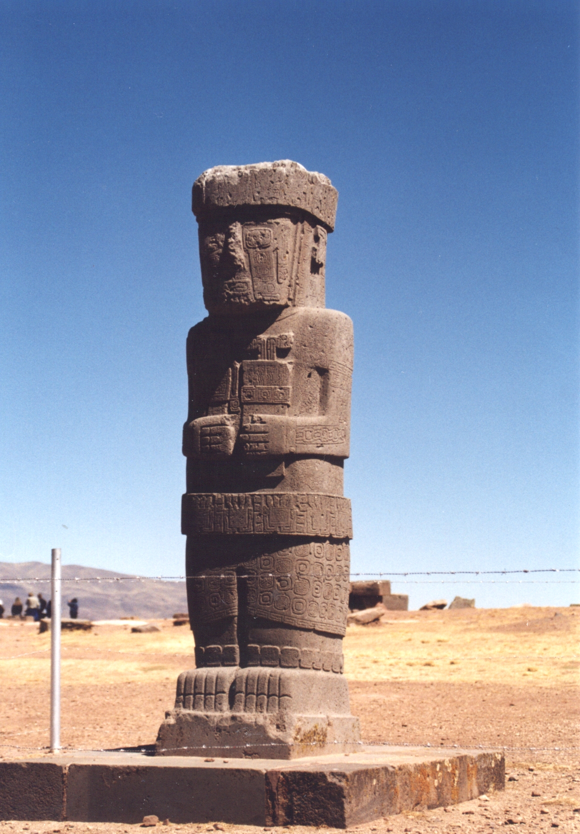
The Pambamarca Fortress Complex consists of the ruins of a large number of pukaras (hilltop forts) and other constructions of the Inca Empire. The fortresses were constructed in the late 15th century by the Incas to overcome the opposition of the people of the Cayambe chiefdom to the expansion of the Incas in the Andes highlands of present-day northern Ecuador. The Pambamarca fortresses are located in Cayambe Canton in Pichincha Province about in a straight-line distance northeast of the city of Quito. In 1998, Pambamarca was placed on the tentative List of UNESCO World Heritage Sites. The opponents The Pais Caranqui In the 15th century, the people of the Andes highlands of Ecuador north of Quito were organized into several chiefdoms, apparently similar in language and culture but competitive with each other and frequently engaged in internecine warfare. The names of the most prominent chiefdoms were the Caranqui, Cayambe, Otavalo, and Cochasquí. Pais Caranqui (Caran ... [...More Info...] [...Related Items...] OR: [Wikipedia] [Google] [Baidu] |
Glory (optical Phenomenon)
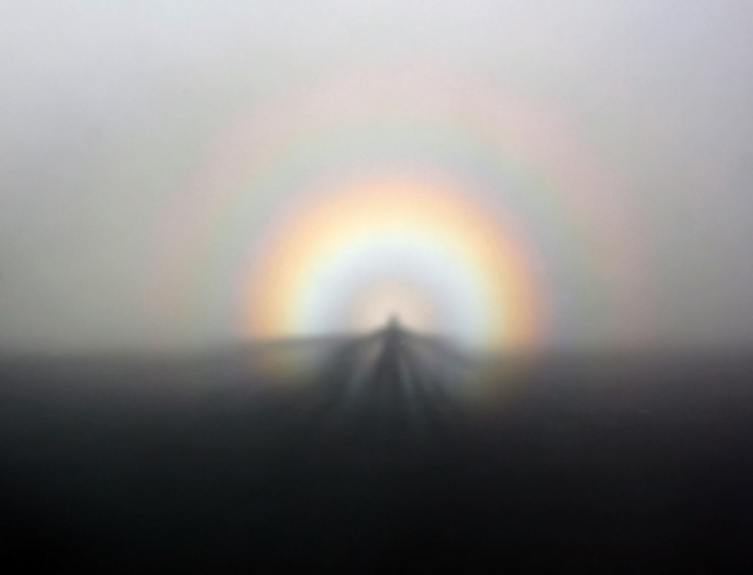
A glory is an optical phenomenon, resembling an iconic saint's halo (religious iconography), halo around the shadow of the observer's head, caused by sunlight or (more rarely) moonlight interacting with the tiny water drop (liquid), droplets that comprise mist or clouds. The glory consists of one or more concentric, successively dimmer rings, each of which is red on the outside and bluish towards the centre. Due to its appearance, the phenomenon is sometimes mistaken for a Rainbow#Full-circle rainbow, circular rainbow, but the latter has a much larger diameter and is caused by different physical processes. Glories arise due to interference (wave propagation), wave interference of light total internal reflection, internally refracted within small droplets. Appearance and observation Depending on circumstances (such as the uniformity of droplet size in the clouds), one or more of the glory's rings can be visible. The rings are rarely complete, being interrupted by the shadow of ... [...More Info...] [...Related Items...] OR: [Wikipedia] [Google] [Baidu] |
Brocken Spectre
A Brocken spectre (British English; American spelling: Brocken specter; ), also called Brocken bow, mountain spectre, or spectre of the Brocken is the magnified (and apparently enormous) shadow of an observer cast in mid air upon any type of cloud opposite a strong light source. The figure's head can be surrounded by a bright area called , or Halo (optical phenomenon), halo-like rings of rainbow-coloured light forming a glory (optical phenomenon), glory, which appear opposite the Sun's direction when uniformly sized water droplets in clouds refract and backscatter sunlight. The phenomenon can appear on any misty mountainside, cloud bank, or be seen from an aircraft, but the frequent fogs and low-altitude accessibility of the Brocken, the highest peak of the Harz Mountains in Germany, have created a local legend from which the phenomenon draws its name. The Brocken spectre was observed and described by Johann Silberschlag in 1780, and has often been recorded in literature about t ... [...More Info...] [...Related Items...] OR: [Wikipedia] [Google] [Baidu] |
Inca Empire
The Inca Empire, officially known as the Realm of the Four Parts (, ), was the largest empire in pre-Columbian America. The administrative, political, and military center of the empire was in the city of Cusco. The History of the Incas, Inca civilisation rose from the Peruvian highlands sometime in the early 13th century. The Portuguese explorer Aleixo Garcia was the first European to reach the Inca Empire in 1524. Later, in 1532, the Spanish Empire, Spanish began the conquest of the Inca Empire, and by 1572 Neo-Inca State, the last Inca state was fully conquered. From 1438 to 1533, the Incas incorporated a large portion of western South America, centered on the Andes, Andean Mountains, using conquest and peaceful assimilation, among other methods. At its largest, the empire joined modern-day Peru with what are now western Ecuador, western and south-central Bolivia, northwest Argentina, the southwesternmost tip of Colombia and Incas in Central Chile, a large portion of modern- ... [...More Info...] [...Related Items...] OR: [Wikipedia] [Google] [Baidu] |
Antonio De Ulloa
Antonio de Ulloa y de la Torre-Guiral (12 January 1716 – 3 July 1795) was a Spanish Navy officer. He spent much of his career in the Spanish America, Americas, where he carried out important scientific work. As a scientist, Ulloa is regarded as one of the major figures of the Enlightenment in Spain. As a military officer, Ulloa achieved the rank of vice admiral. He also served the Spanish Empire as an administrator in the Viceroyalty of Peru and in Louisiana (New Spain), Spanish Louisiana. At the age of nineteen, Ulloa joined the French Geodesic Mission to the Equator, which established that the shape of the Earth is an Spheroid#Oblate_spheroids, oblate spheroid, flattened at the poles, as predicted by Isaac Newton. The mission took more than eight years to complete its work, during which time Ulloa, in close collaboration with his fellow naval officer Jorge Juan y Santacilia, Jorge Juan, made many astronomical, natural, and social observations in South America. Ullo ... [...More Info...] [...Related Items...] OR: [Wikipedia] [Google] [Baidu] |
Pukaras
Pukara ( Aymara and Quechuan "fortress", Hispanicized spellings ''pucara, pucará'') is a defensive hilltop site or fortification built by the prehispanic and historic inhabitants of the central Andean area (from Ecuador to central Chile and northwestern Argentina). In some cases, these sites acted as temporary fortified refuges during periods of increased conflict, while other sites show evidence for permanent occupation. Emerging as a major site type during the Late Intermediate Period (-1430AD), the pukara form was adopted in some areas by the Inca military in contested borderlands of the Inca Empire. The Spanish also referred to the Mapuche earthen forts built during the Arauco War in the 16th and 17th centuries by this term. Today, the term is commonly found in toponyms of the Andes region, e.g. Andalicán, Pucará de Angol, Camiña, Cañete, Nama, Quiapo, Tilcara, Turi, Pucara del Cerro La Muralla, Pukara of La Compañía, Pukara de Lasana, Pucará de Belén ... [...More Info...] [...Related Items...] OR: [Wikipedia] [Google] [Baidu] |
Andes
The Andes ( ), Andes Mountains or Andean Mountain Range (; ) are the List of longest mountain chains on Earth, longest continental mountain range in the world, forming a continuous highland along the western edge of South America. The range is long and wide (widest between 18th parallel south, 18°S and 20th parallel south, 20°S latitude) and has an average height of about . The Andes extend from south to north through seven South American countries: Argentina, Chile, Bolivia, Peru, Ecuador, Colombia, and Venezuela. Along their length, the Andes are split into several ranges, separated by intermediate depression (geology), depressions. The Andes are the location of several high plateaus—some of which host major cities such as Quito, Bogotá, Cali, Arequipa, Medellín, Bucaramanga, Sucre, Mérida, Mérida, Mérida, El Alto, and La Paz. The Altiplano, Altiplano Plateau is the world's second highest after the Tibetan Plateau. These ranges are in turn grouped into three majo ... [...More Info...] [...Related Items...] OR: [Wikipedia] [Google] [Baidu] |
Jorge Juan Y Santacilia
Jorge Gaspar Juan y Santacilia (Novelda, Province of Alicante, Alicante, 5 January 1713 – Madrid, 21 June 1773) was a Spanish mariner, mathematician, natural scientist, astronomer, engineer, and educator. He is generally regarded as one of the most important scientific figures of the Enlightenment in Spain. As a military officer, he undertook sensitive diplomatic missions for the Spanish crown and contributed to the modernization and professionalization of the Spanish Navy. In his lifetime, he came to be known as ''el sabio español'' ("the Spanish savant"). His career as a public servant constitutes an important chapter in the Bourbon Reforms of the 18th century. As a young naval lieutenant, Juan participated in the French Geodesic Mission to the Equator of 1735–1744, which established definitively that the shape of the Earth is an oblate spheroid, flattened at the poles, as predicted in Isaac Newton's ''Philosophiæ Naturalis Principia Mathematica, Principia''. With h ... [...More Info...] [...Related Items...] OR: [Wikipedia] [Google] [Baidu] |
Harz
The Harz (), also called the Harz Mountains, is a highland area in northern Germany. It has the highest elevations for that region, and its rugged terrain extends across parts of Lower Saxony, Saxony-Anhalt, and Thuringia. The name ''Harz'' derives from the Middle High German word ''Hardt'' or ''Hart'' (hill forest). The name ''Hercynia'' derives from a Celtic name and could refer to other mountain forests, but has also been applied to the geology of the Harz. The Brocken is the highest summit in the Harz with an elevation of above sea level. The Wurmberg () is the highest peak located entirely within the state of Lower Saxony. Geography Location and extent The Harz has a length of , stretching from the town of Seesen in the northwest to Eisleben in the east, and a width of . It occupies an area of , and is divided into the Upper Harz (''Oberharz'') in the northwest, which is up to 800 m high, apart from the 1,100 m high Brocken massif, and the Lower Harz (''Unterhar ... [...More Info...] [...Related Items...] OR: [Wikipedia] [Google] [Baidu] |
Brocken
The Brocken, also sometimes referred to as the Blocksberg, is a mountain near Schierke in the German state of Saxony-Anhalt, between the rivers Weser River, Weser and Elbe. The highest peak in the Harz mountain range, and in Northern Germany, it is subalpine, yet has a microclimate resembling that of mountains nearly higher. The elevation above its tree line tends to have snowcover from September to May, and mists and fogs shroud it up to 300 days a year. The mean annual temperature is only . It is the easternmost mountain in northern Germany; the next prominent elevation directly to its east would be in the Ural Mountains in Russia. The Brocken has always played a role in legends and has been connected with witches and devils; Johann Wolfgang von Goethe took up the legends in his play ''Goethe's Faust, Faust''. The Brocken spectre is a common phenomenon on this misty mountain, where a climber's shadow cast upon fog creates eerie optical effects. Today the Brocken is part of ... [...More Info...] [...Related Items...] OR: [Wikipedia] [Google] [Baidu] |
Springer Science & Business Media
Springer Science+Business Media, commonly known as Springer, is a German multinational publishing company of books, e-books and peer-reviewed journals in science, humanities, technical and medical (STM) publishing. Originally founded in 1842 in Berlin, it expanded internationally in the 1960s, and through mergers in the 1990s and a sale to venture capitalists it fused with Wolters Kluwer and eventually became part of Springer Nature in 2015. Springer has major offices in Berlin, Heidelberg, Dordrecht, and New York City. History Julius Springer founded Springer-Verlag in Berlin in 1842 and his son Ferdinand Springer grew it from a small firm of 4 employees into Germany's then second-largest academic publisher with 65 staff in 1872.Chronology ". Springer Science+Business Media. In 1964, Springer expanded its business internationally, ... [...More Info...] [...Related Items...] OR: [Wikipedia] [Google] [Baidu] |
Pierre Bouguer
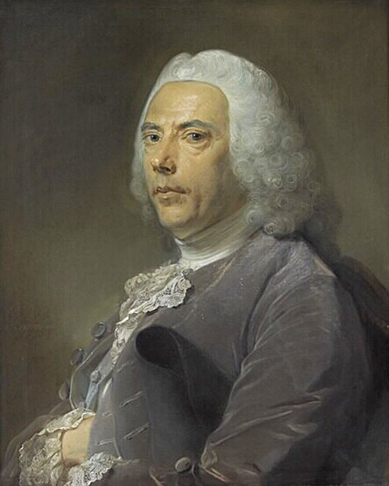
Pierre Bouguer () (16 February 1698, Le Croisic – 15 August 1758, Paris) was a French mathematician, geophysicist, geodesist, and astronomer. He is also known as "the father of naval architecture". Career Bouguer's father, Jean Bouguer, one of the best hydrographers of his time, was Regius Professor of hydrography at Le Croisic in lower Brittany, and author of a treatise on navigation. He taught his sons Pierre and Jan at their home, where he also taught private students. In 1714, at the age of 16, Pierre was appointed to succeed his deceased father as professor of hydrography. In 1727 he gained the prize given by the French Academy of Sciences for his paper ''On the masting of ships'', beating Leonhard Euler; and two other prizes, one for his dissertation ''On the best method of observing the altitude of stars at sea'', the other for his paper ''On the best method of observing the variation of the compass at sea''. These were published in the Prix de l'Académie des Sci ... [...More Info...] [...Related Items...] OR: [Wikipedia] [Google] [Baidu] |


