|
Paignton
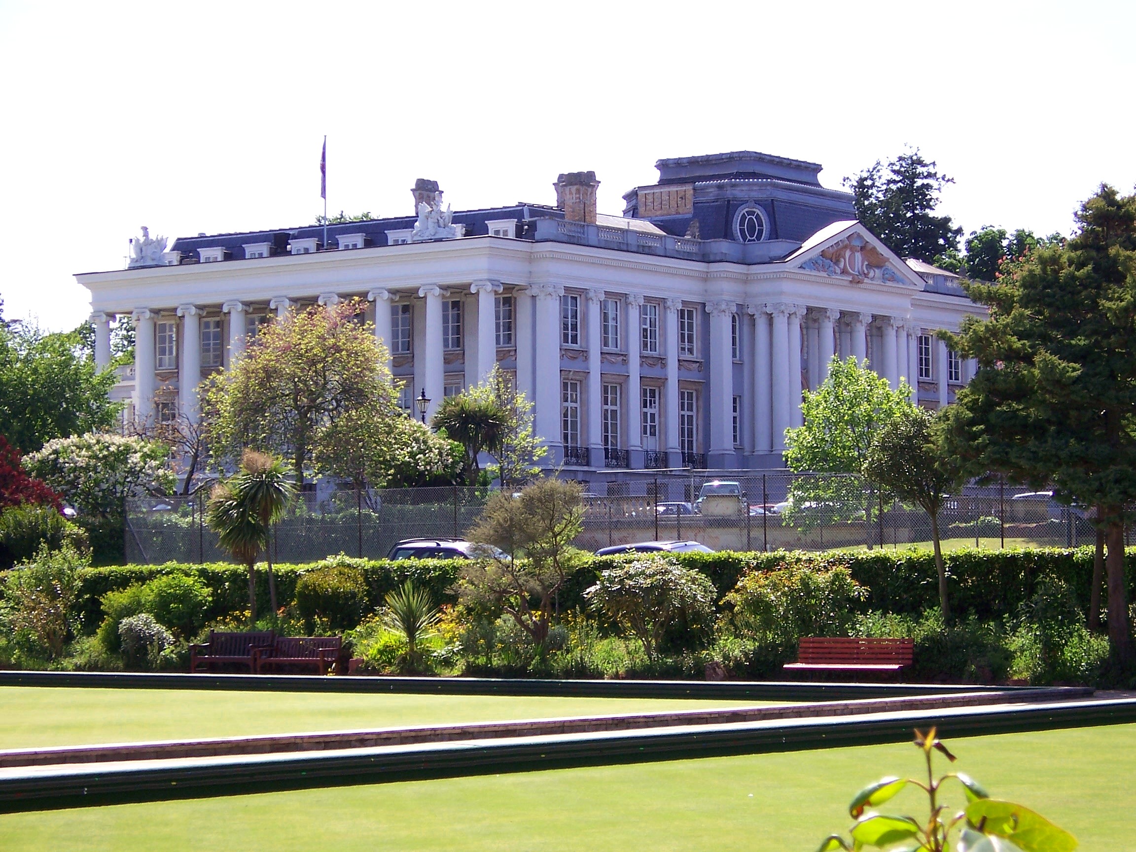
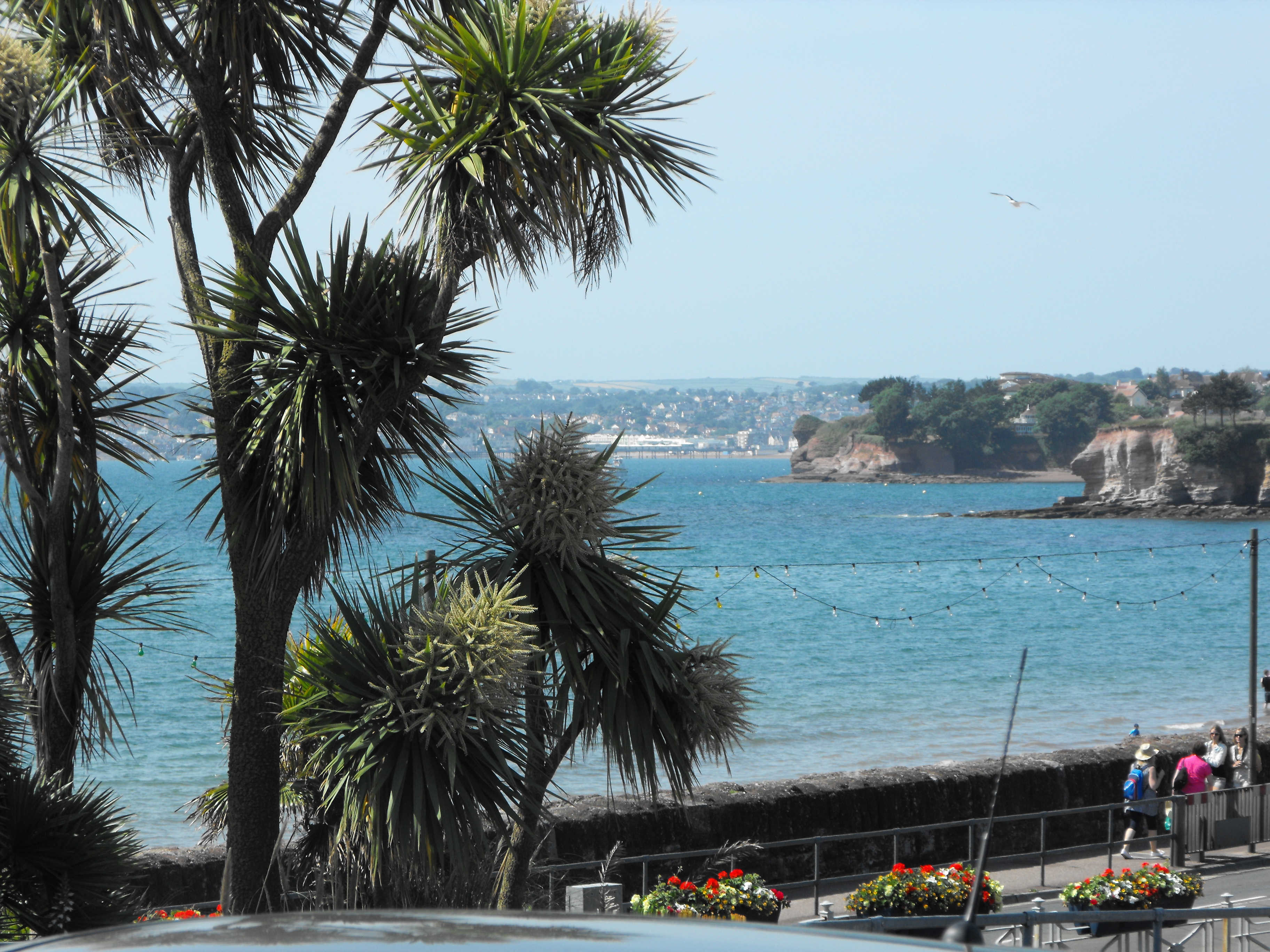
Paignton ( ) is a seaside town on the coast of Tor Bay in Devon, England. Together with Torquay and Brixham it forms the unitary authority, borough of Torbay which was created in 1968. The Torbay area is a holiday destination known as the English Riviera. Paignton has origins as a Celtic settlement and was first mentioned in 1086. It grew as a small fishing village and a new harbour was built in 1847. A railway line was opened to passengers in 1859 creating links to Torquay and London. As its population increased, it merged with the villages of Goodrington and Preston, Devon, Preston. Paignton is around north east of Plymouth and south of Exeter. History A Roman burial was discovered in 1993 on the Hookhills estate by a householder digging a patio. At first thought to be Neolithic, it was later radiocarbon dated to be between 230 and 390 CE. The burial is of a young woman aged between 15 and 25 years. The burial included oysters and her teeth and bone reveal a diet rich i ... [...More Info...] [...Related Items...] OR: [Wikipedia] [Google] [Baidu] |
Torbay
Torbay is a unitary authority with a borough status in the ceremonial county of Devon, England. It is governed by Torbay Council, based in the town of Torquay, and also includes the towns of Paignton and Brixham. The borough consists of of land around the east-facing Tor Bay, part of Lyme Bay on the English Channel. (Word document) A popular tourist destination, Torbay's sandy beaches, mild climate and recreational and leisure attractions have given rise to its nickname of the ''English Riviera''. The neighbouring districts are South Hams and Teignbridge. History Human bones and tools found in Kents Cavern in Torquay show that people have inhabited the Torbay area since Paleolithic times. A maxilla fragment known as Kents Cavern 4 may be the oldest example of a modern human in Europe, dating back to 37,000–40,000 years ago. Roman soldiers are known to have visited Torquay during the period when Britannia formed a part of the Roman Empire; they left offeri ... [...More Info...] [...Related Items...] OR: [Wikipedia] [Google] [Baidu] |
Torquay
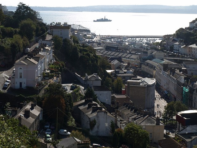
Torquay ( ) is a seaside town in Devon, England, part of the unitary authority area of Torbay. It lies south of the county town of Exeter and east-north-east of Plymouth, on the north of Tor Bay, adjoining the neighbouring town of Paignton on the west of the bay and across from the fishing port of Brixham. In 2011 the built-up area of Torquay had a population of 65,245. The town's economy, like Brixham's, was initially based upon fishing and agriculture; however, in the early 19th century, it began to develop into a fashionable seaside resort. Later, as the town's fame spread, it was popular with Victorian society. Renowned for its mild climate (at least for England), the town earned the nickname the English Riviera. The writer Agatha Christie was born in the town and lived at Ashfield in Torquay during her early years. There is an "Agatha Christie Mile", a tour with plaques dedicated to her life and work. The poet Elizabeth Barrett Browning lived in the town from ... [...More Info...] [...Related Items...] OR: [Wikipedia] [Google] [Baidu] |
Brixham
Brixham is a coastal town and civil parish in the borough of Torbay in the county of Devon, in the south-west of England. As of the 2021 census, Brixham had a population of 16,825. It is one of the main three centres of the borough, along with Paignton and Torquay. It is believed that the name Brixham originates from the personal name of an early resident, Brioc, followed by the Old English suffix, ''ham'' meaning home. The town, which is predominantly hilly, is built around a natural harbour, which in addition to leisure craft, provides anchorage for what is now one of England's (but not the UK's) largest remaining commercial fishing fleets. A conspicuous local tourist attraction is the permanently moored replica of Francis Drake, Sir Francis Drake's ship ''Golden Hind''. Historically Brixham was made up of two separate communities connected only by a marshy lane. In Fishtown, in the immediate vicinity of the harbour, as the name suggests, the residents made a living mainly fr ... [...More Info...] [...Related Items...] OR: [Wikipedia] [Google] [Baidu] |
Kirkham House
Kirkham House is a late medieval stone house in Paignton, Devon, England. It is believed to be a 14th or 15th century building. The house was designated a Grade II* listed building on 13 March 1951. History There is no documentary evidence of who built Kirkham House or when. The design suggests that it is of 14th or 15th century origin, and it has been called "The Priest's House", suggesting the residence of a church official, or a priest of the Kirkham Chantry. The house may have been built as the residence of a prosperous local merchant. Mrs Ada Frances Jennings bequeathed the house to the nation in 1960, together with a sum of money for its repair. The stone and plasterwork have been extensively renovated, but many of the original oak beams and carvings can still be seen. The building contains reproduction furniture and tapestries in the medieval style. Structure The building is a single depth cottage with three rooms, and is made of breccia with a slate roof. The ground fl ... [...More Info...] [...Related Items...] OR: [Wikipedia] [Google] [Baidu] |
Preston, Devon
Preston is a suburb located in the northern part of Paignton in Devon. Preston is a popular destination for family holidays and has two main beaches; Hollicombe, a red sandy beach with cliffs and rock pools, and Preston Sands with rock pools, beach huts and facilities. At low tide it is possible to walk between Preston Sands and the adjoining beaches at Paignton. The ward population at the United Kingdom Census 2011, 2011 census was 10,924. Preston had a railway station called Preston Platform briefly between 1911 and 1914. The entrance to the platform (now bricked up with grey breeze blocks) can be found on the footpath that runs in a northerly direction below the railway bridge at the bottom of Seaway Road. Preston Platform was the only halt ever built between the Torquay and Paignton railway stations. The main road through Preston is the A3022 (formerly A379) with Stagecoach service 12 operating every 10 minutes between Brixham and Newton Abbot. On the edge of the distri ... [...More Info...] [...Related Items...] OR: [Wikipedia] [Google] [Baidu] |
Bishop's Palace, Paignton
The Bishop's Palace of Paignton, the remnants of which stand beside the parish church of St John the Baptist, comprise the remains of the residence of the bishops of Exeter in the town. The site is defined as a scheduled monument by Historic England Historic England (officially the Historic Buildings and Monuments Commission for England) is an executive non-departmental public body of the British Government sponsored by the Department for Culture, Media and Sport. It is tasked with prot ..., with the standing medieval walls and the C14th Century corner tower, sometimes called Coverdale's Tower, being Listed Grade II*. Within the walls are the fragmentary remnants of the palace chapel (Listed Grade II) along with a Grade II Listed vicarage of the 20th Century. References Scheduled monuments in Devon Grade II* listed buildings in Devon Buildings and structures in Paignton {{Devon-struct-stub ... [...More Info...] [...Related Items...] OR: [Wikipedia] [Google] [Baidu] |
Goodrington
Goodrington is an area of Paignton in Devon, England. It is situated in Tor Bay and lies between Paignton town centre and Brixham, less than south of central Paignton. Its beach is known as Goodrington Sands. History Goodrington is mentioned in the Domesday Book of AD 1086 as ''Godrintone'' in the ancient hundred of Kerswell. The village became part of Haytor Hundred when it was derived from Kerswell Hundred. In the 18th century the name was written as ''Goderington''. In the late 19th century, the administrative functions of the hundred became a part of other units of government. In 1968 three councils were amalgamated, then since 1972 the Torbay Council provides many governmental services for Goodrington. Goodrington has a railway station, on the Paignton and Dartmouth Steam Railway, a water park, three beaches, a park with boating lake, various shops and other facilities, including a petrol station, public house and several holiday parks. To the south there is als ... [...More Info...] [...Related Items...] OR: [Wikipedia] [Google] [Baidu] |
Devon
Devon ( ; historically also known as Devonshire , ) is a ceremonial county in South West England. It is bordered by the Bristol Channel to the north, Somerset and Dorset to the east, the English Channel to the south, and Cornwall to the west. The city of Plymouth is the largest settlement, and the city of Exeter is the county town. The county has an area of and a population of 1,194,166. The largest settlements after Plymouth (264,695) are the city of Exeter (130,709) and the Seaside resort, seaside resorts of Torquay and Paignton, which have a combined population of 115,410. They all are located along the south coast, which is the most populous part of the county; Barnstaple (31,275) and Tiverton, Devon, Tiverton (22,291) are the largest towns in the north and centre respectively. For local government purposes Devon comprises a non-metropolitan county, with eight districts, and the Unitary authorities of England, unitary authority areas of Plymouth City Council, Plymouth an ... [...More Info...] [...Related Items...] OR: [Wikipedia] [Google] [Baidu] |
Exeter
Exeter ( ) is a City status in the United Kingdom, cathedral city and the county town of Devon in South West England. It is situated on the River Exe, approximately northeast of Plymouth and southwest of Bristol. In Roman Britain, Exeter was established as the base of Legio II Augusta under the personal command of Vespasian. Exeter became a religious centre in the Middle Ages. Exeter Cathedral, founded in the mid 11th century, became Anglicanism, Anglican in the 16th-century English Reformation. Exeter became an affluent centre for the wool trade, although by the First World War the city was in decline. After the Second World War, much of the city centre was rebuilt and is now a centre for education, business and tourism in Devon and Cornwall. It is home to two of the constituent campuses of the University of Exeter: Streatham Campus, Streatham and St Luke's Campus, St Luke's. The administrative area of Exeter has the status of a non-metropolitan district under the administ ... [...More Info...] [...Related Items...] OR: [Wikipedia] [Google] [Baidu] |
Torbay (UK Parliament Constituency)
Torbay is a constituency in Devon represented in the House of Commons of the UK Parliament since 2024 by Steve Darling, a Liberal Democrat. He defeated Kevin Foster of the Conservative Party, who had held the seat since 2015. Boundaries 1974–1983: The County Borough of Torbay. 1983–2010: The Borough of Torbay wards of Cockington with Chelston, Coverdale, Ellacombe, Preston, St Marychurch, St Michael's with Goodrington, Shiphay, Tormohun, and Torwood. 2010–2024: The Borough of Torbay wards of Clifton with Maidenway, Cockington with Chelston, Ellacombe, Goodrington with Roselands, Preston, Roundham with Hyde, St Marychurch, Shiphay with the Willows, Tormohun, Watcombe, and Wellswood. 2024–present: The Borough of Torbay wards of: Barton with Watcombe; Clifton with Maidenway; Cockington with Chelston; Ellacombe; Goodrington with Roselands; Preston; Roundham with Hyde; St. Marychurch; Shiphay; Tormohun; Wellswood. ''Minor changes following re-organisation of local auth ... [...More Info...] [...Related Items...] OR: [Wikipedia] [Google] [Baidu] |
Tor Bay
Tor Bay (sometimes written as Torbay) is a bay on the south-east coast of the county of Devon, England. Facing east into the English Channel, it is about wide from north to south. The settlements of Torquay, Paignton and Brixham, which lie along its coastline, are known collectively as Torbay. Geology Tor Bay is bounded by outcrops of Devonian limestone forming its northern limit at Hope's Nose and its southern at Berry Head. The geology of the area is varied and complex, recognised by the 2007 designation of the English Riviera Geopark which includes all of Tor Bay's coastline. During the last glacial period, when sea level was much lower, Tor Bay was dry land, as is shown by the existence of a submerged forest in the bay. It was overwhelmed during the Flandrian interglacial, Flandrian transgression which started about 10,000 years ago. History Because it is sheltered from the prevailing south-westerly winds, Tor Bay has long been one of the safest refuges for shipping betw ... [...More Info...] [...Related Items...] OR: [Wikipedia] [Google] [Baidu] |
South Devon (UK Parliament Constituency)
South Devon is the southern part of Devon, England. Because Devon has its major population centres on its two coasts, the county is divided informally into North Devon and South Devon.For exampleNorth DevonanSouth Devonnews sites. In a narrower sense "South Devon" is used to refer to the part of Devon south of Exeter and Dartmoor, including Plymouth, Torbay and the districts of South Hams, West Devon and Teignbridge. South Devon is also sometimes, although incorrectly, taken to include East Devon, which includes the first seaside resort to be developed in the county, Exmouth and the more upmarket Georgian town of Sidmouth, headquarters of the East Devon District Council. National character area South Devon is more precisely defined as a natural region which has been designated as National Character Area 151 by Natural England. [...More Info...] [...Related Items...] OR: [Wikipedia] [Google] [Baidu] |


