|
Pacific Rim
The Pacific Rim comprises the lands around the rim of the Pacific Ocean. The '' Pacific Basin'' includes the Pacific Rim and the islands in the Pacific Ocean. The Pacific Rim roughly overlaps with the geological Pacific Ring of Fire. List of countries on the Pacific Rim This is a list of countries that are generally considered to be a part of the Pacific Rim, since they lie along the Pacific Ocean. Arranging from north to south, west to east in directional order. * East Asia ** Russian Federation ** ** ** ** *** *** ** * Southeast Asia ** ** ** ** ** ** ** ** ** * Oceania (Sovereign states) ** ** ** ** ** ** ** ** ** ** ** ** ** ** ** ** * Oceania (Dependent territories) ** External territory of Australia *** ** Realm of New Zealand *** ** French overseas collectivities *** *** *** ** British Overseas Territory *** ** United States insular areas *** *** *** ** United States *** ** Insular Chile *** * North Ameri ... [...More Info...] [...Related Items...] OR: [Wikipedia] [Google] [Baidu] |
Insular Chile
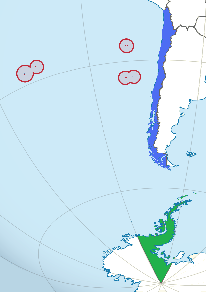
Insular Chile, also called ''Las islas Esporádicas'', or "the Sporadic Islands", is a scattered group of oceanic islands of volcanic origin located in the South Pacific, and which are under the sovereignty of Chile. The islands lie on the Nazca Plate, separate from the South American continental plate. Despite not being continental islands, the Juan Fernández Islands and the Desventuradas Islands are considered "Continental Insular Chile"; Salas y Gómez Island and Easter Island (both geographically situated in Polynesia) form the zone known as "Oceanic Insular Chile". All of insular Chile is administrated as part of the Valparaíso Region. History Easter Island was first inhabited by a Polynesian culture known as the Rapa Nui, and the Rapa Nui knew about Salas y Gómez Island during prehistoric times. As such, academics often group them in with Oceania rather than South America. Descendants of the ancient Rapa Nui make up the majority of Easter Island's current popul ... [...More Info...] [...Related Items...] OR: [Wikipedia] [Google] [Baidu] |
Port Of Kaohsiung
The Port of Kaohsiung (POK; ) is the largest harbor in Taiwan, handling approximately 10.26 million twenty-foot equivalent units (TEU) worth of cargo in 2015. The port is located in southern Taiwan, adjacent to Kaohsiung City, and surrounded by the city districts of Gushan, Yancheng, Lingya, Cianjhen, Siaogang, as well as Cijin. It is operated by Taiwan International Ports Corporation, Taiwan's state-owned harbor management company. History The port was a natural lagoon before eventually developed through into a modern harbor over the period of several hundred years. At the time of 16th century, some villages had already established on the seashore of the present-day Kaohsiung, which was called as "Takau" by natives at that time. The colonists of Dutch East India Company (VOC) arrived at Takau in 1620s and then began to develop the lagoon. The port, historically referred to as the "Takau Port" (), developed gradually during the Dutch Era, Koxinga Era, and the early Qin ... [...More Info...] [...Related Items...] OR: [Wikipedia] [Google] [Baidu] |
Port Of Kobe
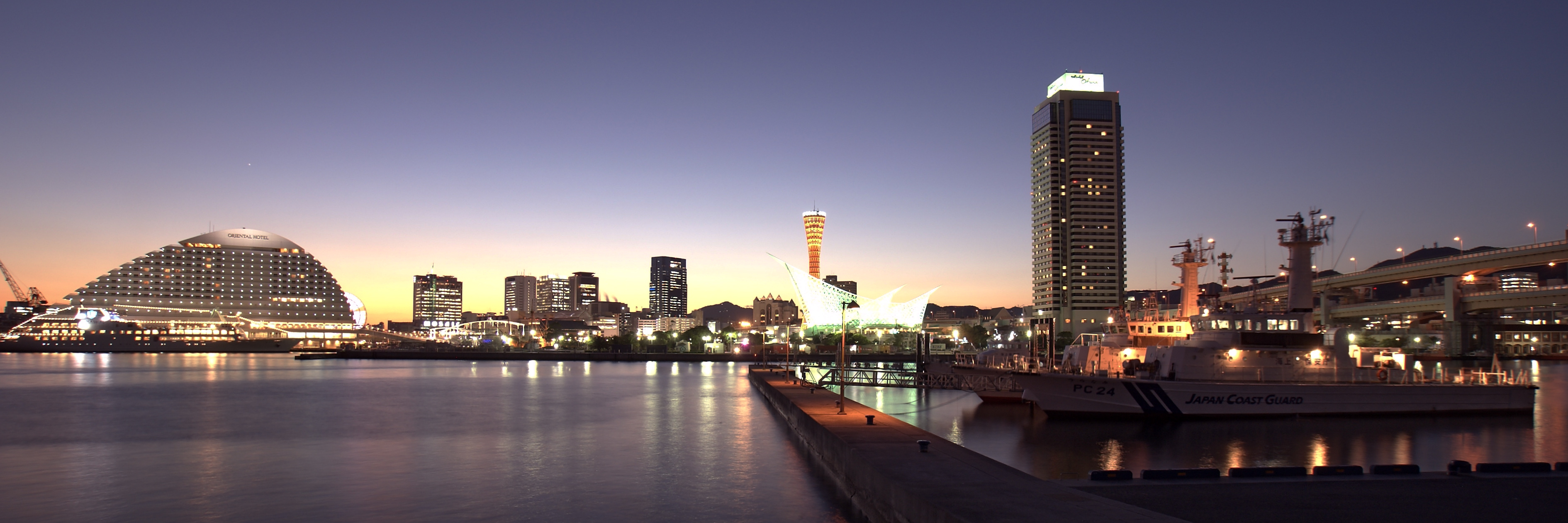
The Port of Kobe is a Japanese maritime port in Kobe, Hyōgo in the Keihanshin area, backgrounded by the Hanshin Industrial Region. Located at a foothill of the range of Mount Rokkō, flat lands are limited and constructions of artificial islands have carried out, to make Port Island, Rokkō Island, island of Kobe Airport to name some. History In the 12th century, Taira no Kiyomori renovated the then and moved to , the short-lived capital neighbouring the port. Throughout medieval era, the port was known as . In 1858 the Treaty of Amity and Commerce opened the Hyōgo Port to foreigners. In 1865, the Hyōgo Port Opening Demand Incident occurred, in which nine warships from Britain, France, the Netherlands, and the United States invaded the Hyōgo Port demanding its opening. In 1868, a new port of Kobe was built east of the Hyōgo Port and opened. After the World War II pillars were occupied by the Allied Forces, later by United States Forces Japan. (Last one returned ... [...More Info...] [...Related Items...] OR: [Wikipedia] [Google] [Baidu] |
Port Of Nagoya
The , located in Ise Bay, is the largest and busiest trading port in Japan, accounting for about 10% of the total trade value of Japan. Notably, this port is the largest exporter of cars in Japan and where the Toyota Motor Corporation exports most of its cars. It has piers in Nagoya, Tōkai, Chita, Yatomi, and Tobishima. Its mascots are Potan and Mitan. According to Japanese media sources, Kodo-kai, a yakuza faction in the Yamaguchi-gumi group, earns large revenues by controlling the stevedoring and warehousing companies at the port. History The Port of Nagoya opened for international trade in 1907. Nagoya Port Authority The (NPA) was established on 8 September 1951 as a special local public entity that jointly operates the Port of Nagoya for the city of Nagoya and Aichi Prefecture. It has special district authority over the Port of Nagoya, which includes facilities in four different cities and one village. The president of the NPA alternates every two years between the ... [...More Info...] [...Related Items...] OR: [Wikipedia] [Google] [Baidu] |
Port Of Tokyo
The Port of Tokyo is one of the largest Japanese seaports and one of the largest seaports in the Pacific Ocean basin having an annual traffic capacity of around 100 million tonnes of cargo and 4,500,000 twenty-foot equivalent units. The port is also an important employer in the area having more than 30,000 employees that provide services to more than 32,000 ships every year. History The forerunner of the Port of Tokyo, the ''Edo Port'' (Edo Minato) played a very important role in the history of marine transport of Japan and as a distribution point for supplying goods for the people of Edo. During the Tokugawa Shogunate the Port of Tokyo was not allowed to open to international trade, although the neighbouring Port of Yokohama was already open for this kind of trade. The development of the port was finally encouraged during the Meiji Period with the influence of a project that was meant to improve the estuary of the Sumida River by dredging channels and reclaiming land at Tsuk ... [...More Info...] [...Related Items...] OR: [Wikipedia] [Google] [Baidu] |
Port Of Yokohama
The is operated by the Port and Harbor Bureau of the City of Yokohama in Japan. It opens onto Tokyo Bay. The port is located at a latitude of 35.27–00°N and a longitude of 139.38–46°E. To the south lies the Port of Yokosuka; to the north, the ports of Kawasaki and Tokyo. History The Treaty of Amity and Commerce of 1858 specified Kanagawa as an open port. The Port of Yokohama formally opened to foreign trade on the 2nd of June 1859. The port grew rapidly through the Meiji and Taisho periods as a center for raw silk export and technology import. Current facilities Yokohama Port has ten major piers. Honmoku Pier is the port's core facility with 24 berths including 14 container berths. Osanbashi Pier handles passenger traffic including cruises, and has customs, immigration and quarantine facilities for international travel. Detamachi, the "banana pier," is outfitted for receiving fresh fruits and vegetables. Daikoku Pier, on an artificial island measuring 321 ... [...More Info...] [...Related Items...] OR: [Wikipedia] [Google] [Baidu] |
Busan
Busan (), officially Busan Metropolitan City, is South Korea's second list of cities in South Korea by population, most populous city after Seoul, with a population of over 3.3 million as of 2024. Formerly romanized as Pusan, it is the economic, cultural and educational center of southeastern South Korea, with its port being South Korea's busiest and the sixth-busiest in the world. The surrounding "Southeastern Maritime Industrial Region" (including Ulsan, South Gyeongsang Province, South Gyeongsang, Daegu, and part of North Gyeongsang Province, North Gyeongsang and South Jeolla Province, South Jeolla) is South Korea's largest industrial area. The large volumes of port traffic and urban population in excess of 1 million make Busan a Large-Port metropolis using the Southampton System of Port-City classification. As of 2019, Busan Port is the primary port in Korea and the world's sixth-largest container port. Busan is divided into 15 major administrative districts and a single co ... [...More Info...] [...Related Items...] OR: [Wikipedia] [Google] [Baidu] |
List Of World's Busiest Container Ports
This article lists the world's busiest Containerization, container ports (ports with container terminals that specialize in handling goods transported in Intermodal container, intermodal shipping containers), by total number of twenty-foot equivalent units (TEUs) transported through the port. The table lists volume in thousands of TEU per year. The vast majority of containers moved by large, ocean-faring container ships are 20-foot (1 TEU) and 40-foot (2 TEU) ISO 668, ISO-standard shipping containers, with 40-foot units outnumbering 20-foot units to such an extent that the actual number of containers moved is between 55%–60% of the number of TEUs counted.Assuming that all boxes are either counted as 1 or 2 TEUs (which is pretty much the case), and that for every 20-foot / single TEU box, there are at least ''two'' 40-foot (or other 2 TEU) units (meaning 2 × 2 = 4 TEUs) in circulation, the 40-footers represent at least 80% of the TEU volume; and for every 10 TEUs, on average, a ... [...More Info...] [...Related Items...] OR: [Wikipedia] [Google] [Baidu] |
Port Of Jebel Ali
Port of Jebel Ali, also known as Mina Jebel Ali, is a deep port located in Jebel Ali, Dubai, United Arab Emirates. Jebel Ali is the world's ninth busiest port, the largest man-made harbour, and the biggest and by far the busiest port in the Middle-East. Port Jebel Ali was constructed in the late 1970s to supplement the facilities at Port Rashid. Geography Jebel Ali port is located 35 km southwest of Dubai, in the Persian Gulf. The port is part of the Maritime Silk Road that runs from the Chinese coast to the south via the southern tip of India to Mombasa, from there through the Red Sea via the Suez Canal to the Mediterranean, there to the Upper Adriatic region to the northern Italian hub of Trieste with its rail connections to Central Europe, Eastern Europe and the North Sea. History Jebel Ali Port, credited to the efforts of Rashid bin Saeed Al-Maktoum, was constructed in the late 1970s and opened in 1979 to supplement the facilities at Port Rashid. It was inaugurated ... [...More Info...] [...Related Items...] OR: [Wikipedia] [Google] [Baidu] |
Dubai
Dubai (Help:IPA/English, /duːˈbaɪ/ Help:Pronunciation respelling key, ''doo-BYE''; Modern Standard Arabic, Modern Standard Arabic: ; Emirati Arabic, Emirati Arabic: , Romanization of Arabic, romanized: Help:IPA/English, /diˈbej/) is the List of cities in the United Arab Emirates#Major cities, most populous city in the United Arab Emirates and the capital of the Emirate of Dubai. It is located on a Dubai Creek, creek on the south-eastern coast of the Persian Gulf, Persian Gulf. As of 2025, the city population stands at 4 million, 92% of whom are Expatriates in the United Arab Emirates, expatriates. The wider urban area includes Sharjah and has a population of 5 million people as of 2023,https://www.demographia.com/db-worldua.pdf while the Dubai–Sharjah–Ajman metropolitan area counts 6 million inhabitants. Founded in the early 18th century as a Cultured pearl, pearling and fishing settlement, Dubai became a regional trade hub in the 20th century after declaring itself a f ... [...More Info...] [...Related Items...] OR: [Wikipedia] [Google] [Baidu] |
Ship Transport
Maritime transport (or ocean transport) or more generally waterborne transport, is the transport of people (passengers or goods (cargo) via waterways. Freight transport by watercraft has been widely used throughout recorded history, as it provides a higher-capacity mode of transportation for passengers and cargo than land transport, the latter typically being more costly per unit payload due to it being affected by terrain conditions and road/rail infrastructures. The advent of aviation during the 20th century has diminished the importance of sea travel for passengers, though it is still popular for ferry, short trips and cruise ship, pleasure cruises. Transport by watercraft is much cheaper than transport by aircraft or land vehicles (both road and rail), but is significantly slower for longer journeys and heavily dependent on adequate port facilities. Maritime transport accounts for roughly 80% of international trade, according to United Nations Conference on Trade and Developm ... [...More Info...] [...Related Items...] OR: [Wikipedia] [Google] [Baidu] |


