|
P78 Road (Ukraine)
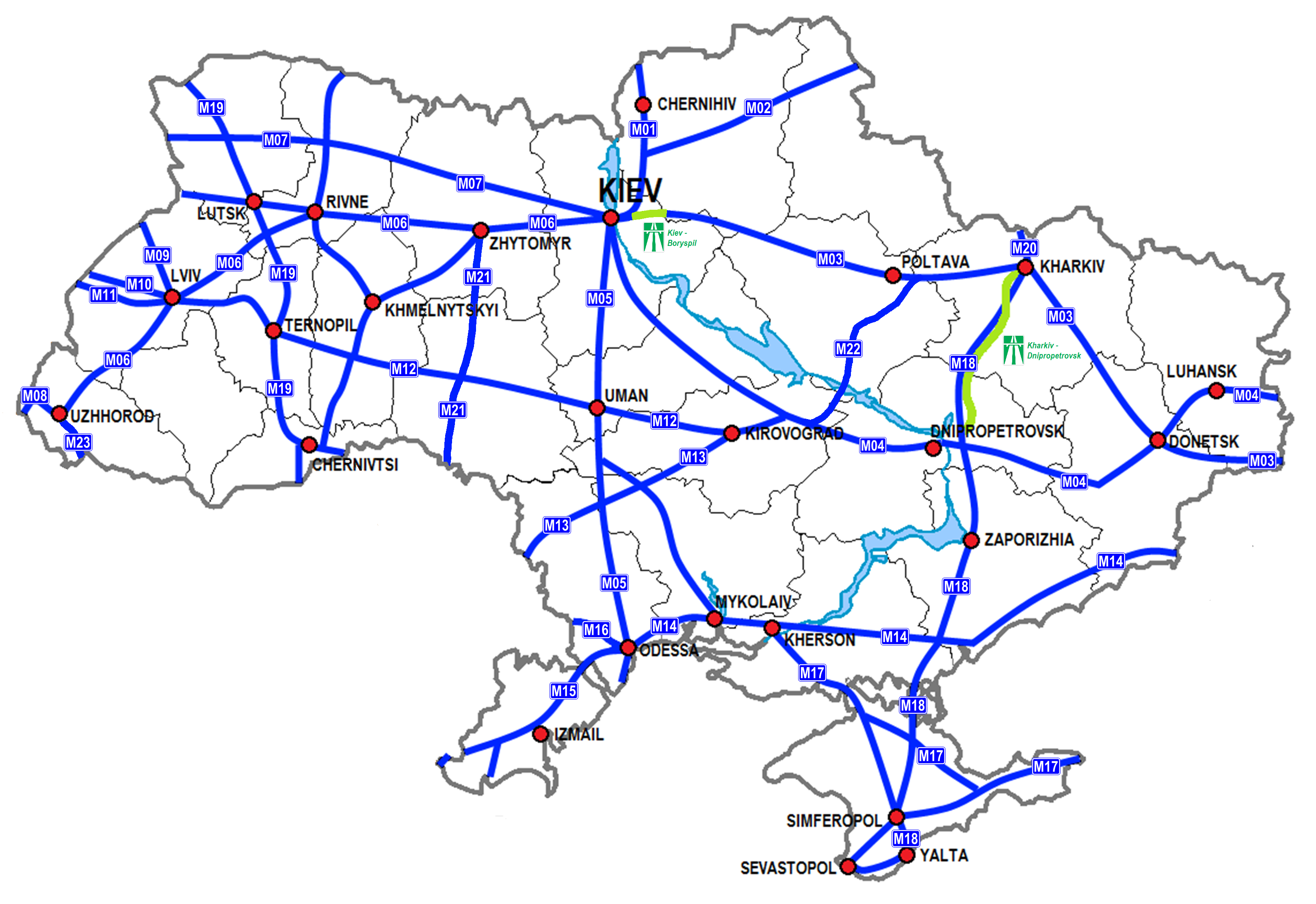
P78 is a regional road ( P-Highway) in Kharkiv Oblast, Ukraine. It runs northwest–southeast and connects Kharkiv with Horokhovatka. The road runs somewhat parallel to the highway M03 between Kharkiv and Izium. Among notable landmarks, there is Zmiiv thermal power station. The road passes such cities like Zmiiv, Slobozhanske, Balakliya, and crosses river Siversky Donets. In 2019, road rehabilitation works continued on the highway. See also * Roads in Ukraine Roads in Ukraine's transportation network are divided into two main categories: general-use roads, which consist of streets and roads in cities, villages, and other populated areas; and specialized roads, which include official, private, and spec ... References {{Roads in Ukraine Roads in Kharkiv Oblast ... [...More Info...] [...Related Items...] OR: [Wikipedia] [Google] [Baidu] |
Kharkiv
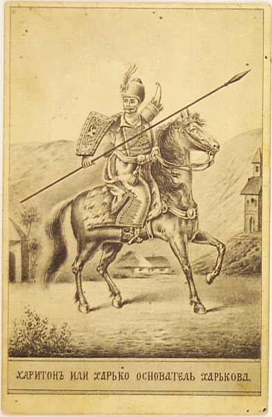
Kharkiv, also known as Kharkov, is the second-largest List of cities in Ukraine, city in Ukraine.Kharkiv "never had eastern-western conflicts" , ''Euronews'' (23 October 2014) Located in the northeast of the country, it is the largest city of the historic region of Sloboda Ukraine. Kharkiv is the administrative centre of Kharkiv Oblast and Kharkiv Raion. Prior to the Russian invasion of Ukraine in early 2022, it had an estimated population of 1,421,125. Founded in 1654 as a Cossacks, Cossack fortress, by late 19th century Kharkiv had developed within the Russian Empire as a major commercial and industrial centre. From December 1919 to January 1934, Kharkiv was the capital of the Ukrainian Soviet Socialist Rep ... [...More Info...] [...Related Items...] OR: [Wikipedia] [Google] [Baidu] |
Kharkiv Oblast
Kharkiv Oblast (, ), also referred to as Kharkivshchyna (), is an oblast (province) in eastern Ukraine. Kharkiv borders Luhansk Oblast to the east, Donetsk Oblast to the southeast, Dnipropetrovsk Oblast to the southwest, Poltava Oblast to the west, Sumy Oblast to the northwest and Russia's Belgorod Oblast to the north. Its area is , or 5.2% of the total territory of Ukraine. The oblast is the third-most populous of Ukraine, with a population of 2,598,961 in 2021, more than half (1.42 million) of whom live in the city of Kharkiv, the oblast's administrative center. Nomenclature Most of Ukraine's oblasts are named after their capital cities, officially called "oblast centers" (, translit. ''oblasnyi tsentr''). The name of each oblast is a relative adjective, formed by adding a feminine suffix to the name of respective center city: ''Kharkiv'' is the center of the ''Kharkivs’ka oblast’'' (Kharkiv Oblast). Most oblasts are also sometimes referred to in a feminine noun f ... [...More Info...] [...Related Items...] OR: [Wikipedia] [Google] [Baidu] |
State Highways (Ukraine)
State highways in Ukraine () are subdivided into four categories: international (M-network), national (H-network), regional (P-network), and territorial (Т-network). The letter's indexes are in Cyrillic, standing for their respective abbreviations in Ukrainian. List of international highways in Ukraine International highways in Ukraine are the roads in Ukraine on routes involving international transport corridors and/or highways that are part of the European network. The international highways in Ukraine are identified with the letter M for the Ukrainian designation (''Mizhnarodni''), followed by the double digits 01 through 30. Usually their major routes of freeways detour around highly congested areas such as cities; however, these highways also might have some branches with the same identification signs posted while going through such congested areas. Some of these highways, especially around major cities have 8, 10, or more lanes. There are 28 international highways of Ukrai ... [...More Info...] [...Related Items...] OR: [Wikipedia] [Google] [Baidu] |
Highway M03 (Ukraine)
Highway M03 is a Ukrainian international highway ( M-highway) connecting Kyiv with Dovzhansky on the border with Russia, where it continues into Russia as the A270. It is part of European route E40 from Kyiv to Debaltseve at which it is part of European route E50 to the border with Russia. At , the M03 is the longest international state highway in Ukraine. In Soviet times the M03 was part of the M19. Today, the highway stretches through five oblasts and ends at the border checkpoint at Dovzhansky which is part of Sverdlovsk Raion (Luhansk Oblast). The route connects Kyiv and Kharkiv with the industrial region of Donbas. Part of the M03 between Kyiv and Boryspil was reconstructed into an automagistral to handle higher traffic between Kyiv and the Boryspil International Airport. From Boryspil to Lubny, the road is a dual carriageway, thereon it continues as a single carriageway with some 2x2 sections. Significant armed conflict has occurred on or near the eastern portions of ... [...More Info...] [...Related Items...] OR: [Wikipedia] [Google] [Baidu] |
Izium
Izium or Izyum (, ; ) is a city on the Donets River in Kharkiv Oblast, eastern Ukraine that serves as the administrative center of Izium Raion and Izium urban hromada. It is about southeast of the city of Kharkiv, the oblast's administrative center. Izium has a population of making it the second-most populous city in Kharkiv Oblast behind Kharkiv proper. It has held economic significance for centuries due to its position as a transportation link between Kharkiv and the Donbas region to the southeast. The area around Izium has been periodically inhabited since ancient times, but the modern city has its origins in a 17th-century fortress defending against Tatars, Tatar raids. Izium was the site of several battles during World War II, but still grew rapidly during the 20th century due to its importance as a transport hub. During the Russian invasion of Ukraine, Russian forces occupied the city in April 2022 after Battle of Izium, a battle that destroyed much of the city. However, ... [...More Info...] [...Related Items...] OR: [Wikipedia] [Google] [Baidu] |
Zmiiv Thermal Power Station
Zmiiv or Zmiyiv () from 1976 to 1990, is a city in Chuhuiv Raion, Kharkiv, Ukraine. It hosts the administration of Zmiiv urban hromada, one of the hromadas of Ukraine. The population in 2001 was 17,063, falling to The town is located from Kharkiv. In 1976-1990, the city was called Gotwald () in honor of the Czechoslovak communist and politician Klement Gottwald. Until 2020, Zmiiv was the administrative centre of Zmiiv Raion, before it was merged into Chuhuiv Raion as part of that year's administrative reform. Toponymy The name ''Zmiiv'' or ''Zmiyiv'' is almost certainly derived from the Ukrainian word for snakes (). In addition, there are at least five potential origins for the source of the name Zmiiv or Zmiev: # There is an old legend that in the dense forests and impenetrable swamps surrounding the town, there lived a winged many-headed serpent, the Zmii Horynych, who was harnessed to a large plough by Nikita Kozhemyak, and the Zmiiv ramparts were formed from the dump ... [...More Info...] [...Related Items...] OR: [Wikipedia] [Google] [Baidu] |
Balakliya
Balakliia or Balakliya (, ; ) is a city in the Izium Raion, Kharkiv Oblast, eastern Ukraine, on the northeast side of the Siverskyi Donets river close to where it is joined by the , which runs through the town. It is an important railroad junction in the oblast. Balakliia hosts the administration of Balakliia urban hromada, one of the hromadas of Ukraine. Population: Administrative status Until 18 July 2020, Balakliia was the administrative center of Balakliia Raion. The raion was abolished in July 2020 as part of the administrative reform of Ukraine, which reduced the number of raions of Kharkiv Oblast to seven. The area of Balakliia Raion was merged into Izium Raion. History Early history and etymology The land that is now Balakliia has been inhabited since ancient times. Settlements from the Neolithic Age and Bronze Age have been preserved. The name "Balakliia" is derived from the , a tributary of the Donets. The river's name in turn comes from a Turkic word meaning 'fi ... [...More Info...] [...Related Items...] OR: [Wikipedia] [Google] [Baidu] |
Siversky Donets
The Seversky Donets () or Siverskyi Donets (), usually simply called the Donets (), is a river on the south of the East European Plain. It originates in the Central Russian Upland, north of Belgorod, flows south-east through Ukraine (Kharkiv, Donetsk and Luhansk Oblasts) and then again through Russia (Rostov Oblast) to join the river Don, about from the Sea of Azov. The Donets is the fourth-longest river in Ukraine, and the largest in eastern Ukraine, where it is an important source of fresh water. It gives its name to the Donets Basin, known commonly as the Donbas, an important coal-mining and industrial region in Ukraine. Etymology The names ''Don'' and its diminutive ''Donets'' are derived from Iranic, Sarmatian "the river".Mallory, J.P. and Victor H. Mair. ''The Tarim Mummies: Ancient China and the Mystery of the Earliest Peoples from the West''. London: Thames and Hudson, 2000. p. 106 Scytho-Sarmatians inhabited the areas to the north of the Black Sea from 1100 B ... [...More Info...] [...Related Items...] OR: [Wikipedia] [Google] [Baidu] |
Roads In Ukraine
Roads in Ukraine's transportation network are divided into two main categories: general-use roads, which consist of streets and roads in cities, villages, and other populated areas; and specialized roads, which include official, private, and special-use roads. Most members of the public travel on general-use roads, the most prominent of which are part of the international E-road network. However, high-speed highways, locally known as ''avtomahistrali'' (motorways) or ''shvydkisni dorohy'' (Controlled-access highway, expressways), are rare and only exist on certain segments of major routes. In early 2010, in preparation for Ukraine co-hosting the UEFA Euro 2012 football tournament, significant infrastructure improvement projects were announced by the newly-established Ministry of Infrastructure of Ukraine, then headed by Borys Kolesnikov. These efforts fell short of expectations in some areas, and the road network at-large is still in need of significant renovation. Ukraine inheri ... [...More Info...] [...Related Items...] OR: [Wikipedia] [Google] [Baidu] |


