|
Ouzoum
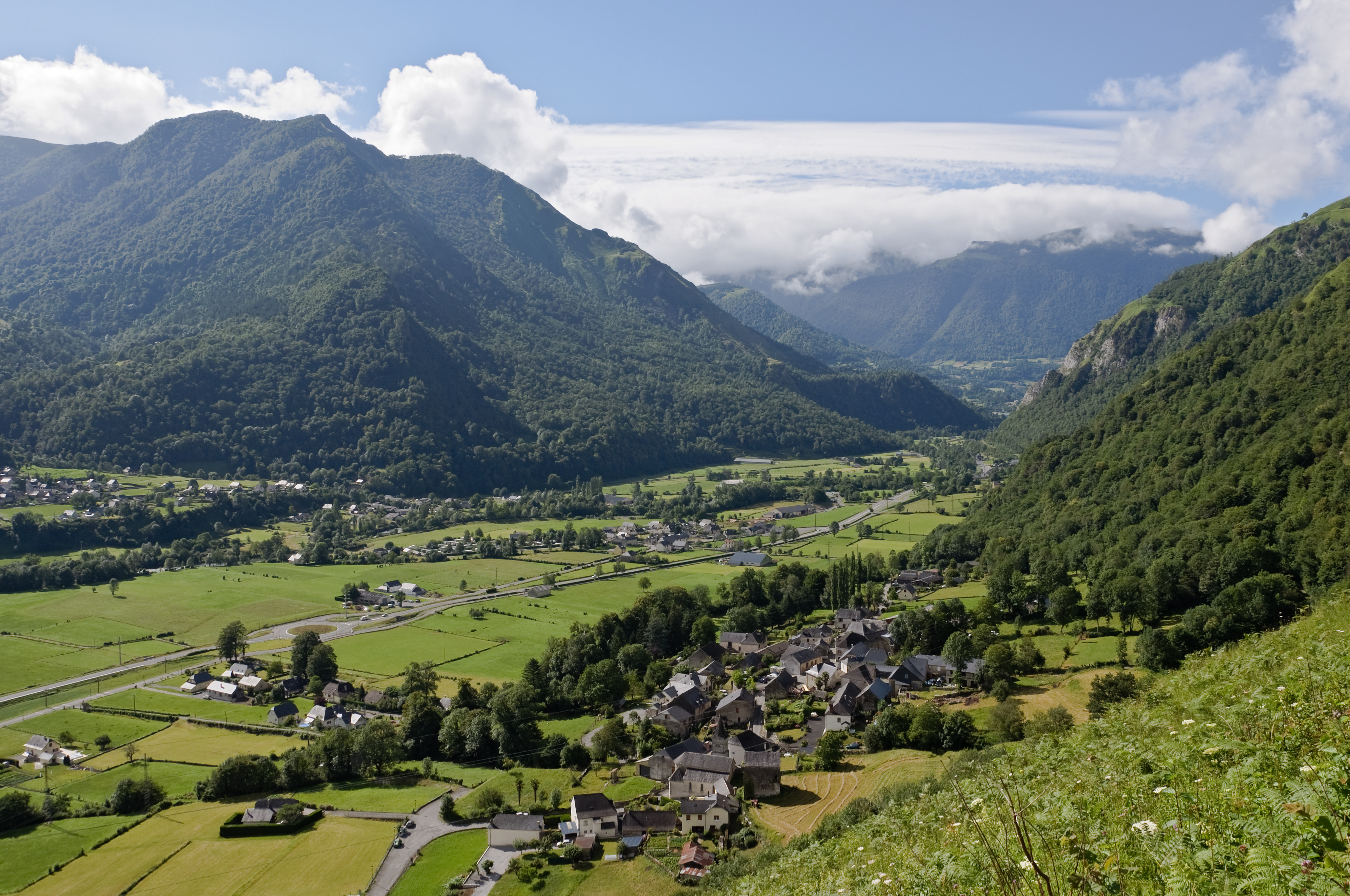
The Ouzoum or Ouzom (/ uzũ /) is a left tributary of the Gave de Pau, in the Southwest of France, between the Génie longue and the Béez. It is long. It flows into the Gave in Nay, upstream from Pau. Name Historical graphies were oscillating between the voiced -s- and the unvoiced -ss-: ''Oson'' (1441), ''Osom, Osson, Ozon'' (1538), ''le Lozon'' (1581), l'''Ouson'' (1585). This name could be related with the Pyrenean hydronym Ousse.Michel Grosclaude, « L'hydronyme Ousse », ''Dictionnaire toponymique des communes du Béarn'', 1991, p. 390. Geography The valley of the Ouzoum is separated in two distinct parts by a long narrow pass. The villages in the upper part of the valley (Arbéost and Ferrières) belong to the Hautes-Pyrénées and have relationships with the Val d'Azun, on the other side of the mountain. On the other hand, the lower part of the valley, close to Pau, is Béarnese (Pyrénées-Atlantiques). The Ouzoum rises at ''Cap d’Ouzom'' ("head of Ouz ... [...More Info...] [...Related Items...] OR: [Wikipedia] [Google] [Baidu] |
Asson
Asson () is a commune in the Pyrénées-Atlantiques department in the Nouvelle-Aquitaine region of south-western France. The inhabitants of the commune are known as ''Assonais''. Geography Asson is a large commune in the Ouzom Valley some 30 km south by south-east of Pau and 35 km east by south-east of Oloron-Sainte-Marie which almost completely surrounds the commune of Arthez-d'Asson. The south-eastern border of the commune is the border between the departments of Pyrenees-Atlantiques and Hautes-Pyrénées. Access to the commune is by the D 35 road from Igon in the east which passes through the village and continues west to Bruges-Capbis-Mifaget. The D 36 road comes from Nay in the north to join the D 35 just west of the village. The D 126 road goes south from the village to Arthez-d'Asson. The D 226 branches from the D 126 and goes east by a circuitous route to Lestelle-Betharram. The southern half of the commune is mountainous and heavily forested while the ... [...More Info...] [...Related Items...] OR: [Wikipedia] [Google] [Baidu] |
Arthez-d'Asson
Arthez-d'Asson ( oc, Artés d'Asson) is a commune in the Pyrénées-Atlantiques department in the Nouvelle-Aquitaine region of south-western France. The inhabitants of the commune are known as ''Arthéziens'' or ''Arthéziennes'' Geography Arthez-d'Asson is in the Ouzom Valley some 30 km south by south-east of Pau and 35 km east by south-east of Oloron-Sainte-Marie. The commune is almost entirely surrounded by the commune of Asson. Access to the commune is by road D126 which comes from Asson in the north passing through the commune and the village, continuing south up the Valley to Ferrières. The commune is almost entirely farmland although with patches of forest particularly along the river. The Ouzom River flows through the length of the commune from south to north gathering some tributaries on the right bank, such as the ''Cau du Hau'', the ''Cau du Gat'', the ''Arriou Sec'', and the ''Cau de la Heche'', and continuing north to join the Gave de Pau near Coarraze ... [...More Info...] [...Related Items...] OR: [Wikipedia] [Google] [Baidu] |
Béez
The Béez,also known as ''Béès'' or ''Bez'' is a left tributary of the Gave de Pau, in Béarn (Pyrénées-Atlantiques), in the Southwest of France. It flows into the Gave de Pau upstream from Pau, between the Ouzoum and the Luz. It is long. Name The name ''Béez'', which presents some parallelism with those of the Léez or the Néez, is in fact a variant of the name of the Baïse. The names of the ''Bès'', a tributary of the neighboring Luz, and of the ''Bez'', a tributary of the Midouze, are related. Geography The Béez rises on the slopes of the ''Pic Durban'', elevation , where it is known as the ''Bazest, Baseigt'' or ''Baset''. It flows north into the Gave de Pau in Nay. Départements and towns * Pyrénées-Atlantiques: Pé-de-Hourat, Capbis, Nay. Main tributaries ''Baseigt'' / ''Baset'' * (R) the ''Izou'', from the ''Izou Pass'' (847 m), * (L) the ''Cau de Heus'' ''Béez'' * (L) the ''Lestarrès'' / ''Lestarrezoû'', from Louvie-Juzon. ** (R) the ''Escour ... [...More Info...] [...Related Items...] OR: [Wikipedia] [Google] [Baidu] |
Gave De Pau
The Gave de Pau () is a river of south-western France. It takes its name from the city of Pau, through which it flows. The river is long ( including the Gaves réunis), and its source is at the Cirque de Gavarnie in the Pyrenees mountains. The Gave de Pau joins the Gave d'Oloron in Peyrehorade to form the about long Gaves réunis (united Gaves), which is a left tributary of the Adour. The Gaves réunis is often considered to be part of the Gave de Pau. Its main tributaries are the Béez, the Néez, the Ouzoum and the Ousse. The Gave de Pau flows through the following ''départements'' and towns: * Hautes-Pyrénées: Argelès-Gazost, Lourdes. * Pyrénées-Atlantiques: Pau, Orthez Orthez (; eu, Ortheze; oc, Ortès, ) is a commune in the Pyrénées-Atlantiques department, and region of New Aquitaine, southwestern France. It lies 40 km NW of Pau on the Southern railway to Bayonne. The town also encompasses the sm .... * Landes: Peyrehorade. Referenc ... [...More Info...] [...Related Items...] OR: [Wikipedia] [Google] [Baidu] |
Béarn
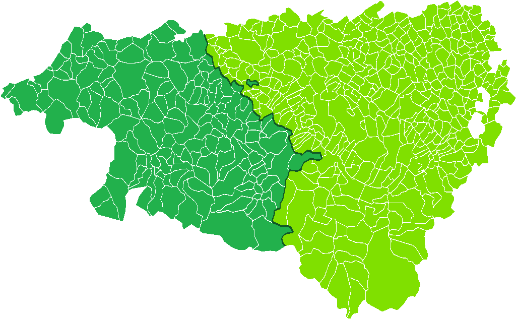
The Béarn (; ; oc, Bearn or ''Biarn''; eu, Bearno or ''Biarno''; or ''Bearnia'') is one of the traditional provinces of France, located in the Pyrenees mountains and in the plain at their feet, in southwest France. Along with the three Basque provinces of Soule, Lower Navarre, and Labourd, the Principality of Bidache, as well as small parts of Gascony, it forms in the southwest the current ''département'' of Pyrénées-Atlantiques (64). The capitals of Béarn were Beneharnum (until 841), Morlaàs (from ca. 1100), Orthez (from the second half of the 13th century), and then Pau (beginning in the mid-15th century). Béarn is bordered by Basque provinces Soule and Lower Navarre to the west, by Gascony ( Landes and Armagnac) to the north, by Bigorre to the east, and by Spain (Aragon) to the south. Today, the mainstays of the Béarn area are the petroleum industry, the aerospace industry through the helicopter turboshaft engine manufacturer Turbomeca, tourism and ... [...More Info...] [...Related Items...] OR: [Wikipedia] [Google] [Baidu] |
Rivers Of France
This is a list of rivers that are at least partially in France. The rivers are grouped by sea or ocean. The rivers flowing into the sea are sorted along the coast. Rivers flowing into other rivers are listed by the rivers they flow into. Some rivers (e.g. Sûre/Sauer) do not flow through France themselves, but they are mentioned for having French tributaries. They are given in ''italics''. For clarity, only rivers that are longer than 50 km (or have longer tributaries) are shown. In French, rivers are traditionally classified either as ''fleuves'' when they flow into the sea (or into a desert or lake), or as ''rivières'' when they flow into another river. The ''fleuves'' are shown in bold. For an alphabetical overview of rivers of France, see the category Rivers of France. Tributary list North Sea The rivers in this section are sorted north-east (Netherlands) to south-west (Calais). * Rhine/Rhin (main branch at Hook of Holland, Netherlands) ** Moselle (in Koblenz, Germ ... [...More Info...] [...Related Items...] OR: [Wikipedia] [Google] [Baidu] |
Igon
Igon (; oc, Aigon) is a commune in the Pyrénées-Atlantiques department in southwestern France. See also *Communes of the Pyrénées-Atlantiques department The following is a list of the 546 Communes of France, communes of the Pyrénées-Atlantiques Departments of France, department of France. The communes cooperate in the following Communes of France#Intercommunality, intercommunalities (as of 202 ... References Communes of Pyrénées-Atlantiques {{PyrénéesAtlantiques-geo-stub ... [...More Info...] [...Related Items...] OR: [Wikipedia] [Google] [Baidu] |
Pluvio-nival Regime
The river regime generally describes the character of the typical fluctuations of flow of a river, but can also refer to the mathematical relationship between the river discharge and its width, depth and slope. Thus, "river regime" can describe one of two characteristics of a reach of an alluvial river: * The variability in its discharge throughout the course of a year in response to precipitation, temperature, evapotranspiration and drainage basin characteristics (Beckinsale, 1969) * A series of characteristic power-law relationships between discharge and width, depth and slope The latter is described by the fact that the discharge through a river of an approximate rectangular cross-section must, through conservation of mass, equal :Q = \bar b h where Q is the volumetric discharge, \bar is the mean flow velocity, b is the channel width (breadth) and h is the channel depth. Because of this relationship, as discharge increases, depth, width, and/or mean velocity must increase as ... [...More Info...] [...Related Items...] OR: [Wikipedia] [Google] [Baidu] |
River Regime
The river regime generally describes the character of the typical fluctuations of flow of a river, but can also refer to the mathematical relationship between the river discharge and its width, depth and slope. Thus, "river regime" can describe one of two characteristics of a reach of an alluvial river: * The variability in its discharge throughout the course of a year in response to precipitation, temperature, evapotranspiration and drainage basin characteristics (Beckinsale, 1969) * A series of characteristic power-law relationships between discharge and width, depth and slope The latter is described by the fact that the discharge through a river of an approximate rectangular cross-section must, through conservation of mass, equal :Q = \bar b h where Q is the volumetric discharge, \bar is the mean flow velocity, b is the channel width (breadth) and h is the channel depth. Because of this relationship, as discharge increases, depth, width, and/or mean velocity must increase as we ... [...More Info...] [...Related Items...] OR: [Wikipedia] [Google] [Baidu] |
Col D'Aubisque
The Col d'Aubisque ( oc, Còth d'Aubisca) (elevation ) is a mountain pass in the Pyrenees south of Tarbes and Pau in the department of the Pyrénées-Atlantiques, in the Aquitaine region of France.Chany, Pierre (1988), La Fabuleuse Histoire du Tour de France, La Martinière, France, p112 The pass is on the northern slopes of the Pic de Ger () and connects Laruns, in the valley of the Gave d'Ossau, via Eaux-Bonnes (west) to Argelès-Gazost, in the valley of the Gave de Pau, via the Col du Soulor (east). The road crosses the Cirque du Litor, in the upper part of the Ouzom valley. It is generally closed from December to June. The pass is starting point of excursions and a centre for winter sports. In summer, it is popular with cyclists. It is regularly part of the Tour de France, generally rated an ''hors catégorie'' climb. The col The summit of the col is marked by a commemorative plaque to André Bach (1888–1945), a member of Legion of Honour and President of the ''Cycl ... [...More Info...] [...Related Items...] OR: [Wikipedia] [Google] [Baidu] |
Ossau Valley
The Ossau Valley (French: ''Vallée d'Ossau''; Gascon: ''Aussau'' / ''la vath d'Aussau'') is a valley of the French Pyrénées, in the Pyrénées-Atlantiques ''département''. Administration 18 communes belong to the Valley: Arudy, Aste-Béon, Béost, Bescat, Bielle, Bilhères, Buzy, Castet, Eaux-Bonnes, Gère-Bélesten, Izeste, Laruns, Louvie-Juzon, Louvie-Soubiron, Lys, Rébénacq, Sainte-Colome and Sévignacq-Meyracq. See also * Gave d'Ossau (river) * Pic du Midi d'Ossau * Col d'Aubisque * Gourette * Ossau-Iraty (cheese) * Petit train d'Artouste The Petit train d'Artouste is a narrow gauge tourist railway situated in the French Pyrenees close to the Spanish border, some south of the town of Pau, and within the ''commune'' of Laruns. The line runs high above the headwaters of the Gave d' ... References External links Landforms of Pyrénées-Atlantiques Valleys of France Nouvelle-Aquitaine region articles needing translation from French Wikipedia {{Py ... [...More Info...] [...Related Items...] OR: [Wikipedia] [Google] [Baidu] |


