|
Oscott
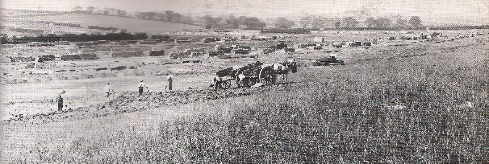
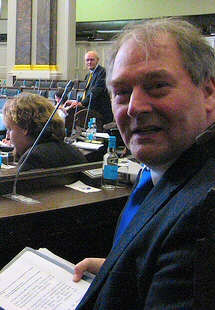
Oscott is a Ward (country subdivision), ward in the northwest of Birmingham, England, within the Government of Birmingham, England#Districts, formal district of Perry Barr. The Ward is centred on the area known as Old Oscott, originally just "Oscott", and should not be confused with nearby New Oscott. It includes the former Booths Farm sand quarry, Aldridge Road Recreation Ground, and Kingstanding Circle. The ward borders the Metropolitan Borough of Walsall and areas such as Perry Beeches and Queslett. Parts fall within Great Barr. The nearest library serving the ward iKingstanding Library History The area is mainly a housing estate built in the 1930s and 1940s. Before that time, it was mainly rural farmland. * Keith Linnecor, - Labour Councillor for Oscott Ward for 25 years until his death in 2020 Population The 2001 Population Census recorded that there were 24,073 people living in the ward. 9.4% (2,273) of the ward's population consists of ethnic minorities which is low com ... [...More Info...] [...Related Items...] OR: [Wikipedia] [Google] [Baidu] |
New Oscott
New Oscott is an area of Birmingham, England. It was named after the Oscott area of Birmingham, when St. Mary's College, the Roman Catholic seminary, moved from that site to the new one. The original then became known as Old Oscott. The only pub in New Oscott is the Beggars Bush. The area also hosts the Princess Alice Retail Park and adjacent Tesco Extra superstore. Princess Alice Retail Park was the site of a large and well known children's home from the late 19th century. When the site was sold for redevelopment in the 1980s the home was demolished leaving Brampton Hall which was a Community Centre serving the local area. Brampton Hall offered a range of classes and interest groups to the community and was a popular venue for parties and children's birthday parties. In recent years, this hall got knocked down and turned into a casual Italo-American chain restaurant, Frankie and Benny's, which has since been turned into a Burger King. The area near The Beggars Bush used to ... [...More Info...] [...Related Items...] OR: [Wikipedia] [Google] [Baidu] |
Old Oscott
Old Oscott (originally Oscott) is an area of Great Barr, Birmingham, England (previously in the parish of Handsworth, Staffordshire). The suburb forms a triangle bounded to the north by Pheasey, to the west by Perry Beeches, and to the east by Kingstanding. The Birmingham City Council ward that covers the area is called simply Oscott. The area has been known locally as "Old" Oscott since St. Mary's College, the Roman Catholic seminary, moved to a new site in an area that became known as New Oscott. The area was mostly developed between 1920 and 1960, with a mix of both private and council housing Public housing in the United Kingdom, also known as council housing or social housing, provided the majority of rented accommodation until 2011, when the number of households in private rental housing surpassed the number in social housing. D .... Old Oscott F.C. takes its name from the area. External links Areas of Birmingham, West Midlands History of Staffordshir ... [...More Info...] [...Related Items...] OR: [Wikipedia] [Google] [Baidu] |
Birmingham Perry Barr (UK Parliament Constituency)
Birmingham Perry Barr is a constituency in the West Midlands, represented in the House of Commons of the UK Parliament by independent Ayoub Khan since July 2024. It had previously been held since 2001 by Khalid Mahmood of the Labour Party. Boundaries The constituency covers a broad area of north-west Birmingham. 1950–1974: The County Borough of Birmingham wards of Kingstanding and Perry Barr. 1974–1983: The County Borough of Birmingham wards of Kingstanding, Oscott, and Perry Barr. 1983–1997: The City of Birmingham wards of Handsworth, Kingstanding, Oscott, and Perry Barr. 1997–2010: The City of Birmingham wards of Handsworth, Oscott, Perry Barr, and Sandwell. 2010–2018: The City of Birmingham wards of Handsworth Wood, Lozells and East Handsworth, Oscott, and Perry Barr. 2018–2024: Following a local government boundary review, which did not effect the parliamentary boundaries, the contents of the constituency were as follows with effect from May 2018: * ... [...More Info...] [...Related Items...] OR: [Wikipedia] [Google] [Baidu] |
2022 Birmingham City Council Election
The 2022 Birmingham City Council election took place on 5 May 2022, with all 101 council seats up for election across 37 single-member and 32 two-member wards. The election was held alongside other local elections across Great Britain and town council elections in Sutton Coldfield. In the previous council election in 2018, the first all-out elections in Birmingham, Labour maintained its control of the council, winning 67 seats. The Conservatives formed the main opposition with twenty-five seats, with the Liberal Democrats on eight and the Green Party winning a single seat. In 2022, Labour maintained overall control. The Liberal Democrats and the Greens gained seats at the expense of Labour and the Conservatives. Background The Local Government Act 1972 created a two-tier system of metropolitan counties and districts covering Greater Manchester, Merseyside, South Yorkshire, Tyne and Wear, the West Midlands, and West Yorkshire starting in 1974. Birmingham was a district of ... [...More Info...] [...Related Items...] OR: [Wikipedia] [Google] [Baidu] |
Great Barr
Great Barr is a large and loosely defined area to the north-west of Birmingham, in the county of the West Midlands (county), West Midlands, England. The area was historically in Staffordshire, and the parts now in Birmingham were once known as Perry Barr, which is still the name of an adjacent Birmingham district. Other parts still known as Great Barr are now in the Metropolitan Boroughs of Walsall and Sandwell. "Barr" means "hill", and the name refers to nearby Barr Beacon. The name Barr Magna is used on some old maps. Others show it as "Gt. Barr". History Samuel Taylor, an itinerant Methodist preacher, visited Great Barr in 1792 and remarked "preached at Barr, a village famous for nothing as having given birth to Francis Asbury of America and being the present residence of his parents, at whose house we preached". Great Barr was largely rural until the early 20th century, though it was influenced by the early stages of the industrial revolution which affected the nearby ... [...More Info...] [...Related Items...] OR: [Wikipedia] [Google] [Baidu] |
Perry Barr
Perry Barr is a suburban area in north Birmingham, in the county of the West Midlands (county), West Midlands, England. It is also the name of a Government of Birmingham, England#Council constituencies, council constituency, managed by its own district committee. Birmingham Perry Barr (UK Parliament constituency), Birmingham Perry Barr is also a parliamentary constituency; its Member of Parliament (United Kingdom), Member of Parliament between 2001 and 2024 was Labour's Khalid Mahmood (politician, born 1961), Khalid Mahmood. The MP as of July 2024 is Ayoub Khan, who ran as an Independent. The constituency includes the smaller Perry Barr ward (politics), ward, and the wards of Handsworth Wood, Lozells and East Handsworth, and Oscott, which each elect three councillors to Birmingham City Council. Etymology There were four ancient manors in this area (all part of the parish of Handsworth) called Hamstead, Oscott, Perry, and Little (or Parva) Barr. Perry is the area around the pa ... [...More Info...] [...Related Items...] OR: [Wikipedia] [Google] [Baidu] |
Kingstanding
Kingstanding is an area in north Birmingham, England. It gives its name to a ward in the Erdington council constituency. Kingstanding ward includes the areas; Perry Common, Witton Lakes. The other part of Kingstanding falls under the Oscott ward. Kingstanding houses a covered drinking water reservoir, Perry Barr Reservoir, on the site of the former Perry Barr Farm. Kingstanding is served by two libraries; Kingstanding Library and Perry Common Library. The area known as Kingstanding Circle is where the Kingstanding village centre lies with its shops and Kings Road/ Kingstanding Road roundabout. History The name of the area is derived from the occasion when the Stuart King Charles I supposedly reviewed his troops standing on the Neolithic Bowl Barrow in the area on 18 October 1642 during the English Civil War, after his stay at nearby Aston Hall. The first references to Kingstanding were as King's Standing. The course of the Icknield Street Roman Road runs past this ba ... [...More Info...] [...Related Items...] OR: [Wikipedia] [Google] [Baidu] |
Birmingham City Council
Birmingham City Council is the local authority for the city of Birmingham in the West Midlands, England. Birmingham has had an elected local authority since 1838, which has been reformed several times. Since 1974 the council has been a metropolitan borough council, a type of unitary authority. It provides the majority of local government services in the city. It is the most populous local government district in England, serving over 1.1million people. The council has been a member of the West Midlands Combined Authority since 2016. The council has been under Labour majority control since 2012. It is based at the Council House on Victoria Square, Birmingham. On 6 September 2023, the council declared effective bankruptcy, and central government commissioners were subsequently appointed to run the council under emergency measures. History Until the 18th century, Birmingham was governed by manorial courts and its parish vestry. A body of improvement commissioners called the ... [...More Info...] [...Related Items...] OR: [Wikipedia] [Google] [Baidu] |
Birmingham
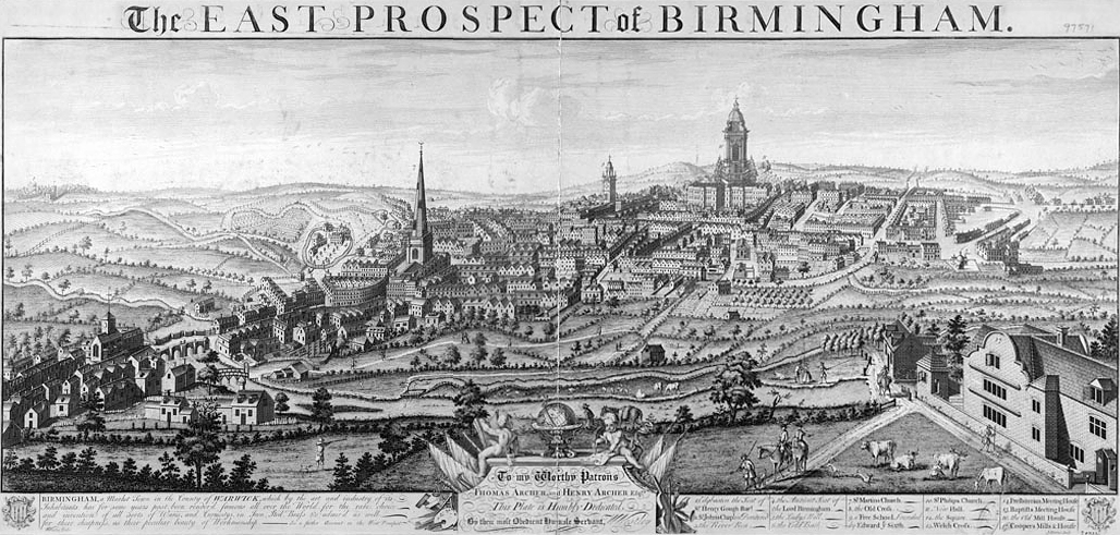
Birmingham ( ) is a City status in the United Kingdom, city and metropolitan borough in the metropolitan county of West Midlands (county), West Midlands, within the wider West Midlands (region), West Midlands region, in England. It is the List of English districts by population, largest local authority district in England by population and the second-largest city in Britain – commonly referred to as the second city of the United Kingdom – with a population of million people in the city proper in . Birmingham borders the Black Country to its west and, together with the city of Wolverhampton and towns including Dudley and Solihull, forms the West Midlands conurbation. The royal town of Sutton Coldfield is incorporated within the city limits to the northeast. The urban area has a population of 2.65million. Located in the West Midlands (region), West Midlands region of England, Birmingham is considered to be the social, cultural, financial and commercial centre of the Midland ... [...More Info...] [...Related Items...] OR: [Wikipedia] [Google] [Baidu] |
Wards Of Birmingham, West Midlands
Ward may refer to: Division or unit * Hospital ward, a hospital division, floor, or room set aside for a particular class or group of patients, for example the psychiatric ward * Prison ward, a division of a penal institution such as a prison * Ward (electoral subdivision), electoral district or unit of local government * Ward (fortification), part of a castle * Ward (LDS Church), a local congregation of The Church of Jesus Christ of Latter-day Saints * Ward (Vietnam), a type of third-tier subdivision of Vietnam * Wards of Japan, a subdivision of a large city Businesses and organizations * WARD (FM), a radio station (91.9 FM) licensed to serve New Paris, Ohio, United States; see List of radio stations in Ohio * WOUF (AM), a radio station (750 AM) licensed to serve Petoskey, Michigan, United States, which held the call sign WARD from 2008 to 2021 * Warring Adolescents Revenge Division (WARD), organization in ''The Hardy Boys'' graphic novels * Ward Body Works, a school ... [...More Info...] [...Related Items...] OR: [Wikipedia] [Google] [Baidu] |
Neighbourhood Renewal Fund
Neighbourhood Renewal Fund (NRF) is a form of Local Government finance in England, launched by the Office of the Deputy Prime Minister in July 2000. NRF is allocated to multi-agency Local Strategic Partnerships (LSPs) in the 88 Local Authority areas judged to be the most deprived based on the 2000 Indices of Multiple Deprivation. It is intended to be spent on the social regeneration of the areas to which it has been awarded, and on interventions designed to reduce the relative deprivations in those areas (such as health inequalities, educational underachievement and high crime rates). See also * Neighbourhood Management Pathfinder Programme The Neighbourhood Management Pathfinder Programme was a co-operative programme in England between Residency (domicile), residents and Stakeholder (corporate), stakeholders such as the Local government, local authority, businesses etc., aimed at impr ... * Start Up Citywide External links Great Yarmouth LSPCurrently funded programmes Stoke on ... [...More Info...] [...Related Items...] OR: [Wikipedia] [Google] [Baidu] |


