|
Orión (rocket)
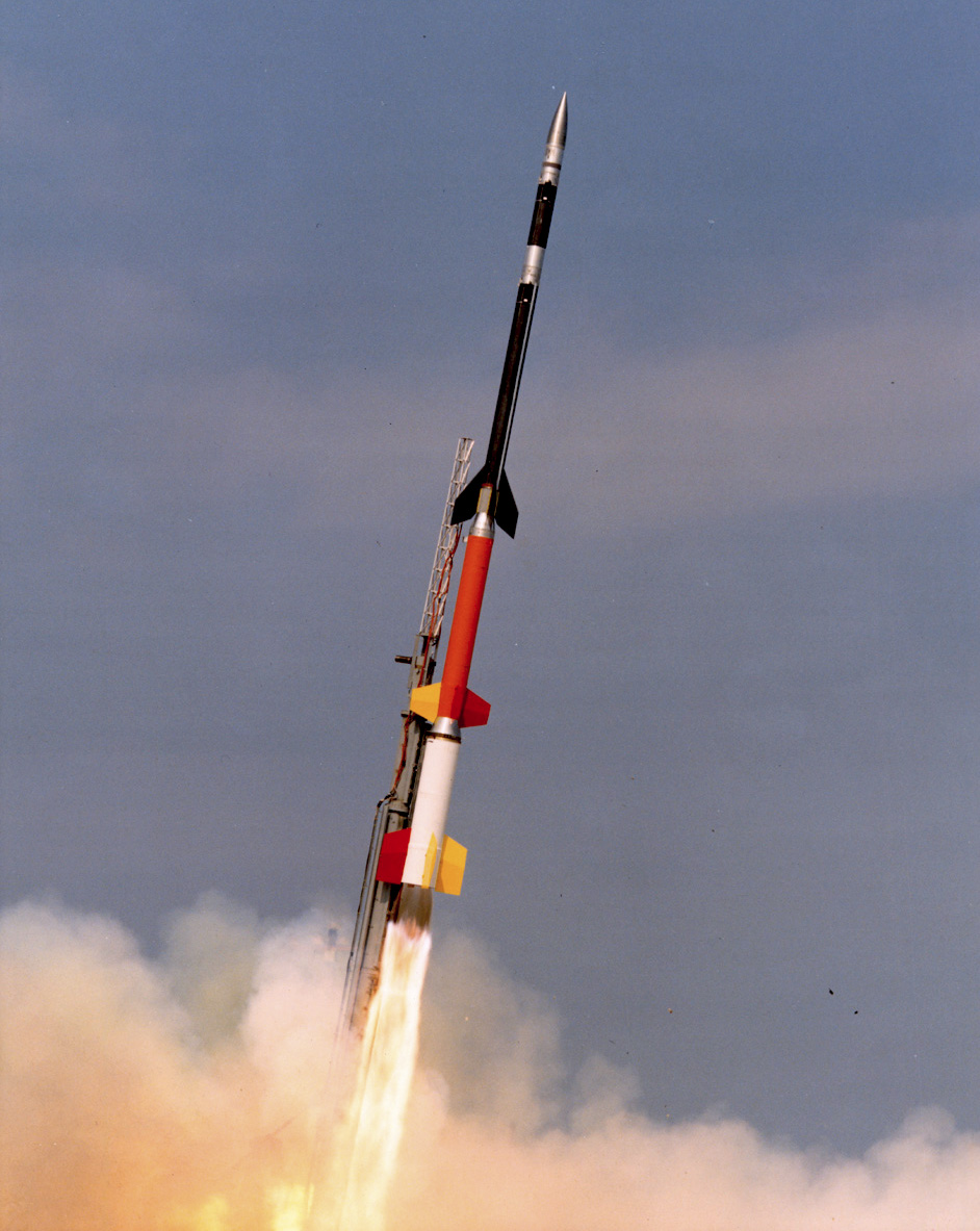
Orión was the designation of a sounding rocket family of Argentina, which was launched between 1965 and 1971 at CELPA (El Chamical), CELPA (Mar Chiquita), Tartagal and Wallops Island. Developed by the Instituto de Investigaciones Aeronauticas y Espaciales (IIAE), An Orión flight on August 13, 1966 that reached an apogee of 114 km, surpassing the Kármán line, made Argentina the first South American nation to launch a rocket into space. Orión-1 The first version Orión-1 was flown twice in 1965 and 1966 from CELPA (El Chamical), in order to test the engines and technologies. It had a length of , a diameter of and a weight of . Apogee was for a payload. Solid fuel mass was with a burn time of 12 seconds. Launches Table of Orión-1 launches: Gallery File:CSA Orión-1.png, Orión-1 diagram File:Argentinian sounding rockets shapes (ORIÓN I).jpg, Orión-1 diagram File:Cohete sonda Orión I.jpg, Orión-1 photo Orión-2 In November 1966, three tests of the ... [...More Info...] [...Related Items...] OR: [Wikipedia] [Google] [Baidu] |
Sounding Rocket
A sounding rocket or rocketsonde, sometimes called a research rocket or a suborbital rocket, is an instrument-carrying rocket designed to take measurements and perform scientific experiments during its sub-orbital flight. The rockets are often used to launch instruments from above the surface of the Earth, the altitude generally between weather balloons and satellites; the maximum altitude for balloons is about and the minimum for satellites is approximately . Due to their suborbital flight profile, sounding rockets are often much simpler than their counterparts built for orbital flight. Certain sounding rockets have an apogee between , such as the Black Brant X and XII, which is the maximum apogee of their class. For certain purposes, sounding rockets may be flown to altitudes as high as to allow observing times of around 40 minutes to provide geophysical observations of the magnetosphere, ionosphere, thermosphere, and mesosphere. Etymology The origin of the term comes fr ... [...More Info...] [...Related Items...] OR: [Wikipedia] [Google] [Baidu] |
Argentina
Argentina, officially the Argentine Republic, is a country in the southern half of South America. It covers an area of , making it the List of South American countries by area, second-largest country in South America after Brazil, the fourth-largest country in the Americas, and the List of countries and dependencies by area, eighth-largest country in the world. Argentina shares the bulk of the Southern Cone with Chile to the west, and is also bordered by Bolivia and Paraguay to the north, Brazil to the northeast, Uruguay and the South Atlantic Ocean to the east, and the Drake Passage to the south. Argentina is a Federation, federal state subdivided into twenty-three Provinces of Argentina, provinces, and one autonomous city, which is the federal capital and List of cities in Argentina by population, largest city of the nation, Buenos Aires. The provinces and the capital have their own constitutions, but exist under a Federalism, federal system. Argentina claims sovereignty ov ... [...More Info...] [...Related Items...] OR: [Wikipedia] [Google] [Baidu] |
CELPA (El Chamical)
CELPA (El Chamical) ''(Centro de Experimentación y Lanzamiento de Proyectiles Autopropulsados)'' was a rocket launch site in Argentina Argentina, officially the Argentine Republic, is a country in the southern half of South America. It covers an area of , making it the List of South American countries by area, second-largest country in South America after Brazil, the fourt ..., near El Chamical at , in the La Rioja Province. The launch site was in service between 1963 and 1973 and was mainly used for launching rockets of the types Centauro, Judi Dart, Orión, Rigel, Centaure and Boosted Dart. A second CELPA compound was built in 1964 in Mar Chiquita, north of Mar del Plata, under the name of CELPA Atlántico. See also * CELPA (Mar Chiquita) References Space programme of Argentina Rocket launch sites in Argentina Science and technology in Argentina Government of Argentina La Rioja Province, Argentina 1963 establishments in Argentina {{rocketr ... [...More Info...] [...Related Items...] OR: [Wikipedia] [Google] [Baidu] |
CELPA (Mar Chiquita)
CELPA (Mar Chiquita) also known as CELPA Atlántico'' (Centro de Experimentación y Lanzamiento de Proyectiles Autopropulsados)'' was a rocket launch site in Mar Chiquita, Argentina, north of Mar del Plata. The launch site was in service from 1968 to 1976 and was mainly used for launching rockets of the types Orión-2, Arcas, Rocketsonde and Dragon I. The tests from CELPA Atlántico were sponsored by the United Nations since 1969. There was a total number of 69 tests. The compound was used by agencies like NASA, Meteorological Rocket Network (USA), CNES (France) and CONAE (Argentina). As of 2016, the site is used by the Argentine Air Force and Army to test anti-aircraft weaponry. See also *CELPA (El Chamical) CELPA (El Chamical) ''(Centro de Experimentación y Lanzamiento de Proyectiles Autopropulsados)'' was a rocket launch site in Argentina Argentina, officially the Argentine Republic, is a country in the southern half of South America. It c ... Notes and refe ... [...More Info...] [...Related Items...] OR: [Wikipedia] [Google] [Baidu] |
Tartagal, Salta
Tartagal () is a Tropics, tropical city in northern Argentina, in the province of Salta Province, Salta. It is located in the northeast of the province, within the General José de San Martín Department, of which it is the capital. It is located in the Yungas jungle, at the foot of the sub-Andean mountain ranges to the west and the Salta plains to the east. This location gives it a wide variety of flora and fauna, and its territory is home to eight indigenous communities. It stands out for the large density of large trees in its streets and squares, such as mangoes, algarrobos and lapachos. It is one of the few places in the world where the green macaw is not extinct in the wild. Due to its economy, it is the third most important city in the province, after San Ramón de la Nueva Orán, Orán. It stands out as a center for oil and gas extraction, and also has strong activity in the forestry and agricultural sectors. It is located 365 km from the provincial capital, Salta, 57 ... [...More Info...] [...Related Items...] OR: [Wikipedia] [Google] [Baidu] |
Wallops Island
Wallops Island is a island in Accomack County, Virginia, part of the Virginia Barrier Islands that stretch along the eastern seaboard of the United States. It is just south of Chincoteague Island, a popular tourist destination. Wallops Island proper, originally known as Kegotank Island, was granted to John Wallop by the Crown on April 29, 1692. Ownership was divided through the years, until the Commonwealth of Virginia seized the property in 1876 and 1877 in lieu of unpaid taxes. From 1877, ownership was again divided and subdivided until 1889, when it was held by various trustees for the Wallops Island Club. The club was incorporated and assumed ownership in 1933 as the Wallops Island Association, Inc. Association members and their families spent the summers fishing and swimming on the island. The Association grazed sheep, cattle, and ponies on the area until the mid-1940s. In 1947, the U.S. Navy began using the upper two-thirds of the island on a lease-rental basis for av ... [...More Info...] [...Related Items...] OR: [Wikipedia] [Google] [Baidu] |
Apogee
An apsis (; ) is the farthest or nearest point in the orbit of a planetary body about its primary body. The line of apsides (also called apse line, or major axis of the orbit) is the line connecting the two extreme values. Apsides pertaining to orbits around different bodies have distinct names to differentiate themselves from other apsides. Apsides pertaining to geocentric orbits, orbits around the Earth, are at the farthest point called the ''apogee'', and at the nearest point the ''perigee'', like with orbits of satellites and the Moon around Earth. Apsides pertaining to orbits around the Sun are named ''aphelion'' for the farthest and ''perihelion'' for the nearest point in a heliocentric orbit. Earth's two apsides are the farthest point, ''aphelion'', and the nearest point, ''perihelion'', of its orbit around the host Sun. The terms ''aphelion'' and ''perihelion'' apply in the same way to the orbits of Jupiter and the other planets, the comets, and the asteroids of t ... [...More Info...] [...Related Items...] OR: [Wikipedia] [Google] [Baidu] |
Kármán Line
The Kármán line (or von Kármán line ) is a conventional definition of the Outer space#Boundary, edge of space; it is widely but not universally accepted. The international record-keeping body Fédération Aéronautique Internationale, FAI (Fédération aéronautique internationale) defines the Kármán line at an altitude of above above mean sea level, mean sea level. While named after Theodore von Kármán, who calculated a theoretical limit of altitude for aeroplane flight at above Earth, the later established Kármán line is more general and has no distinct physical significance, in that there is a rather gradual difference between the characteristics of the atmosphere at the line, and experts disagree on defining a distinct boundary where the atmosphere ends and space begins. It lies well above the altitude reachable by conventional airplanes or high-altitude balloons, and is approximately where satellites, even on very eccentric trajectories, will Orbital decay, dec ... [...More Info...] [...Related Items...] OR: [Wikipedia] [Google] [Baidu] |
Solid-propellant Rocket
A solid-propellant rocket or solid rocket is a rocket with a rocket engine that uses solid propellants (fuel/ oxidizer). The earliest rockets were solid-fuel rockets powered by gunpowder. The inception of gunpowder rockets in warfare can be credited to the ancient Chinese, and in the 13th century, the Mongols played a pivotal role in facilitating their westward adoption. All rockets used some form of solid or powdered propellant until the 20th century, when liquid-propellant rockets offered more efficient and controllable alternatives. Because of their simplicity and reliability, solid rockets are still used today in military armaments worldwide, model rockets, solid rocket boosters and on larger applications. Since solid-fuel rockets can remain in storage for an extended period without much propellant degradation, and since they almost always launch reliably, they have been frequently used in military applications such as missiles. The lower performance of solid propellant ... [...More Info...] [...Related Items...] OR: [Wikipedia] [Google] [Baidu] |
Wallops Flight Facility
Wallops Flight Facility (WFF) is a rocket launch site on Wallops Island on the Eastern Shore of Virginia, United States, just east of the Delmarva Peninsula and approximately north-northeast of Norfolk, VA, Norfolk. The facility is operated by the Goddard Space Flight Center in Greenbelt, Maryland, and primarily serves to support science and exploration missions for NASA and other Federal government of the United States, federal agencies. WFF includes an extensively instrumented range to support launches of more than a dozen types of sounding rockets; small expendable suborbital and orbital rockets; high-altitude balloon flights carrying scientific instruments for atmospheric and astronomical research; and, using its Research Airport, flight tests of aeronautical research aircraft, including unmanned aerial vehicles. There have been over 16,000 launches from the rocket testing range at Wallops since its founding in 1945 in the quest for information on the flight characteristi ... [...More Info...] [...Related Items...] OR: [Wikipedia] [Google] [Baidu] |
Solar Eclipse Of November 12, 1966
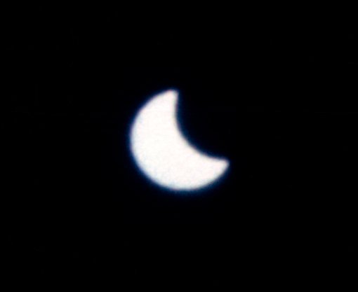
A total solar eclipse occurred at the Moon's descending node of orbit on Saturday, November 12, 1966, with a magnitude of 1.0234. A solar eclipse occurs when the Moon passes between Earth and the Sun, thereby totally or partly obscuring the image of the Sun for a viewer on Earth. A total solar eclipse occurs when the Moon's apparent diameter is larger than the Sun's, blocking all direct sunlight, turning day into darkness. Totality occurs in a narrow path across Earth's surface, with the partial solar eclipse visible over a surrounding region thousands of kilometres wide. Occurring about 2.25 days after perigee (on November 10, 1966, at 8:40 UTC), the Moon's apparent diameter was larger. The path of totality cut a swath across South America from north of Lima, Peru, passing the northeastern tip of Chile, Bolivia, Northwest of Argentina, southwestern tip of Ñeembucú Department in Paraguay, nearly to the southernmost tip of Brazil. A partial eclipse was visible for parts of Centra ... [...More Info...] [...Related Items...] OR: [Wikipedia] [Google] [Baidu] |


