|
Only, Tennessee
Only is an unincorporated community in Hickman County, Tennessee, United States. Only is located on Tennessee State Route 229 near Tennessee State Route 50 and Interstate 40, west-northwest of Centerville. Only has a post office A post office is a public facility and a retailer that provides mail services, such as accepting letter (message), letters and parcel (package), parcels, providing post office boxes, and selling postage stamps, packaging, and stationery. Post o ..., with ZIP code 37140. History The origin of the place name Only is obscure. Some state its name is derived from the family of pioneer settlers, while others believe the name refers to a store owner who was always heard to describe his prices as "only five cents", etc. References Unincorporated communities in Hickman County, Tennessee Unincorporated communities in Tennessee {{HickmanCountyTN-geo-stub ... [...More Info...] [...Related Items...] OR: [Wikipedia] [Google] [Baidu] |
Unincorporated Area
An unincorporated area is a parcel of land that is not governed by a local general-purpose municipal corporation. (At p. 178.) They may be governed or serviced by an encompassing unit (such as a county) or another branch of the state (such as the military). There are many unincorporated communities and areas in the United States and Canada, but many countries do not use the concept of an unincorporated area. By country Argentina In Argentina, the provinces of Chubut Province, Chubut, Córdoba Province (Argentina), Córdoba, Entre Ríos Province, Entre Ríos, Formosa Province, Formosa, Neuquén Province, Neuquén, Río Negro Province, Río Negro, San Luis Province, San Luis, Santa Cruz Province, Argentina, Santa Cruz, Santiago del Estero Province, Santiago del Estero, Tierra del Fuego Province, Argentina, Tierra del Fuego, and Tucumán Province, Tucumán have areas that are outside any municipality or commune. Australia Unlike many other countries, Australia has only local go ... [...More Info...] [...Related Items...] OR: [Wikipedia] [Google] [Baidu] |
Tennessee State Route 229
State Route 229 (SR 229), also known as R W Moore Memorial Rt Highway, is a very short long north-south state highway in Hickman County, Tennessee. It is the only access road in and out of Turney Center Industrial Complex, a state prison. SR 229 is a very curvy and rural two-lane highway for its entire length, and it parallels the Duck River for the majority of its length. Some maps, such as Google Maps, show SR 229 continuing north along Only Road and Dyer Road to pass through the community of Only, even though this is not recognized by TDOT as part of SR 229 and is actually a former alignment of SR 50. Major intersections References {{reflist 229 __NOTOC__ Year 229 ( CCXXIX) was a common year starting on Thursday of the Julian calendar. At the time, it was known as the Year of the Consulship of Severus and Cassius (or, less frequently, year 982 ''Ab urbe condita''). The denomination 22 ... Transportation in Hickman County, Tennessee ... [...More Info...] [...Related Items...] OR: [Wikipedia] [Google] [Baidu] |
United States Postal Service
The United States Postal Service (USPS), also known as the Post Office, U.S. Mail, or simply the Postal Service, is an independent agencies of the United States government, independent agency of the executive branch of the federal government of the United States, United States federal government responsible for providing mail, postal service in the United States, its insular areas and Compact of Free Association, associated states. It is one of a few government agencies Postal Clause, explicitly authorized by the Constitution of the United States. As of March 29, 2024, the USPS has 525,377 career employees and nearly 114,623 pre-career employees. The USPS has a monopoly on traditional Letter (message), letter delivery within the U.S. and operates under a Universal service, universal service obligation (USO), both of which are defined across a broad set of legal mandates, which obligate it to provide uniform price and quality across the entirety of its service area. The Post ... [...More Info...] [...Related Items...] OR: [Wikipedia] [Google] [Baidu] |
Post Office
A post office is a public facility and a retailer that provides mail services, such as accepting letter (message), letters and parcel (package), parcels, providing post office boxes, and selling postage stamps, packaging, and stationery. Post offices may offer additional services, which vary by country. These include providing and accepting government forms (such as passport applications), and processing government services and fees (such as road tax, Postal savings system, postal savings, or bank fees). The chief administrator of a post office is called a postmaster. During the 19th century, when the postal deliveries were made, it would often be delivered to public places. For example, it would be sent to bars and/or general store. This would often be delivered with newspapers and those who were expecting a post would go into town to pick up the mail, along with anything that was needed to be picked up in town. Before the advent of postal codes and the post office, postal syst ... [...More Info...] [...Related Items...] OR: [Wikipedia] [Google] [Baidu] |
Tennessee Department Of Transportation
The Tennessee Department of Transportation (TDOT) is the department of transportation for the State of Tennessee, with multimodal responsibilities in roadways, aviation, public transit, waterways, and railroads. It was established in 1915 as the Tennessee Department of Highways and Public Works, and renamed the Tennessee Department of Transportation in 1972. The core agency mission of TDOT is to provide a safe and reliable transportation system for people, goods, and services that supports economic prosperity in Tennessee. Since 1998, TDOT has been ranked amongst the top five in the nation for quality highway infrastructure. It is primarily headquartered in downtown Nashville and operates four regional offices in Chattanooga, Jackson, Tennessee, Jackson, Knoxville, and Nashville. Major responsibilities The major duties and responsibilities of TDOT are to: * plan, build, and maintain the List of state routes in Tennessee, state-owned highway and Interstate system of over ; * admin ... [...More Info...] [...Related Items...] OR: [Wikipedia] [Google] [Baidu] |
Centerville, Tennessee
Centerville is a town in Hickman County, Tennessee, United States. The population was 3,489 as of the 2020 United States census, 2020 Census. It is the county seat and the only incorporated town in Hickman County. It is best known for being the hometown of American comedian Minnie Pearl. Geography Centerville sits at the center of Hickman County in the valley of the Duck River (Tennessee), Duck River, a west-flowing tributary of the Tennessee River. According to the United States Census Bureau, the town has a total area of , all land. Transportation Tennessee State Route 100 is the main road running the length of the town. It leads northeast to Nashville, Tennessee, Nashville, the state capital, and southwest to Linden, Tennessee, Linden. Tennessee State Route 50 passes through the southern part of Centerville, leading northwest to Interstate 40 (via exit 148) near Only, Tennessee, Only and southeast to Columbia, Tennessee, Columbia. The town limits extend north from the ... [...More Info...] [...Related Items...] OR: [Wikipedia] [Google] [Baidu] |
Interstate 40 In Tennessee
Interstate 40 (I-40) is part of the Interstate Highway System that runs from Barstow, California, to Wilmington, North Carolina. The highway crosses Tennessee from west to east, from the Mississippi River at the Arkansas border to the Blue Ridge Mountains at the North Carolina border. At , the Tennessee segment of I-40 is the longest of the eight states through which it passes and the state's longest Interstate Highway. I-40 passes through Tennessee's three largest cities— Memphis, Nashville, and Knoxville—and serves the Great Smoky Mountains National Park, the most-visited national park in the United States. It crosses all of Tennessee's physiographic regions and Grand Divisions—the Mississippi embayment and Gulf Coastal Plain in West Tennessee, the Highland Rim and Nashville Basin in Middle Tennessee, and the Cumberland Plateau, Cumberland Mountains, Ridge-and-Valley Appalachians, and Blue Ridge Mountains in East Tennessee. Landscapes on the route vary from fl ... [...More Info...] [...Related Items...] OR: [Wikipedia] [Google] [Baidu] |
Tennessee State Route 50
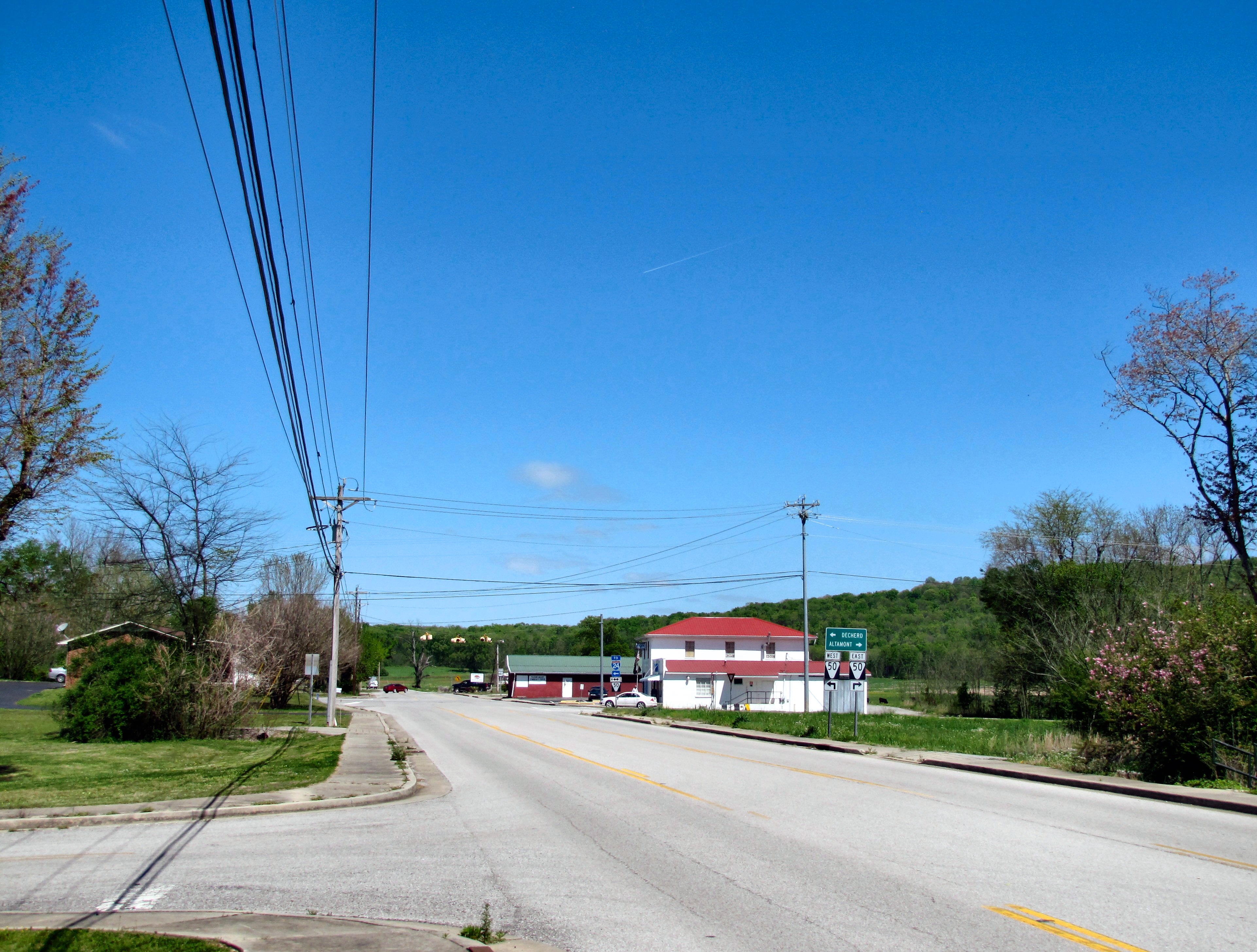
State Route 50 (SR 50) is a west–to–east highway in Middle Tennessee. The road begins near Only and ends in Altamont. The current length is . Route description Hickman County SR 50 begins as a 2-lane secondary highway in Hickman County at exit 148 on I-40 near Only as a continuation of Duck River Road. SR 50 travels southeast and crosses a bridge over the Duck River to enter Only and have an intersection with Dyer Road, which follows SR 50's former alignment through the community. SR 50 then passes through wooded areas as it bypasses Only to the south before having an intersection with SR 229, which provides access to the Turney Center Industrial Complex. SR 50 continues east to cross the Duck River again before paralleling it and having an intersection with SR 438. The highway then has two more crossings of the Duck river before passing near Grinder's Switch and entering Centerville. SR 50 then passes south of downtown as it then comes t ... [...More Info...] [...Related Items...] OR: [Wikipedia] [Google] [Baidu] |
Geographic Names Information System
The Geographic Names Information System (GNIS) is a database of name and location information about more than two million physical and cultural features, encompassing the United States and its territories; the Compact of Free Association, associated states of the Marshall Islands, Federated States of Micronesia, and Palau; and Antarctica. It is a type of gazetteer. It was developed by the United States Geological Survey (USGS) in cooperation with the United States Board on Geographic Names (BGN) to promote the standardization of feature names. Data were collected in two phases. Although a third phase was considered, which would have handled name changes where local usages differed from maps, it was never begun. The database is part of a system that includes topographic map names and bibliographic references. The names of books and historic maps that confirm the feature or place name are cited. Variant names, alternatives to official federal names for a feature, are also recor ... [...More Info...] [...Related Items...] OR: [Wikipedia] [Google] [Baidu] |
List Of Sovereign States
The following is a list providing an overview of sovereign states around the world with information on their status and recognition of their sovereignty. The 205 listed states can be divided into three categories based on membership within the United Nations System: 193 member states of the United Nations, UN member states, two United Nations General Assembly observers#Current non-member observers, UN General Assembly non-member observer states, and ten other states. The ''sovereignty dispute'' column indicates states having undisputed sovereignty (188 states, of which there are 187 UN member states and one UN General Assembly non-member observer state), states having disputed sovereignty (15 states, of which there are six UN member states, one UN General Assembly non-member observer state, and eight de facto states), and states having a political status of the Cook Islands and Niue, special political status (two states, both in associated state, free association with New ... [...More Info...] [...Related Items...] OR: [Wikipedia] [Google] [Baidu] |
Area Code 931
Area code 931 is the telephone area code in the North American Numbering Plan (NANP) serving a horseshoe-shaped region of twenty-eight counties in Middle Tennessee. Area code 931 initiated service on September 15, 1997 in an area code split of 615, which had previously served almost all of Middle Tennessee. The split reduced the numbering plan area to the inner ring of Nashville. Permissive dialing of 615 continued across Middle Tennessee until January 15, 1998. Service area The numbering plan area comprises almost all of Middle Tennessee, except for the Nashville metropolitan area. It contains the following municipalities, towns, or cities: * Algood, Tennessee *Altamont, Tennessee *Baxter, Tennessee * Beersheba Springs, Tennessee * Byrdstown, Tennessee *Celina, Tennessee * Clarkrange, Tennessee *Clarksville, Tennessee *Dover, Tennessee *Columbia, Tennessee *Cookeville, Tennessee *Cowan, Tennessee *Crossville, Tennessee * Estill Springs, Tennessee * Fairfield Glade, Tennessee * ... [...More Info...] [...Related Items...] OR: [Wikipedia] [Google] [Baidu] |


