|
Old Longueuil
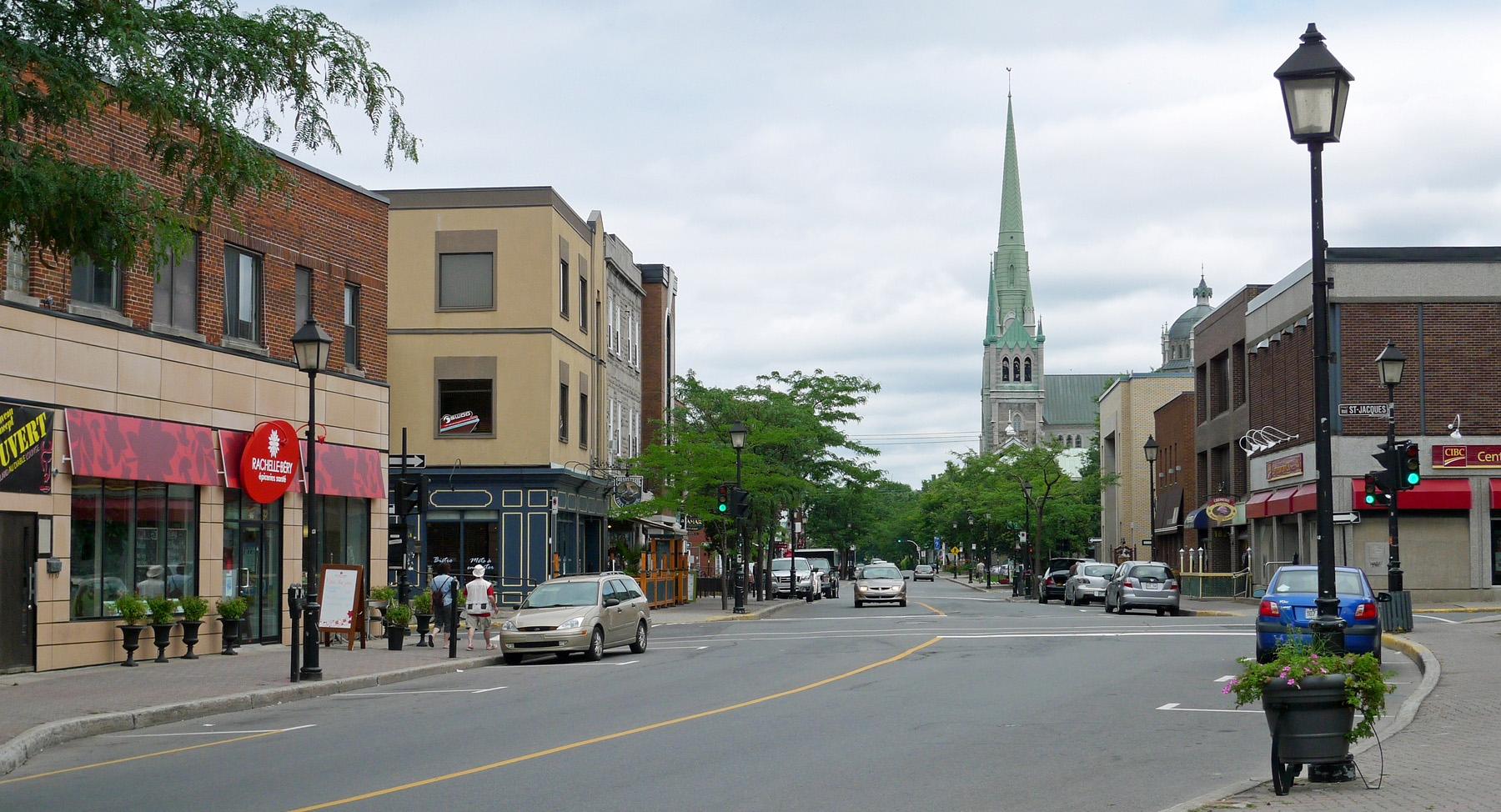
Old Longueuil () is a historic neighbourhood located in the borough of the same name, in the city of Longueuil, Quebec, Canada. The neighbourhood essentially corresponds to the pre-1961 city of Longueuil and is bordered to the west by Joliette street, north by Saint Lawrence River The St. Lawrence River (, ) is a large international river in the middle latitudes of North America connecting the Great Lakes to the North Atlantic Ocean. Its waters flow in a northeasterly direction from Lake Ontario to the Gulf of St. Lawrenc ... and east by d'Augerne street, while its southern limits varies from one definition to another but can go as far as De Gentilly street on some sources. Old Longueuil was named a heritage district by the city in 1993, and features 450 buildings built before 1945. Many historic buildings are found in this district, such as the Co-Cathedral of Saint-Antoine-de-Padoue, the ruins of Fort Longueuil, and Saint Mark's Anglican Church. Rue Saint-Charles, one bloc ... [...More Info...] [...Related Items...] OR: [Wikipedia] [Google] [Baidu] |
Le Vieux-Longueuil
Le Vieux-Longueuil (, ) is a borough in the city of Longueuil. From 2002 to 2006, Le Vieux-Longueuil borough stood for what used to be the city of Longueuil from 1969 to 2002. The former city of Longueuil was composed of 3 cities merged in the 1960s: Ville Jacques-Cartier, Montréal-Sud and Longueuil. Since 2006, Le Vieux-Longueuil borough stands for the combination of the former city of Longueuil and LeMoyne. LeMoyne joined Le Vieux-Longueuil borough when Saint-Lambert left the city of Longueuil in 2006. Canada Post uses "Longueuil" only on addresses that are located within the former city of Longueuil. As such, many people continue to associate the name Longueuil to the former city rather than the current city. The former city of Longueuil has a neighbourhood which is also called Vieux-Longueuil. Le Vieux-Longueuil borough has 9 municipal districts. One of the districts contains LeMoyne and a portion of the former city of Longueuil. The other 8 districts are all located ... [...More Info...] [...Related Items...] OR: [Wikipedia] [Google] [Baidu] |
Longueuil
Longueuil () is a city in the province of Quebec, Canada. It is the seat of the Montérégie, Montérégie administrative region and the central city of the urban agglomeration of Longueuil. It sits on the South Shore (Montreal), south shore of the Saint Lawrence River directly across from Montreal. The population as of the Canada 2021 Census totalled 254,483, making it Montreal's second largest suburb, the fifth most populous city in Quebec and List of the largest municipalities in Canada by population, twentieth largest in Canada. Charles le Moyne de Longueuil et de Châteauguay, Charles Le Moyne founded Longueuil as a ''Seigneurial system of New France, seigneurie'' in 1657. It would become a parish in 1845, a village in 1848, a town in 1874 and a city in 1920. Between 1961 and 2002, Longueuil's borders grew three times, as it was amalgamated with surrounding municipalities; there was a strong de-amalgamation in 2006 (see 2000–2006 municipal reorganization in Quebec). L ... [...More Info...] [...Related Items...] OR: [Wikipedia] [Google] [Baidu] |
Quebec
Quebec is Canada's List of Canadian provinces and territories by area, largest province by area. Located in Central Canada, the province shares borders with the provinces of Ontario to the west, Newfoundland and Labrador to the northeast, New Brunswick to the southeast and a coastal border with the territory of Nunavut. In the south, it shares a border with the United States. Between 1534 and 1763, what is now Quebec was the List of French possessions and colonies, French colony of ''Canada (New France), Canada'' and was the most developed colony in New France. Following the Seven Years' War, ''Canada'' became a Territorial evolution of the British Empire#List of territories that were once a part of the British Empire, British colony, first as the Province of Quebec (1763–1791), Province of Quebec (1763–1791), then Lower Canada (1791–1841), and lastly part of the Province of Canada (1841–1867) as a result of the Lower Canada Rebellion. It was Canadian Confederation, ... [...More Info...] [...Related Items...] OR: [Wikipedia] [Google] [Baidu] |
Canada
Canada is a country in North America. Its Provinces and territories of Canada, ten provinces and three territories extend from the Atlantic Ocean to the Pacific Ocean and northward into the Arctic Ocean, making it the world's List of countries and dependencies by area, second-largest country by total area, with the List of countries by length of coastline, world's longest coastline. Its Canada–United States border, border with the United States is the world's longest international land border. The country is characterized by a wide range of both Temperature in Canada, meteorologic and Geography of Canada, geological regions. With Population of Canada, a population of over 41million people, it has widely varying population densities, with the majority residing in List of the largest population centres in Canada, urban areas and large areas of the country being sparsely populated. Canada's capital is Ottawa and List of census metropolitan areas and agglomerations in Canada, ... [...More Info...] [...Related Items...] OR: [Wikipedia] [Google] [Baidu] |
Saint Lawrence River
The St. Lawrence River (, ) is a large international river in the middle latitudes of North America connecting the Great Lakes to the North Atlantic Ocean. Its waters flow in a northeasterly direction from Lake Ontario to the Gulf of St. Lawrence, traversing Ontario and Quebec in Canada and New York (state), New York in the United States. A section of the river demarcates the Canada–United States border, Canada–U.S. border. As the primary Discharge (hydrology), drainage outflow of the Great Lakes Basin, the St. Lawrence has the List of rivers by discharge, second-highest discharge of any river in North America (after the Mississippi River) and the 16th-highest in the world. The estuary of St. Lawrence, estuary of the St. Lawrence is often cited by scientists as the largest in the world. Significant natural landmarks of the river and estuary include the 1,864 river islands of the Thousand Islands, the endangered whales of Saguenay–St. Lawrence Marine Park, and the limestone ... [...More Info...] [...Related Items...] OR: [Wikipedia] [Google] [Baidu] |
Co-Cathedral Of Saint-Antoine-de-Padoue
The Co-Cathedral of Saint-Antoine-de-Padoue () is a co-cathedral in Longueuil, Quebec, Canada, on Montreal's south shore. It is located on the corner of Rue Saint-Charles and Chemin Chambly in the Borough of Le Vieux-Longueuil. It is dedicated to St. Anthony of Padua. The cathedral houses the remains of the Blessed Marie-Rose Durocher, the foundress of the Sisters of the Holy Names of Jesus and Mary. Its episcopal region is Longueuil-Nord. Lionel Gendron, the bishop, has a cathedra sculpted in walnut. Before the reign of Bernard Hubert, it was simply a parish church. The cathedral was classified as historical monument by the Government of Quebec in 1984. History The site contains the archaeological remains of Fort Longueuil, a fort constructed between 1685 and 1690 as the fortified residence of Charles le Moyne de Longueuil, the only Canadian-born person to be raised to the rank of Baron by the French King. The fort was demolished in 1810 and the cathedral contains stone ... [...More Info...] [...Related Items...] OR: [Wikipedia] [Google] [Baidu] |
Fort Longueuil
Fort Longueuil was a stone fort that stood in Longueuil, in Quebec, Canada from 1690 to 1810. Fort Longueuil was recognized as a National Historic Site of Canada on May 25, 1923. The historic site includes the archaeological site of the fort, which was demolished in 1810. The site extends beneath the present-day Saint-Antoine-de-Padoue Cathedral. It is one of the only buildings in Canada that could ever be considered a castle (fortified residence for a noble), and out of those buildings it most resembles the castles of Europe. This makes it unique in the country. History The territory of New France was divided into seigneuries in order to ensure the colony's defence. Of these seigneuries, Charles Le Moyne was granted the ''Seigneury of Longueuil''. His son, Charles Le Moyne de Longueuil, built a fort with four towers between 1685 and 1690 as his fortified residence. The fort was built entirely in stone masonry, and included a guard house, a chapel and corps de logis. Louis ... [...More Info...] [...Related Items...] OR: [Wikipedia] [Google] [Baidu] |
City Hall
In local government, a city hall, town hall, civic centre (in the UK or Australia), guildhall, or municipal hall (in the Philippines) is the chief administrative building of a city, town, or other municipality. It usually houses the city or town council and at least some other arms of the local government. It also often functions as the office of the mayor (or other executive), if the relevant municipality has such an officer. In large cities, the local government is often administratively expansive, and the city hall may bear more resemblance to a municipal capitol building. By convention, until the middle of the 19th century, a single large open chamber (or "hall") formed an integral part of the building housing the council and such other organs of government as supported it. The hall may be used for council meetings and other significant events. This large chamber, the "town hall" (and its later variant "city hall") became synonymous with the whole building, and, synec ... [...More Info...] [...Related Items...] OR: [Wikipedia] [Google] [Baidu] |
Neighbourhoods In Longueuil
A neighbourhood (Commonwealth English) or neighborhood (American English) is a geographically localized community within a larger town, city, suburb or rural area, sometimes consisting of a single street and the buildings lining it. Neighbourhoods are often social communities with considerable face-to-face interaction among members. Researchers have not agreed on an exact definition, but the following may serve as a starting point: "Neighbourhood is generally defined spatially as a specific geographic area and functionally as a set of social networks. Neighbourhoods, then, are the spatial units in which face-to-face social interactions occur—the personal settings and situations where residents seek to realise common values, socialise youth, and maintain effective social control." Preindustrial cities In the words of the urban scholar Lewis Mumford, "Neighborhoods, in some annoying, inchoate fashion exist wherever human beings congregate, in permanent family dwellings; and ma ... [...More Info...] [...Related Items...] OR: [Wikipedia] [Google] [Baidu] |


